|
Mesoscale Convective System
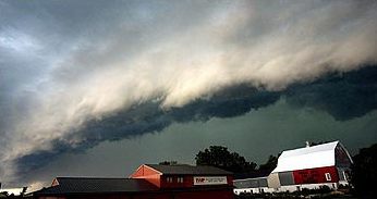
A mesoscale convective system (MCS) is a complex of thunderstorms that becomes organized on a scale larger than the individual thunderstorms but smaller than extratropical cyclones, and normally persists for several hours or more. A mesoscale convective system's overall cloud and precipitation pattern may be round or linear in shape, and include weather systems such as tropical cyclones, squall lines, lake-effect snow events, polar lows, and mesoscale convective complexes (MCCs), and generally forms near weather fronts. The type that forms during the warm season over land has been noted across North and South America, Europe, and Asia, with a maximum in activity noted during the late afternoon and evening hours. Forms of MCS that develop within the tropics use either the Intertropical Convergence Zone (ITCZ) or monsoon troughs as a focus for their development, generally within the warm season between spring and fall. One exception is that of lake-effect snow bands, which form ... [...More Info...] [...Related Items...] OR: [Wikipedia] [Google] [Baidu] |
Millibars
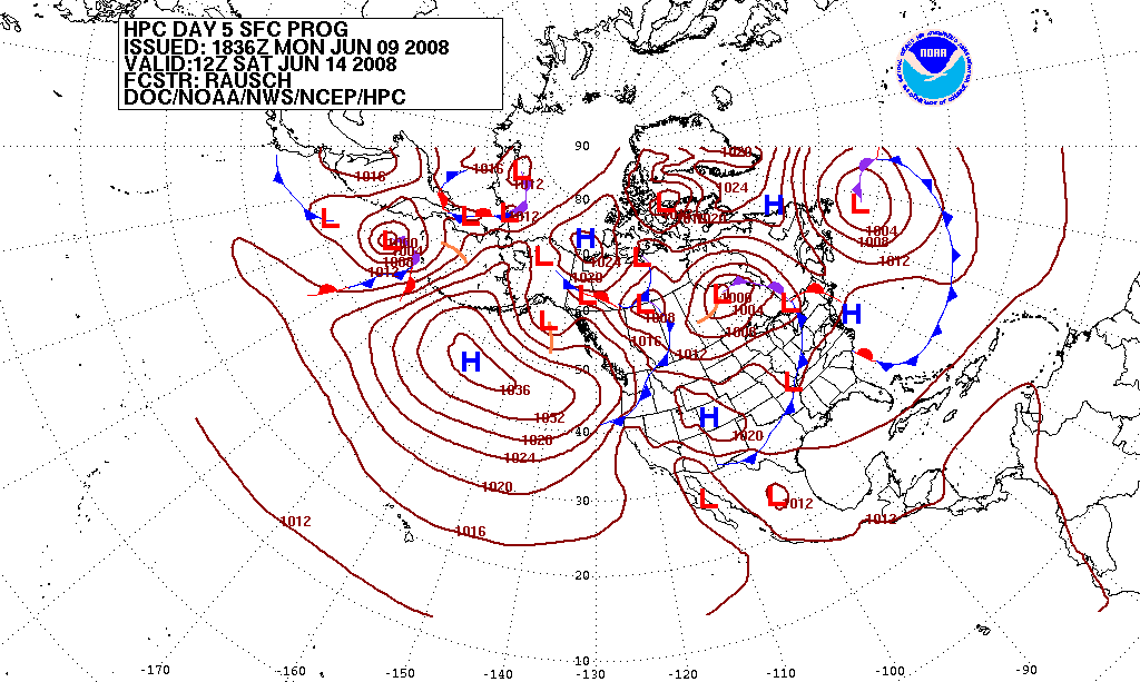
The bar is a metric unit of pressure, but not part of the International System of Units (SI). It is defined as exactly equal to 100,000 Pa (100 kPa), or slightly less than the current average atmospheric pressure on Earth at sea level (approximately 1.013 bar). By the barometric formula, 1 bar is roughly the atmospheric pressure on Earth at an altitude of 111 metres at 15 °C. The bar and the millibar were introduced by the Norwegian meteorologist Vilhelm Bjerknes, who was a founder of the modern practice of weather forecasting. The International System of Units, despite previously mentioning the bar, now omits any mention of it.. The bar has been legally recognised in countries of the European Union since 2004. British Standard BS 350:2004 ''Conversion Factors for Units''. The US National Institute of Standards and Technology (NIST) deprecates its use except for "limited use in meteorology" and lists it as one of several units that "must not be introd ... [...More Info...] [...Related Items...] OR: [Wikipedia] [Google] [Baidu] |
Hail
Hail is a form of solid precipitation. It is distinct from ice pellets (American English "sleet"), though the two are often confused. It consists of balls or irregular lumps of ice, each of which is called a hailstone. Ice pellets generally fall in cold weather, while hail growth is greatly inhibited during low surface temperatures. Unlike other forms of water ice precipitation, such as graupel (which is made of rime ice), ice pellets (which are smaller and translucent), and snow (which consists of tiny, delicately crystalline flakes or needles), hailstones usually measure between and in diameter. The METAR reporting code for hail or greater is GR, while smaller hailstones and graupel are coded GS. Hail is possible within most thunderstorms (as it is produced by cumulonimbus), as well as within of the parent storm. Hail formation requires environments of strong, upward motion of air within the parent thunderstorm (similar to tornadoes) and lowered heights of the freezing l ... [...More Info...] [...Related Items...] OR: [Wikipedia] [Google] [Baidu] |
Nocturnality
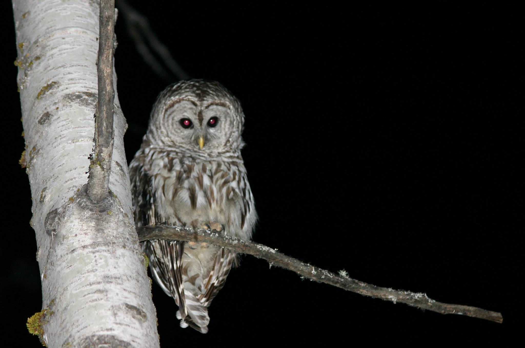
Nocturnality is an animal behavior characterized by being active during the night and sleeping during the day. The common adjective is "nocturnal", versus diurnal meaning the opposite. Nocturnal creatures generally have highly developed senses of hearing, smell, and specially adapted eyesight. Some animals, such as cats and ferrets, have eyes that can adapt to both low-level and bright day levels of illumination (see metaturnal). Others, such as bushbabies and (some) bats, can function only at night. Many nocturnal creatures including tarsiers and some owls have large eyes in comparison with their body size to compensate for the lower light levels at night. More specifically, they have been found to have a larger cornea relative to their eye size than diurnal creatures to increase their : in the low-light conditions. Nocturnality helps wasps, such as ''Apoica flavissima'', avoid hunting in intense sunlight. Diurnal animals, including squirrels and songbirds, are act ... [...More Info...] [...Related Items...] OR: [Wikipedia] [Google] [Baidu] |
Eccentricity (mathematics)
In mathematics, the eccentricity of a conic section is a non-negative real number that uniquely characterizes its shape. More formally two conic sections are similar if and only if they have the same eccentricity. One can think of the eccentricity as a measure of how much a conic section deviates from being circular. In particular: * The eccentricity of a circle is zero. * The eccentricity of an ellipse which is not a circle is greater than zero but less than 1. * The eccentricity of a parabola is 1. * The eccentricity of a hyperbola is greater than 1. * The eccentricity of a pair of lines is \infty Definitions Any conic section can be defined as the locus of points whose distances to a point (the focus) and a line (the directrix) are in a constant ratio. That ratio is called the eccentricity, commonly denoted as . The eccentricity can also be defined in terms of the intersection of a plane and a double-napped cone associated with the conic section. If the cone is orie ... [...More Info...] [...Related Items...] OR: [Wikipedia] [Google] [Baidu] |
Satellite Imagery
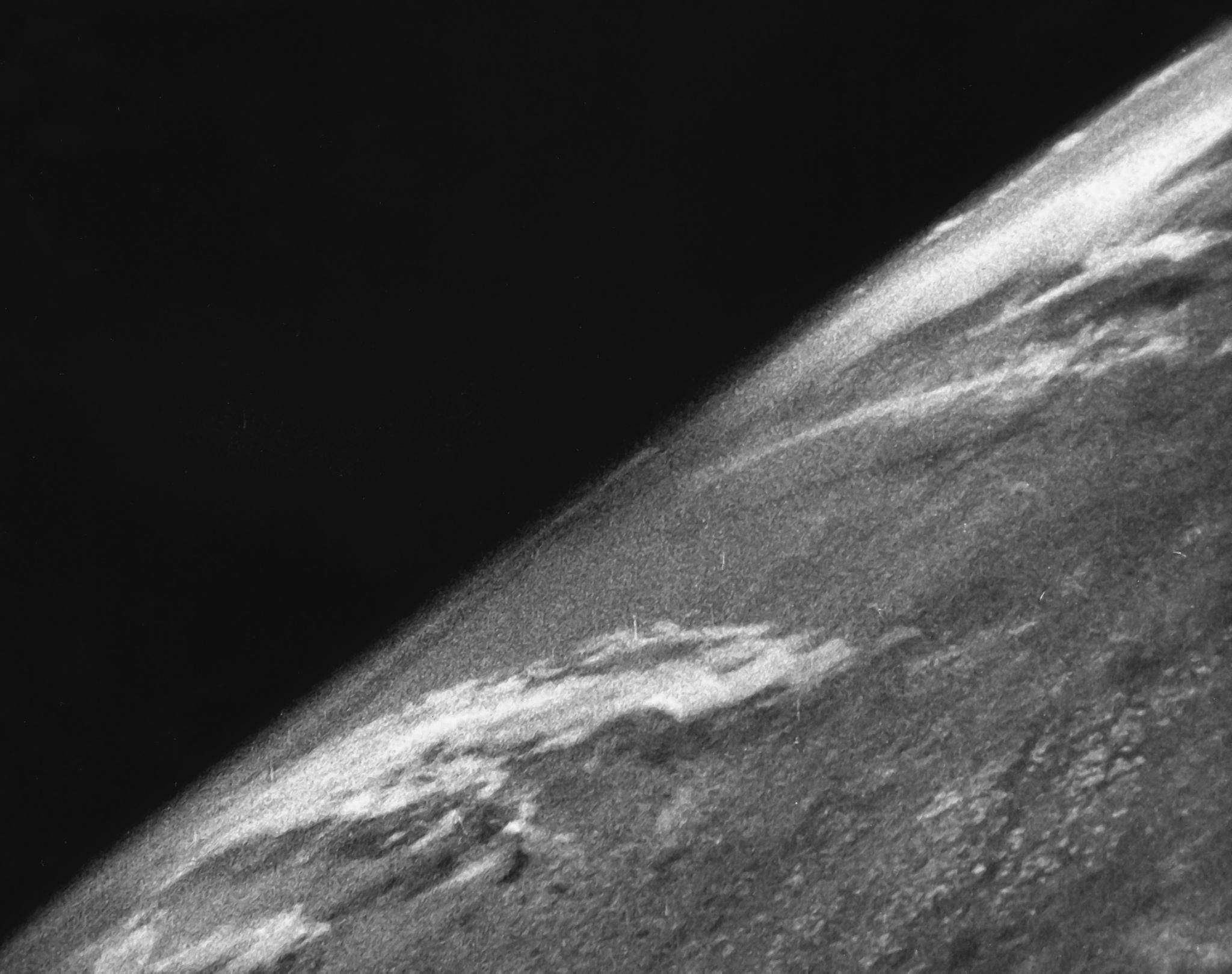
Satellite images (also Earth observation imagery, spaceborne photography, or simply satellite photo) are images of Earth collected by imaging satellites operated by governments and businesses around the world. Satellite imaging companies sell images by licensing them to governments and businesses such as Apple Maps and Google Maps. History The first images from space were taken on sub-orbital flights. The U.S-launched V-2 flight on October 24, 1946, took one image every 1.5 seconds. With an apogee of 65 miles (105 km), these photos were from five times higher than the previous record, the 13.7 miles (22 km) by the Explorer II balloon mission in 1935. The first satellite (orbital) photographs of Earth were made on August 14, 1959, by the U.S. Explorer 6. The first satellite photographs of the Moon might have been made on October 6, 1959, by the Soviet satellite Luna 3, on a mission to photograph the far side of the Moon. The Blue Marble photograph was taken from spac ... [...More Info...] [...Related Items...] OR: [Wikipedia] [Google] [Baidu] |
Atmospheric Instability
Atmospheric instability is a condition where the Earth's atmosphere is generally considered to be unstable and as a result the weather is subjected to a high degree of variability through distance and time. Atmospheric stability is a measure of the atmosphere's tendency to discourage or deter vertical motion, and vertical motion is directly correlated to different types of weather systems and their severity. In unstable conditions, a lifted thing, such as a parcel of air will be warmer than the surrounding air at altitude. Because it is warmer, it is less dense and is prone to further ascent. In meteorology, instability can be described by various indices such as the Bulk Richardson Number, lifted index, K-index, convective available potential energy (CAPE), the Showalter, and the Vertical totals. These indices, as well as atmospheric instability itself, involve temperature changes through the troposphere with height, or lapse rate. Effects of atmospheric instability in ... [...More Info...] [...Related Items...] OR: [Wikipedia] [Google] [Baidu] |
Precipitable Water
Precipitable water is the depth of water in a column of the atmosphere, if all the water in that column were precipitated as rain. As a depth, the precipitable water is measured in millimeters or inches. Often abbreviated as "TPW", for Total Precipitable Water. Measurement There are different measurement techniques: *One type of measurement is based on the measurement of the solar irradiance on two wavelengths, one in a water absorption band, and the other not. The precipitable water column is determined using the irradiances in these bands and the Beer–Lambert law. *The precipitable water can also be calculated by integration of radiosonde data (relative humidity, pressure and temperature) over the whole atmosphere An atmosphere () is a layer of gas or layers of gases that envelop a planet, and is held in place by the gravity of the planetary body. A planet retains an atmosphere when the gravity is great and the temperature of the atmosphere is low. .... *Data can ... [...More Info...] [...Related Items...] OR: [Wikipedia] [Google] [Baidu] |
Troposphere
The troposphere is the first and lowest layer of the atmosphere of the Earth, and contains 75% of the total mass of the planetary atmosphere, 99% of the total mass of water vapour and aerosols, and is where most weather phenomena occur. From the planetary surface of the Earth, the average height of the troposphere is in the tropics; in the middle latitudes; and in the high latitudes of the polar regions in winter; thus the average height of the troposphere is . The term ''troposphere'' derives from the Greek words ''tropos'' (rotating) and '' sphaira'' (sphere) indicating that rotational turbulence mixes the layers of air and so determines the structure and the phenomena of the troposphere. The rotational friction of the troposphere against the planetary surface affects the flow of the air, and so forms the planetary boundary layer (PBL) that varies in height from hundreds of meters up to . The measures of the PBL vary according to the latitude, the landform, and t ... [...More Info...] [...Related Items...] OR: [Wikipedia] [Google] [Baidu] |
Wind Shear
Wind shear (or windshear), sometimes referred to as wind gradient, is a difference in wind speed and/or direction over a relatively short distance in the atmosphere. Atmospheric wind shear is normally described as either vertical or horizontal wind shear. Vertical wind shear is a change in wind speed or direction with a change in altitude. Horizontal wind shear is a change in wind speed with a change in lateral position for a given altitude. Wind shear is a microscale meteorological phenomenon occurring over a very small distance, but it can be associated with mesoscale or synoptic scale weather features such as squall lines and cold fronts. It is commonly observed near microbursts and downbursts caused by thunderstorms, fronts, areas of locally higher low-level winds referred to as low-level jets, near mountains, radiation inversions that occur due to clear skies and calm winds, buildings, wind turbines, and sailboats. Wind shear has significant effects on the contro ... [...More Info...] [...Related Items...] OR: [Wikipedia] [Google] [Baidu] |
Supercell
A supercell is a thunderstorm characterized by the presence of a mesocyclone: a deep, persistently rotating updraft. Due to this, these storms are sometimes referred to as rotating thunderstorms. Of the four classifications of thunderstorms (supercell, squall line, multi-cell, and single-cell), supercells are the overall least common and have the potential to be the most severe. Supercells are often isolated from other thunderstorms, and can dominate the local weather up to away. They tend to last 2–4 hours. Supercells are often put into three classification types: classic (Normal precipitation level), low-precipitation (LP), and high-precipitation (HP). LP supercells are usually found in climates that are more arid, such as the high plains of the United States, and HP supercells are most often found in moist climates. Supercells can occur anywhere in the world under the right pre-existing weather conditions, but they are most common in the Great Plains of the United S ... [...More Info...] [...Related Items...] OR: [Wikipedia] [Google] [Baidu] |
CAPE Vs SHEAR
A cape is a clothing accessory or a sleeveless outer garment which drapes the wearer's back, arms, and chest, and connects at the neck. History Capes were common in medieval Europe, especially when combined with a hood in the chaperon. They have had periodic returns to fashion - for example, in nineteenth-century Europe. Roman Catholic clergy wear a type of cape known as a ferraiolo, which is worn for formal events outside a ritualistic context. The cope is a liturgical vestment in the form of a cape. Capes are often highly decorated with elaborate embroidery. Capes remain in regular use as rainwear in various military units and police forces, in France for example. A gas cape was a voluminous military garment designed to give rain protection to someone wearing the bulky gas masks used in twentieth-century wars. Rich noblemen and elite warriors of the Aztec Empire would wear a tilmàtli; a Mesoamerican cloak/cape used as a symbol of their upper status. Cloth and clothing w ... [...More Info...] [...Related Items...] OR: [Wikipedia] [Google] [Baidu] |


