|
Cut-off Low
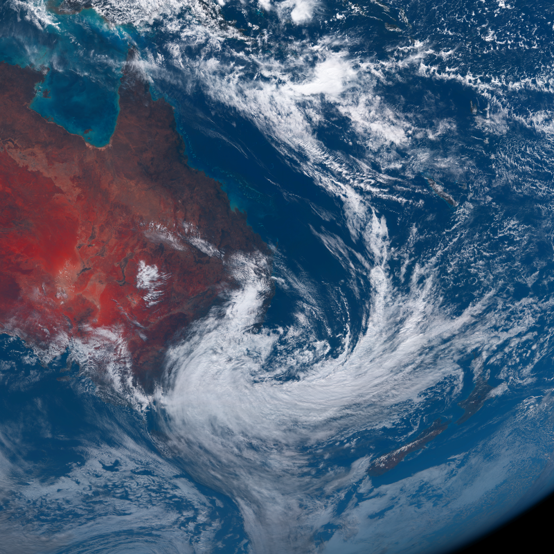
A cut-off low (or cutoff low), sometimes referred to as the weatherman's woe, is defined as "a closed upper-level low which has become completely displaced (cut off) from basic westerly current, and moves independently of that current" by the National Weather Service. Cut-off lows form in mid-latitudes (usually in the subtropics or between 20° and 45°) and would remain nearly stationary for days. Formation A cut-off low is a cold-core low where wind in the upper levels of the troposphere is "cut off"" from the primary westerly winds of the jet stream. They are formed when a trough in the upper-air flow pinches off and separates into a closed circulation. It is defined by concentric isotherms around the core of the low. Because they are a feature of the mid- to upper-troposphere, they may not be visible on a surface weather analysis. Because they are separated from the main westerly flow, cut-off lows can move slowly and erratically. In certain arrangements, known as a block o ... [...More Info...] [...Related Items...] OR: [Wikipedia] [Google] [Baidu] |
Bureau Of Meteorology
The Bureau of Meteorology (BOM or BoM) is an executive agency of the Australian Government responsible for providing weather services to Australia and surrounding areas. It was established in 1906 under the Meteorology Act, and brought together the state meteorological services that existed before then. The states officially transferred their weather recording responsibilities to the Bureau of Meteorology on 1 January 1908. History The Bureau of Meteorology was established on 1 January 1908 following the passage of the ''Meteorology Act 1906''. Prior to Federation in 1901, each colony had had its own meteorological service, with all but two colonies also having a subsection devoted to astronomy. In August 1905, federal home affairs minister Littleton Groom surveyed state governments for their willingness to cede control, finding South Australia and Victoria unwilling. However, at a ministerial conference in April 1906 the state governments agreed to transfer responsibility for m ... [...More Info...] [...Related Items...] OR: [Wikipedia] [Google] [Baidu] |
Extratropical Cyclones
Extratropical cyclones, sometimes called mid-latitude cyclones or wave cyclones, are low-pressure areas which, along with the anticyclones of high-pressure areas, drive the weather over much of the Earth. Extratropical cyclones are capable of producing anything from cloudiness and mild rain, showers to severe gales, thunderstorms, blizzards, and tornadoes. These types of cyclones are defined as Synoptic scale meteorology, large scale (synoptic) low pressure weather systems that occur in the middle latitudes of the Earth. In contrast with tropical cyclones, extratropical cyclones produce rapid changes in temperature and dew point along broad lines, called weather fronts, about the center of the cyclone. Terminology The term "cyclone" applies to numerous types of low pressure areas, one of which is the extratropical cyclone. The descriptor ''extratropical'' signifies that this type of cyclone generally occurs outside the tropics and in the middle latitudes of Earth between 30° a ... [...More Info...] [...Related Items...] OR: [Wikipedia] [Google] [Baidu] |
Subtropical Cyclone
A subtropical cyclone is a weather system that has some characteristics of both tropical cyclone, tropical and an extratropical cyclone. As early as the 1950s, meteorologists were uncertain whether they should be characterized as Tropical cyclone, tropical or Extratropical cyclone, extratropical cyclones. They were officially recognized and titled by the National Hurricane Center in 1972. Beginning in 2002, subtropical cyclones received names from the official tropical cyclone lists in the North Atlantic hurricane, North Atlantic, South-West Indian Ocean tropical cyclone, South-west Indian Ocean, and South Atlantic tropical cyclone, South Atlantic basins. There are two definitions currently used for subtropical cyclones depending on their location. Across the north Atlantic and southwest Indian Ocean, they require some central Convectional Precipitation, convection fairly near the center surrounding a warming core existing in the mid-levels of the troposphere. Across the eastern ... [...More Info...] [...Related Items...] OR: [Wikipedia] [Google] [Baidu] |
Australian East Coast Low
Australian east coast lows (known locally as east coast lows, maritime lows and sometimes as east coast cyclones) are extratropical cyclones or low-pressure systems on the coast of southeastern Australia that may be caused by both mid-latitude and tropical influences over a variety of levels in the atmosphere.East coast lows and climate change in Australia The Earth Systems and Climate Change Hub The most intense of these systems have many of the characteristics of s. They develop between 25˚ south and 40˚ south and within 5˚ of the eastern Australian coa ... [...More Info...] [...Related Items...] OR: [Wikipedia] [Google] [Baidu] |
2021 European Floods
In July 2021, several European countries were affected by severe floods. Some were catastrophic, causing deaths and widespread damage. The floods started in the United Kingdom as flash floods causing some property damage and inconvenience. Later floods affected several river basins across Europe including Austria, Belgium, Croatia, Germany, Italy, Luxembourg, the Netherlands, and Switzerland. At least 243 people died in the floods, including 196 in Germany, 43 in Belgium, two in Romania, one in Italy and one in Austria. Belgian Minister of Home Affairs Annelies Verlinden described the events as "one of the greatest natural disasters our country has ever known." German minister-president Malu Dreyer of the Rhineland-Palatinate state called the floods "devastating". In addition to the confirmed fatalities, the flooding led to widespread power outages, forced evacuations and damage to infrastructure and agriculture in the affected areas. The damage to infrastructure was especi ... [...More Info...] [...Related Items...] OR: [Wikipedia] [Google] [Baidu] |
Thunderstorm
A thunderstorm, also known as an electrical storm or a lightning storm, is a storm characterized by the presence of lightning and its acoustic effect on the Earth's atmosphere, known as thunder. Relatively weak thunderstorms are sometimes called thundershowers. Thunderstorms occur in a type of cloud known as a cumulonimbus. They are usually accompanied by strong winds and often produce heavy rain and sometimes snow, sleet, or hail, but some thunderstorms produce little precipitation or no precipitation at all. Thunderstorms may line up in a series or become a rainband, known as a squall line. Strong or severe thunderstorms include some of the most dangerous weather phenomena, including large hail, strong winds, and tornadoes. Some of the most persistent severe thunderstorms, known as supercells, rotate as do cyclones. While most thunderstorms move with the mean wind flow through the layer of the troposphere that they occupy, vertical wind shear sometimes causes a de ... [...More Info...] [...Related Items...] OR: [Wikipedia] [Google] [Baidu] |
Alicante(30-09-1997)
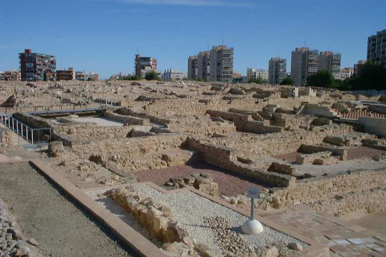
Alicante ( ca-valencia, Alacant) is a city and municipality in the Valencian Community, Spain. It is the capital of the province of Alicante and a historic Mediterranean port. The population of the city was 337,482 , the second-largest in the Valencian Community. Toponymy The name of the city echoes the Arabic name ''Laqant'' () or ''al-Laqant'' (), which in turn reflects the Latin ''Lucentum'' and Greek root ''Leuké'' (or ''Leuka''), meaning "white". History The area around Alicante has been inhabited for over 7000 years. The first tribes of hunter-gatherers moved down gradually from Central Europe between 5000 and 3000 BC. Some of the earliest settlements were made on the slopes of Mount Benacantil. By 1000 BC Greek and Phoenician traders had begun to visit the eastern coast of Spain, establishing small trading ports and introducing the native Iberian tribes to the alphabet, iron, and the pottery wheel. The Carthaginian general Hamilcar Barca established the fortified ... [...More Info...] [...Related Items...] OR: [Wikipedia] [Google] [Baidu] |
Blocking High
Blocks in meteorology are large-scale patterns in the atmospheric pressure field that are nearly stationary, effectively "blocking" or redirecting migratory cyclones. They are also known as blocking highs or blocking anticyclones.Glossary of Meteorology, Second Edition; American Meteorological Society, 2000; . These blocks can remain in place for several days or even weeks, causing the areas affected by them to have the same kind of weather for an extended period of time (e.g. precipitation for some areas, clear skies for others). In the Northern Hemisphere, extended blocking occurs most frequently in the spring over the eastern Pacific and Atlantic Oceans. Whilst these events are linked to the occurrence of extreme weather events such as heat waves, particularly the onset and decay of these events is still not well captured in numerical weather forecasts and remains an open area of research. Impact of the polar vortex Polar cyclones are climatological features which hover nea ... [...More Info...] [...Related Items...] OR: [Wikipedia] [Google] [Baidu] |
Convergence Zone
A convergence zone in meteorology is a region in the atmosphere where two prevailing flows meet and interact, usually resulting in distinctive weather conditions. This causes a mass accumulation that eventually leads to a vertical movement and to the formation of clouds and precipitation. Large-scale convergence, called synoptic-scale convergence, is associated with weather systems such as baroclinic troughs, low-pressure areas, and cyclones. The large-scale convergence zone formed over the equator, the Intertropical Convergence Zone, has condensed and intensified as a result of the global increase in temperature. Small-scale convergence will give phenomena from isolated cumulus clouds to large areas of thunderstorms. The inverse of convergence is divergence. Large scale An example of a convergence zone is the Intertropical Convergence Zone (ITCZ), a low pressure area which girdles the Earth at the Equator.Waliser, D.E.; Jiang, X. (2015). "Tropical Meteorology and Climate ... [...More Info...] [...Related Items...] OR: [Wikipedia] [Google] [Baidu] |
Baroclinic
In fluid dynamics, the baroclinity (often called baroclinicity) of a stratified fluid is a measure of how misaligned the gradient of pressure is from the gradient of density in a fluid. In meteorology a baroclinic flow is one in which the density depends on both temperature and pressure (the fully general case). A simpler case, barotropic flow, allows for density dependence only on pressure, so that the curl of the pressure-gradient force vanishes. Baroclinity is proportional to: :\nabla p \times \nabla \rho which is proportional to the sine of the angle between surfaces of constant pressure and surfaces of constant density. Thus, in a ''barotropic'' fluid (which is defined by zero baroclinity), these surfaces are parallel. In Earth's atmosphere, barotropic flow is a better approximation in the tropics, where density surfaces and pressure surfaces are both nearly level, whereas in higher latitudes the flow is more baroclinic. These midlatitude belts of high atmospheric bar ... [...More Info...] [...Related Items...] OR: [Wikipedia] [Google] [Baidu] |
Sea Level
Mean sea level (MSL, often shortened to sea level) is an average surface level of one or more among Earth's coastal bodies of water from which heights such as elevation may be measured. The global MSL is a type of vertical datuma standardised geodetic datumthat is used, for example, as a chart datum in cartography and marine navigation, or, in aviation, as the standard sea level at which atmospheric pressure is measured to calibrate altitude and, consequently, aircraft flight levels. A common and relatively straightforward mean sea-level standard is instead the midpoint between a mean low and mean high tide at a particular location. Sea levels can be affected by many factors and are known to have varied greatly over geological time scales. Current sea level rise is mainly caused by human-induced climate change. When temperatures rise, Glacier, mountain glaciers and the Ice sheet, polar ice caps melt, increasing the amount of water in water bodies. Because most of human settlem ... [...More Info...] [...Related Items...] OR: [Wikipedia] [Google] [Baidu] |


.jpg)


