|
Bugyals
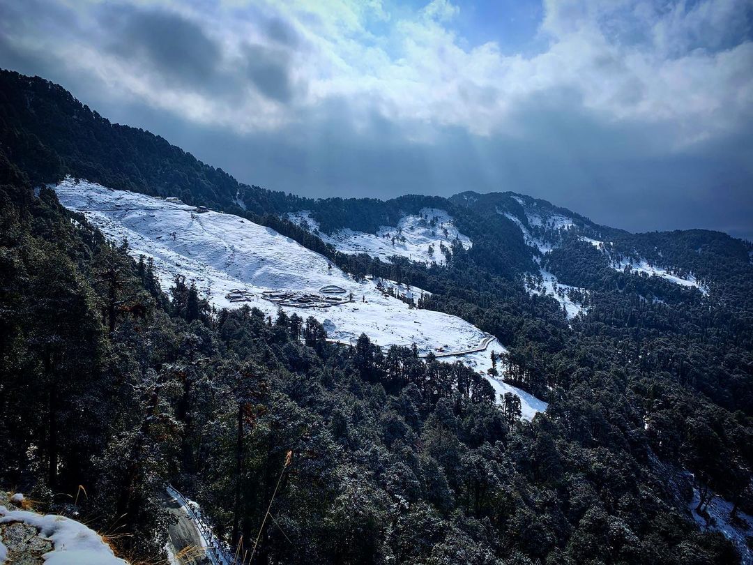
Bugyals are alpine pasture lands, or meadows, in higher elevation range between and of the Himalayas in the Indian state of Uttarakhand, where they are called "nature’s own gardens". The topography of the terrain is either flat or sloped. The surface of these bugyals is covered with natural green grass and seasonal flowers. They are used by tribal herdsmen to graze their cattle. During the winter season the alpine meadows remain snow-covered. During summer months, the Bugyals present a riot of beautiful flowers and grass. As bugyals constitute very fragile ecosystems, particular attention needs to be given for their conservation. Some of the notable bugyals are: Auli near Joshimath, Garsi, Kwanri, Gulabi Kantha, Bedni, Panwali Kantha and Kush Kalyan, Dayara, GidaraBagji Bugyaland Munsiyari. List of Bugyals Conservation issues Bugyal is a fragile ecosystem and it is essential to maintain a balance between ecology and environment. In this context a court case was filed ... [...More Info...] [...Related Items...] OR: [Wikipedia] [Google] [Baidu] |
Har Ki Doon
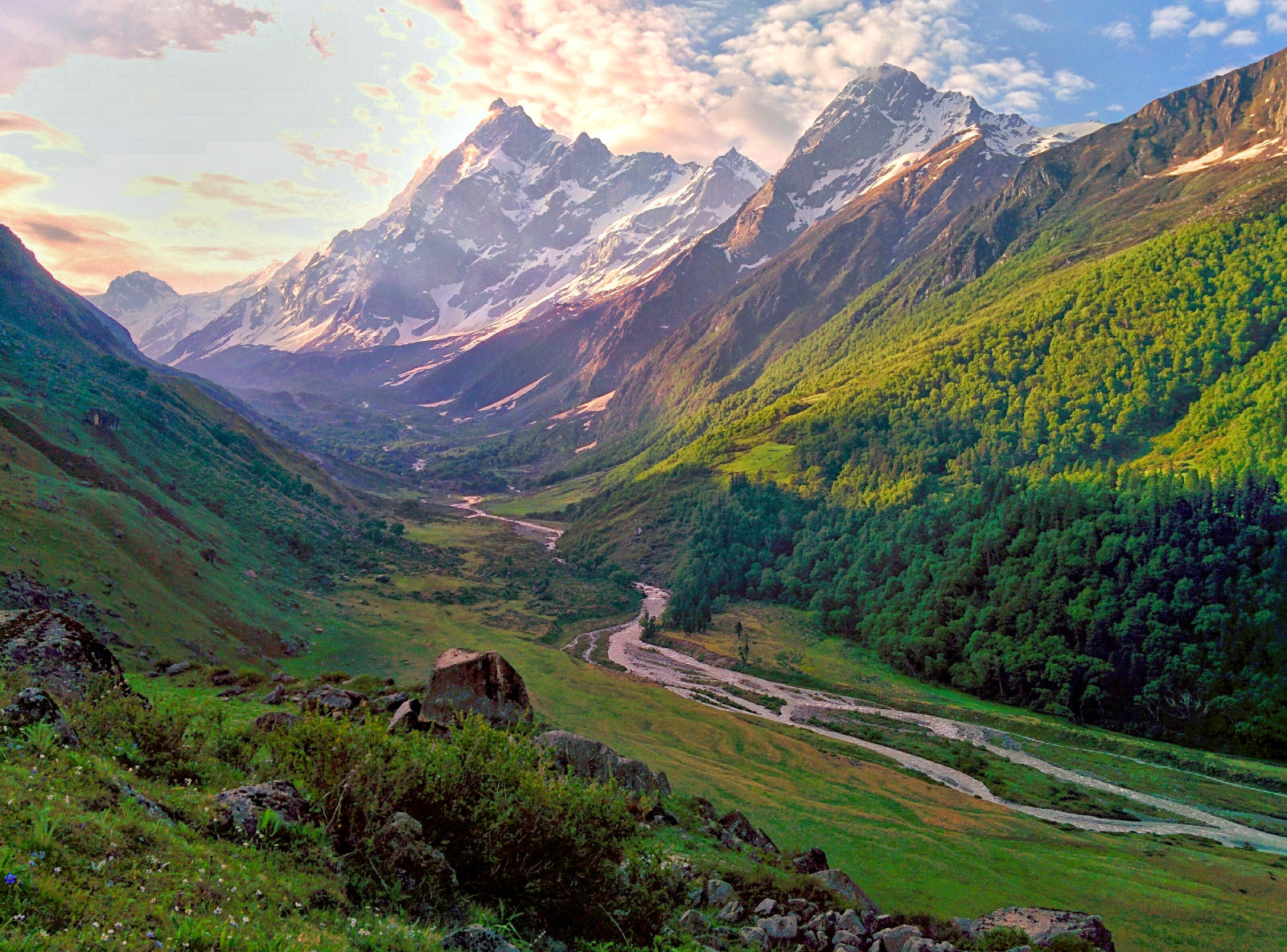
Har Ki Doon or Har Ki Dun is a cradle-shaped hanging valley in the Garhwal Himalayas of Uttarakhand, India. The region is surrounded with green Bugyals (High Altitude Meadows). It is surrounded by snow-covered peaks and alpine vegetation. It is connected to Baspa Valley by the Borasu Pass Borasu Pass or Bara-su (el. ) is a high mountain pass in the Himalaya Mountains of Uttarakhand in the India. The pass is located on the border of Uttarakhand and Himachal Pradesh near the border with Tibet. It was an ancient trade route betw .... This valley is about 3566 m (11700 ft) above mean sea level and is snow-covered from October to March. References External linksGoogle Earth view {{Coord missing, Uttarakhand Valleys of Uttarakhand Hiking trails in Uttarakhand ... [...More Info...] [...Related Items...] OR: [Wikipedia] [Google] [Baidu] |
Bedini Bugyal Green
Bedini is a surname. Notable people with the surname include: *Gaetano Bedini, (1806–1864), Italian Catholic church dignitary *Silvio Bedini, (1917–2007), American historian *Ignazio Bedini Ignazio Bedini, S.D.B., is a former Roman Catholic archbishop emeritus of Ispahan (Isfahan), Iran. Bedini was born in Sassomorello, near Modena, Italy, on 27 June 1939 and ordained as a priest of the Order of the Salesians of Saint John Bosco o ..., Italian catholic archbishop See also * 16672 Bedini * Bedini Bugyal, a Himalayan alpine meadow {{surname, Bedini ... [...More Info...] [...Related Items...] OR: [Wikipedia] [Google] [Baidu] |
Chopta Bugyal
Chopta Bugyal, also known as "Tungnath Bugyal" or "Rohini Bugyal", is a cluster of Bugyals (Himalayan Alpine Meadows) in Chopta, Rudraprayag district of Uttarakhand. Chopta Bugyal is a trekking and camping destination. The Bugyal has an average elevation of 2,849 m (9,347 ft) and is around 30 km (18.6 mi) from Ukhimath. It is situated on the trek route to Tungnath, the third temple of the Panch Kedar and the highest Shiva temple in the world and Chandrashila, a summit at an altitude of 3,645 m (11,959 ft). Chopta Bugyal is surrounded by forests of pine, deodar and rhododendron and is rich in flora and fauna. Chopta is a tourist destination during the winter as well as the summer months due to the climatic conditions that the area experiences. Chopta Bugyal remains covered with red carpet rhododendron flowers during the months of March and April. Views of Garhwal Himalayas including Nanda Devi and Chaukhamba can be seen from Chopta Bugyal. Tungnath is located approximately thre ... [...More Info...] [...Related Items...] OR: [Wikipedia] [Google] [Baidu] |
Moila Bugyal
Moila Bugyal also known as Moila Top is a bugyal (Himalayan Alpine Meadows) in the Dehradun district of Uttarakhand. Moila Bugyal is a hiking and camping Destination. The Bugyal has the highest elevation of 2759m and is around 40 km from Chakrata Chakrata is a cantonment town and also a sub district/tehsil, in Dehradun district. in the state of Uttarakhand, India. It lies between the Tons and Yamuna rivers, at an elevation of 2118 m, 98 km from the state capital, Dehradun. Chakra .... Moila Bugyal is situated between thousands of Deodar trees. The trek to the Bugyal is of 3 km and starts from Budher Forest Rest House, which is around 30 km from Chakrata. Budher Caves, situated at the corner of the Bugyal, believed to be built by the Pandavas is also a place to visit. Also, a historic temple dedicated to Lord Shiva is located at the centre of the Bugyal. The glorious views of the Garhwal Himalayas can be seen from here. References {{Uttarakhan ... [...More Info...] [...Related Items...] OR: [Wikipedia] [Google] [Baidu] |
Madhyamaheshwar Bugyal
Madhyamaheshwar ( sa, मध्यमहेश्वर) or Madmaheshwar is a Hindu temple dedicated to Shiva, located in Gaundar, a village in the Garhwal Himalayas of Uttarakhand, India. Situated at an elevation of , it is one of the Panch Kedar pilgrimage circuits, comprising five Shiva temples in the Garhwal region. The other temples in the circuit include: Kedarnath, Tungnath and Rudranath which are culturally visited before Madhyamaheshwar and, Kalpeshwar generally visited after Madhyamaheshwar. The middle (''madhya'') or belly part or navel (''nabhi'') of Shiva is worshipped here. The temple is believed to have been built by the Pandavas, the central figures of the Hindu epic Mahabharata. Legend Several folk legends exist surrounding the Garhwal region, Shiva and the creation of the Panch Kedar temples. One folklore relates to the Pandavas, the heroes of the Hindu epic Mahabharata. The Pandavas defeated and slayed their cousins — the Kauravas in the epic Kurukshetra ... [...More Info...] [...Related Items...] OR: [Wikipedia] [Google] [Baidu] |
Kush Kalyan Bugyal
Kush or Cush may refer to: Bible * Cush (Bible), two people and one or more places in the Hebrew Bible Places * Kush (mountain), a mountain near Kalat, Pakistan Balochistan * Kush (satrapy), a satrapy of the Achaemenid Empire * Hindu Kush, a mountain range in Afghanistan * Kingdom of Kush, an ancient kingdom in Nubia * Cush (hill), a mountain in County Tipperary, Ireland People Given name * Kush Arora, dub and bhangra music producer from San Francisco * Cush Jumbo (born 1985), English actress * Kusha (Ramayana), one of the twin sons of Lord Rama and Sita Surname * Lennox Cush (born 1974), Guyanese–American cricketer * Wilbur Cush (1928–1981), Northern Irish football player * Emil Kush (1916–1969), American baseball player * Eric Kush (born 1989), American football player * Frank Kush (1929–2017), American football coach * Kundan Singh Kush (1881–1967), Arya Samaj missionary * Rod Kush (born 1956), American football player * Vladimir Kush (born 1965), Russian pain ... [...More Info...] [...Related Items...] OR: [Wikipedia] [Google] [Baidu] |
Khaliya Bugyal
Khaliya Bugyal is a Bugyal (Himalayan Alpine Meadow) in the Pithoragarh district of Uttarakhand. Khaliya Bugyal is a trekking and skiing destination. The Bugyal has the highest elevation of 3709m and is around 16 km from Munsiyari. Khaliya Bugyal is situated between the snowy peaks and the forests of Deodar, Pine and Rhododendrons. The best time to visit the Khaliya Bugyal is either in the Spring or the Winters. In springs, there is greenery of the grasslands and red and pink rhododendron. The Khaliya Bugyal is a destination for nature photographers and bird watchers. In winters, the bugyal turns into snow land and skiing activities take place at Khaliya Bugyal organised by Uttarakhand Tourism Development Board. The Trek to Khaliya Bugyal starts from Munsiyari and is a 5-6 km trek from its starting point. One can see views of Kumaon Himalayas including Nanda Kot and Panchachuli The Panchachuli (पंचाचुली) peaks are a group of five snow-capped Him ... [...More Info...] [...Related Items...] OR: [Wikipedia] [Google] [Baidu] |
Kedarkantha Bugyal
Kedarkantha (Hindi: केदारकंठ) is a mountain peak of the Himalayas in Uttarakhand, India. Its elevation is . Kedarkantha is located within Govind Wildlife Sanctuary in Uttarkashi district Uttarkashi District is a district of Garhwal division of the Uttarakhand state in northern India, and has its headquarters at Uttarkashi city. It has six Tehsils namely Barkot, Dunda, Bhatwadi, Chinyalisaur, Purola and Mori. The district cont .... A trek to the peak of Kedarkantha usually starts from Sankri, a small village, and takes four days to complete. There are several myths around Kedarkantha and Juda ka Talab, a high altitude lake. References Mountains of Uttarakhand Geography of Uttarkashi district {{Uttarakhand-geo-stub ... [...More Info...] [...Related Items...] OR: [Wikipedia] [Google] [Baidu] |
Kedarkantha
Kedarkantha (Hindi: केदारकंठ) is a mountain peak of the Himalayas in Uttarakhand, India. Its elevation is . Kedarkantha is located within Govind Wildlife Sanctuary in Uttarkashi district Uttarkashi District is a district of Garhwal division of the Uttarakhand state in northern India, and has its headquarters at Uttarkashi city. It has six Tehsils namely Barkot, Dunda, Bhatwadi, Chinyalisaur, Purola and Mori. The district cont .... A trek to the peak of Kedarkantha usually starts from Sankri, a small village, and takes four days to complete. There are several myths around Kedarkantha and Juda ka Talab, a high altitude lake. References Mountains of Uttarakhand Geography of Uttarkashi district {{Uttarakhand-geo-stub ... [...More Info...] [...Related Items...] OR: [Wikipedia] [Google] [Baidu] |


