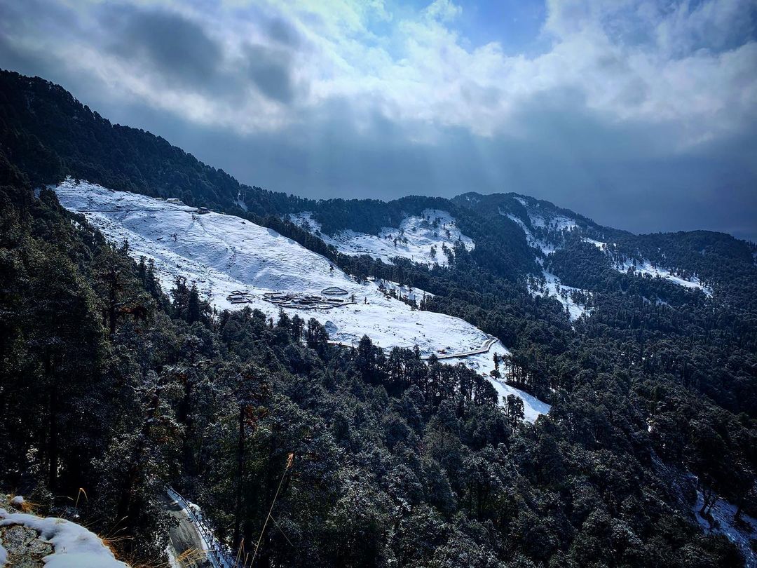
Chopta Bugyal on:
[Wikipedia]
[Google]
[Amazon]
Chopta Bugyal, also known as "Tungnath Bugyal" or "Rohini Bugyal", is a cluster of 

Bugyal
Bugyals are alpine pasture lands, or meadows, in higher elevation range between and of the Himalayas in the Indian state of Uttarakhand, where they are called "nature’s own gardens". The topography of the terrain is either flat or sloped. Th ...
s (Himalayan Alpine Meadows) in Chopta
Chopta is a small region of meadows and evergreen forest area, a part of Kedarnath wildlife sanctuary located in Uttarakhand state, India and a base for trekking to Tungnath, the third temple of Panch Kedar which lies away. Located at a dista ...
, Rudraprayag district
Rudraprayag is a district of the state of Uttarakhand of northern India. The district occupies an area of 1984 km2. The town of Rudraprayag is the administrative headquarters of the district. The district is bounded by Uttarkashi District ...
of Uttarakhand
Uttarakhand ( , or ; , ), also known as Uttaranchal ( ; the official name until 2007), is a state in the northern part of India. It is often referred to as the "Devbhumi" (literally 'Land of the Gods') due to its religious significance and ...
. Chopta Bugyal is a trekking
Backpacking is the outdoor recreation of carrying gear on one's back, while hiking for more than a day. It is often an extended journey, and may involve camping outdoors. In North America tenting is common, where simple shelters and mountain h ...
and camping
Camping is an outdoor activity involving overnight stays away from home, either without shelter or using basic shelter such as a tent, or a recreational vehicle. Typically, participants leave developed areas to spend time outdoors in more nat ...
destination. The Bugyal has an average elevation of 2,849 m (9,347 ft) and is around 30 km (18.6 mi) from Ukhimath
Ukhimath (also spelled Okhimath) is a small town and a Hindu pilgrimage site in Rudraprayag district, Uttarakhand in India. It is situated at an elevation of 1,311 meters and at a distance of 41 km from Rudraprayag. During the winter, t ...
. It is situated on the trek route to Tungnath
Tungnath ( IAST:tuņgnāth) is one of the highest Shiva temples in the world and is the highest of the five Panch Kedar temples located in the Rudraprayag district, in the Indian state of Uttarakhand. The Tungnath (literal meaning: Lord of the ...
, the third temple of the Panch Kedar
Panch Kedar ( sa, पञ्चकेदार) refers to five Hindu temples or holy places of the Shivaite sect dedicated to god Shiva. They are located in the Garhwal Himalayan region in Uttarakhand, India. They are the subject of many l ...
and the highest Shiva temple in the world and Chandrashila
Chandrashila is the summit above Tungnath temple in India. It literally means "Moon Rock". It is located at a height of about above sea level. This peak provides views of the Himalayas, including Nandadevi, Trisul, Kedar Peak, Bandarpunch a ...
, a summit at an altitude of 3,645 m (11,959 ft). Chopta Bugyal is surrounded by forests of pine, deodar and rhododendron and is rich in flora and fauna.
Chopta is a tourist destination during the winter as well as the summer months due to the climatic conditions that the area experiences. Chopta Bugyal remains covered with red carpet rhododendron flowers during the months of March and April. Views of Garhwal Himalayas including Nanda Devi
Nanda Devi is the second-highest mountain in India, after Kangchenjunga, and the highest located entirely within the country (Kangchenjunga is on the border of India and Nepal). It is the 23rd-highest peak in the world.
Nanda Devi was consid ...
and Chaukhamba
Chaukhamba is a mountain massif in the Gangotri Group of the Garhwal Himalaya. Its main summit, Chaukhamba I, is the highest peak in the group. It lies at the head of the Gangotri Glacier and forms the eastern anchor of the group.Andy Fanshaw ...
can be seen from Chopta Bugyal. Tungnath is located approximately three and a half km from Chopta, and Chandrashila peak is located about five km from Chopta. Deoria Tal
Deoria Tal (also Devaria or Deoriya) is a lake about from the villages of Mastura and Sari on the Ukhimath- Chopta road in the state of Uttarakhand in India. Situated at an altitude of in the Garhwal Himalayas, it has heavily wooded, lush gre ...
is a freshwater lake which is around 20 km (12.4 mi) from here.


References
Geography of Uttarakhand Montane grasslands and shrublands {{Uttarakhand-geo-stub