|
Blidinje Nature Park
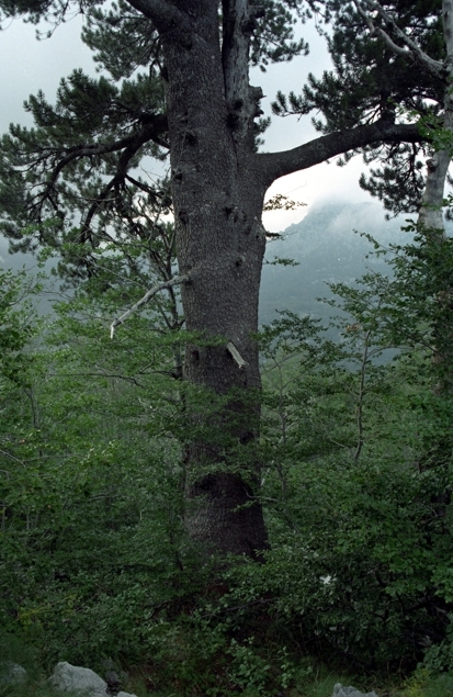
Blidinje Nature Park () is a nature park in Bosnia and Herzegovina, established on 30 April 1995. It is situated at the Blidinje plateau, in the heart of Dinaric Alps, between major mountains of the range, Čvrsnica, Čabulja and Vran, with characteristic karstic features such as Dugopolje field, Blidinje Lake, Grabovica and Drežanka valleys, and others. It represents important natural, hydrogeological reserves in Dinaric karst of Bosnia and Herzegovina, with significant cultural and historical heritage. Geography and hydrology The melting glaciers from Čvrsnica during the two past ice ages created this open and barren valley. A spacious plateau, 3–5 km long, is situated at an elevation of 1.150-1.300 meters a.s.l., between Čvrsnica and Vran mountains with a total area of 364 km². Although geomorphologically one whole, plateau is divided in two geographically and topographic distinct features, first in lower southern part, areal around the lake Blidinje, a ... [...More Info...] [...Related Items...] OR: [Wikipedia] [Google] [Baidu] |
Bosnia And Herzegovina
Bosnia and Herzegovina ( sh, / , ), abbreviated BiH () or B&H, sometimes called Bosnia–Herzegovina and often known informally as Bosnia, is a country at the crossroads of south and southeast Europe, located in the Balkans. Bosnia and Herzegovina borders Serbia to the east, Montenegro to the southeast, and Croatia to the north and southwest. In the south it has a narrow coast on the Adriatic Sea within the Mediterranean, which is about long and surrounds the town of Neum. Bosnia, which is the inland region of the country, has a moderate continental climate with hot summers and cold, snowy winters. In the central and eastern regions of the country, the geography is mountainous, in the northwest it is moderately hilly, and in the northeast it is predominantly flat. Herzegovina, which is the smaller, southern region of the country, has a Mediterranean climate and is mostly mountainous. Sarajevo is the capital and the largest city of the country followed by Banja Luka, Tu ... [...More Info...] [...Related Items...] OR: [Wikipedia] [Google] [Baidu] |
Geomorphologically
Geomorphology (from Ancient Greek: , ', "earth"; , ', "form"; and , ', "study") is the scientific study of the origin and evolution of topographic and bathymetric features created by physical, chemical or biological processes operating at or near Earth's surface. Geomorphologists seek to understand why landscapes look the way they do, to understand landform and terrain history and dynamics and to predict changes through a combination of field observations, physical experiments and numerical modeling. Geomorphologists work within disciplines such as physical geography, geology, geodesy, engineering geology, archaeology, climatology, and geotechnical engineering. This broad base of interests contributes to many research styles and interests within the field. Overview Earth's surface is modified by a combination of surface processes that shape landscapes, and geologic processes that cause tectonic uplift and subsidence, and shape the coastal geography. Surface processes compr ... [...More Info...] [...Related Items...] OR: [Wikipedia] [Google] [Baidu] |
Shepherd
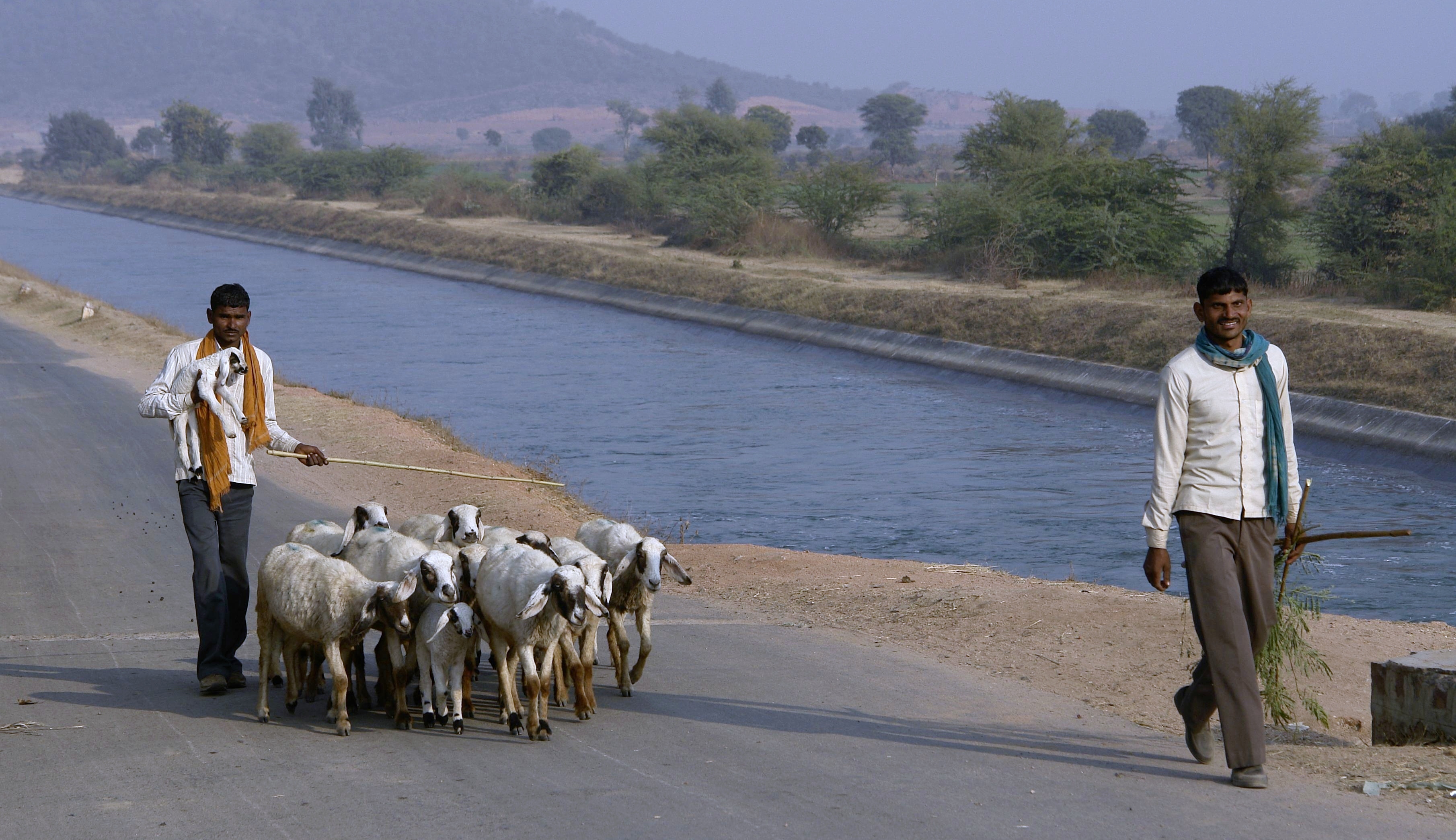
A shepherd or sheepherder is a person who tends, herds, feeds, or guards flocks of sheep. ''Shepherd'' derives from Old English ''sceaphierde (''sceap'' 'sheep' + ''hierde'' 'herder'). ''Shepherding is one of the world's oldest occupations, it exists in all parts of the globe, and it is an important part of Pastoralism, pastoralist animal husbandry. Because of the ubiquity of the profession, many religions and cultures have symbolic or metaphorical references to the shepherd profession. For example, Jesus called himself the Good Shepherd, and ancient Greek mythologies highlighted shepherds such as Endymion (mythology), Endymion and Daphnis. This symbolism and shepherds as characters are at the center of pastoral literature and art. Origins Shepherding is among the oldest occupations, beginning some 5,000 years ago in Asia Minor. Sheep were kept for their milk, sheep meat, meat and especially their wool. Over the next thousand years, sheep and shepherding spread throughout ... [...More Info...] [...Related Items...] OR: [Wikipedia] [Google] [Baidu] |
Diva Grabovica
Diva (; ) is the Latin word for a goddess. It has often been used to refer to a celebrated woman of outstanding talent in the world of opera, theatre, cinema, fashion and popular music. If referring to an actress, the meaning of ''diva'' is closely related to that of ''prima donna''. Diva can also refer to a person, especially one in show business, with a reputation for being temperamental or demanding. Derivation The word entered the English language in the late 19th century. It is derived from the Italian noun ''diva'', a female deity. The plural of the word in English is "divas"; in Italian, ''dive'' . The basic sense of the term is ''goddess'', the feminine of the Latin word ''divus'' (Italian ''divo''), someone deified after death, or Latin ''deus'', a god. The male form '' divo'' exists in Italian and is usually reserved for the most prominent leading tenors, like Enrico Caruso and Beniamino Gigli. The Italian term '' divismo'' describes the star-making system in the fi ... [...More Info...] [...Related Items...] OR: [Wikipedia] [Google] [Baidu] |
Gornja Grabovica (Jablanica)
Gornja Grabovica is a village in the municipality of Valjevo, Serbia Serbia (, ; Serbian language, Serbian: , , ), officially the Republic of Serbia (Serbian language, Serbian: , , ), is a landlocked country in Southeast Europe, Southeastern and Central Europe, situated at the crossroads of the Pannonian Bas .... According to the 2002 census, the village has a population of 1366 people.Popis stanovništva, domaćinstava i Stanova 2002. Knjiga 1: Nacionalna ili etnička pripadnost po naseljima. Republika Srbija, Republički zavod za statistiku Beograd 2003. File:Selo Gornja Grabovica - opština Valjevo - zapadna Srbija - panorama 1.jpg, village Gornja Grabovica - panorama File:Selo Gornja Grabovica - opština Valjevo - zapadna Srbija - panorama 11.jpg, village Gornja Grabovica - panorama File:Selo Gornja Grabovica - opština Valjevo - zapadna Srbija - panorama 15 - pogled ka valjevskim planinama.jpg, village Gornja Grabovica - panorama File:Selo Gornja Grabovica - opštin ... [...More Info...] [...Related Items...] OR: [Wikipedia] [Google] [Baidu] |
Canyon
A canyon (from ; archaic British English spelling: ''cañon''), or gorge, is a deep cleft between escarpments or cliffs resulting from weathering and the erosion, erosive activity of a river over geologic time scales. Rivers have a natural tendency to cut through underlying surfaces, eventually wearing away rock layers as sediments are removed downstream. A river bed will gradually reach a baseline elevation, which is the same elevation as the body of water into which the river drains. The processes of weathering and erosion will form canyons when the river's River source, headwaters and estuary are at significantly different elevations, particularly through regions where softer rock layers are intermingled with harder layers more resistant to weathering. A canyon may also refer to a rift between two mountain peaks, such as those in ranges including the Rocky Mountains, the Alps, the Himalayas or the Andes. Usually, a river or stream carves out such splits between mountains. Examp ... [...More Info...] [...Related Items...] OR: [Wikipedia] [Google] [Baidu] |
Grabovica Creek
__NOTOC__ Grabovica may refer to: Places in Bosnia and Herzegovina * Grabovica, Doboj * Grabovica, Kotor Varoš * Grabovica, Nevesinje * Grabovica, Olovo * Grabovica, Tomislavgrad * Grabovica, Vlasenica * Grabovica, Zavidovići * Grabovica, Žepče * Grabovica Donja * Grabovica Gornja Places in Croatia * Grabovica, Croatia Places in Serbia * Grabovica, Despotovac * Grabovica, Gornji Milanovac * Grabovica, Kladovo * Grabovica, Sjenica See also *Grabovica River (other) Grabovica River may refer to: * Grabovica (Vapa), a river in Serbia, in the municipality of Sjenica, tributary of Vapa *, a river in Serbia, in the municipality of Ivanjica ) , motto = , image_map = , map_capti ... * Grabovac (other) {{geodis ... [...More Info...] [...Related Items...] OR: [Wikipedia] [Google] [Baidu] |
Neretva
The Neretva ( sr-cyrl, Неретва, ), also known as Narenta, is one of the largest rivers of the eastern part of the Adriatic basin. Four HE power-plants with large dams (higher than 150,5 metres) provide flood protection, power and water storage. It is recognized for its natural environment and diversity of its landscape. Freshwater ecosystems have suffered from an increasing population and the associated development pressures. One of the most valuable natural resources of Bosnia and Herzegovina and Croatia is its freshwater resource, contained by an abundant wellspring and clear rivers. Situated between the major regional rivers (Drina river on the east, Una river on the west and the Sava river) the Neretva basin contains the most significant source of drinking water. The Neretva is notable among rivers of the Dinaric Alps region, especially regarding its diverse ecosystems and habitats, flora and fauna, cultural and historic heritage. Its name has been suggested to co ... [...More Info...] [...Related Items...] OR: [Wikipedia] [Google] [Baidu] |
Doljanka River
The Doljanka River is a right tributary of Neretva river in North Herzegovina, Bosnia and Herzegovina.Spahić M. et al. (2000): Bosna i Hercegovina (1:250.000). Izdavačko preduzeće „Sejtarija“, Sarajevo. The length of Doljanka is around 18 km, and it descends about 400 meters in elevation. It rises from sources scattered type under the far northeast slopes of Vran mountain at 1324 meters elevation. It runs through limestone canyon, which is up to 1,200 meters deep, and flows through the village of Doljani. The Doljanka flows into the Neretva River between Jablanica and Mostar, at an elevation of 300 m. It is also the connection over which trout from the Neretva crossing in Doljanka during spawning. The watershed of the Doljanka encompasses the area between the mountains Baćine in the north and Čvrsnica in the south: it is 69 km2 in area. It receives a small number of tributaries (Bijeli potok, Trn, Loznik, and Cvitan), so that water mainly comes from undergroun ... [...More Info...] [...Related Items...] OR: [Wikipedia] [Google] [Baidu] |
Jablanica, Bosnia And Herzegovina
Jablanica (Јабланица) is a town and municipality located in Herzegovina-Neretva Canton of the Federation of Bosnia and Herzegovina, an entity of Bosnia and Herzegovina. It is situated on the Neretva river and Jablanica lake. Municipality The municipality of Jablanica is a major tourist destination in Bosnia and Herzegovina. The municipality offer a wide variety of activities. The surrounding mountains such as Plasa, Čvrsnica and Prenj offer both hunting grounds and a variety of hiking trails. One popular hiking destination is "Hajdučka Vrata", a natural wonder, the product of wind erosion, located 2,000 meters above sea level on the mountain of Čvrsnica. Risovac is a settlement in the municipality, located on a plateau outside of the city, it has several attractions. It is the site of two necropolises, both locations filled with medieval tombstones known as Stećci. Stećci necropolises are characteristic and most prevalent in Bosnia and Herzegovina. Risovac has ... [...More Info...] [...Related Items...] OR: [Wikipedia] [Google] [Baidu] |
Mostar
Mostar (, ; sr-Cyrl, Мостар, ) is a city and the administrative center of Herzegovina-Neretva Canton of the Federation of Bosnia and Herzegovina, an entity of Bosnia and Herzegovina, and the historical capital of Herzegovina. Mostar is situated on the Neretva River and is the fifth-largest city in the country. Mostar was named after the bridge keepers (''mostari'') who in the medieval times guarded the Stari Most (Old Bridge) over the Neretva. The Old Bridge, a UNESCO World Heritage Site, built by the Ottoman Bosnia and Herzegovina, Ottomans in the 16th century, is one of Bosnia and Herzegovina's most visited landmarks, and is considered an exemplary piece of Islamic architecture in the Balkans. History Ancient and medieval history Human settlements on the river Neretva, between Mount Hum (Mostar), Mount Hum and the Velež Mountain, have existed since prehistory, as witnessed by discoveries of fortified enceintes and cemeteries. Evidence of Roman people, Roman occupation wa ... [...More Info...] [...Related Items...] OR: [Wikipedia] [Google] [Baidu] |


