|
Arrondissement Of Céret
The arrondissement of Céret is an arrondissement of France in the Pyrénées-Orientales department (Northern Catalonia) in the Occitanie region. It has 64 communes. Its population is 129,464 (2016), and its area is . Composition The communes of the arrondissement of Céret, and their INSEE codes, are: # L'Albère (66001) # Alénya (66002) # Amélie-les-Bains-Palalda (66003) # Argelès-sur-Mer (66008) # Arles-sur-Tech (66009) # Bages (66011) # Banyuls-dels-Aspres (66015) # Banyuls-sur-Mer (66016) # La Bastide (66018) # Le Boulou (66024) # Brouilla (66026) # Caixas (66029) # Calmeilles (66032) # Camélas (66033) # Castelnou (66044) # Cerbère (66048) # Céret (66049) # Les Cluses (66063) # Collioure (66053) # Corneilla-del-Vercol (66059) # Corsavy (66060) # Coustouges (66061) # Elne (66065) # Fourques (66084) # Lamanère (66091) # Laroque-des-Albères (66093) # Latour-Bas-Elne (66094) # Llauro (66099) # Maureillas-las-Illas (66106) # Montauriol (66112) # Montbolo (66113) # Mon ... [...More Info...] [...Related Items...] OR: [Wikipedia] [Google] [Baidu] |
Céret
Céret (; ) is a commune in the Pyrénées-Orientales department in southern France. It is the capital of the historic Catalan comarca of Vallespir. Geography The town lies in the foothills of the Pyrénées mountains, in southern France. It has an altitude of 175–1400 meters. It is located from the Autoroute A9, from Montpellier, from Toulouse and from Barcelona. It lies on the river Tech. The GR 10 footpath runs close by. Céret is located in the canton of Vallespir-Albères and in the arrondissement of Céret. Toponymy The name of the town in Catalan is ''Ceret''. Former known names of Céret are, in order of appearance, ''vicus Sirisidum'' in 814, ''vico Cereto'' in 866, ''villa Cerseto'' in 915, ''vigo Ceresido'' in 930, also ''Cered'' and ''Ceriteto'' in the 10th century, ''Ceret'', ''Cericeto'' in the 11th and 12th centuries, ''Cirset'' around 1070, ''Cersed'' (one of the most common forms) in 1130 and ''Cerset'' in 1138, and from the 13th to 15th cent ... [...More Info...] [...Related Items...] OR: [Wikipedia] [Google] [Baidu] |
Banyuls-sur-Mer
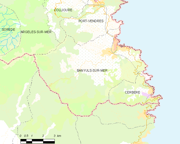
Banyuls-sur-Mer (; ) is a commune in the Pyrénées-Orientales department in southern France. It was first settled by Greeks starting in 400 BCE. Geography Location Banyuls-sur-Mer is located in the canton of La Côte Vermeille and in the arrondissement of Céret. Banyuls-sur-Mer is neighbored by Cerbère, Port-Vendres, Argelès-sur-Mer and Collioure on its French borders, and by Espolla, Rabós, Colera and Portbou on its Spanish borders. The foothills of Pyrenees, the ''Monts Albères'', run into the Mediterranean Sea in Banyuls-sur-Mer, creating a steep cliff line. Toponymy Banyuls-sur-Mer was first mentioned in 981 as ''Balneum'' or ''Balneola''. In 1074, the town started being called ''Bannils de Maritimo'' in order to distinguish it from Banyuls-dels-Aspres, which lies away. In 1197, the town was mentioned as ''Banullis de Maredine'' and in 1674. In Catalan, it has been called ''Banyuls de la Marenda'' since the 19th century. The name Banyuls indicates the presence ... [...More Info...] [...Related Items...] OR: [Wikipedia] [Google] [Baidu] |
Coustouges
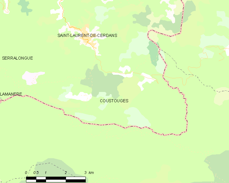
Coustouges (; ca, Costoja) is a commune in the Pyrénées-Orientales department in southern France. Inhabitants are called Coustougiens (male) or Coustougiennes (female). Geography Localisation Coustouges is located in the canton of Le Canigou and in the arrondissement of Céret. Coustouges is the second most southerly commune of mainland France, after Lamanère. The village is situated at an altitude of 832 m. Toponymy Coustouges was previously recorded with the name ''Costogia'' in 936, ''Custajas'' or ''Costogia'', and finally ''Coustouges'' (end of the 19th century). History Coustouges was a dependency of the Abbey of Arles-sur-Tech from 988 until the French Revolution. Population Notable people * Francesc Sabaté Llopart (1915-1960), anarchist, anti-Francoist maquisard, spent several years in Coustouges * François Pinault, French entrepreneur, bought a house there in September 2004. Images File:Coustouges 2010 05.jpg, Church of Notre-Dame de l� ... [...More Info...] [...Related Items...] OR: [Wikipedia] [Google] [Baidu] |
Corsavy
Corsavy (; ca, Cortsaví) is a commune in the Pyrénées-Orientales department in southern France. It is part of the historical Vallespir comarca. Geography Localisation Corsavy is located in the canton of Le Canigou and in the arrondissement of Céret. Population See also *Communes of the Pyrénées-Orientales department The Pyrénées-Orientales department is composed of 226 communes. Most of the territory (except for the district of Fenolheda) formed part of the Principality of Catalonia until 1659, and Catalan is still spoken (in addition to French) by a si ... References Communes of Pyrénées-Orientales {{PyrénéesOrientales-geo-stub ... [...More Info...] [...Related Items...] OR: [Wikipedia] [Google] [Baidu] |
Corneilla-del-Vercol
Corneilla-del-Vercol (; ca, Cornellà del Bercol) is a commune in the Pyrénées-Orientales department in southern France. Geography Localisation Corneilla-del-Vercol is located in the canton of La Plaine d'Illibéris and in the arrondissement of Perpignan. Population Notable people * Pierre Jonquères d'Oriola (1920-2011), equestrian born in Corneilla-del-Vercol. See also *Communes of the Pyrénées-Orientales department The Pyrénées-Orientales department is composed of 226 communes. Most of the territory (except for the district of Fenolheda) formed part of the Principality of Catalonia until 1659, and Catalan is still spoken (in addition to French) by a ... References Communes of Pyrénées-Orientales {{PyrénéesOrientales-geo-stub ... [...More Info...] [...Related Items...] OR: [Wikipedia] [Google] [Baidu] |
Collioure
Collioure (; ca, Cotlliure, ) is a commune in the southern French department of Pyrénées-Orientales. Geography The town of Collioure is on the Côte Vermeille (Vermilion Coast), in the canton of La Côte Vermeille and in the arrondissement of Céret. Toponymy Collioure is named ''Cotlliure'' in Catalan. History There is a record of the castle at "Castrum Caucoliberi" having been mentioned as early as 673, indicating that the settlement here was of strategic and commercial importance during the Visigoth ascendancy. Collioure used to be divided into two villages separated by the river Douy, the old town to the south named ''Port d'Avall'' (in French known as ''Le Faubourg'') and the upstream port, ''Port d'Amunt'' (in French known as ''Le Mouré''). Collioure was taken in 1642 by the French troops of Maréchal de la Meilleraye. A decade later, the town was officially surrendered to France by the 1659 Treaty of Pyrenees. Because of its highly strategic importance, the t ... [...More Info...] [...Related Items...] OR: [Wikipedia] [Google] [Baidu] |
Les Cluses
Les Cluses () is a commune in the Pyrénées-Orientales department in southern France. Geography Localisation Les Cluses is located in the canton of Vallespir-Albères and in the arrondissement of Céret. Population See also *Communes of the Pyrénées-Orientales department The Pyrénées-Orientales department is composed of 226 communes. Most of the territory (except for the district of Fenolheda) formed part of the Principality of Catalonia until 1659, and Catalan is still spoken (in addition to French) by a si ... References Communes of Pyrénées-Orientales {{PyrénéesOrientales-geo-stub ... [...More Info...] [...Related Items...] OR: [Wikipedia] [Google] [Baidu] |
Cerbère
Cerbère (; ca, Cervera de la Marenda) is a commune and railway town in the Pyrénées-Orientales department in southern France.Commune de Cerbère (66048) INSEE Its inhabitants are called ''Cerbériens'' (''Cerverins'' / ''Cerverines'' in Catalan). The village is best known for the border railway station, , on the French side of the on the railway line between Perpignan and |
Castelnou, Pyrénées-Orientales
Castelnou (; ca, Castellnou dels Aspres) is a commune in the Pyrénées-Orientales department in southern France. Geography Localisation Castelnou is located in the canton of Les Aspres and in the arrondissement of Perpignan. Population Sites of interest * Château de Castelnou : the medieval castle. * The old village, labelled as ''Plus Beaux Villages de France''. * The church of Sainte-Marie du Mercadal, from the 13th century. * The tower of Castelnou, a former watch tower. Gallery Castellnou dels Aspres.jpg, A tower of the castle Castellnou dels Aspres - Santa Maria del Mercadal.JPG, The church of Sainte-Marie du Mercadal 130607 Castelnou-07.jpg, A street in the village Castelnou21.jpg, The village seen from the castle See also *Communes of the Pyrénées-Orientales department The Pyrénées-Orientales department is composed of 226 communes. Most of the territory (except for the district of Fenolheda) formed part of the Principality of Catalonia un ... [...More Info...] [...Related Items...] OR: [Wikipedia] [Google] [Baidu] |
Camélas
Camélas (; ca, Cameles) is a commune in the Pyrénées-Orientales department in southern France. Geography Localisation Camélas is located in the canton of Les Aspres and in the arrondissement of Perpignan. Government and politics Mayors Population See also *Communes of the Pyrénées-Orientales department The Pyrénées-Orientales department is composed of 226 communes. Most of the territory (except for the district of Fenolheda) formed part of the Principality of Catalonia until 1659, and Catalan is still spoken (in addition to French) by a ... References Communes of Pyrénées-Orientales {{PyrénéesOrientales-geo-stub ... [...More Info...] [...Related Items...] OR: [Wikipedia] [Google] [Baidu] |
Calmeilles
Calmeilles (; ca, Calmella) is a commune in the Pyrénées-Orientales department in southern France. Geography Localisation Calmeilles is located in the canton of Les Aspres and in the arrondissement of Céret. Government and politics Mayors Population See also *Communes of the Pyrénées-Orientales department The Pyrénées-Orientales department is composed of 226 communes. Most of the territory (except for the district of Fenolheda) formed part of the Principality of Catalonia until 1659, and Catalan is still spoken (in addition to French) by a ... References Communes of Pyrénées-Orientales {{PyrénéesOrientales-geo-stub ... [...More Info...] [...Related Items...] OR: [Wikipedia] [Google] [Baidu] |
Caixas, Pyrénées-Orientales
Caixas (; ca, Queixàs) is a commune in the Pyrénées-Orientales department in southern France. Geography Localisation Caixas is located in the canton of Les Aspres and in the arrondissement of Perpignan. Government and politics Mayors Population See also *Communes of the Pyrénées-Orientales department The Pyrénées-Orientales department is composed of 226 communes. Most of the territory (except for the district of Fenolheda) formed part of the Principality of Catalonia until 1659, and Catalan is still spoken (in addition to French) by a ...Caixas web site References Communes of Pyrénées-Orientales {{PyrénéesOrientales-geo-stub ... [...More Info...] [...Related Items...] OR: [Wikipedia] [Google] [Baidu] |


