|
Castelnou, Pyrénées-Orientales
Castelnou (; ca, Castellnou dels Aspres) is a commune in the Pyrénées-Orientales department in southern France. Geography Localisation Castelnou is located in the canton of Les Aspres and in the arrondissement of Perpignan. Population Sites of interest * Château de Castelnou : the medieval castle. * The old village, labelled as ''Plus Beaux Villages de France''. * The church of Sainte-Marie du Mercadal, from the 13th century. * The tower of Castelnou, a former watch tower. Gallery Castellnou dels Aspres.jpg, A tower of the castle Castellnou dels Aspres - Santa Maria del Mercadal.JPG, The church of Sainte-Marie du Mercadal 130607 Castelnou-07.jpg, A street in the village Castelnou21.jpg, The village seen from the castle See also *Communes of the Pyrénées-Orientales department The Pyrénées-Orientales department is composed of 226 communes. Most of the territory (except for the district of Fenolheda) formed part of the Principality of Catalonia un ... [...More Info...] [...Related Items...] OR: [Wikipedia] [Google] [Baidu] |
Communes Of France
The () is a level of administrative division in the French Republic. French are analogous to civil townships and incorporated municipalities in the United States and Canada, ' in Germany, ' in Italy, or ' in Spain. The United Kingdom's equivalent are civil parishes, although some areas, particularly urban areas, are unparished. are based on historical geographic communities or villages and are vested with significant powers to manage the populations and land of the geographic area covered. The are the fourth-level administrative divisions of France. vary widely in size and area, from large sprawling cities with millions of inhabitants like Paris, to small hamlets with only a handful of inhabitants. typically are based on pre-existing villages and facilitate local governance. All have names, but not all named geographic areas or groups of people residing together are ( or ), the difference residing in the lack of administrative powers. Except for the municipal arrondi ... [...More Info...] [...Related Items...] OR: [Wikipedia] [Google] [Baidu] |
Thuir
Thuir (; Catalan: Tuïr, ) is a commune in the Pyrénées-Orientales department, southern France. Geography Thuir is located southwest of Perpignan, in the canton of Les Aspres and in the arrondissement of Perpignan. It is situated in a plain between the natural zones of the Aspres and the Riberal. Population See also *Communes of the Pyrénées-Orientales department The Pyrénées-Orientales department is composed of 226 communes. Most of the territory (except for the district of Fenolheda) formed part of the Principality of Catalonia until 1659, and Catalan is still spoken (in addition to French) by a si ... References External links Information in Catalan Encyclopaedia Communes of Pyrénées-Orientales {{PyrénéesOrientales-geo-stub ... [...More Info...] [...Related Items...] OR: [Wikipedia] [Google] [Baidu] |
Communes Of The Pyrénées-Orientales Department
The Pyrénées-Orientales department is composed of 226 communes. Most of the territory (except for the district of Fenolheda) formed part of the Principality of Catalonia until 1659, and Catalan is still spoken (in addition to French) by a significant minority of the population. The Catalan names of communes are taken from the ''Enciclopèdia catalana'' and are intended for comparison with the official French names: they do not indicate the current or former linguistic status of the commune. List of intercommunalities The communes cooperate in the following intercommunalities (as of 2020):BANATIC Périmètre des EPCI à fiscalité propre. Accessed 3 July 2020. * |
Les Plus Beaux Villages De France
''Les Plus Beaux Villages de France'' (meaning “the most beautiful villages of France”) is an independent association created in 1982 for the promotion of the tourist appeal of small rural villages with a rich cultural heritage. As of September 2016, it numbers 156 member villages (independent ''communes'' or part of a ''communauté de communes''). Membership requires meeting certain selection criteria and offers a strategy for development and promotion to tourists. The three initial selection criteria are the rural nature of the village (a population of less than 2,000 inhabitants), the presence of at least two national heritage sites ( ''sites classés'' or ''monuments historiques'') and local support in the form of a vote by the council. Each village must pay an annual fee to the association and the mayor must sign the association's Quality Charter. If the village fails to meet the requirements of the charter it may be excluded. The association claims membership can bri ... [...More Info...] [...Related Items...] OR: [Wikipedia] [Google] [Baidu] |
Château De Castelnou
The Château de Castelnou (also called the Château Vicomtal) is a medieval castle in the '' commune'' of Castelnou (Catalan: Castellnou dels Aspres) in the French ''département'' of Pyrénées-Orientales. The village of Castelnou takes its name from the castle. The Latin ''castellum novum'' became in Catalan ''castell nou'', the "new castle". History From 990, the castle served as the administrative and military capital of the Viscount of Vallespir. Its irregular pentagonal plan follows the rocky outcrop on which it was built, this elevated position providing defence against enemy attacks. The castle was taken by the troops of James II of Majorca en 1286, and again in 1483. Largely demolished in 1559, it was no longer restored or inhabited and deteriorated throughout the 17th and 18th centuries. At the time of the French Revolution it became the property of the ''commune''. It was sold to Viscount Satgé in 1875 and, by 1900, had become again an elegant and habitable fort ... [...More Info...] [...Related Items...] OR: [Wikipedia] [Google] [Baidu] |
Terrats
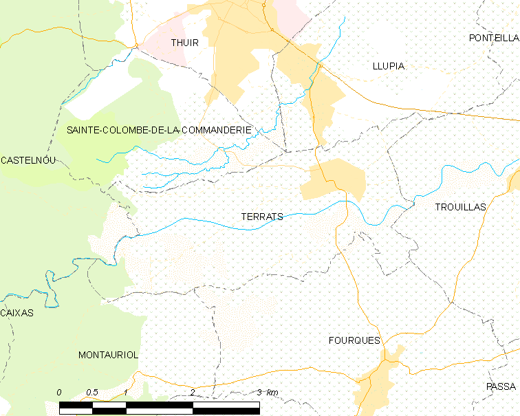
Terrats () is a commune in the Pyrénées-Orientales department in southern France. Geography Terrats is located in the canton of Les Aspres and in the arrondissement of Perpignan. Population See also *Communes of the Pyrénées-Orientales department The Pyrénées-Orientales department is composed of 226 communes. Most of the territory (except for the district of Fenolheda) formed part of the Principality of Catalonia until 1659, and Catalan is still spoken (in addition to French) by a si ... References Communes of Pyrénées-Orientales {{PyrénéesOrientales-geo-stub ... [...More Info...] [...Related Items...] OR: [Wikipedia] [Google] [Baidu] |
Sainte-Colombe-de-la-Commanderie
Sainte-Colombe-de-la-Commanderie (; ca, Santa Coloma de Tuïr) is a commune in the Pyrénées-Orientales department in southern France. Geography Sainte-Colombe-de-la-Commanderie is in the canton of Les Aspres and in the arrondissement of Perpignan. Population See also *Communes of the Pyrénées-Orientales department The Pyrénées-Orientales department is composed of 226 communes. Most of the territory (except for the district of Fenolheda) formed part of the Principality of Catalonia until 1659, and Catalan is still spoken (in addition to French) by a si ... References Communes of Pyrénées-Orientales {{PyrénéesOrientales-geo-stub ... [...More Info...] [...Related Items...] OR: [Wikipedia] [Google] [Baidu] |
Montauriol, Pyrénées-Orientales
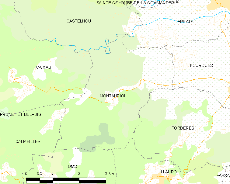
Montauriol (; ca, Montoriol) is a commune in the Pyrénées-Orientales department in southern France. Geography Montauriol is located in the canton of Les Aspres and in the arrondissement of Céret. Population See also *Communes of the Pyrénées-Orientales department The Pyrénées-Orientales department is composed of 226 communes. Most of the territory (except for the district of Fenolheda) formed part of the Principality of Catalonia until 1659, and Catalan is still spoken (in addition to French) by a si ... References Communes of Pyrénées-Orientales {{PyrénéesOrientales-geo-stub ... [...More Info...] [...Related Items...] OR: [Wikipedia] [Google] [Baidu] |
Caixas
Caixas (; ca, Queixàs) is a commune in the Pyrénées-Orientales department in southern France. Geography Localisation Caixas is located in the canton of Les Aspres and in the arrondissement of Perpignan. Government and politics Mayors Population See also *Communes of the Pyrénées-Orientales department The Pyrénées-Orientales department is composed of 226 communes. Most of the territory (except for the district of Fenolheda) formed part of the Principality of Catalonia until 1659, and Catalan is still spoken (in addition to French) by a si ...Caixas web site References Communes of Pyrénées-Orientales {{PyrénéesOrientales-geo-stub ... [...More Info...] [...Related Items...] OR: [Wikipedia] [Google] [Baidu] |
Camélas
Camélas (; ca, Cameles) is a commune in the Pyrénées-Orientales department in southern France. Geography Localisation Camélas is located in the canton of Les Aspres and in the arrondissement of Perpignan. Government and politics Mayors Population See also *Communes of the Pyrénées-Orientales department The Pyrénées-Orientales department is composed of 226 communes. Most of the territory (except for the district of Fenolheda) formed part of the Principality of Catalonia until 1659, and Catalan is still spoken (in addition to French) by a ... References Communes of Pyrénées-Orientales {{PyrénéesOrientales-geo-stub ... [...More Info...] [...Related Items...] OR: [Wikipedia] [Google] [Baidu] |
Pyrénées-Orientales
Pyrénées-Orientales (; ca, Pirineus Orientals ; oc, Pirenèus Orientals ; ), also known as Northern Catalonia, is a department of the region of Occitania, Southern France, adjacent to the northern Spanish frontier and the Mediterranean Sea. It also surrounds the tiny Spanish exclave of Llívia, and thus has two distinct borders with Spain. In 2019, it had a population of 479,979.Populations légales 2019: 66 Pyrénées-Orientales INSEE Some parts of the Pyrénées-Orientales (like the ) are part of the . It is na ... [...More Info...] [...Related Items...] OR: [Wikipedia] [Google] [Baidu] |
Quadripoint
A quadripoint is a point on Earth where four distinct territories meet. The territories can be of different types, such as national and provincial. In North America, several such places are commonly known as Four Corners. Several examples exist throughout the world that use other names. Usage The word ''quadripoint'' does not appear in the ''Oxford English Dictionary'' or ''Merriam-Webster Online'', though it has been used since 1964 by the Office of the Geographer of the United States Department of State. and appears in the ''Encyclopædia Britannica'', as well as in the ''World Factbook'' articles on Botswana, Namibia, Zambia, and Zimbabwe, dating as far back as 1990. History An early instance of four political divisions meeting at a point is the Four Shire Stone in Moreton-in-Marsh, England (attested in the Domesday Book, 1086, and mentioned since 969 if not 772); until 1931, it was the meeting point of the English counties of Gloucestershire, Oxfordshire, Warwickshire, an ... [...More Info...] [...Related Items...] OR: [Wikipedia] [Google] [Baidu] |


