|
Apadana
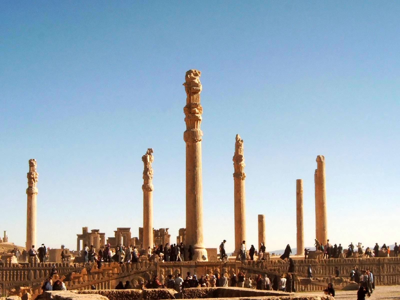
Apadana ( peo, 𐎠𐎱𐎭𐎠𐎴) is a large hypostyle hall in Persepolis, Iran. It belongs to the oldest building phase of the city of Persepolis, in the first half of the 6th century BC, as part of the original design by Darius the Great. Its construction was completed by Xerxes I. Modern scholarship "demonstrates the metaphorical nature of the Apadana reliefs as idealised social orders". M. Root (1986) p. 1. Etymology As a word, ( Old Persian 𐎠𐎱𐎭𐎠𐎴, masc.) is used to designate a hypostyle hall, i.e., a palace or audience hall of stone construction with columns. The word is rendered in Elamite as ''ha-ha-da-na'' and in Babylonian ''ap-pa-da-an'' is etymologically ambiguous. It has been compared to the Sanskrit (आपादन) which means 'to arrive at', and also to the Sanskrit ''apa-dhā'' (अपधा) which means "a hide-out or concealment", and the Greek (), meaning "storehouse". The word survived into later periods in Iran, as the Parthian '' ... [...More Info...] [...Related Items...] OR: [Wikipedia] [Google] [Baidu] |
Iran
Iran, officially the Islamic Republic of Iran, and also called Persia, is a country located in Western Asia. It is bordered by Iraq and Turkey to the west, by Azerbaijan and Armenia to the northwest, by the Caspian Sea and Turkmenistan to the north, by Afghanistan and Pakistan to the east, and by the Gulf of Oman and the Persian Gulf to the south. It covers an area of , making it the 17th-largest country. Iran has a population of 86 million, making it the 17th-most populous country in the world, and the second-largest in the Middle East. Its largest cities, in descending order, are the capital Tehran, Mashhad, Isfahan, Karaj, Shiraz, and Tabriz. The country is home to one of the world's oldest civilizations, beginning with the formation of the Elamite kingdoms in the fourth millennium BC. It was first unified by the Medes, an ancient Iranian people, in the seventh century BC, and reached its territorial height in the sixth century BC, when Cyrus the Great fo ... [...More Info...] [...Related Items...] OR: [Wikipedia] [Google] [Baidu] |
Persepolis001
, native_name_lang = , alternate_name = , image = Gate of All Nations, Persepolis.jpg , image_size = , alt = , caption = Ruins of the Gate of All Nations, Persepolis. , map = , map_type = Iran#West Asia , map_alt = , map_caption = , map_size = , altitude_m = , altitude_ref = , relief = yes , coordinates = , map_dot_label = , location = Marvdasht, Fars Province, Iran , region = , type = Settlement , part_of = , length = , width = , area = , volume = , diameter = , circumference = , height = , builder = , and , material = Limestone, mud-brick, cedar wood , built = 6th century BC , abandoned = , epochs = Achaemenid Empire , cultures = Persian , dependency_of = , occupants = , event = *Battle of the Pers ... [...More Info...] [...Related Items...] OR: [Wikipedia] [Google] [Baidu] |
Persepolis
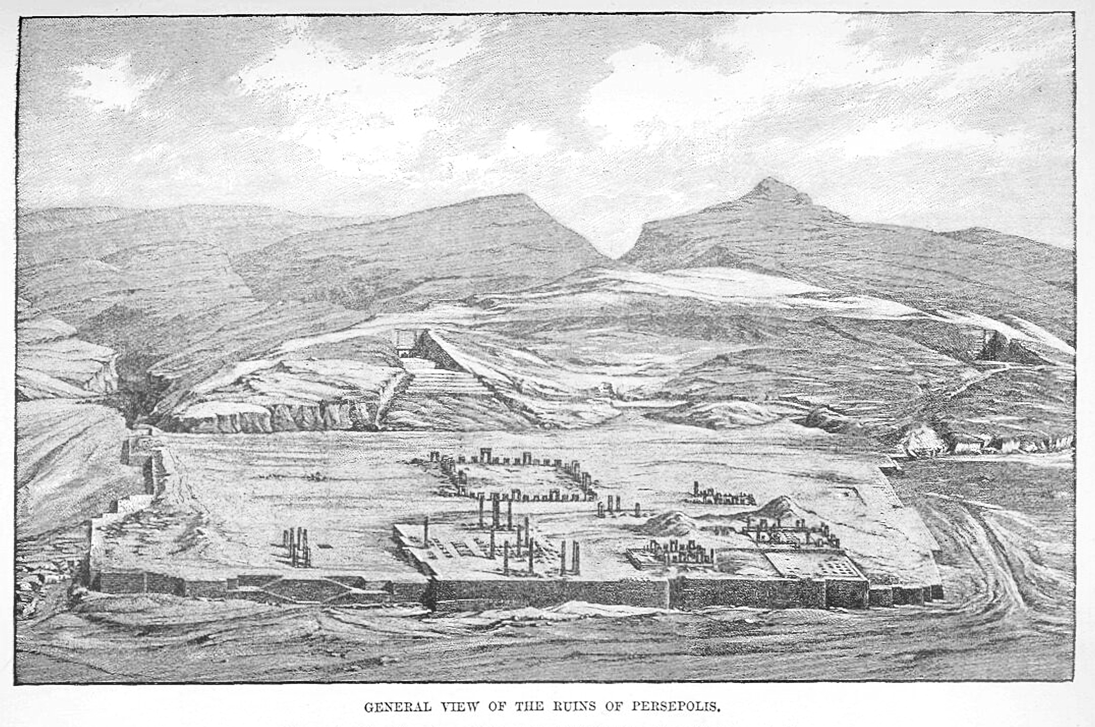
, native_name_lang = , alternate_name = , image = Gate of All Nations, Persepolis.jpg , image_size = , alt = , caption = Ruins of the Gate of All Nations, Persepolis. , map = , map_type = Iran#West Asia , map_alt = , map_caption = , map_size = , altitude_m = , altitude_ref = , relief = yes , coordinates = , map_dot_label = , location = Marvdasht, Fars Province, Iran , region = , type = Settlement , part_of = , length = , width = , area = , volume = , diameter = , circumference = , height = , builder = , and , material = Limestone, mud-brick, cedar wood , built = 6th century BC , abandoned = , epochs = Achaemenid Empire , cultures = Persian , dependency_of = , occupants = , event = * Battle of the Pe ... [...More Info...] [...Related Items...] OR: [Wikipedia] [Google] [Baidu] |
Iwan
An iwan ( fa, ایوان , ar, إيوان , also spelled ivan) is a rectangular hall or space, usually vaulted, walled on three sides, with one end entirely open. The formal gateway to the iwan is called , a Persian term for a portal projecting from the facade of a building, usually decorated with calligraphy bands, glazed tilework, and geometric designs. Since the definition allows for some interpretation, the overall forms and characteristics can vary greatly in terms of scale, material, or decoration. Iwans are most commonly associated with Islamic architecture; however, the form is Iranian in origin and was invented much earlier and fully developed in Mesopotamia around the third century CE, during the Parthian period of Persia. Etymology ''Iwan'' is a Persian word which was subsequently borrowed into other languages such as Arabic and Turkish. Its etymology is unclear. A theory by scholars like Ernst Herzfeld and W. B. Henning proposed that the root of this term is Old ... [...More Info...] [...Related Items...] OR: [Wikipedia] [Google] [Baidu] |
Persepolis Reconstruction Apadana Toit Chipiez
, native_name_lang = , alternate_name = , image = Gate of All Nations, Persepolis.jpg , image_size = , alt = , caption = Ruins of the Gate of All Nations, Persepolis. , map = , map_type = Iran#West Asia , map_alt = , map_caption = , map_size = , altitude_m = , altitude_ref = , relief = yes , coordinates = , map_dot_label = , location = Marvdasht, Fars Province, Iran , region = , type = Settlement , part_of = , length = , width = , area = , volume = , diameter = , circumference = , height = , builder = , and , material = Limestone, mud-brick, cedar wood , built = 6th century BC , abandoned = , epochs = Achaemenid Empire , cultures = Persian , dependency_of = , occupants = , event = *Battle of the Pers ... [...More Info...] [...Related Items...] OR: [Wikipedia] [Google] [Baidu] |
Persepolis Reconstruction Apadana Chipiez
, native_name_lang = , alternate_name = , image = Gate of All Nations, Persepolis.jpg , image_size = , alt = , caption = Ruins of the Gate of All Nations, Persepolis. , map = , map_type = Iran#West Asia , map_alt = , map_caption = , map_size = , altitude_m = , altitude_ref = , relief = yes , coordinates = , map_dot_label = , location = Marvdasht, Fars Province, Iran , region = , type = Settlement , part_of = , length = , width = , area = , volume = , diameter = , circumference = , height = , builder = , and , material = Limestone, mud-brick, cedar wood , built = 6th century BC , abandoned = , epochs = Achaemenid Empire , cultures = Persian , dependency_of = , occupants = , event = *Battle of the Pers ... [...More Info...] [...Related Items...] OR: [Wikipedia] [Google] [Baidu] |
Chehel Sotoun
Chehel Sotoun ( fa, چهل ستون, literally: “Forty Columns”) is a Persian pavilion in the middle of a park at the far end of a long pool, in Isfahan, Iran, built by Shah Abbas II to be used for his entertainment and receptions. In this palace, Shah Abbas II and his successors would receive dignitaries and ambassadors, either on the terrace or in one of the stately reception halls. The name, meaning "Forty Columns" in Persian, was inspired by the twenty slender wooden columns supporting the entrance pavilion, which, when reflected in the waters of the fountain, is said to appear to be forty. As with Ali Qapu, the palace contains many frescoes and paintings on ceramic. Many of the ceramic panels have been dispersed and are now in the possession of major museums in the west. They depict specific historical scenes such as the infamous Battle of Chaldiran against the Ottoman Sultan Selim I, the reception of an Uzbek King in 1646, when the palace had just been completed; t ... [...More Info...] [...Related Items...] OR: [Wikipedia] [Google] [Baidu] |
Isfahan
Isfahan ( fa, اصفهان, Esfahân ), from its Achaemenid empire, ancient designation ''Aspadana'' and, later, ''Spahan'' in Sassanian Empire, middle Persian, rendered in English as ''Ispahan'', is a major city in the Greater Isfahan Region, Isfahan Province, Iran. It is located south of Tehran and is the capital of Isfahan Province. The city has a population of approximately 2,220,000, making it the third-largest city in Iran, after Tehran and Mashhad, and the second-largest metropolitan area. Isfahan is located at the intersection of the two principal routes that traverse Iran, north–south and east–west. Isfahan flourished between the 9th and 18th centuries. Under the Safavids, Safavid dynasty, Isfahan became the capital of Achaemenid Empire, Persia, for the second time in its history, under Shah Abbas the Great. The city retains much of its history. It is famous for its Perso–Islamic architecture, grand boulevards, covered bridges, palaces, tiled mosques, and mina ... [...More Info...] [...Related Items...] OR: [Wikipedia] [Google] [Baidu] |
Ctesiphon
Ctesiphon ( ; Middle Persian: 𐭲𐭩𐭮𐭯𐭥𐭭 ''tyspwn'' or ''tysfwn''; fa, تیسفون; grc-gre, Κτησιφῶν, ; syr, ܩܛܝܣܦܘܢThomas A. Carlson et al., “Ctesiphon — ܩܛܝܣܦܘܢ ” in The Syriac Gazetteer last modified July 28, 2014, http://syriaca.org/place/58.) was an ancient city, located on the eastern bank of the Tigris, about southeast of present-day Baghdad. Ctesiphon served as a royal capital of the empires in the Parthian and Sasanian eras for over eight hundred years. Ctesiphon was capital of the Sasanian Empire from 226–637 until the Muslim conquest of Persia in 651 AD. Ctesiphon developed into a rich commercial metropolis, merging with the surrounding cities along both shores of the river, including the Hellenistic city of Seleucia. Ctesiphon and its environs were therefore sometimes referred to as "The Cities" (Aramaic: ''Mahuza'', ar, المدائن, '' al-Mada'in''). In the late sixth and early seventh century, it was listed as ... [...More Info...] [...Related Items...] OR: [Wikipedia] [Google] [Baidu] |
Armenian Language
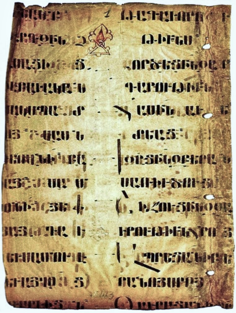
Armenian ( classical: , reformed: , , ) is an Indo-European language and an independent branch of that family of languages. It is the official language of Armenia. Historically spoken in the Armenian Highlands, today Armenian is widely spoken throughout the Armenian diaspora. Armenian is written in its own writing system, the Armenian alphabet, introduced in 405 AD by the priest Mesrop Mashtots. The total number of Armenian speakers worldwide is estimated between 5 and 7 million. History Classification and origins Armenian is an independent branch of the Indo-European languages. It is of interest to linguists for its distinctive phonological changes within that family. Armenian exhibits more satemization than centumization, although it is not classified as belonging to either of these subgroups. Some linguists tentatively conclude that Armenian, Greek (and Phrygian) and Indo-Iranian were dialectally close to each other;''Handbook of Formal Languages'' (1997p. 6 wit ... [...More Info...] [...Related Items...] OR: [Wikipedia] [Google] [Baidu] |
Sasanian
The Sasanian () or Sassanid Empire, officially known as the Empire of Iranians (, ) and also referred to by historians as the Neo-Persian Empire, was the last Iranian empire before the early Muslim conquests of the 7th-8th centuries AD. Named after the House of Sasan, it endured for over four centuries, from 224 to 651 AD, making it the longest-lived Persian imperial dynasty. The Sasanian Empire succeeded the Parthian Empire, and re-established the Persians as a major power in late antiquity alongside its neighbouring arch-rival, the Roman Empire (after 395 the Byzantine Empire).Norman A. Stillman ''The Jews of Arab Lands'' pp 22 Jewish Publication Society, 1979 International Congress of Byzantine Studies ''Proceedings of the 21st International Congress of Byzantine Studies, London, 21–26 August 2006, Volumes 1–3'' pp 29. Ashgate Pub Co, 2006 The empire was founded by Ardashir I, an Iranian ruler who rose to power as Parthia weakened from internal strife and wars with th ... [...More Info...] [...Related Items...] OR: [Wikipedia] [Google] [Baidu] |
Parthia
Parthia ( peo, 𐎱𐎼𐎰𐎺 ''Parθava''; xpr, 𐭐𐭓𐭕𐭅 ''Parθaw''; pal, 𐭯𐭫𐭮𐭥𐭡𐭥 ''Pahlaw'') is a historical region located in northeastern Greater Iran. It was conquered and subjugated by the empire of the Medes during the 7th century BC, was incorporated into the subsequent Achaemenid Empire under Cyrus the Great in the 6th century BC, and formed part of the Hellenistic Seleucid Empire following the 4th-century-BC conquests of Alexander the Great. The region later served as the political and cultural base of the Eastern Iranian Parni people and Arsacid dynasty, rulers of the Parthian Empire (247 BC – 224 AD). The Sasanian Empire, the last state of pre-Islamic Iran, also held the region and maintained the seven Parthian clans as part of their feudal aristocracy. Name The name "Parthia" is a continuation from Latin ', from Old Persian ', which was the Parthian language self-designator signifying "of the Parthians" who were an Iranian ... [...More Info...] [...Related Items...] OR: [Wikipedia] [Google] [Baidu] |


.jpg)


