|
Zwiefalten
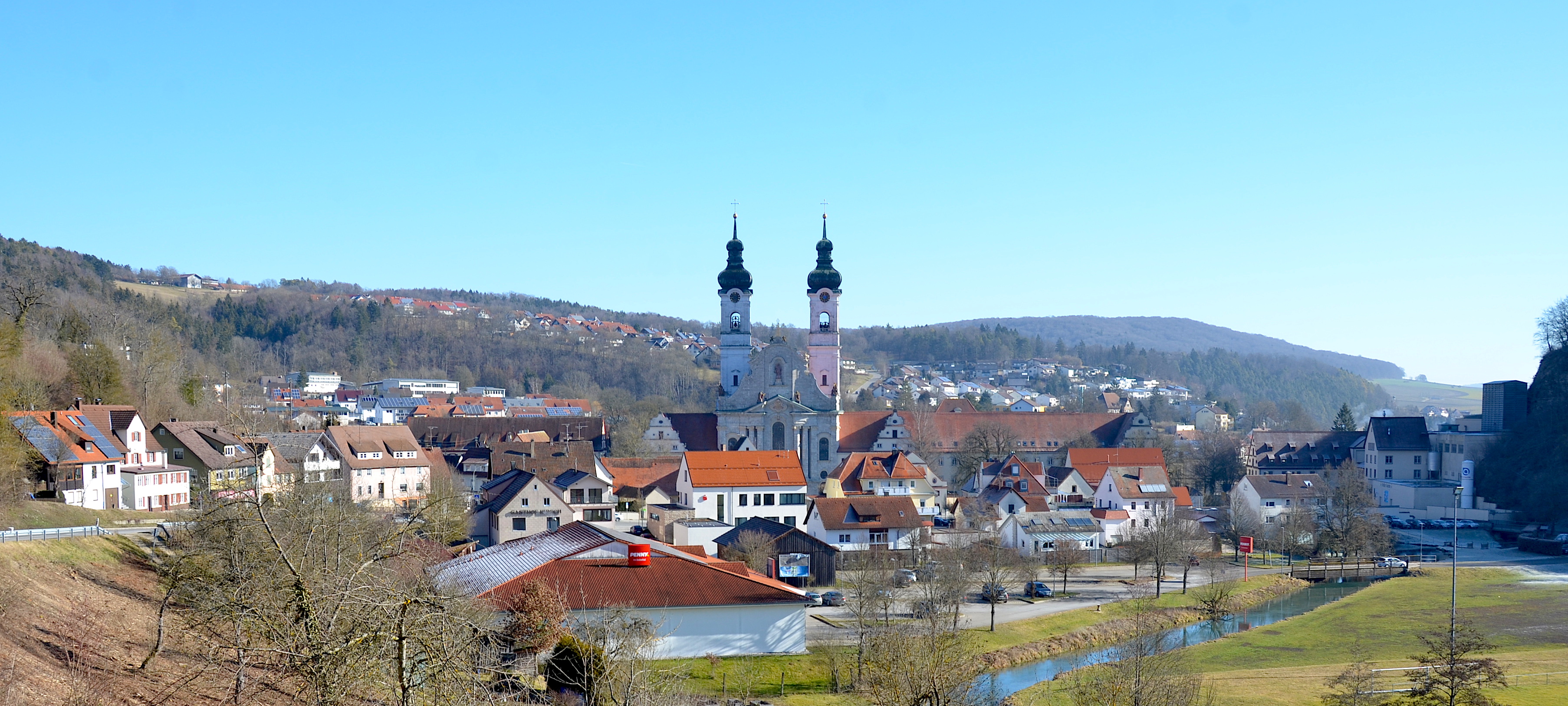
Zwiefalten is a municipality in the district of Reutlingen, Baden-Württemberg, Germany located halfway between Stuttgart and Lake Constance. The former Zwiefalten Abbey dominates the town. The former monastery is considered one of the finest examples of late Baroque art. Geographical location The name derives from its location in the valleys of Zwiefalter Aach and the Kessel-Aach and was mentioned first as Zwivaltum in 904. Neighboring communities The following cities and towns are bordering to the municipality of Zwiefalten (listed clockwise from the north) and belong to the district of Reutlingen and the Alb-Donau-district¹ and district Biberach²: Hayingen, Emeringen¹, Riedlingen², Langenenslingen² and Pfronstetten. Municipality arrangement The municipality Zwiefalten with the municipality parts Baach, Gauingen, Gossenzungen, Hochberg, Mörsingen, Sonderbuch, and Upflamör Zwiefalten include a total of seven villages, one hamlet (Attenhöfen) and three yards (Loretto, ... [...More Info...] [...Related Items...] OR: [Wikipedia] [Google] [Baidu] |
Zwiefalten 1890
Zwiefalten is a municipality in the district of Reutlingen, Baden-Württemberg, Germany located halfway between Stuttgart and Lake Constance. The former Zwiefalten Abbey dominates the town. The former monastery is considered one of the finest examples of late Baroque art. Geographical location The name derives from its location in the valleys of Zwiefalter Aach and the Kessel-Aach and was mentioned first as Zwivaltum in 904. Neighboring communities The following cities and towns are bordering to the municipality of Zwiefalten (listed clockwise from the north) and belong to the district of Reutlingen and the Alb-Donau-district¹ and district Biberach²: Hayingen, Emeringen¹, Riedlingen², Langenenslingen² and Pfronstetten. Municipality arrangement The municipality Zwiefalten with the municipality parts Baach, Gauingen, Gossenzungen, Hochberg, Mörsingen, Sonderbuch, and Upflamör Zwiefalten include a total of seven villages, one hamlet (Attenhöfen) and three yards (Loretto, B� ... [...More Info...] [...Related Items...] OR: [Wikipedia] [Google] [Baidu] |
Zwiefalten Abbey
Zwiefalten Abbey (german: Kloster Zwiefalten, Abtei Zwiefalten or after 1750, ) is a former Benedictine monastery situated at Zwiefalten near Reutlingen in Baden-Württemberg in Germany. History The monastery was founded in 1089 at the time of the Investiture Controversy by Counts Gero and Kuno of Achalm, advised by Bishop Adalbero of Würzburg and Abbot William of Hirsau. The first monks were also from Hirsau Abbey, home of the Hirsau Reforms (under the influence of the Cluniac reforms), which strongly influenced the new foundation. Noker von Zwiefalten was the first abbot and led from 1065–90. The monk Ortlieb wrote a history of the monastery in the early 12th century. Berthold continued it to 1137–38. He served as abbot in 1139–1141, 1146/7–1152/6 and 1158–1169. During the 12th century Saint Ernest (died 1148) was abbot. Between 1145 and 1149 he participated in the Second Crusade to regain the Holy Lands including Jerusalem. Although Pope Urban VI granted spec ... [...More Info...] [...Related Items...] OR: [Wikipedia] [Google] [Baidu] |
Langenenslingen
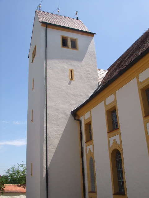
Langenenslingen (; Swabian: ''Ẽslenga'') is a municipality in the district of Biberach in Baden-Württemberg in Germany. It has a population close to 3,500. Geography Location Langenenslingen is located on the northern edge of Upper Swabia in Old and Young Drift in the district of Biberach. It lies on the Upper Swabian Baroque Route, a tourist route. The highest elevation of the Biberach district with 801 metres is located in Ittenhausen. History Langenenslingen was first mentioned in a document in 935. It originally belonged to the Counts of Veringen. They sold it in 1291 to the House of Habsburg. In 1806 Langenenslingen fell to Hohenzollern-Sigmaringen, where it was assigned to ''Oberamt'' Sigmaringen, later Sigmaringen district. In 1945 it became a part of the newly formed Württemberg-Hohenzollern and since 1952 it has been part of the state of Baden-Württemberg. Since 1973 Langenenslingen has been located in Biberach district. Amalgamations *1 February 1972: Egelfin ... [...More Info...] [...Related Items...] OR: [Wikipedia] [Google] [Baidu] |
Zwiefalter Aach
The Zwiefalter Aach or Zwiefalter Ach is a river in Reutlingen district and Biberach district in Baden-Württemberg, Germany. It is approximately 9 kilometres long and is a tributary of the Danube near Zwiefalten. The river is known for the Wimsener Höhle The Wimsener Höhle (or Wimsen Cave) is Germany´s only water cave, which can be visited by boat. It is located in the municipal area of Hayingen on the Swabian Alb, about three kilometers north of Zwiefalten. Description The Wimsener Höhle or .... References Rivers of Baden-Württemberg Rivers of Germany {{BadenWürttemberg-river-stub ... [...More Info...] [...Related Items...] OR: [Wikipedia] [Google] [Baidu] |
Riedlingen
Riedlingen () is a town in the district (''Kreis'') of Biberach, Baden-Württemberg, in the south-west of Germany. It is one of the destinations of the Upper Swabian Baroque Route. Riedlingen has approximately 10,000 inhabitants. Geography The town is situated on the river Danube. Furthermore, there it lies in a dale which is created by the extensions of the Swabian Alps. Around Riedlingen there are seven villages which are part of the urban district. These are called Neufra, Daugendorf, Grüningen, Pflummern, Zwiefaltendorf, Zell and Bechingen. History Riedlingen is probably an Alemannic foundation. The first written reference dates back to 835. The medieval city was built 1247–1255, situated east of the hamlet of the Earl of Veringen. It was a typical town with its foundations kept in rectangular and square roads with the market place as the centre. Even in the late 13th Century the city was in possession of the Habsburgs, but which they pledged later. In 1314 th ... [...More Info...] [...Related Items...] OR: [Wikipedia] [Google] [Baidu] |
Kaufbeuren
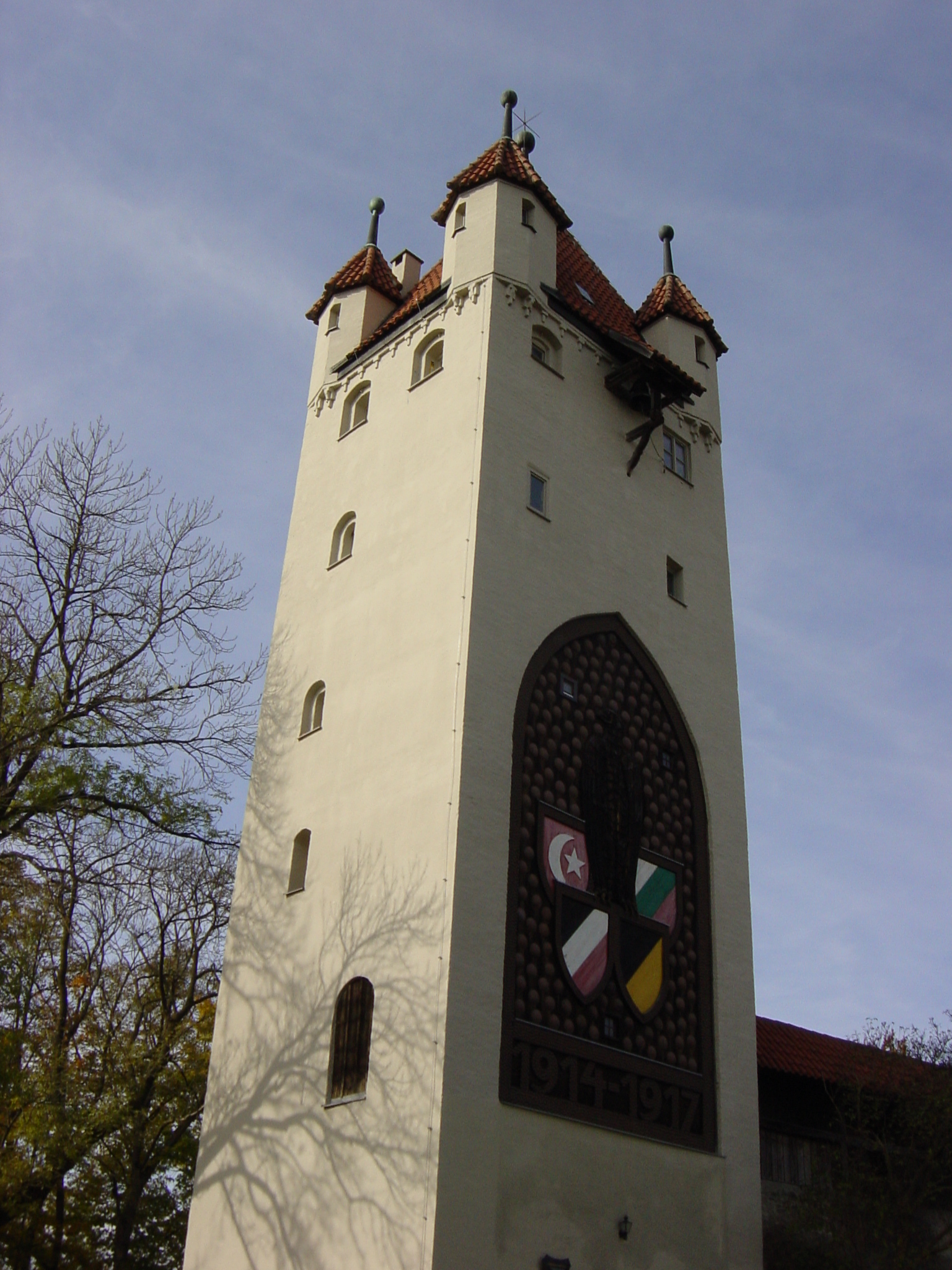
Kaufbeuren (; Bavarian: ''Kaufbeiren'') is an independent town in the ''Regierungsbezirk'' of Swabia, Bavaria. The town is an enclave within the district of Ostallgäu. Districts Kaufbeuren consists of nine districts: * Kaufbeuren (town core incl. historical town) * Kaufbeuren-Neugablonz * Oberbeuren * Hirschzell * Kleinkemnat * Großkemnat * Märzisried * Ölmühlhang * Sankt Cosmas MayorsStefan Bosse (CSU) is the Lord Mayor of Kaufbeuren since November 2004. He was reelected in March 2014 with 57.48% of the votes and again in March 2020 with 54.5% of the votes. Landmarks * Town hall (built 1879–1881)Crescentiakloster (founded 1150) * Historical town with partial ... [...More Info...] [...Related Items...] OR: [Wikipedia] [Google] [Baidu] |
Grafeneck
Grafeneck is a small rural village in the German municipality of Gomadingen, south of Stuttgart. World War II history Grafeneck Castle, which had previously been an asylum for crippled people, was turned by the Nazis into an extermination facility. Between January and December 1940, 10,654 people with mental disabilities or psychological disorders were gassed at this facility with carbon monoxide in the first gas chamber and then cremated. This was the beginning of the T-4 Euthanasia Program (German, ) was a campaign of mass murder by involuntary euthanasia in Nazi Germany. The term was first used in post-war trials against doctors who had been involved in the killings. The name T4 is an abbreviation of 4, a street address of t .... Grafeneck was the first Nazi institution to be transformed in a gas chamber and crematorium. References Villages in Baden-Württemberg Reutlingen (district) {{BadenWurttemberg-geo-stub ... [...More Info...] [...Related Items...] OR: [Wikipedia] [Google] [Baidu] |
Gemeinnützige Krankentransport GmbH
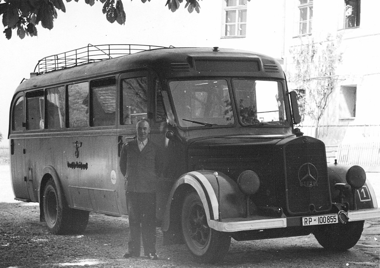
The Gemeinnützige Krankentransport GmbH (; known as ''"Gekrat"'' or ''"GeKraT"'', commonly translated as "Charitable Ambulance") was a subdivision of the Action T4 organization. The euphemistically named company transported sick and disabled people to the Nazi killing centers to be murdered under the Nazi eugenics program and was known for the gray buses it used. The many victims were murdered in sealed gas chambers with carbon monoxide gas supplied in metal gas cylinders, and fed through false spray heads appearing to be shower heads. The programme Aktion T4 was managed by Viktor Brack, who was tried for his crimes at Nuremberg, and executed as a result. The operation was ordered by Adolf Hitler in early September 1939, and organized by Philip Bouhler and Karl Brandt of the Reich Chancellery. Background ''Gekrat'' was created to transport the victims to the Nazi killing centers Grafeneck Castle, Brandenburg, Schloss Hartheim, Schloss Sonnenstein, Bernburg and Hadamar E ... [...More Info...] [...Related Items...] OR: [Wikipedia] [Google] [Baidu] |
Ellwangen
Ellwangen an der Jagst, officially Ellwangen (Jagst), in common use simply Ellwangen () is a town in the district of Ostalbkreis in the east of Baden-Württemberg in Germany. It is situated about north of Aalen. Ellwangen has 25,000 inhabitants. Geography Ellwangen is situated in the valley of the river Jagst, between the foothills of the Swabian Alb and Virngrund (ancient Virgundia) forest, the latter being part of the Swabian-Franconian Forest. The Jagst runs through Ellwangen from south to north. History The town developed in the 7th century as an Alemannic settlement in the Virgunna forest next to the Franconian-Swabian border. In 764 the Frankish noble Hariolf, Bishop of Langres, founded a Benedictine monastery, Ellwangen Abbey, on a hill next to the settlement. The monastery was mentioned in a document of Louis the Pious as ''Elehenuuwang'' in 814. It became a ''Reichsabtei'' in 817. From 870 to 873 the Byzantine Greek "Apostle of the Slavs" Saint Methodius was impris ... [...More Info...] [...Related Items...] OR: [Wikipedia] [Google] [Baidu] |
Krautheim
Krautheim (East Franconian German, East Franconian: ''Graude'') is a town in the Hohenlohe (district), Hohenlohe district of Baden-Württemberg, in south central Germany. It is situated on the river Jagst, 12 km (8 mi) northwest of Künzelsau, and 16 km (10 mi) southwest of Bad Mergentheim. The town lies in the border area between the Baden and Württemberg regions. Records from the year 1096 mention the area as "Crutheim", but the modern incorporation was approved during 1972-73. Geography Geographical location Krautheim is located at the northernmost point of the Jagst river, at elevation , in southern Germany. The Jagst river, in this area, has dug into the limestone terrain of the Hoheloher Ebene. Characteristic of Krautheim is the view of the same castle visible from afar, which offers a 17 m high and up to 2.70 m thick shield wall (), as an impressive sight. The massive keep, castle keep, with its height of , gives a comprehensive view into the J ... [...More Info...] [...Related Items...] OR: [Wikipedia] [Google] [Baidu] |
Konstanz
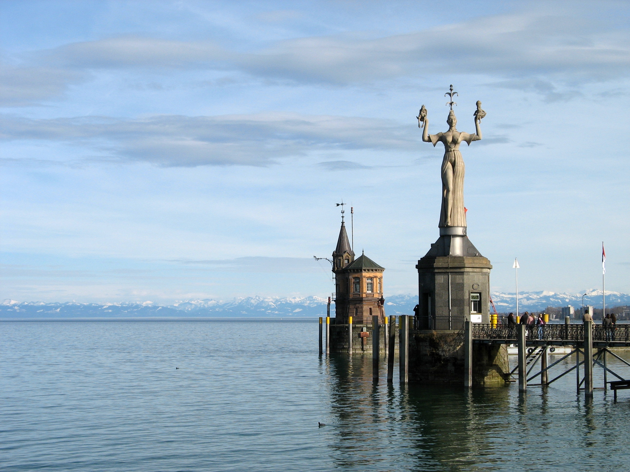
Konstanz (, , locally: ; also written as Constance in English) is a university city with approximately 83,000 inhabitants located at the western end of Lake Constance in the south of Germany. The city houses the University of Konstanz and was the residence of the Roman Catholic Diocese of Konstanz for more than 1,200 years. Location The city is located in the state of Baden-Württemberg and situated at the banks of Lake Constance (''Bodensee'' in German). The river Rhine, which starts in the Swiss Alps, passes through Lake Constance and leaves it, considerably larger, by flowing under a bridge connecting the two parts of the city. North of the river lies the larger part of the city with residential areas, industrial estates, and the University of Konstanz; while south of the river is the old town, which houses the administrative centre and shopping facilities in addition to the ''Hochschule'' or the ''University of Applied Sciences''. Car ferries provide access across Lake Cons ... [...More Info...] [...Related Items...] OR: [Wikipedia] [Google] [Baidu] |
