|
Zselic National Landscape Protection Area
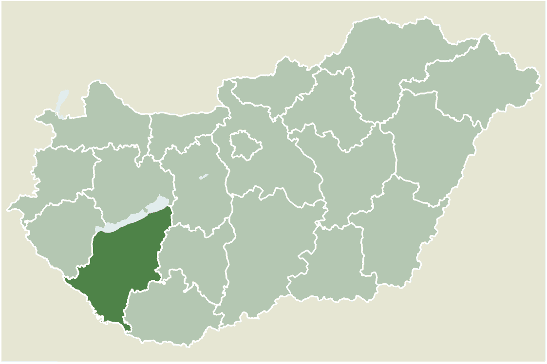
Zselic National Landscape Protection Area (Hungarian language: Zselici T√°jv√©delmi K√∂rzet ą í…õlitsi ňątaňźjveňźd…õlmi ňąk√ł…ĺz…õt is a dark-sky preserve in Hungary. It is located in the counties of Somogy and Baranya, between Kaposv√°r and P√©cs, and whose boundary is managed by the Danube-Drava National Park. This includes some of the hills of Transdanubia, in the heart of the massif In geology, a massif ( or ) is a section of a planet's crust that is demarcated by faults or flexures. In the movement of the crust, a massif tends to retain its internal structure while being displaced as a whole. The term also refers to a ... of Zselic. References {{Park-stub Dark-sky preserves Protected areas established in 1976 Protected areas of the Carpathians Somogy County Baranya County ... [...More Info...] [...Related Items...] OR: [Wikipedia] [Google] [Baidu] |
Kaposv√°r
Kaposv√°r (; also known by other alternative names) is a city with county rights in the southwestern part of Hungary, south of Lake Balaton. It is one of the leading cities of Transdanubia, the capital of Somogy County, and the seat of the Kaposv√°r District and the Roman Catholic Diocese of Kaposv√°r. Etymology and names The name ''Kaposv√°r'' is derived from the Hungarian words ''kapu'' (gate) and ''v√°r'' (castle). Variants of the city's name include ''Ruppertsburg'' / ''Ruppertsberg'' / ''Kopisch'' (German), ''KapoŇüvar'' ( Turkish), ''Rupertgrad'' ( Slovene), and ''KapoŇ°var'' ( Croatian). Symbols The shield of Kaposv√°r features a castle with a rounded arch port surmounted by three battlements with loopholes on a hill of green grass. The flag of Kaposv√°r consists of the coat of arms placed over a yellow background. Geography Kaposv√°r is surrounded by the hills of the outer Somogy area around the Kapos river and the forests of Zselic. It lies southwest of Budapes ... [...More Info...] [...Related Items...] OR: [Wikipedia] [Google] [Baidu] |
Danube-Drava National Park
Danube-Drava National Park was founded in 1996 and is located in the south west of Hungary. The current area is 490 square kilometres and the majority of the national park sites are located within the Danube and Drava floodland areas, of which 190 km2 are Ramsar Convention, Ramsar wetlands. Black stork and White-tailed eagle populations are of European significance. Seven invertebrate species are found only here in Hungary. Habitats along the Drava host more than 400 protected plants and animals. Species endemic to national park areas include the Crataegus nigra, black hawthorn and the Drava caddis fly. External links * National parks of Hungary Protected areas established in 1996 Geography of Baranya County Geography of Tolna County Geography of B√°cs-Kiskun County Tourist attractions in Baranya County Tourist attractions in Tolna County Tourist attractions in B√°cs-Kiskun County 1996 establishments in Hungary {{Hungary-geo-stub ... [...More Info...] [...Related Items...] OR: [Wikipedia] [Google] [Baidu] |
Hungarian Language
Hungarian () is an Uralic language spoken in Hungary and parts of several neighbouring countries. It is the official language of Hungary and one of the 24 official languages of the European Union. Outside Hungary, it is also spoken by Hungarian communities in southern Slovakia, western Ukraine ( Subcarpathia), central and western Romania (Transylvania), northern Serbia (Vojvodina), northern Croatia, northeastern Slovenia (Prekmurje), and eastern Austria. It is also spoken by Hungarian diaspora communities worldwide, especially in North America (particularly the United States and Canada) and Israel. With 17 million speakers, it is the Uralic family's largest member by number of speakers. Classification Hungarian is a member of the Uralic language family. Linguistic connections between Hungarian and other Uralic languages were noticed in the 1670s, and the family itself (then called Finno-Ugric) was established in 1717. Hungarian has traditionally been assigned to the Ugric alo ... [...More Info...] [...Related Items...] OR: [Wikipedia] [Google] [Baidu] |
Dark-sky Preserve
A dark-sky preserve (DSP) is an area, usually surrounding a park or observatory, that restricts artificial light pollution. The purpose of the dark-sky movement is generally to promote astronomy. However, astronomy is certainly not the only objective of conserving a dark sky. A dark night sky is associated with many facets of history, philosophy, religion, societal development, poetry, song, mathematics, and science. Different terms have been used to describe the areas as national organizations have worked independently to create their programs. The International Dark-Sky Association (IDA) uses International Dark Sky Reserve (IDSR) and International Dark Sky Park (IDSP). A third designation, International Dark Sky Sanctuary, was introduced in 2015. History An International Dark-Sky Association (IDA) was founded in 1988 to reserve public or private land for an exquisite outlook of nocturnal territories and starry night skies. These reserves are specifically conserved for its sci ... [...More Info...] [...Related Items...] OR: [Wikipedia] [Google] [Baidu] |
Counties Of Hungary
, alt_name = , alt_name1 = , alt_name2 = , alt_name3 = , alt_name4 = , map = , category = Unitary state , territory = Hungary , upper_unit = , start_date = 1950 (Current form, 19 + Budapest) , start_date1 = , start_date2 = , start_date3 = , start_date4 = , legislation_begin = , legislation_begin1 = , legislation_begin2 = , legislation_begin3 = , legislation_begin4 = , legislation_end = , legislation_end1 = , legislation_end2 = , legislation_end3 = , legislation_end4 = , end_date = , end_date1 = , end_date2 = , end_date3 = , end_date4 = , current_number = 19 , number_date = 1950 , type = , type1 = , type2 = , type3 = , type4 = , status = , statu ... [...More Info...] [...Related Items...] OR: [Wikipedia] [Google] [Baidu] |
Somogy County
Somogy ( hu, Somogy megye, ; hr, ҆omońĎska Ňĺupanija; sl, ҆omodska Ňĺupanija, german: Komitat Schomodei) is an administrative county (comitatus or ''megye'') in present Hungary, and also in the former Kingdom of Hungary. Somogy County lies in south-western Hungary, on the border with Croatia (Koprivnica-KriŇĺevci County and Virovitica-Podravina County). It stretches between the river Dr√°va and the southern shore of Lake Balaton. It shares borders with the Hungarian counties of Zala, Veszpr√©m, Fej√©r, Tolna, and Baranya. It is the most sparsely populated county in Hungary. The capital of Somogy County is Kaposv√°r. Its area is 6,036 km2. History Somogy was also the name of a historic administrative county (comitatus) of the Kingdom of Hungary. Its territory, which was slightly larger than that of present Somogy County, is now in south-western Hungary. The capital of the county was and still is Kaposv√°r. Demographics In 2015, it had a population of 312,084 an ... [...More Info...] [...Related Items...] OR: [Wikipedia] [Google] [Baidu] |
Baranya County
Baranya ( hu, Baranya megye, ) is a county () in southern Hungary. It is part of the Southern Transdanubia statistical region and the historical Baranya region, which was a county (''comitatus'') in the Kingdom of Hungary dating back to the 11th century. Its current status as one of the 19 counties of Hungary was established in 1950 as part of wider Soviet administrative territorial reform following World War II. It is bordered by Somogy County to the northwest, Tolna County to the north, Bács-Kiskun County and the Danube to the east, and the border with Croatia (part of which is formed by the Drava River) to the south. As of the 2011 census, it had a population of 386,441 residents. Of the 19 counties of Hungary (excluding Budapest), it is ranked 10th by both geographic area and population. Its county seat and largest city is Pécs. Etymology In German, it is known as , and in Croatian as . The county was probably named after its first comes 'Brana' or 'Braina'. Geogr ... [...More Info...] [...Related Items...] OR: [Wikipedia] [Google] [Baidu] |
Pécs
P√©cs ( , ; hr, Peńćuh; german: F√ľnfkirchen, ; also known by other #Name, alternative names) is List of cities and towns of Hungary#Largest cities in Hungary, the fifth largest city in Hungary, on the slopes of the Mecsek mountains in the country's southwest, close to its border with Croatia. It is the administrative and economic centre of Baranya County, and the seat of the Roman Catholic Diocese of P√©cs. A city dating back to ancient times, settled by the Celts and the Romans, it was made an episcopal see in early medieval Hungary. It has University of P√©cs, the oldest university in the country, and is one of its major cultural centers. It has a rich cultural heritage from the age of a 150-year Ottoman occupation. It is historically a multi-ethnic city where many cultures have interacted through 2000 years of history. In recent times, it has been recognized for its cultural heritage, including being named as one of the European Capital of Culture cities. Name The earliest ... [...More Info...] [...Related Items...] OR: [Wikipedia] [Google] [Baidu] |
Transdanubia
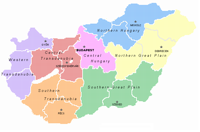
Transdanubia ( hu, Dun√°nt√ļl; german: Transdanubien, hr, Prekodunavlje or ', sk, Zadunajsko :sk:Zadunajsko) is a traditional region of Hungary. It is also referred to as Hungarian Pannonia, or Pannonian Hungary. Administrative divisions Traditional interpretation The borders of Transdanubia are the Danube River (north and east), the Drava and Mura rivers (south), and the foothills of the Alps roughly along the border between Hungary and Austria (west). Transdanubia comprises the counties of GyŇĎr-Moson-Sopron, Kom√°rom-Esztergom, Fej√©r, Veszpr√©m, Vas, Zala, Somogy, Tolna, Baranya and the part of Pest that lies west of the Danube. (In the early Middle Ages the latter was known as Pilis county.) This article deals with Transdanubia in this geographical meaning. Territorial changes While the northern, eastern and southern borders of the region are clearly marked by the Danube and Drava rivers, the western border was always identical with the political boundary of ... [...More Info...] [...Related Items...] OR: [Wikipedia] [Google] [Baidu] |
Massif
In geology, a massif ( or ) is a section of a planet's crust that is demarcated by faults or flexures. In the movement of the crust, a massif tends to retain its internal structure while being displaced as a whole. The term also refers to a group of mountains formed by such a structure. In mountaineering and climbing literature, a massif is frequently used to denote the main mass of an individual mountain. The massif is a smaller structural unit of the crust than a tectonic plate, and is considered the fourth-largest driving force in geomorphology. The word is taken from French (in which the word also means "massive"), where it is used to refer a large mountain mass or compact group of connected mountains forming an independent portion of a range. One of the most notable European examples of a massif is the Massif Central of the Auvergne region of France. The Face on Mars is an example of an extraterrestrial massif. Massifs may also form underwater, as with the Atlanti ... [...More Info...] [...Related Items...] OR: [Wikipedia] [Google] [Baidu] |


