|
Zugspitzplatt
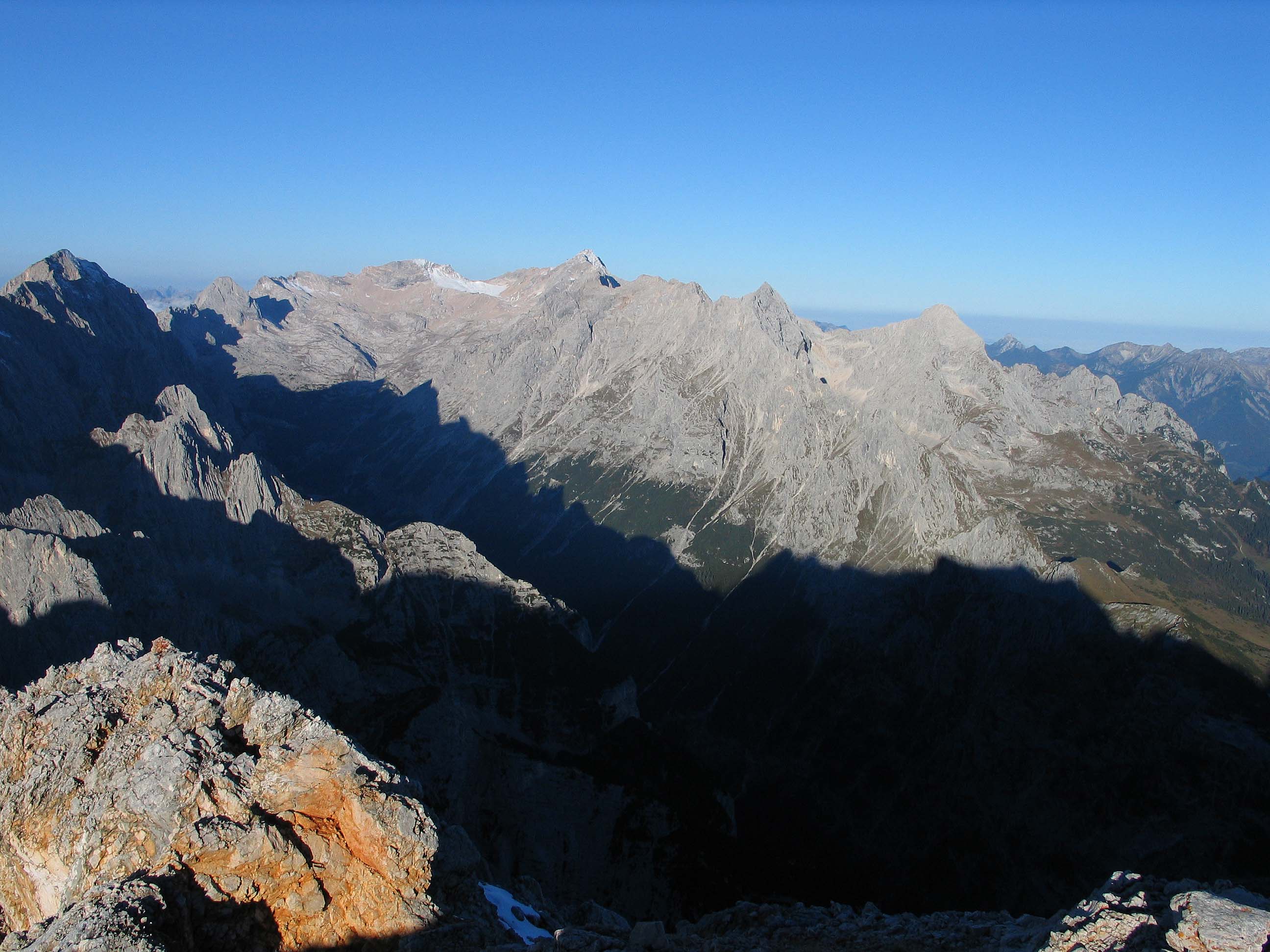
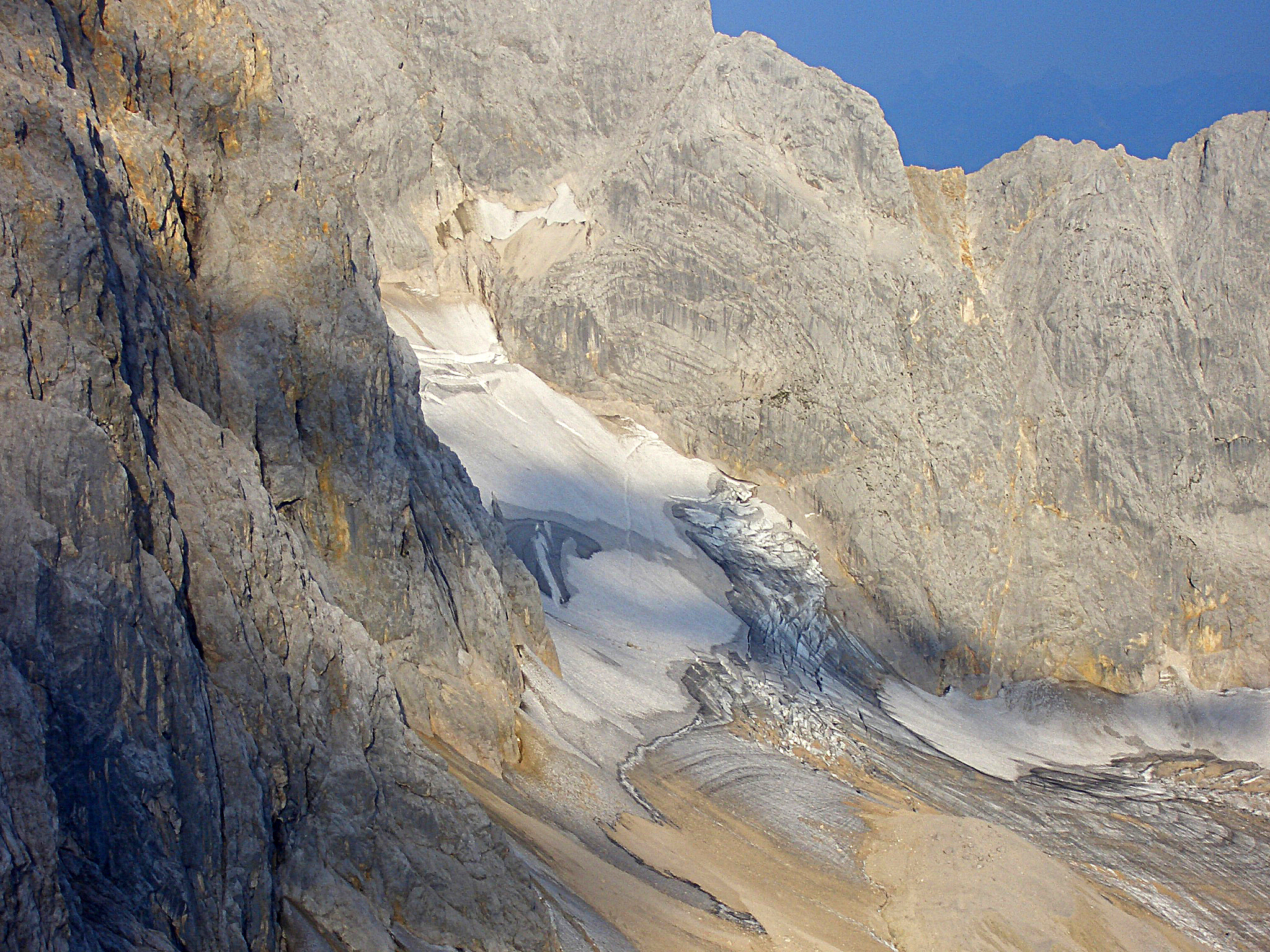
The Zugspitze (), at above sea level, is the highest peak of the Wetterstein Mountains as well as the highest mountain in Germany. It lies south of the town of Garmisch-Partenkirchen, and the Austria–Germany border runs over its western summit. South of the mountain is the ''Zugspitzplatt'', a high karst plateau with numerous caves. On the flanks of the Zugspitze are three glaciers, including the two largest in Germany: the Northern Schneeferner with an area of 30.7 hectares and the Höllentalferner with an area of 24.7 hectares. The third is the Southern Schneeferner which covers 8.4 hectares. The Zugspitze was first climbed on 27 August 1820 by Josef Naus, his survey assistant, Maier, and mountain guide, Johann Georg Tauschl. Today there are three normal routes to the summit: one from the Höllental valley to the northeast; another out of the Reintal valley to the southeast; and the third from the west over the Austrian Cirque (''Österreichische Schneekar''). One of t ... [...More Info...] [...Related Items...] OR: [Wikipedia] [Google] [Baidu] |
Wetterstein Mountains
The Wetterstein mountains (german: Wettersteingebirge), colloquially called Wetterstein, is a mountain group in the Northern Limestone Alps within the Eastern Alps. It is a comparatively compact range located between Garmisch-Partenkirchen, Mittenwald, Seefeld in Tirol and Ehrwald along the border between Germany (Bavaria) and Austria (Tyrol). Zugspitze, the highest peak is at the same time the highest mountain in Germany. The Wetterstein mountains are an ideal region for mountaineers and climbers. Mountain walkers sometimes need to allow for significant differences in elevation. The proximity of the range to the south German centres of population, the scenic landscape and its good network of cable cars and lifts mean that the mountains are heavily frequented by tourists for most of the year. There are, however, places in the Wetterstein that are rarely or never visited by people. Neighbouring ranges The Wetterstein borders on the following other mountain rang ... [...More Info...] [...Related Items...] OR: [Wikipedia] [Google] [Baidu] |
Schneeferner
} The Schneeferner in the Bavarian Alps is Germany's highest and largest glacier.''Kaltgestellter Gletscher'' at www.sueddeutsche.de. Accessed on 23 Dec 2010 Geography Schneeferner glacier is located on the '' Zugspitzplatt'', a plateau south of the country's highest peak, the , that descends from west to east and forms the head of the Reintal valley. The |
Wettersteingebirge
The Wetterstein mountains (german: Wettersteingebirge), colloquially called Wetterstein, is a mountain group in the Northern Limestone Alps within the Eastern Alps. It is a comparatively compact range located between Garmisch-Partenkirchen, Mittenwald, Seefeld in Tirol and Ehrwald along the border between Germany (Bavaria) and Austria (Tyrol). Zugspitze, the highest peak is at the same time the highest mountain in Germany. The Wetterstein mountains are an ideal region for mountaineers and climbers. Mountain walkers sometimes need to allow for significant differences in elevation. The proximity of the range to the south German centres of population, the scenic landscape and its good network of cable cars and lifts mean that the mountains are heavily frequented by tourists for most of the year. There are, however, places in the Wetterstein that are rarely or never visited by people. Neighbouring ranges The Wetterstein borders on the following other mountain ranges of ... [...More Info...] [...Related Items...] OR: [Wikipedia] [Google] [Baidu] |
Reintal (Wetterstein)
The Reintal ("Rein Valley") is the name given to the upper and lower valleys of the River Partnach between the ''Zugspitzplatt'' plateau and the Partnachklamm gorge. A hiking route to Germany's highest mountain, the Zugspitze runs through the valley. The valley was formed during the Würm Ice Age by the Reintal Glacier and then deepened by the Partnach in the post-ice age period after the retreat of the glacier to the periphery of the Schneefernerkopf mountain. The upper Reintal, which was shaped by the glacier and today forms a U-shaped glacial valley, ends between the ''Hohe Gaifkopf'' in the west and the Schachen in the east. The lower Reintal lies in the area of the former glacial lake of the Loisach Glacier, into which the Reintal Glacier flowed from the southwest. It is a V-shaped valley and has been predominantly shaped by the Partnach river. Together with the Höllental valley to the north, the Reintal divides the Wetterstein Mountains into several ridges. The north ... [...More Info...] [...Related Items...] OR: [Wikipedia] [Google] [Baidu] |
Jubiläumsgrat
The Jubiläumsgrat ("Jubilee Arête") or Jubiläumsweg ("Jubilee Way"), also nicknamed ''Jubi'' in climbing circles, is the name given to the climbing route along the arête between the Zugspitze (2,962 m) and the Hochblassen (2,706 m) (hence it is also called the ''Blassenkamm'' which means "Blassen Crest"). In front of its northwestern end, at the wind gap known as ''Falsche Grießkarscharte'', climbers normally cross over to the Alpspitze (2,628 m) or down to the Matheisen cirque. Along the arête the three peaks of the Höllentalspitzen (2,740 m), the Vollkarspitze (2,630 m) and several rises have to be assailed or circumnavigated. The route is a serious, high Alpine tour and not, as often described, a ''Klettersteig''. History Its name goes back to the founding members of the Munich branch of the German Alpine Club who, in 1894 in return for being honoured at the 25th anniversary of the branch, initially donated 900 marks, so that a "Jubilee Way" could be financed. By ... [...More Info...] [...Related Items...] OR: [Wikipedia] [Google] [Baidu] |
Fern Pass
Fern Pass (elevation 1212 m) is a mountain pass in the Tyrolean Alps in Austria. It is located between the Lechtal Alps on the west and the Mieming Mountains on the east. The highest peak in Germany, the Zugspitze is only 13.5 km away to the northeast. The pass lies between the Grubigstein (2233 m) on the northwest, the Wannig (2493 m) on the southeast, and the Loreakopf (2471 m) on the west. History The pass was created when a huge mountain slide (actually the collapse of an entire mountain, with an estimated volume of 1 km3; the third-largest mountain slide ever in the eastern Alps) filled part of the valley to a height of 300–400 meters, distributing its boulders up to 16 km away. While it was initially believed that this had happened at least 12,000 years B.P. as a consequence of the strong temperature increase and intense run-off after the end of the last deglaciation, pollen analysis performed as early as 1940 had already indicated an age of not much m ... [...More Info...] [...Related Items...] OR: [Wikipedia] [Google] [Baidu] |
Höllental (Wetterstein)
The ''Höllental'', English translation "Hell Valley" or "Valley of Hell" is one of the routes on the German side leading up the Zugspitze on the German-Austrian border in the northern Alps. It is located in the district of Garmisch-Partenkirchen. See also *Zugspitze The Zugspitze (), at above sea level, is the highest peak of the Wetterstein Mountains as well as the highest mountain in Germany. It lies south of the town of Garmisch-Partenkirchen, and the Austria–Germany border runs over its western su ... * Höllental on the German Wikipedia ZUGSPITZE 360° atop the Zugspitze via the Höllental External links Valleys of the Alps Valleys of Bavaria Canyons and gorges of Germany {{GarmischPartenkirchendistrict-geo-stub ... [...More Info...] [...Related Items...] OR: [Wikipedia] [Google] [Baidu] |
Normal Route
A normal route or normal way (french: voie normale; german: Normalweg) is the most frequently used route for ascending and descending a mountain peak. It is usually the simplest route. Overview In the Alps, routes are classed in the following ways, based on their waymarking, construction and upkeep: * Footpaths (''Fußwege'') *Hiking trails (''Wanderwege'') * Mountain trails (''Bergwege'') * Alpine routes (''Alpine Routen'') *Climbing routes (''Kletterrouten'') and High Alpine routes (''Hochalpine Routen'') in combined rock and ice terrain, (UIAA) graded by difficulty Sometimes the normal route is not the easiest ascent to the summit, but just the one that is most used. There may be technically easier variations. This is especially the case on the Watzmannfrau, the Hochkalter and also Mount Everest. There may be many reasons these easier options are less well-used: * the simplest route is less well known than the normal route (Watzmannfrau). * the technically easiest route is mor ... [...More Info...] [...Related Items...] OR: [Wikipedia] [Google] [Baidu] |
Mountain Guide
A mountain guide is a specially trained and experienced professional mountaineer who is certified by local authorities or mountain guide associations. They are considered to be high-level experts in mountaineering, and are hired to instruct or lead individuals or small groups who require this advanced expertise. This professional class of guides arose in the middle of the 19th century when Alpine climbing became recognized as a sport.A short introduction to the history of mountain guiding SummitPost.org Attributes Skills A mountain guide's skills include: * *[...More Info...] [...Related Items...] OR: [Wikipedia] [Google] [Baidu] |
Höllentalferner
The Höllentalferner is a glacier in the western Wetterstein Mountains. It is a cirque glacier that covers the upper part of the Höllental valley and its location in a rocky bowl between the Riffelwandspitzen and Germany's highest mountain, the Zugspitze, means that it is well-protected from direct sunshine. Geography With an area of (as of 2006)''Höllentalferner - Topographie'' at www.lrz.de. Accessed on 24 December 2010 it is almost as big as the nearby Northern , the largest glacier in Germany. It is about long and up to wide. It is the only German glacier with a proper glacial tongue. In spite of its relatively low elevation of just 2,570 m ... [...More Info...] [...Related Items...] OR: [Wikipedia] [Google] [Baidu] |
Hectare
The hectare (; SI symbol: ha) is a non-SI metric unit of area equal to a square with 100- metre sides (1 hm2), or 10,000 m2, and is primarily used in the measurement of land. There are 100 hectares in one square kilometre. An acre is about and one hectare contains about . In 1795, when the metric system was introduced, the ''are'' was defined as 100 square metres, or one square decametre, and the hectare ("hecto-" + "are") was thus 100 ''ares'' or km2 (10,000 square metres). When the metric system was further rationalised in 1960, resulting in the International System of Units (), the ''are'' was not included as a recognised unit. The hectare, however, remains as a non-SI unit accepted for use with the SI and whose use is "expected to continue indefinitely". Though the dekare/decare daa (1,000 m2) and are (100 m2) are not officially "accepted for use", they are still used in some contexts. Description The hectare (), although not a unit of SI, ... [...More Info...] [...Related Items...] OR: [Wikipedia] [Google] [Baidu] |
Plateau
In geology and physical geography, a plateau (; ; ), also called a high plain or a tableland, is an area of a highland consisting of flat terrain that is raised sharply above the surrounding area on at least one side. Often one or more sides have deep hills or escarpments. Plateaus can be formed by a number of processes, including upwelling of volcanic magma, extrusion of lava, and erosion by water and glaciers. Plateaus are classified according to their surrounding environment as intermontane, piedmont, or continental. A few plateaus may have a small flat top while others have wide ones. Formation Plateaus can be formed by a number of processes, including upwelling of volcanic magma, extrusion of lava, Plate tectonics movements and erosion by water and glaciers. Volcanic Volcanic plateaus are produced by volcanic activity. The Columbia Plateau in the north-western United States is an example. They may be formed by upwelling of volcanic magma or extrusion of ... [...More Info...] [...Related Items...] OR: [Wikipedia] [Google] [Baidu] |


