|
Zuce
Zuce ( Serbian Cyrillic: Зуце) is a suburban settlement of Belgrade, Serbia. It is located in Belgrade's municipality of Voždovac. Location and geography Zuce is the easternmost settlement in the municipality, located in the low Šumadija region, on the eastern slopes of the Avala mountain in the valley of the Vranovac creek, a tributary to the Bolečica river. Zuce is located south-east of downtown Belgrade, next to both the railway and highway Belgrade-Niš. It generally spreads to the north (in the direction of the neighborhood of Bubanj Potok) and to the south (in the direction of Vrčin). The area is known for several water springs, including the "Točak" (wheel) spring. In June 2008, a geothermal water spring (22 Celsius) was found in the alluvial valley of the Zavojnička river, on the depth of 150 meters. Water is currently being tested by the Geology Institute of Serbia, which initially reported that the water, though not hot, might be used for heating via ... [...More Info...] [...Related Items...] OR: [Wikipedia] [Google] [Baidu] |
Subdivisions Of Belgrade
Serbia's capital city of Belgrade is divided into 17 municipalities. Most of the municipalities are situated on the southern side of the Danube and Sava rivers, in the Šumadija region. Three municipalities (Zemun, Novi Beograd, and Surčin) are on the northern bank of the Sava, in the Syrmia region, and the municipality of Palilula, spanning the Danube, is in both the Šumadija and Banat regions. Municipalities Governmental structure A municipality is a part of the territory of the City of Belgrade, in which certain operations of local self-government laid down by the City Charter are run. Pursuant to the Constitution, legislation, present Charter and bylaws of the municipality, the citizens participate in conducting operations of the municipality through the councilors elected to the municipal assembly, civil initiative, local citizens’ meeting and referendum. The bodies of the municipality are: *Municipal Assembly *Municipal Council The number of councilors in the ... [...More Info...] [...Related Items...] OR: [Wikipedia] [Google] [Baidu] |
Voždovac
Voždovac ( sr-cyr, Вождовац, ) is a municipality of the city of Belgrade. According to the 2011 census results, the municipality has a population of 158,213 inhabitants. The municipality is located in the south-central part of the urban area of Belgrade and in the central section of the wider Belgrade City area. It stretches meridionally (north to south) for almost , spreading to the south more than any other municipality of Belgrade. Due to its shape, it borders more municipalities than any other: Vračar on the north, Zvezdara on the north-east, Grocka on the east, Sopot on the south, Barajevo on the south-west, Čukarica and Rakovica on the west and Savski Venac on the north-west. History The municipality of Voždovac originates from 1904. In 1945 Belgrade was divided into districts (''rejon'') and Voždovac became part of District VI. In 1952 the districts were abolished and the municipalities re-established. Municipality of Pašino Brdo was annexed to Voždovac on ... [...More Info...] [...Related Items...] OR: [Wikipedia] [Google] [Baidu] |
Avala
Avala ( sr-cyr, Авала, ) is a mountain in Serbia, overlooking Belgrade. It is situated in the south-eastern corner of the city and provides a great panoramic view of Belgrade, Vojvodina and Šumadija, as the surrounding area on all sides is mostly lowlands. It stands at above sea level, which means that it enters the locally defined mountain category just by . Location Avala is located south-east of downtown Belgrade. The entire area of the mountain belongs to the Belgrade City area, the majority of it being in the municipality of Voždovac, with the eastern slopes being in the municipality of Grocka, and the southernmost extension in the municipality of Sopot. It is possible that in the future the entire area of Avala will create a separate municipality of Belgrade, named Avalski Venac. Geography Avala is a low type of the Pannonian island mountain, though it is actually the northernmost mountain in Šumadija. Until 600,000 years ago, when the surrounding low area ... [...More Info...] [...Related Items...] OR: [Wikipedia] [Google] [Baidu] |
Bolečica
The Bolečica ( Serbian Cyrillic: Болечица) is a short river in north-central Serbia, a 12 km-long right tributary to the Danube. During its entire flow it runs through the suburban section of Belgrade and despite being short it flows through the three Belgrade's municipalities, next to the half dozen of suburbs of Belgrade (giving its name to one of them) with a total population of 35,000 and is a route to important roads. Course Bolečica originates in the northern, low Šumadija region, between two "Belgrade mountains", Avala and Kosmaj, on the slopes of the Begaljica Hill, at an altitude of 105 meters. Originally, it flows to the north along the eastern slopes of the Avala, crossing between the municipalities of Grocka and Voždovac, next to the villages of Vrčin and Zuce, where it receives the ''Vranovac'' creek from the right and enters the valley of Bubanj Potok where it marks the eastern border of the woods of Stepin Lug, turns to the north-east through ... [...More Info...] [...Related Items...] OR: [Wikipedia] [Google] [Baidu] |
Vrčin
Vrčin ( Serbian Cyrillic: Врчин) is a suburban settlement of Belgrade, Serbia. It is located in Belgrade's municipality of Grocka. Name Though the village itself was mentioned much later, historians Dušan J. Popović and Vladimir Ćorović traced the name of the locality back to the Roman period and the nearby temple of rcinium. It was dedicated to the Etruscan-Roman goddess of destiny, Nortia. After Slavic settlement, Roman names ending with ''-cin um' were mostly contracted to ''čin'', while suffix ''-dunum'' was morphed into ''din''. rcinium was thus shortened to rčin and then modified to Vrčin. Geography Vrčin is located southeast of Avala mountain, in the central-eastern part of the municipality, 20 km southeast of Belgrade and 14 km west of the municipal seat of Grocka. It is situated in the spring area of the Bolečica river and is a major crossroad located on the Belgrade-Požarevac railway, the Belgrade-Niš highway, a regional road c ... [...More Info...] [...Related Items...] OR: [Wikipedia] [Google] [Baidu] |
250th Air Defense Missile Brigade
The 250th Air Defence Missile Brigade ( sr, 250. ракетна бригада за протвваздухопловна дејства, translit=250. raketna brigada za protivvazduhoplovna dejstva) is a joint tactical unit of Serbian Air Force and Air Defence. History Yugoslavia The origins of the 250th Air Defense Missile Brigade dates back to 25 November 1962, when 250th Air Defense Missile Regiment of Yugoslav Air Force was established in Belgrade with the task of defending the capital. Between 1962 and 1980, the 250th Air Defense Missile Regiment was armed with S-75 Dvina high-level air defense system and its structure was composed of four rocket and one rocket-technical battalions. In 1966 1st and 2nd Missile battalions, rocket-technical battalions and part of regiments command were sent to the Soviet Union for missile shooting with Soviet Air Defence Forces units at "Ashuluk" shooting ground near Astrakhan. This was the first time that a Yugoslav People's Army unit went ab ... [...More Info...] [...Related Items...] OR: [Wikipedia] [Google] [Baidu] |
List Of Belgrade Neighborhoods And Suburbs
Belgrade, the capital city of Serbia, is divided into seventeen municipalities, of which ten are urban and seven suburban. In this list, each neighbourhood or suburb is categorised by the municipality in which it is situated. Six of these ten urban municipalities are completely within the bounds of Belgrade City Proper, while the remaining four have both urban and suburban parts. The seven suburban municipalities, on the other hand, are completely located within suburban bounds. Municipalities of the City of Belgrade are officially divided into local communities ( Serbian: месна заједница / ''mesna zajednica''). These are arbitrary administrative units which on occasion correspond to the neighbourhoods and suburbs located in a municipality, though usually they don't. Their boundaries often change as the communities merge with each other, split from one another, or change names, so the historical and traditional names of the neighbourhoods survive. In the majority ... [...More Info...] [...Related Items...] OR: [Wikipedia] [Google] [Baidu] |
Bubanj Potok
Bubanj Potok ( sr-cyr, Бубањ Поток) is a non-residential suburban settlement of Belgrade, the capital of Serbia. It is located in Belgrade's municipality of Voždovac. Location Bubanj Potok is located on the highway Belgrade–Niš, in the valley of the same name, a section of the valley of the Bolečica river, where many smaller creeks, some of them intermittent, flow into the Bolečica: ''Bubanj Potok'', ''Zavojnička reka'', ''Vranovac'', ''Kamena voda'', ''Gleđevac'', etc. East of the valley is Leštane, municipality of Grocka, while Beli Potok on the west, mountain Avala on the southwest and Zuce on the south, are in the municipality of Voždovac. The southernmost tip of Zvezdara municipality is just north of it. Characteristics Bubanj Potok is named after the creek of the same name and means "drum creek" in Serbian. It is a non-residential settlement which spawns around the crossroads of the highway and the ''Kružni put'', the major road connecting the set ... [...More Info...] [...Related Items...] OR: [Wikipedia] [Google] [Baidu] |
S-125 Neva/Pechora
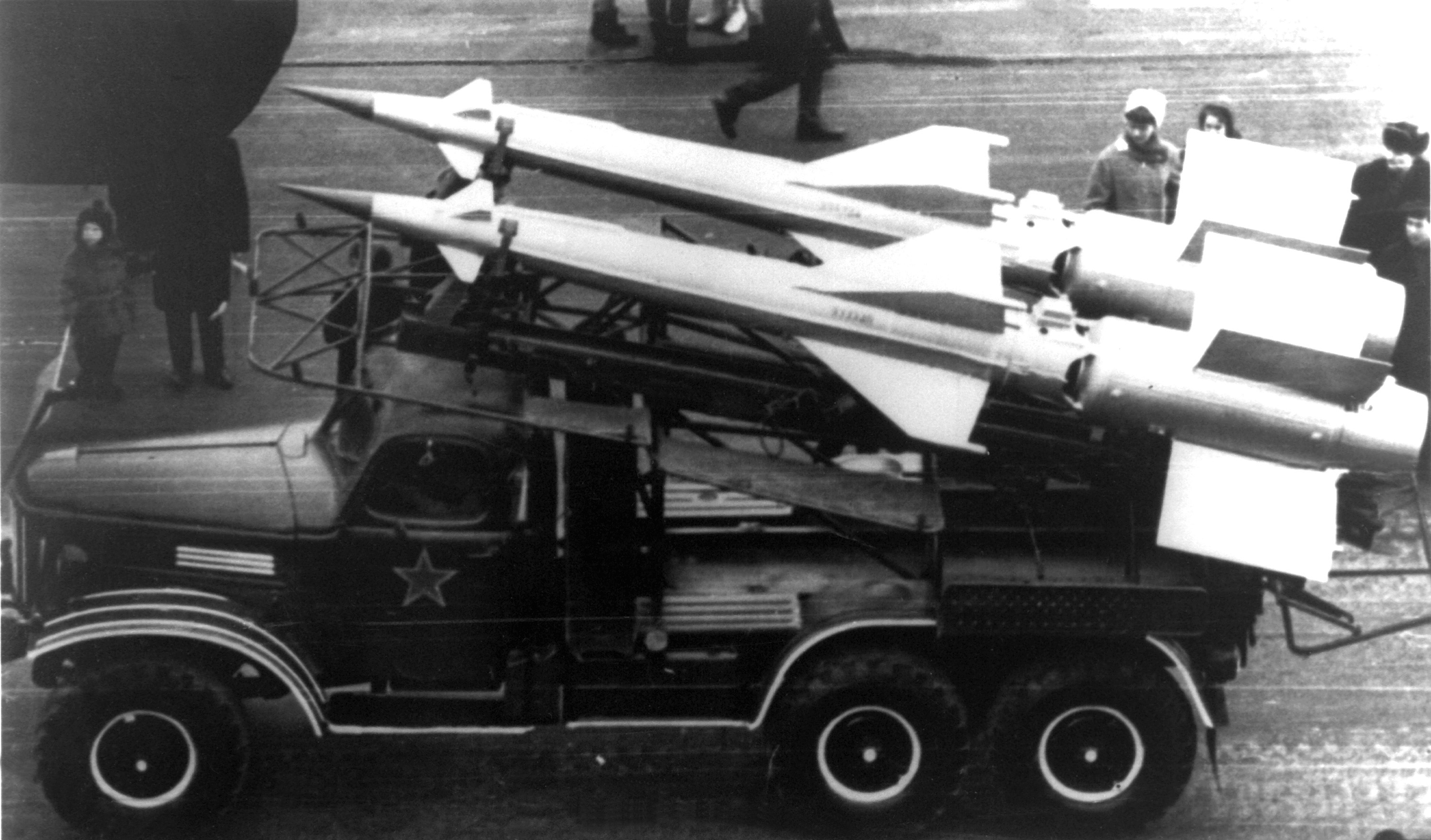
The S-125 ''Neva/Pechora'' (russian: С-125 "Нева"/"Печора", NATO reporting name SA-3 ''Goa'') is a Soviet surface-to-air missile system that was designed by Aleksei Isaev to complement the S-25 and S-75. It has a shorter effective range and lower engagement altitude than either of its predecessors and also flies slower, but due to its two-stage design it is more effective against more maneuverable targets. It is also able to engage lower flying targets than the previous systems, and being more modern it is much more resistant to ECM than the S-75. The 5V24 (V-600) missiles reach around Mach 3 to 3.5 in flight, both stages powered by solid fuel rocket motors. The S-125, like the S-75, uses radio command guidance. The naval version of this system has the NATO reporting name SA-N-1 Goa and original designation M-1 Volna (Russian Волна – ''wave''). Operational history Soviet Union The S-125 was first deployed between 1961 and 1964 around Moscow, augmenting th ... [...More Info...] [...Related Items...] OR: [Wikipedia] [Google] [Baidu] |
Brined Cheese
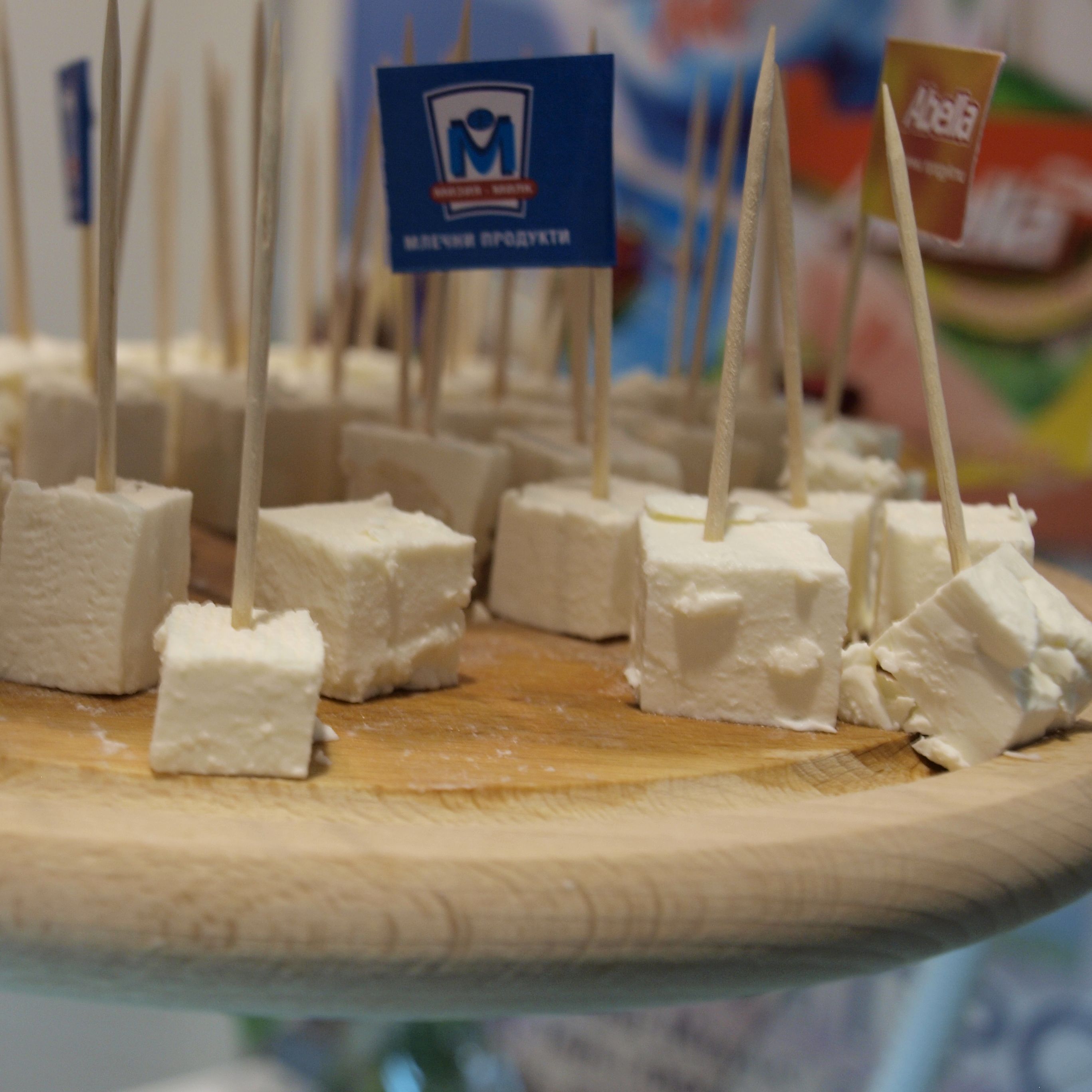
Brined cheese, also sometimes referred to as pickled cheese for some varieties, is cheese that is matured in brine in an airtight or semi-permeable container. This process gives the cheese good stability, inhibiting bacterial growth even in warmer climates. Brined cheeses may be soft or hard, varying in moisture content and in colour and flavour according to the type of milk used. However, all are rindless and generally taste clean, salty and acidic when fresh, developing some piquancy when aged; most are white. Brine is used in the production of other cheeses, notably washed-rind cheeses, but they are not considered brined cheeses as they are not matured in brine. List Brined cheese is widely produced and eaten in the Middle East and Mediterranean areas. Brined cheeses include: * Akkawi (Levant) * Balkánský sýr (Czechia and Slovakis) * Bryndza (Romania, Slovakia, Ukraine, Russia) * Chechil (Armenia) * Cherni Vit (Bulgaria) * Domiati (Egypt) * Feta (Greece) * Halloumi ( ... [...More Info...] [...Related Items...] OR: [Wikipedia] [Google] [Baidu] |
Belgrade Bypass
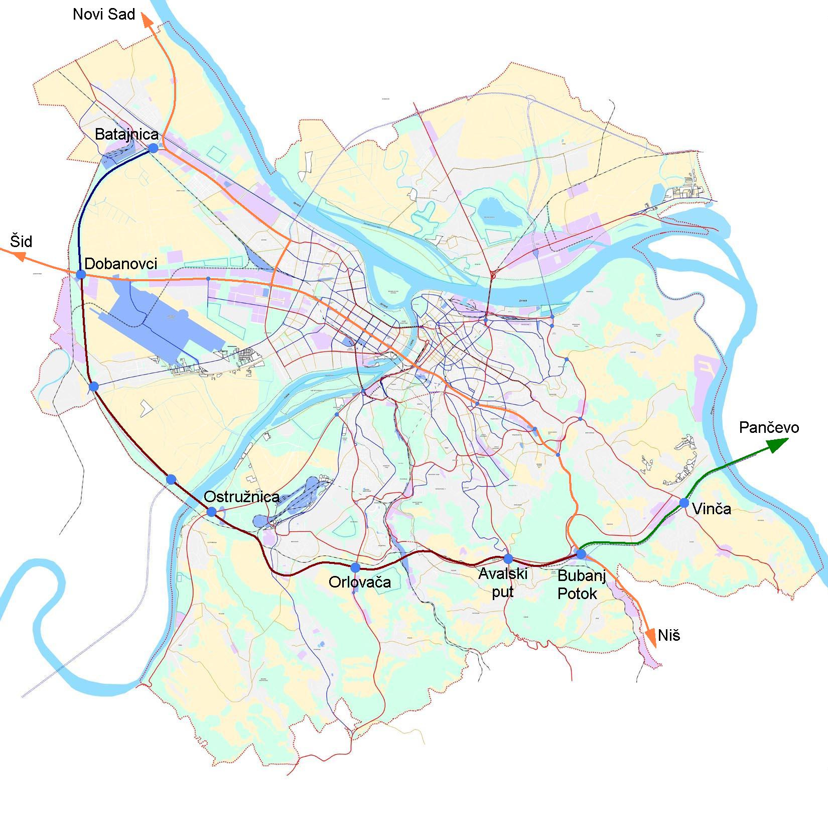
The Belgrade bypass ( sr, Обилазница око Београда, Obilaznica oko Beograda) or Belgrade city road bypass is a U-shaped, 69-km long motorway partially encircling the city of Belgrade, the capital of Serbia. Some 9.6 km of the bypass is the section of A1 motorway (currently under construction), and the rest is planned eastern extension of A3. The construction of the bypass started in 1990 and its parts have been sporadically built ever since. Its completion is expected to help alleviate Belgrade's traffic congestion, and remove all transit traffic from the city itself. Route ;Sector A (Batajnica - Dobanovci, A3 interchange) Sector A is 11.1 km long part of A1 motorway that intersects with A3 motorway at Dobanovci interchange. It is completed and opened to traffic in 2012. ;Sector B (Dobanovci, A3 interchange – Bubanj Potok) Sector B is 37.2 km long part of A1 motorway that intersects with A2 motorway at Surčin interchange. It is currently ... [...More Info...] [...Related Items...] OR: [Wikipedia] [Google] [Baidu] |
Gorani People
The Gorani (, ) or Goranci (, ), are a Slavic Muslim ethnic group inhabiting the Gora region—the triangle between Kosovo, Albania, and North Macedonia. They number an estimated 60,000 people, and speak a transitional South Slavic dialect, called '' Goranski''. The vast majority of the Gorani people adhere to Sunni Islam. Name The ethnonym ''Goranci'', meaning "highlanders", is derived from the Slavic toponym '' gora'', which means "hill, mountain". Another autonym of this people is ''Našinci'', which literally means "our people, our ones". In Macedonian sources, the Gorani are sometimes called Torbeši, a term used for Muslim Macedonians. In the Albanian language, they are known as ''Goranët'' "Goranët jetojnë në krahinën e Gorës, që sot ndahet mes shteteve të Shqipërisë, të Kosovës etë Maqedonisë, krahinë nga ku e marrin edhe emrin." and sometimes by other exonyms, such as ''Bulgareci'' ("Bulgarians"), ''Torbesh'' ("bag carriers") and ''Poturë'' (" tu ... [...More Info...] [...Related Items...] OR: [Wikipedia] [Google] [Baidu] |
.png)


.png)