|
Zoigê Marsh
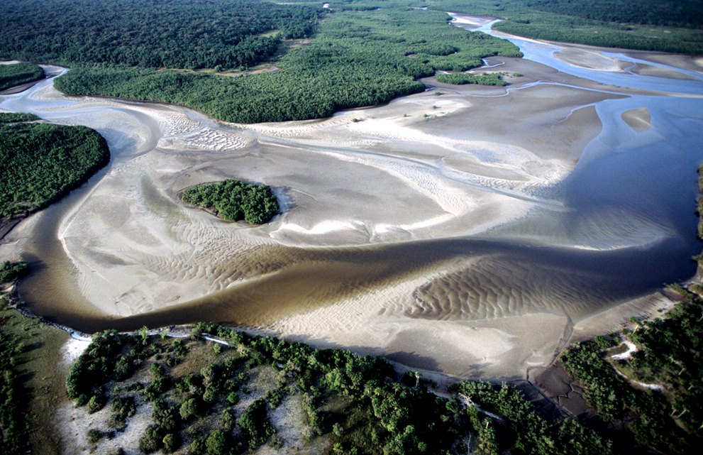
The Zoigê Marsh (), also known as the Ruo'ergai Marsh or the Songpan Grasslands, is located in the eastern part of the Tibetan Plateau and forms the largest high-altitude marsh area in the world.Shuang Xiang, Ruqing Guo, Ning Wu, Shucun Sun, Current status and future prospects of Zoige Marsh in Eastern Qinghai-Tibet Plateau, Ecological Engineering 35: 553-562 Location The marsh areas are mainly located in northern Sichuan Province, but extend into southern Gansu and southeastern Qinghai. The marshes are formed in a region of poor drainage that is located between the watersheds of the Yellow and Yangtze Rivers. The marshes are located at an altitude of about 3,600 meters above sea level and cover an area of about 2,600 square kilometers. To east, they are bordered by the Min Mountains and to the west by the Amne Machin mountain range. Geology The marshes can be divided into four geomorphological regions: the Zoigê plateau plain, the Hong Yuan plateau mound, the A Ba pla ... [...More Info...] [...Related Items...] OR: [Wikipedia] [Google] [Baidu] |
Ramsar Convention
The Ramsar Convention on Wetlands of International Importance Especially as Waterfowl Habitat is an international treaty for the conservation and sustainable use of Ramsar site, Ramsar sites (wetlands). It is also known as the Convention on Wetlands. It is named after the city of Ramsar, Mazandaran, Ramsar in Iran, where the convention was signed in 1971. Every three years, representatives of the contracting parties meet as the Ramsar Convention#Conference of the Contracting Parties, Conference of the Contracting Parties (COP), the policy-making organ of the wetland conservation, convention which adopts decisions (site designations, resolutions and recommendations) to administer the work of the convention and improve the way in which the parties are able to implement its objectives. In 2022, COP15 was held in Montreal, Canada. List of wetlands of international importance The list of wetlands of international importance included 2,531 Ramsar site, Ramsar sites in Februa ... [...More Info...] [...Related Items...] OR: [Wikipedia] [Google] [Baidu] |
Himalayan Orogeny
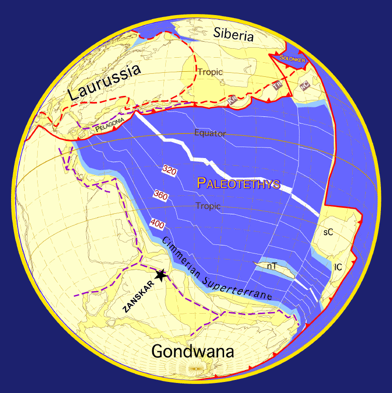
The geology of the Himalayas is a record of the most dramatic and visible creations of the immense mountain range formed by plate tectonic forces and sculpted by weathering and erosion. The Himalayas, which stretch over 2400 km between the Namcha Barwa syntaxis (geology), syntaxis at the eastern end of the mountain range and the Nanga Parbat syntaxis at the western end, are the result of an ongoing orogeny — the collision of the continental crust of two tectonic plates, namely, the Indian Plate thrusting into the Eurasian Plate. The Himalaya-Tibet region supplies fresh water for more than one-fifth of the world population, and accounts for a quarter of the global sedimentary budget. Topographically, the belt has many wikt:superlative, superlatives: the highest rate of Tectonic uplift, uplift (nearly 10 mm/year at Nanga Parbat), the List of highest mountains on Earth, highest relief (8848 m at Mt. Everest Chomolangma), among the highest Erosion#Mountain ranges, ... [...More Info...] [...Related Items...] OR: [Wikipedia] [Google] [Baidu] |
Wetlands Of China
A wetland is a distinct semi-aquatic ecosystem whose groundcovers are flooded or saturated in water, either permanently, for years or decades, or only seasonally. Flooding results in oxygen-poor (anoxic) processes taking place, especially in the soils. Wetlands form a transitional zone between waterbodies and dry lands, and are different from other terrestrial or aquatic ecosystems due to their vegetation's roots having adapted to oxygen-poor waterlogged soils. They are considered among the most biologically diverse of all ecosystems, serving as habitats to a wide range of aquatic and semi-aquatic plants and animals, with often improved water quality due to plant removal of excess nutrients such as nitrates and phosphorus. Wetlands exist on every continent, except Antarctica. The water in wetlands is either freshwater, brackish or saltwater. The main types of wetland are defined based on the dominant plants and the source of the water. For example, ''marshes'' are wetlands ... [...More Info...] [...Related Items...] OR: [Wikipedia] [Google] [Baidu] |
Landforms Of Sichuan
A landform is a land feature on the solid surface of the Earth or other planetary body. They may be natural or may be anthropogenic (caused or influenced by human activity). Landforms together make up a given terrain, and their arrangement in the landscape is known as topography. Landforms include hills, mountains, canyons, and valleys, as well as shoreline features such as bays, peninsulas, and seas, including submerged features such as mid-ocean ridges, volcanoes, and the great oceanic basins. Physical characteristics Landforms are categorized by characteristic physical attributes such as elevation, slope, orientation, structure stratum, stratification, rock exposure, and soil type. Gross physical features or landforms include intuitive elements such as berms, cliffs, hills, mounds, peninsulas, ridges, rivers, valleys, volcanoes, and numerous other structural and size-scaled (e.g. ponds vs. lakes, hills vs. mountains) elements including various kinds of inland and oceanic b ... [...More Info...] [...Related Items...] OR: [Wikipedia] [Google] [Baidu] |
Black-necked Crane
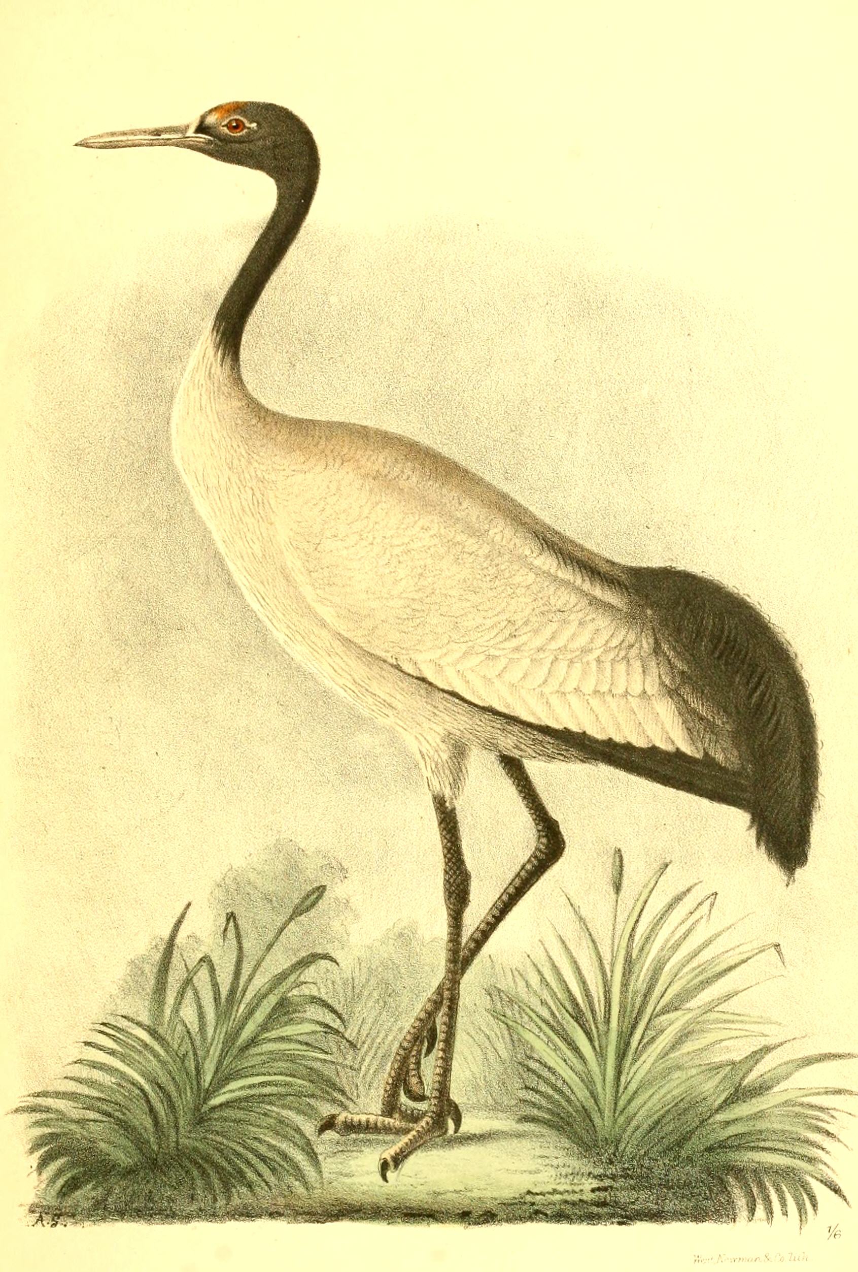
The black-necked crane (''Grus nigricollis'') is a medium-sized crane (bird), crane in Asia that breeds on the Tibetan Plateau and remote parts of India and Bhutan. It is long with a wingspan, and it weighs . It is whitish-gray, with a black head, red crown patch, black upper neck and legs, and white patch to the rear of the eye. It has black primaries and secondaries. Both sexes are similar. Some populations are known to make seasonal movements. It is Black-necked cranes in Bhutan, revered in Buddhist traditions and culturally protected across much of its range. A festival in Bhutan celebrates the bird while the Indian union territory of Ladakh has designated it as the state bird. Description This medium-sized crane is mostly grey with a black head and neck. The lores and crown are naked and dull red. A small patch of white feathers are present below and behind the eye. The tail is black and makes it easy to distinguish at a distance from the similar looking common crane whic ... [...More Info...] [...Related Items...] OR: [Wikipedia] [Google] [Baidu] |
National Forestry And Grassland Administration
The National Forestry and Grassland Administration, concurrently known as the National Park Administration, is China's national bureau responsible for the supervision and management of forests, grasslands, wetlands, deserts, and terrestrial wildlife. It is managed by the Ministry of Natural Resources (China), Ministry of Natural Resources. History The agency was originally founded in 1949 as the Ministry of Forestry and Farming. On November 5, 1951, it changed to the Ministry of Forestry, and the farming section was transferred to the Ministry of Agriculture. On March 10, 1998, it was renamed the National Forestry Administration. On 10 April 2018, the name was changed to the National Forestry and Grassland Administration as part of the deepening the reform of the Party and state institutions. Leadership Heads Ministry of Forestry and Farming Ministry of Forestry National Forestry Administration National Forestry and Grassland Administration References ... [...More Info...] [...Related Items...] OR: [Wikipedia] [Google] [Baidu] |
Cloud Seeding
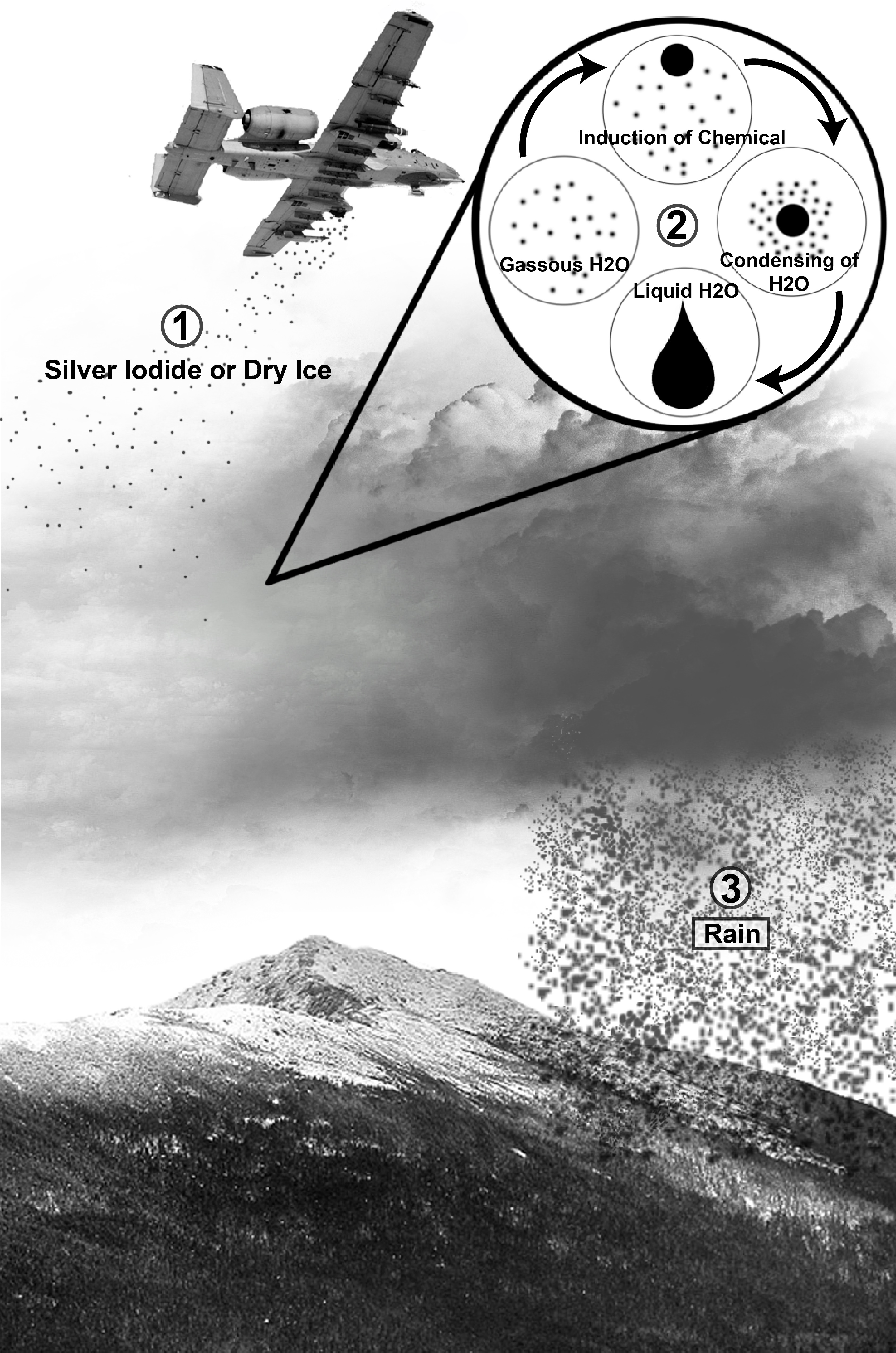
Cloud seeding is a type of weather modification that aims to change the amount or type of precipitation, mitigate hail, or disperse fog. The usual objective is to increase rain or snow, either for its own sake or to prevent precipitation from occurring in days afterward. Cloud seeding is undertaken by dispersing substances into the air that serve as Cloud condensation nuclei, cloud condensation or ice nucleus, ice nuclei. Common agents include silver iodide, potassium iodide, and dry ice, with hygroscopic materials like table salt gaining popularity due to their ability to attract moisture. Techniques vary from static seeding, which encourages ice particle formation in supercooled clouds to increase precipitation, to dynamic seeding, designed to enhance convective cloud development through the release of latent heat. Methods of dispersion include aircraft and ground-based generators, with newer approaches involving Unmanned aerial vehicle, drones delivering electric charges to ... [...More Info...] [...Related Items...] OR: [Wikipedia] [Google] [Baidu] |
Environmental Issues In China
Environmental issues in China had risen in tandem with the country's rapid industrialisation, as well as lax environmental oversight especially during the early 2000s. China was ranked 120th out of the 180 countries on the 2020 Environmental Performance Index. The Chinese government has acknowledged the problems and made various responses, resulting in some improvements, but western media has criticized the actions as inadequate. In recent years, there has been increased citizens' activism against government decisions that are perceived as environmentally damaging, and a retired government official claimed that the year of 2012 saw over 50,000 environmental protests in China. Since the 2010s, the government has given greater attention to environmental protection through policy actions such as the signing of the Paris climate accord, the 13th Five-Year Plan and the 2015 Environmental Protection Law reform From 2006 to 2017, sulphur dioxide levels in China were reduced by 70 p ... [...More Info...] [...Related Items...] OR: [Wikipedia] [Google] [Baidu] |
Long March
The Long March ( zh, s=长征, p=Chángzhēng, l=Long Expedition) was a military retreat by the Chinese Red Army and Chinese Communist Party (CCP) from advancing Kuomintang forces during the Chinese Civil War, occurring between October 1934 and October 1935. About 100,000 troops retreated from the Jiangxi Soviet and other bases to a new headquarters in Yan'an, Shaanxi, traversing some . About 8,000 troops ultimately survived the Long March. After the defeat of the Red Army in Chiang Kai-shek's Fifth encirclement campaign against the Jiangxi Soviet, Fifth Encirclement Campaign, on 10 October 1934 the CCP decided to abandon its Jiangxi Soviet and headquarters in Ruijin, Jiangxi. The First Front Red Army of some 86,000 troops headed west, traveling over the rugged terrain of China's western provinces, including eastern Tibet. The Red Army broke several of Chiang's blockades with heavy losses, and by the time it crossed the Xiang River on 1 December had only 36,000 men left. Its lea ... [...More Info...] [...Related Items...] OR: [Wikipedia] [Google] [Baidu] |
Quaternary
The Quaternary ( ) is the current and most recent of the three periods of the Cenozoic Era in the geologic time scale of the International Commission on Stratigraphy (ICS), as well as the current and most recent of the twelve periods of the Phanerozoic eon. It follows the Neogene Period and spans from 2.58 million years ago to the present. The Quaternary Period is divided into two epochs: the Pleistocene (2.58 million years ago to 11.7 thousand years ago) and the Holocene (11.7 thousand years ago to today); a proposed third epoch, the Anthropocene, was rejected in 2024 by IUGS, the governing body of the ICS. The Quaternary is typically defined by the Quaternary glaciation, the cyclic growth and decay of continental ice sheets related to the Milankovitch cycles and the associated climate and environmental changes that they caused. Research history In 1759 Giovanni Arduino proposed that the geological strata of northern Italy could be divided into four succ ... [...More Info...] [...Related Items...] OR: [Wikipedia] [Google] [Baidu] |


