|
Zhangye National Geopark
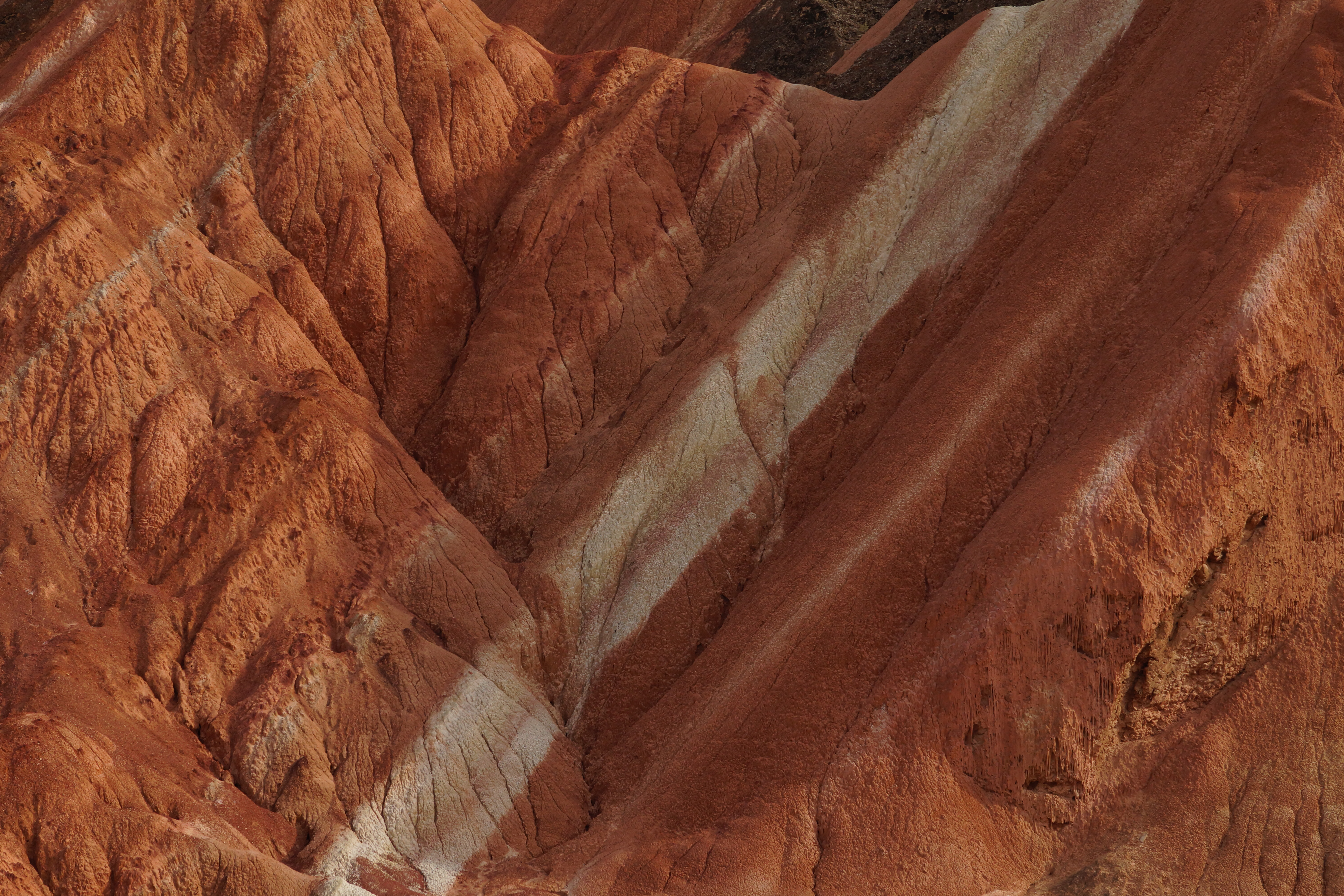
The Zhangye National Geopark () is located in Sunan and Linze counties within the prefecture-level city of Zhangye, in Gansu, China. It covers an area of . The site became a quasi-national geopark on April 23, 2012 (provisional name: Zhangye Danxia Geopark). It was formally designated as "Zhangye National Geopark" by the Ministry of Land and Resources on June 16, 2016 after it has passed the on-site acceptance test. Known for its colorful rock formations, it has been voted by Chinese media outlets as one of the most beautiful landforms in China. It is not a UNESCO world heritage site. Location The park is located in the northern foothills of the Qilian Mountains, in the counties of Linze and Sunan, which are under the administration of the prefecture-level city of Zhangye, Gansu province. The main areas of Danxia landform are in Kangle and Baiyin townships. The core area of the park, Linze Danxia Scenic Area, is located west of downtown Zhangye and south of the seat of L ... [...More Info...] [...Related Items...] OR: [Wikipedia] [Google] [Baidu] |
Linze County
Linze County () is one of the 58 counties of Gansu province, China, bordering Inner Mongolia to the northeast. It is under the administration of the prefecture-level city of Zhangye. Its postal code is 734200, and in 1999 its population was 144,613 people. Administrative divisions Linze County is divided to 7 towns and 6 others. ;Towns ;Others Climate Transport *China National Highway 312 See also * List of administrative divisions of Gansu Gansu, a province of the People's Republic of China, is made up of the following administrative divisions Administrative division, administrative unit,Article 3(1). country subdivision, administrative region, subnational entity, constitue ... References Linze County Zhangye {{Gansu-geo-stub ... [...More Info...] [...Related Items...] OR: [Wikipedia] [Google] [Baidu] |
Himalayan Mountains
The Himalayas, or Himalaya (; ; ), is a mountain range in Asia, separating the plains of the Indian subcontinent from the Tibetan Plateau. The range has some of the planet's highest peaks, including the very highest, Mount Everest. Over 100 peaks exceeding in elevation lie in the Himalayas. By contrast, the highest peak outside Asia (Aconcagua, in the Andes) is tall. The Himalayas abut or cross five countries: Bhutan, India, Nepal, China, and Pakistan. The sovereignty of the range in the Kashmir region is disputed among India, Pakistan, and China. The Himalayan range is bordered on the northwest by the Karakoram and Hindu Kush ranges, on the north by the Tibetan Plateau, and on the south by the Indo-Gangetic Plain. Some of the world's major rivers, the Indus, the Ganges, and the Tsangpo–Brahmaputra, rise in the vicinity of the Himalayas, and their combined drainage basin is home to some 600 million people; 53 million people live in the Himalayas. The Himalayas have pro ... [...More Info...] [...Related Items...] OR: [Wikipedia] [Google] [Baidu] |
Vinicunca
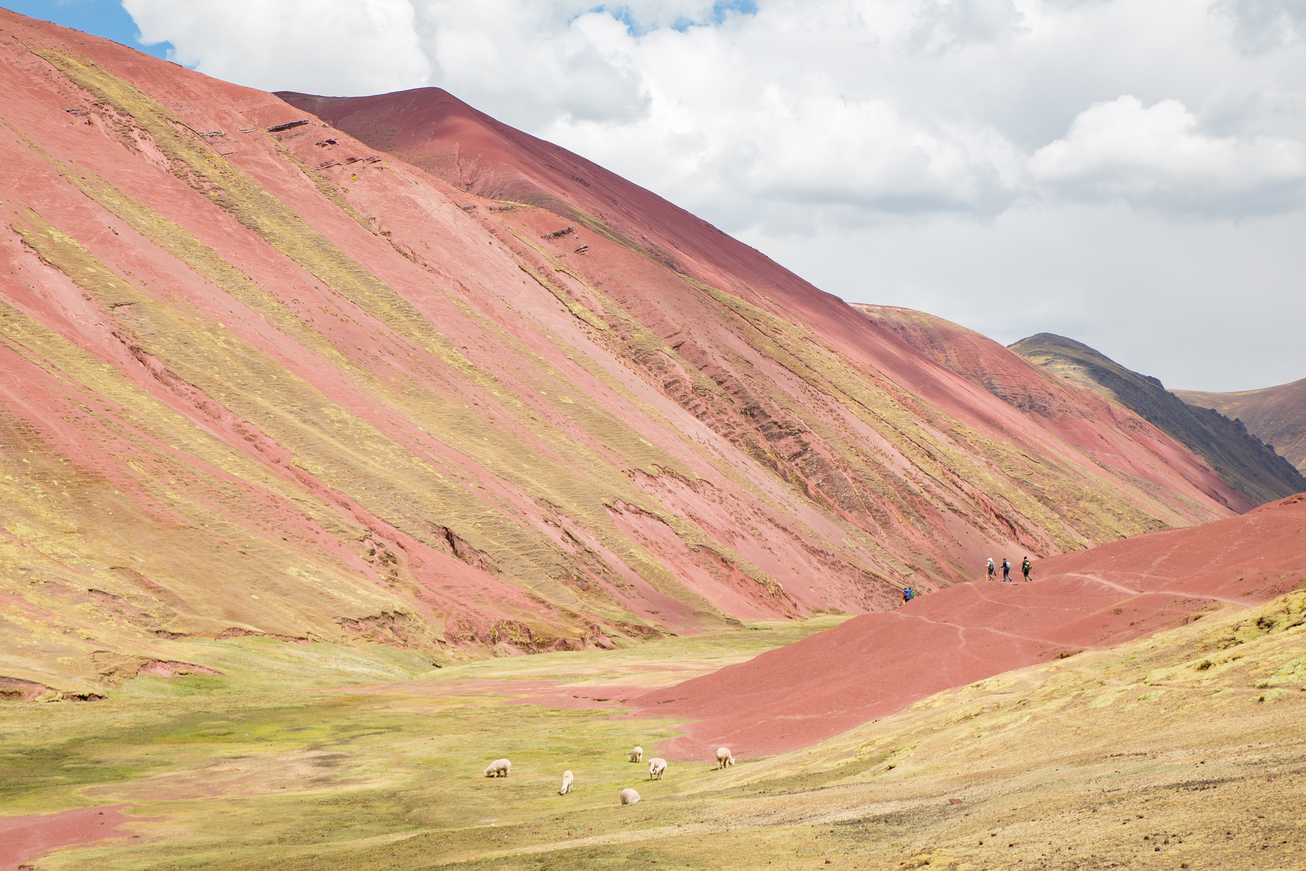
Vinicunca, or Winikunka, also called Montaña de Siete Colores, Montaña de Colores or Rainbow Mountain, is a mountain in the Andes of Peru with an altitude of above sea level. It is located on the road to the Ausangate mountain, in the Department of Cuzco, Cusco region, between Cusipata District, province of Quispicanchi Province, Quispicanchi, and Pitumarca District, province of Canchis Province, Canchis. Tourist access requires a two-hour drive from Cusco and a walk of about , or a three-and-a-half-hour drive through Pitumarca and a steep walk (1–1.5 hours) to the hill. As of 2019, no robust methods of transportation to Vinicunca have been developed to accommodate travelers, as it requires passage through a valley. In mid-2010, mass tourism came, attracted by the mountain's series of stripes of various colors due to its mineralogical composition on the slopes and summits. The mountain used to be covered by glacier caps, but these have melted due to climate change approxima ... [...More Info...] [...Related Items...] OR: [Wikipedia] [Google] [Baidu] |
Seven Coloured Earths
The seven Coloured Earths are a geological formation and prominent tourist attraction found in the Chamarel plain of the Rivière Noire District in south-western Mauritius. It is a relatively small area of sand dunes comprising sand of seven distinct colours (approximately red, brown, violet, green, blue, purple and yellow). The main feature of the place is that since these differently coloured sands spontaneously settle in different layers, dunes acquire a surrealistic, striped colouring. Since the earth was first exposed, rains have carved beautiful patterns into the hillside, creating an effect of earthen meringue. Description The sands formed from the decomposition of volcanic rock (basalt) gullies into clay, further transformed into ferralitic soil by total hydrolysis; the two main elements of the resulting soil, iron and aluminium Aluminium (aluminum in American and Canadian English) is a chemical element with the symbol Al and atomic number 13. Alu ... [...More Info...] [...Related Items...] OR: [Wikipedia] [Google] [Baidu] |
Painted Hills
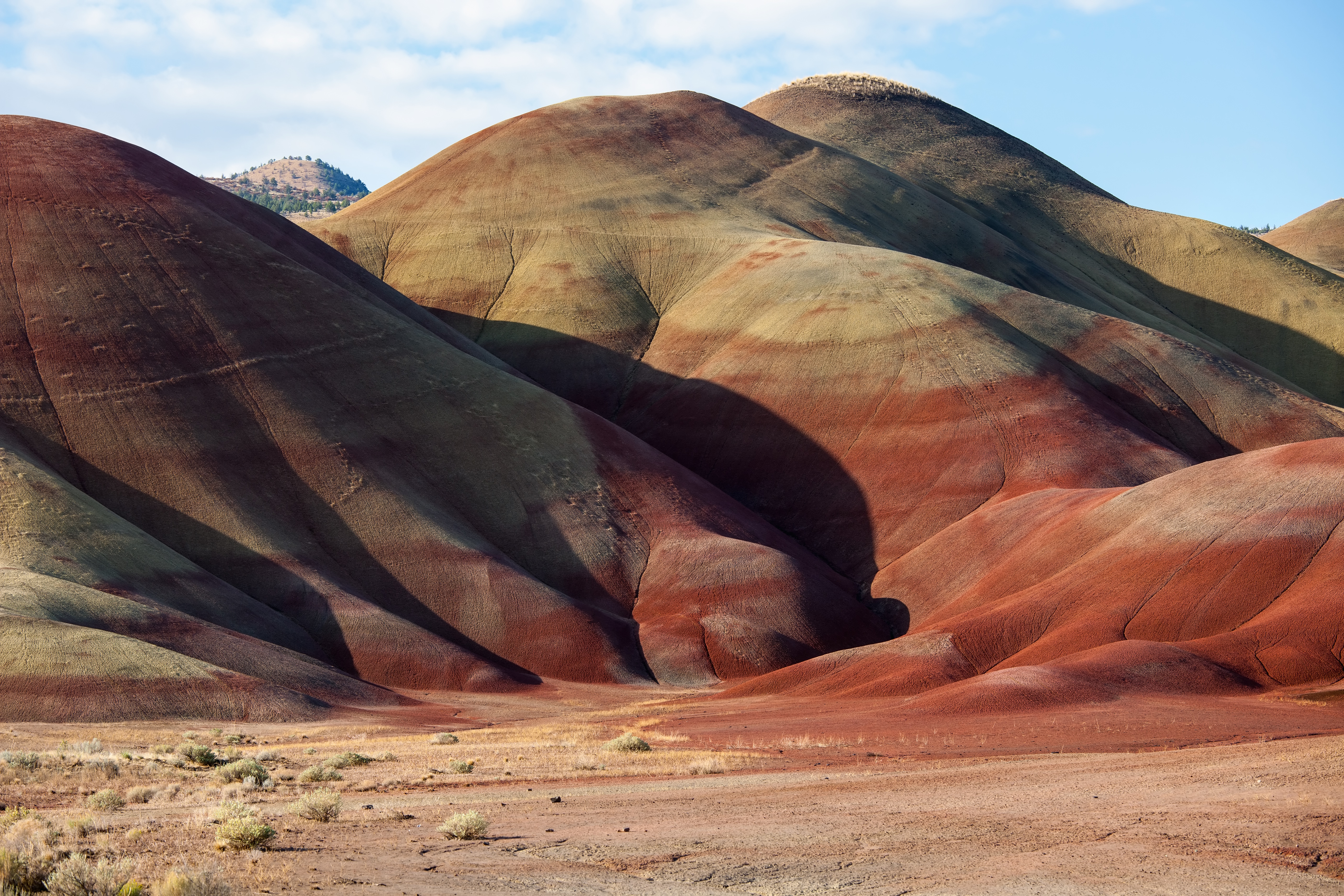
The Painted Hills is a geologic site in Wheeler County, Oregon that is one of the three units of the John Day Fossil Beds National Monument along with Sheep Rock and Clarno. It totals and is located northwest of Mitchell, Oregon. The Painted Hills are listed as one of the Seven Wonders of Oregon. The layers of color for which the site is named can be traced back to cycling periods of wet and dry climate conditions associated with the transition from the Eocene epoch to the cooler, more temperate Oligocene epoch. The different layers of colors are due to the soil being composed of a combination of mudstone, siltstone, shale and lignite. Geology Formation The Painted Hills began to form 35 million years ago when pumice and ash from volcanic eruptions in the Cascade Mountains traveled 100 miles east and settled over the area. Once there, the ash and other sediments were mixed by natural processes including the flow of water, growth of plants, and the movement of animals. Over ... [...More Info...] [...Related Items...] OR: [Wikipedia] [Google] [Baidu] |
Candy Cane Mountains
The Candy Cane Mountains ( az, Şəkər əsası dağları) are shale mountains in the Khizi and Siyazan districts of Azerbaijan, part of the Greater Caucasus mountain range. The 'Candy Cane Mountains' were originally dubbed so by travel author Mark Elliott in his guidebook 'Azerbaijan with Excursions to Georgia'. The mountains' colors are produced by groundwater that alters the oxidation state of the iron compounds in the earth. The Candy Cane Mountains contain numerous belemnites and fossils from the Cretaceous The Cretaceous ( ) is a geological period that lasted from about 145 to 66 million years ago (Mya). It is the third and final period of the Mesozoic Era, as well as the longest. At around 79 million years, it is the longest geological period of th ... period, many of which can be spotted on the surface. See also * Orography of Azerbaijan References Mountains of Azerbaijan Khizi District Siyazan District Shale formations Tourist attractions in Azerbaijan ... [...More Info...] [...Related Items...] OR: [Wikipedia] [Google] [Baidu] |
China Danxia
The Danxia landform () refers to various landscapes found in southeast, southwest and northwest China that "consist of a red bed characterized by steep cliffs". It is a unique type of petrographic geomorphology found in China. Danxia landform is formed from red-coloured sandstones and conglomerates of largely Cretaceous age. The landforms look very much like karst topography that forms in areas underlain by limestones, but since the rocks that form danxia are sandstones and conglomerates, they have been called "pseudo-karst" landforms. They were formed by endogenous forces (including uplift) and exogenous forces (including weathering and erosion). The first studies on what are now referred to as Danxia landforms were conducted at Mount Danxia near Shaoguan, China. In the 1920s and 1930s Chinese geologists made an effort to learn more about these interesting geomorphic structures. Danxia landforms are made up of uplifted continental crust that has been faulted and eroded, exposing ... [...More Info...] [...Related Items...] OR: [Wikipedia] [Google] [Baidu] |
Sid Meier's Civilization VI
''Sid Meier's Civilization VI'' is a turn-based strategy 4X video game developed by Firaxis Games, published by 2K Games, and distributed by Take-Two Interactive. The mobile port was published by Aspyr Media. The latest entry into the ''Civilization'' series, it was released on Microsoft Windows and macOS in October 2016, with later ports for Linux in February 2017, iOS in December 2017, Nintendo Switch in November 2018, PlayStation 4 and Xbox One in November 2019, and Android in 2020. Similar to previous installments, the goal for the player is to develop a civilization from an early settlement through many in-game millennia to become a world power and achieve one of several victory conditions, such as through military domination, technological superiority, or cultural influence, over the other human and computer-controlled opponents. Players do this by exploring the world, founding new cities, building city improvements, deploying military troops to attack and defend themselv ... [...More Info...] [...Related Items...] OR: [Wikipedia] [Google] [Baidu] |
Chinese National Geography
''Chinese National Geography'' () is a Chinese monthly magazine similar to the ''National Geographic Magazine''. Founded in 1949 in China, the magazine has revamped itself several times, and is now a popular magazine in mainland China. There is also an edition in traditional Chinese for readers in Hong Kong and Taiwan. History Founded by a group of teachers with a keen interest in geography in 1949, the original Chinese edition was first published in January 1950 under the name ''Dili Zhishi'' (''Knowledge of Geography''; Chinese: 《地理知识》). The magazine focused on delivering scientific and geographical concepts. At first only 600 copies were printed, but the publication quickly became popular, and soon 2,000 copies of each volume were being printed. From August–December 1960, ''Dili Zhishi'' temporarily stopped publication. It reformed itself and resumed publication in January 1961 under a new name, ''Dili'' (''Geography''; Chinese: 《地理》). However, this new ... [...More Info...] [...Related Items...] OR: [Wikipedia] [Google] [Baidu] |
Layer Cake
A layer cake (US English) or sandwich cake (UK English) is a cake consisting of multiple stacked sheets of cake, held together by frosting or another type of filling, such as jam or other preserves. Most cake recipes can be adapted for layer cakes; butter cakes and sponge cakes are common choices. Frequently, the cake is covered with icing, but sometimes, the sides are left undecorated, so that the filling and the number of layers are visible. Popular flavor combinations include the German chocolate cake, red velvet cake, Black Forest cake, and carrot cake with cream cheese icing. Many wedding cakes are decorated layer cakes. In the mid-19th century, modern cakes were first described in English. Maria Parloa's ''Appledore Cook Book'', published in Boston in 1872, contained one of the first layer cake recipes. Another early recipe for layer cake was published in ''Cassell's New Universal Cookery Book'', published in London in 1894. Older forms An older form of layer cak ... [...More Info...] [...Related Items...] OR: [Wikipedia] [Google] [Baidu] |
Sunan Yugur Autonomous County
Sunan Yugur Autonomous County () is an autonomous county under the administration of the prefecture-level city of Zhangye, Gansu Province, China, bordering Qinghai province to the south. It is home to the majority of the Yugur ethnic group. The seat of government is in the town of (). The autonomous county spans an area of , and is home to a total population of 39,283 as of 2021. The autonomous county is ethnically diverse, with large populations of Han Chinese, Yugurs, and Tibetans, with none comprising a majority. Sùnán Yugur Autonomous County consists of three separate areas: Mínghua District, situated in the plains in the northwest, and Huángcheng District, situated in the mountains in the southeast, are separated from the main part of the county. Toponymy The autonomous county's name refers to its location to the south () of Suzhou (), the former name of Jiuquan. History Sunan Yugur Autonomous County was established in 1954. Geography Sunan Yugur Autonomous Cou ... [...More Info...] [...Related Items...] OR: [Wikipedia] [Google] [Baidu] |


.jpg)
