|
Zero Milestone
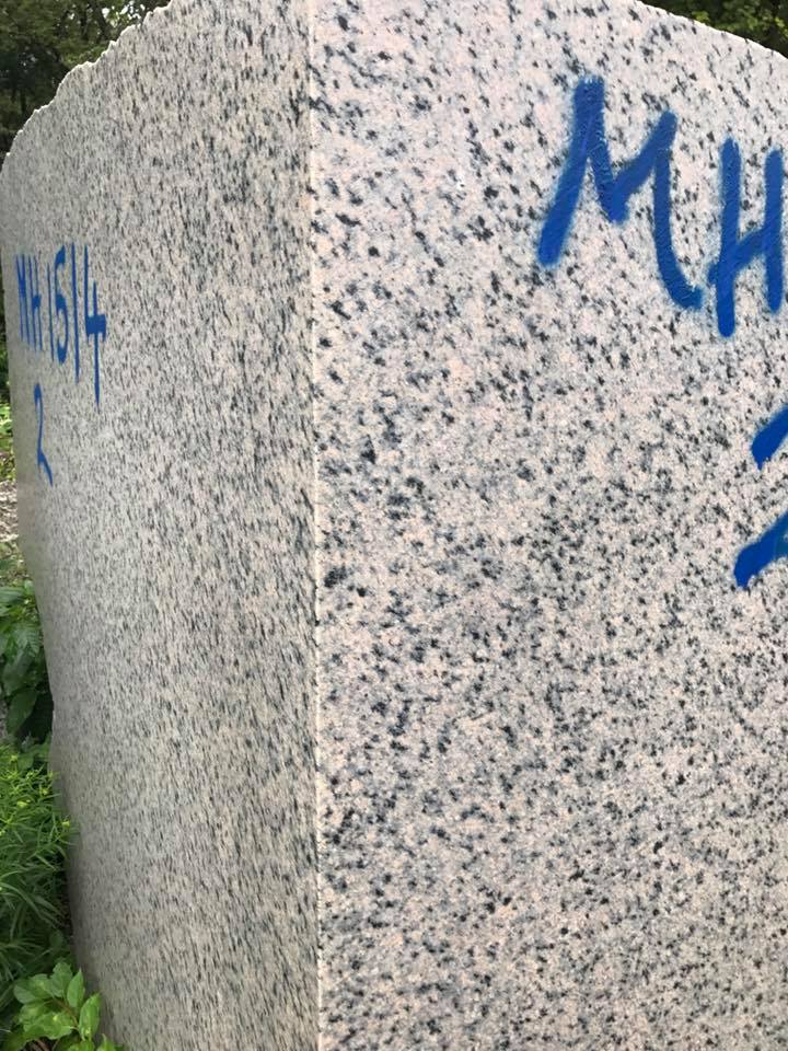
The Zero Milestone is a zero mile marker monument in Washington, D.C. intended as the initial milestone from which all road distances in the United States should be measured when it was built. At present, only roads in the Washington, D.C. area have distances measured from it. Location The monument stands just south of the White House at the north edge of The Ellipse, within President's Park. Atop the monument is a bronze 16-point compass rose with a very small worn-down pyramid at its center whose top serves as a National Geodetic Survey benchmark (HV1847). * Coordinates: (NAD83) * Altitude: 8.382 m (27.50 ft) (NAVD88) Description Designed by Washington architect Horace W. Peaslee, the monolith is about 2 feet square and about 4 feet high. It is made of precambrian Milford granite from Milford, Massachusetts, light pinkish to greenish gray, with spots of black biotite mica. The bronze disk on top of the milestone is "an adaptation from ancient portolan c ... [...More Info...] [...Related Items...] OR: [Wikipedia] [Google] [Baidu] |
Lincoln Highway
The Lincoln Highway is the first transcontinental highway in the United States and one of the first highways designed expressly for automobiles. Conceived in 1912 by Indiana entrepreneur Carl G. Fisher, and formally dedicated October 31, 1913, the Lincoln Highway runs coast-to-coast from Times Square in New York City west to Lincoln Park in San Francisco, originally through 13 states: New York, New Jersey, Pennsylvania, Ohio, Indiana, Illinois, Iowa, Nebraska, Colorado, Wyoming, Utah, Nevada, and California. In 1915, the "Colorado Loop" was removed, and in 1928, a realignment relocated the Lincoln Highway through the northern tip of West Virginia. Thus, there are a total of 14 states, 128 counties, and more than 700 cities, towns and villages through which the highway passed at some time in its history. The first officially recorded length of the entire Lincoln Highway in 1913 was . Over the years, the road was improved and numerous realignments were made, See throughout, bu ... [...More Info...] [...Related Items...] OR: [Wikipedia] [Google] [Baidu] |
1919 Motor Transport Corps Convoy
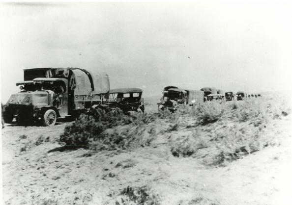
The 1919 Motor Transport Corps convoy was a long distance convoy (described as a Motor Truck Trip with a "Truck Train"typescript./ref>) carried out by the U.S. Army Motor Transport Corps that drove over on the historic Lincoln Highway from Washington, D.C., to Oakland, California and then by ferry over to end in San Francisco. Lieutenant Colonel Charles W. McClure and Captain Bernard H. McMahon were the respective expedition and train commanders and civilian Henry C. Ostermann of the Lincoln Highway Association was the pilot (guide). Official observers included those from the Air Service, A.S.A.P., Coast and Field Artillery, Medical Corps, Ordnance, Signal Corps and Tank Corps including the then Brevet Lieutenant Colonel Dwight D. Eisenhower. Eisenhower later said he joined the convoy "partly for a lark, and partly to learn." Organization The Signal Corps filmed convoy events; and the civilians of the Goodyear band were transported from Chicago in one of the trucks. The Publi ... [...More Info...] [...Related Items...] OR: [Wikipedia] [Google] [Baidu] |
Bankhead Highway
The Bankhead Highway was a United States cross-country automobile highway connecting Washington, D.C., and San Diego. The Bankhead Highway's beginnings can be traced back to 1916 when the Bankhead Highway Association was organized to promote the highway's development. It was part of the National Auto Trail system. The road was named for Alabama politician John H. Bankhead, a leader in the early national road-building movement. In later years, several stretches of U.S. Route 78 in northwest Alabama were renamed for Bankhead's son, former U.S. Representative and Speaker of the House William B. Bankhead. Route description As was common with early auto trails, the Bankhead Highway had several different routes. The main and branch routes below are considered to be the primary configurations of the highway. California The route followed the former US 80 from San Diego and through La Mesa, El Cajon, and El Centro before crossing into Arizona. This section of the Bankhead ... [...More Info...] [...Related Items...] OR: [Wikipedia] [Google] [Baidu] |
Federal Highway Administration
The Federal Highway Administration (FHWA) is a division of the United States Department of Transportation that specializes in highway transportation. The agency's major activities are grouped into two programs, the Federal-aid Highway Program and the Federal Lands Highway Program. Its role had previously been performed by the Office of Road Inquiry, Office of Public Roads and the Bureau of Public Roads. History Background The organization has several predecessor organizations and complicated history. The Office of Road Inquiry (ORI) was founded in 1893. In 1905, that organization's name was changed to the Office of Public Roads (OPR) which became a division of the United States Department of Agriculture. The name was changed again to the Bureau of Public Roads in 1915 and to the Public Roads Administration (PRA) in 1939. It was then shifted to the Federal Works Agency which was abolished in 1949 when its name reverted to Bureau of Public Roads under the Department of Commerce ... [...More Info...] [...Related Items...] OR: [Wikipedia] [Google] [Baidu] |
United States Department Of Transportation
The United States Department of Transportation (USDOT or DOT) is one of the executive departments of the U.S. federal government. It is headed by the secretary of transportation, who reports directly to the President of the United States and is a member of the president's Cabinet. The department's mission is "to develop and coordinate policies that will provide an efficient and economical national transportation system, with due regard for need, the environment, and the national defense." History Prior to the creation of the Department of Transportation, its functions were administered by the under secretary of commerce for transportation. In 1965, Najeeb Halaby, administrator of the Federal Aviation Agency (predecessor to the Federal Aviation Administration, FAA), suggested to President Lyndon B. Johnson that transportation be elevated to a cabinet-level post, and that the FAA be folded into the DOT. It was established by Congress in the Department of Transportation Act ... [...More Info...] [...Related Items...] OR: [Wikipedia] [Google] [Baidu] |
Portolan Chart
Portolan charts are nautical charts, first made in the 13th century in the Mediterranean basin and later expanded to include other regions. The word ''portolan'' comes from the Italian ''portulano'', meaning "related to ports or harbors", and which since at least the 17th century designates "a collection of sailing directions". Definition The term “portolan chart” was coined in the 1890s because at the time it was assumed that these maps were related to portolani, medieval or early modern books of sailing directions. Other names that have been proposed include rhumb line charts, compass charts or loxodromic charts whereas modern French scholars prefer to call them nautical charts to avoid any relationship with portolani. Several definitions of portolan chart coexist in the literature. A narrow definition includes only medieval or, at the latest, early modern sea charts (i.e. maps that primarily cover maritime rather than inland regions) that include a network of rhumb li ... [...More Info...] [...Related Items...] OR: [Wikipedia] [Google] [Baidu] |
Massachusetts
Massachusetts (Massachusett language, Massachusett: ''Muhsachuweesut [Massachusett writing systems, məhswatʃəwiːsət],'' English: , ), officially the Commonwealth of Massachusetts, is the most populous U.S. state, state in the New England region of the Northeastern United States. It borders on the Atlantic Ocean and Gulf of Maine to the east, Connecticut and Rhode Island to the south, New Hampshire and Vermont to the north, and New York (state), New York to the west. The state's capital and List of municipalities in Massachusetts, most populous city, as well as its cultural and financial center, is Boston. Massachusetts is also home to the urban area, urban core of Greater Boston, the largest metropolitan area in New England and a region profoundly influential upon American History of the United States, history, academia, and the Economy of the United States, research economy. Originally dependent on agriculture, fishing, and trade. Massachusetts was transformed into a manuf ... [...More Info...] [...Related Items...] OR: [Wikipedia] [Google] [Baidu] |
Milford, Massachusetts
Milford is a town in Worcester County, Massachusetts, United States. The population was 30,379 according to the 2020 census. First settled in 1662 and incorporated in 1780, Milford became a booming industrial and quarrying community in the 19th century due to its unique location which includes the nearby source of the Charles River, the Mill River, the Blackstone River watershed, and large quantities of Milford pink granite. History Milford was first settled in 1662 as a part of Mendon after Native Americans, including the Sachem, Quashaamit, granted land to the early settlers. King Philip's War destroyed the town in 1676, but settlers returned in 1680. The Mill River flows through Milford and had several conspicuous fords that were familiar to the Native Americans, and used by the early white settlers. These "mill (river) fords" are said to have given Milford its name. Milford was incorporated April 11, 1780 and the first town hall built in 1819; a brick structure later named ... [...More Info...] [...Related Items...] OR: [Wikipedia] [Google] [Baidu] |
Milford Granite (Massachusetts)
Milford pink granite, also known as Milford granite or Milford pink is a Proterozoic igneous rock located in and around the town of Milford, Massachusetts, covering an area of approximately , as mapped by the USGS. It is also sometimes referred to as Braggville granite, for several quarries in the neighboring village of Braggville, Massachusetts. From 1870 to 1940, the town of Milford became famous for the "pink" variety of this stone, prized as a building material. According to local legend, the granite was "discovered" in the early 1870s by two brothers, James and William Sherman at Rocky Woods in Milford. At its peak, over 1,000 men labored in dozens of quarries in Milford and nearby Hopkinton. A sample of Milford Pink is on display at the Smithsonian Institution. Milford pink granite is quarried by the Fletcher Granite Company, at their Lumber Street quarry in Hopkinton. Description The granite is described as a light gray or light pinkish-gray to a medium, slightly pink ... [...More Info...] [...Related Items...] OR: [Wikipedia] [Google] [Baidu] |
Precambrian
The Precambrian (or Pre-Cambrian, sometimes abbreviated pꞒ, or Cryptozoic) is the earliest part of Earth's history, set before the current Phanerozoic Eon. The Precambrian is so named because it preceded the Cambrian, the first period of the Phanerozoic Eon, which is named after Cambria, the Latinised name for Wales, where rocks from this age were first studied. The Precambrian accounts for 88% of the Earth's geologic time. The Precambrian is an informal unit of geologic time, subdivided into three eons ( Hadean, Archean, Proterozoic) of the geologic time scale. It spans from the formation of Earth about 4.6 billion years ago ( Ga) to the beginning of the Cambrian Period, about million years ago ( Ma), when hard-shelled creatures first appeared in abundance. Overview Relatively little is known about the Precambrian, despite it making up roughly seven-eighths of the Earth's history, and what is known has largely been discovered from the 1960s onwards. The Precambrian fossil ... [...More Info...] [...Related Items...] OR: [Wikipedia] [Google] [Baidu] |


