|
Zavala County, Texas
Zavala County is a County (United States), county located in the U.S. state of Texas. As of the 2020 United States census, 2020 census, the population was 9,670. Its county seat is Crystal City, Texas, Crystal City. The county was created in 1858 and later organized in 1884. Zavala is named for Lorenzo de Zavala, Mexican politician, signer of the Texas Declaration of Independence, and first vice president of the Republic of Texas. History Native Americans Radiocarbon assays indicate the county's Tortuga Flat Site was used in the 15th and 16th centuries by Pacuache. Archeologist T. C. Hill of Crystal City conducted excavations in 1972–1973 at the site, uncovering artifacts. More than 100 archeological sites have been identified by researchers of the University of Texas at San Antonio at the Chaparrosa Ranch. Coahuiltecan, Tonkawa, Lipan Apache people, Lipan Apache and Mescalero, Mescalero Apache and Comanche have inhabited the area after the Pacuache. The Wild Horse Desert ... [...More Info...] [...Related Items...] OR: [Wikipedia] [Google] [Baidu] |
Lorenzo De Zavala
Manuel Lorenzo Justiniano de Zavala y Sánchez (October 3, 1788 – November 15, 1836), known simply as Lorenzo de Zavala, was a Mexican and later Tejano physician, politician, diplomat and author. Born in Yucatán (state), Yucatán under Viceroyalty of New Spain, Spanish rule, he was closely involved in drafting the constitution for the First Mexican Republic, First Federal Republic of Mexico 1824 Constitution of Mexico, in 1824 after Mexico won independence from Spain. Years later, he also helped in drafting a constitution for Mexico's rebellious enemy at the time, the Republic of Texas, to secure independence from Mexico in 1836. Zavala was said to have had a keen intellect and was fluent in multiple languages. Zavala was one of the most prominent liberals in the era of the First Mexican Republic, First Republic. Since his youth, Zavala was an indefatigable believer in the principle of democratic representative government. As a young man he founded several newspapers and wrote ... [...More Info...] [...Related Items...] OR: [Wikipedia] [Google] [Baidu] |
Comanche
The Comanche (), or Nʉmʉnʉʉ (, 'the people'), are a Tribe (Native American), Native American tribe from the Great Plains, Southern Plains of the present-day United States. Comanche people today belong to the List of federally recognized tribes in the United States, federally recognized Comanche Nation, headquartered in Lawton, Oklahoma. The Comanche language is a Numic languages, Numic language of the Uto-Aztecan languages, Uto-Aztecan family. Originally, it was a Shoshoni language, Shoshoni dialect, but diverged and became a separate language. The Comanche were once part of the Shoshone people of the Great Basin. In the 18th and 19th centuries, Comanche lived in most of present-day northwestern Texas and adjacent areas in eastern New Mexico, southeastern Colorado, southwestern Kansas, and western Oklahoma. Spanish colonists and later Mexicans called their historical territory ''Comancheria, Comanchería''. During the 18th and 19th centuries, Comanche practiced a nomadic h ... [...More Info...] [...Related Items...] OR: [Wikipedia] [Google] [Baidu] |
Pancho Villa
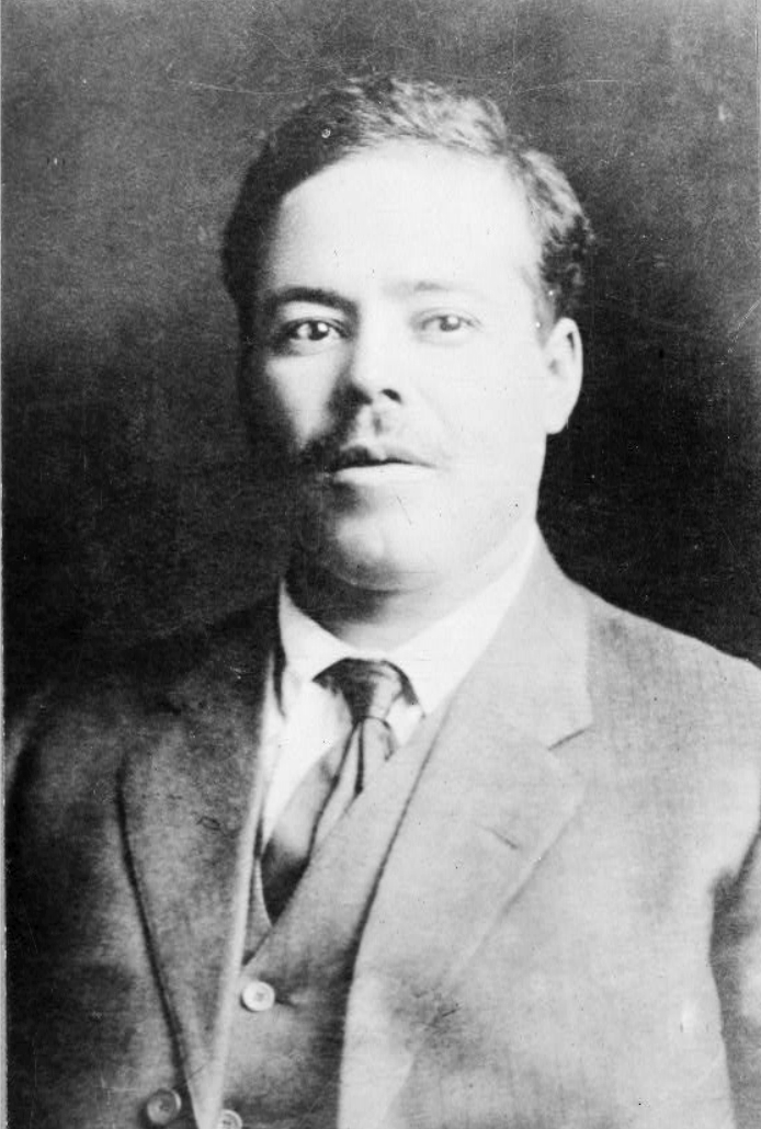
Francisco "Pancho" Villa ( , , ; born José Doroteo Arango Arámbula; 5 June 1878 – 20 July 1923) was a Mexican revolutionary and prominent figure in the Mexican Revolution. He was a key figure in the revolutionary movement that forced out President and dictator Porfirio Díaz and brought Francisco I. Madero to power in 1911. When Madero was ousted by a coup led by General Victoriano Huerta in February 1913, Villa joined the anti-Huerta forces in the Constitutionalist Army led by Venustiano Carranza. After the defeat and exile of Huerta in July 1914, Villa broke with Carranza. Villa dominated the Convention of Aguascalientes, meeting of revolutionary generals that excluded Carranza and helped create a coalition government. Emiliano Zapata and Villa became formal allies in this period. Like Zapata, Villa was strongly in favor of land reform, but did not implement it when he had power. At the height of his power and popularity in late 1914 and early 1915, the U.S. conside ... [...More Info...] [...Related Items...] OR: [Wikipedia] [Google] [Baidu] |
Mexican Revolution
The Mexican Revolution () was an extended sequence of armed regional conflicts in Mexico from 20 November 1910 to 1 December 1920. It has been called "the defining event of modern Mexican history". It saw the destruction of the Federal Army, its replacement by a Liberation Army of the South, revolutionary army, and the transformation of Mexican culture and Federal government of Mexico, government. The northern Constitutionalists in the Mexican Revolution, Constitutionalist faction prevailed on the battlefield and drafted the present-day Constitution of Mexico, which aimed to create a strong central government. Revolutionary generals held power from 1920 to 1940. The revolutionary conflict was primarily a civil war, but foreign powers, having important economic and strategic interests in Mexico, figured in the outcome of Mexico's power struggles; United States involvement in the Mexican Revolution, the U.S. involvement was particularly high. The conflict led to the deaths of around ... [...More Info...] [...Related Items...] OR: [Wikipedia] [Google] [Baidu] |
Popeye
Popeye the Sailor Man is a fictional cartoon character created by E. C. Segar, Elzie Crisler Segar.Segar, Elzie (Crisler) – Encyclopædia Britannica Article . Britannica.com. Retrieved on March 29, 2013.Goulart, Ron, "Popeye", ''St. James Encyclopedia of Popular Culture''. Detroit: St. James Press, 2000. (Volume 4, pp. 87-8).Walker, Brian. ''The Comics: The Complete Collection''. New York: Abrams ComicArts, 2011. (pp. 188-9,191, 238-243) The character first appeared on January 17, 1929, in the daily King Features Syndicate, King Features comic strip ''Thimble Theatre''. The strip was in its tenth year when Popeye made his debut, but the one-eyed sailor quickly became the lead character, and ''Thimble Th ... [...More Info...] [...Related Items...] OR: [Wikipedia] [Google] [Baidu] |
World War II
World War II or the Second World War (1 September 1939 – 2 September 1945) was a World war, global conflict between two coalitions: the Allies of World War II, Allies and the Axis powers. World War II by country, Nearly all of the world's countries participated, with many nations mobilising all resources in pursuit of total war. Tanks in World War II, Tanks and Air warfare of World War II, aircraft played major roles, enabling the strategic bombing of cities and delivery of the Atomic bombings of Hiroshima and Nagasaki, first and only nuclear weapons ever used in war. World War II is the List of wars by death toll, deadliest conflict in history, causing World War II casualties, the death of 70 to 85 million people, more than half of whom were civilians. Millions died in genocides, including the Holocaust, and by massacres, starvation, and disease. After the Allied victory, Allied-occupied Germany, Germany, Allied-occupied Austria, Austria, Occupation of Japan, Japan, a ... [...More Info...] [...Related Items...] OR: [Wikipedia] [Google] [Baidu] |
La Salle County, Texas
La Salle County is a county in Texas. As of the 2020 census, its population was 6,664. Its county seat is Cotulla. The county was created in 1858 and later organized in 1880. It is named for René-Robert Cavelier, Sieur de La Salle, a 17th-century French explorer. History Early history The area of present-day La Salle County was occupied by the Coahuiltecan Indians until the 18th century, when they were squeezed out by the Spanish from the south and the Apache from the north. After the Mexican War of Independence, the Mexican government used land grants to encourage settlement, but very few settled in the area. By 1836, the area was entirely populated by Indians. Between the Texas Revolution and the Mexican War, the area of present-day La Salle County lay in the disputed area between the Rio Grande and the Nueces River. Desperadoes ruled the area, as neither the Mexican government nor the Republic of Texas could gain control. The Treaty of Guadalupe Hidalgo assigned the N ... [...More Info...] [...Related Items...] OR: [Wikipedia] [Google] [Baidu] |
Frio County, Texas
Frio County is a county located in the U.S. state of Texas. As of the 2020 census, its population was 18,385. Its county seat is Pearsall. The county was created in 1858 and later organized in 1871. Frio is named for the Frio River, whose name is Spanish for "cold". Geography According to the U.S. Census Bureau, the county has a total area of , of which are land and (0.07%) is covered by water. Major highways * Interstate 35 * U.S. Highway 57 * State Highway 85 * State Highway 173 * * Adjacent counties * Medina County (north) * Atascosa County (east) * McMullen County (southeast) * La Salle County (south) * Dimmit County (southwest) * Zavala County (west) * Uvalde County (northwest) Demographics 2020 census As of the 2020 United States census, there were 18,385 people, 4,673 households, and 3,306 families residing in the county. As of the census of 2000, 16,252 people, 4,743 households, and 3,642 families resided in the county. The populati ... [...More Info...] [...Related Items...] OR: [Wikipedia] [Google] [Baidu] |
Dimmit County, Texas
Dimmit County ( ) is a county located in the U.S. state of Texas. As of the 2020 census, its population was 8,615. Its county seat is Carrizo Springs. The county was founded in 1858 and later organized in 1880. It is named after Philip Dimmitt, a major figure in the Texas Revolution. The spelling of the county name and the individual's name differ because of a spelling error in the bill creating the county name. History Native Americans Paleo-Indians artifacts indicate these people lived in Dimmit County as far back as 9200 BC. The archaic period (6000 BC to AD 1000) up to the arrival of the Spanish brought increased hunter-gatherers to the area. These Indians subsisted mostly on game, wild fruits, seeds, and roots. They carved tools from wood and stone, wove baskets, and sewed rabbitskin robes. They also made pottery and hunted with bows and arrows. Their most effective weapon was the ''atlatl'', a throwing stick that greatly increased the deadliness of their spears. Coa ... [...More Info...] [...Related Items...] OR: [Wikipedia] [Google] [Baidu] |
La Pryor, Texas
La Pryor ( ) is a census-designated place in Zavala County, Texas, United States. Its population was 1,294 at the 2020 census. The town is named for Col. Isaac (Ike) T. Pryor, who in the 1880s owned a ranch that included the site of the community. The Nueces River crosses U.S. Highway 83 north of La Pryor. The community has within its limits branches of the Texas Department of Transportation and the Zavala County Bank. Geography La Pryor is located at (28.943879, -99.844349). According to the United States Census Bureau, the CDP has a total area of 2.7 square miles (6.9 km2), all land. Demographics La Pryor first appeared as a census designated place in the 1980 U.S. Census. 2020 census As of the 2020 United States census, there were 1,294 people, 365 households, and 286 families residing in the CDP. 2000 census As of the census of 2000, 1,491 people, 462 households, and 368 families were residing in the CDP. The population density was . The 571 housi ... [...More Info...] [...Related Items...] OR: [Wikipedia] [Google] [Baidu] |
Overgrazing
Overgrazing occurs when plants are exposed to intensive grazing for extended periods of time, or without sufficient recovery periods. It can be caused by either livestock in poorly managed agricultural applications, game reserves, or nature reserves. It can also be caused by immobile, travel restricted populations of native or non-native wild animals. Overgrazing reduces the usefulness, productivity and biodiversity of the land and is one cause of desertification and erosion. Overgrazing is also seen as a cause of the spread of invasive species of non-native plants and of weeds. Degrading land, emissions from animal agriculture and reducing the biomass in a ecosystem contribute directly to climate change between grazing events. Successful planned grazing strategies have been in support of the American bison of the Great Plains, or migratory wildebeest of the African savannas, or by holistic planned grazing. [...More Info...] [...Related Items...] OR: [Wikipedia] [Google] [Baidu] |
Batesville, Texas
Batesville is a census-designated place (CDP) in Zavala County, Texas, United States. The population was 1,068 at the 2010 census. Geography Batesville is located at (28.952424, -99.629311). The CDP had a total area of 11.6 square miles (30.0 km2), all land. Prior to the 2010 census, the CDP lost area, reducing its total area to , all land, as before. Demographics Batesville first appeared as a census designated place in the 1990 U.S. Census. 2020 census As of the 2020 United States census, there were 787 people, 323 households, and 255 families residing in the CDP. 2000 Census As of the census of 2000, there were 1,298 people, 370 households, and 318 families residing in the CDP. The population density was . There were 456 housing units at an average density of . The racial makeup of the CDP was 50.15% White, 0.08% African American, 0.92% Native American, 45.30% from other races, and 3.54% from two or more races. Hispanic or Latino of any race were 91.37% ... [...More Info...] [...Related Items...] OR: [Wikipedia] [Google] [Baidu] |


