|
Yuquot, British Columbia
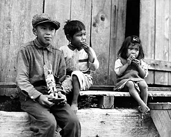
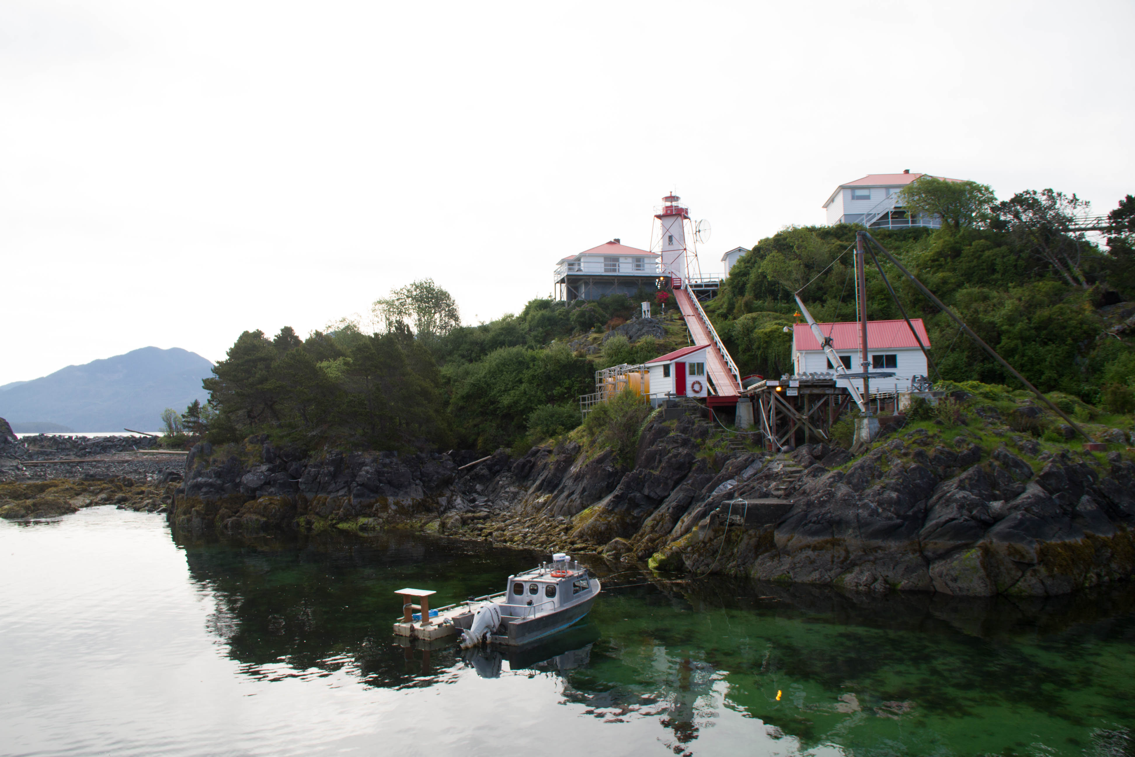
Yuquot , also known as Friendly Cove, is a small settlement of around six people—the Williams family of the Mowachaht band—plus two full-time lighthouse keepers, located on Nootka Island in Nootka Sound, just west of Vancouver Island, British Columbia, Canada. It was the summer home of Chief Maquinna and the Mowachaht/Muchalaht (Nuu-chah-nulth) people for generations, housing approximately 1,500 people in 20 traditional wooden longhouses. The name means "Wind comes from all directions" in Nuu-chah-nulth. The community is located within the Strathcona Regional District but like all Indian Reserve communities is not governed by nor represented in the regional district. The Mowchaht/Muchalaht First Nations are rather part of the Nuu-chah-nulth Tribal Council, which unites the governments of the indigenous communities of the Island's West Coast. The Canadian government declared Friendly Cove a National Historic Site in 1923, with recognition of the significance of the Spanish c ... [...More Info...] [...Related Items...] OR: [Wikipedia] [Google] [Baidu] |
Nootka Island
Nootka Island (french: île Nootka) is an island adjacent to Vancouver Island in British Columbia, Canada. It is in area. It is separated from Vancouver Island by Nootka Sound and its side-inlets, and is located within Electoral Area A of the Strathcona Regional District. Europeans named the island after a Nuu-chah-nulth language word meaning "go around, go around". They likely thought the natives were referring to the island itself. The Spanish and later English applied the word to the island and the sound, thinking they were naming both after the people. In the 1980s, the First Nations peoples in the region created the collective autonym of ''Nuu-chah-nulth'', a term that means "along the outside (of Vancouver Island)". An older term for this group of peoples was "Aht", which means "people" in their language and is a component in all the names of their subgroups, and of some locations (e.g. Yuquot, Mowachaht, Kyuquot, Opitsaht etc.). Climate See also *Nootka Crisis *N ... [...More Info...] [...Related Items...] OR: [Wikipedia] [Google] [Baidu] |
Juan José Pérez Hernández
Juan José Pérez Hernández (born Joan Perés c. 1725 – November 3, 1775), often simply Juan Pérez, was an 18th-century Spanish explorer. He was the first known European to sight, examine, name, and record the islands near present-day British Columbia, Canada. Born in Palma de Mallorca, Spain, he first served as a ''piloto'' in western Spanish colonial North America on Manila galleons en route to and from the Philippines in the Spanish East Indies. In 1768, he was assigned to the Pacific port of San Blas, in the Viceroyalty of New Spain (present day Mexico), and acquired the rank of ensign (''alférez''). 1774 expedition Confident of their territorial claims, the Spanish Empire did not explore or settle the northwest coast of North America in the 250 years after being claimed for the crown by Vasco Núñez de Balboa. By the late 18th century; however, learning of Russian and British arrivals along the Pacific Northwest and Alaskan coasts, Spain finally grew sufficiently ... [...More Info...] [...Related Items...] OR: [Wikipedia] [Google] [Baidu] |
Americas
The Americas, which are sometimes collectively called America, are a landmass comprising the totality of North and South America. The Americas make up most of the land in Earth's Western Hemisphere and comprise the New World. Along with their associated islands, the Americas cover 8% of Earth's total surface area and 28.4% of its land area. The topography is dominated by the American Cordillera, a long chain of mountains that runs the length of the west coast. The flatter eastern side of the Americas is dominated by large river basins, such as the Amazon, St. Lawrence River–Great Lakes basin, Mississippi, and La Plata. Since the Americas extend from north to south, the climate and ecology vary widely, from the arctic tundra of Northern Canada, Greenland, and Alaska, to the tropical rain forests in Central America and South America. Humans first settled the Americas from Asia between 42,000 and 17,000 years ago. A second migration of Na-Dene speakers followed later ... [...More Info...] [...Related Items...] OR: [Wikipedia] [Google] [Baidu] |
European Colonization Of The Americas
During the Age of Discovery, a large scale European colonization of the Americas took place between about 1492 and 1800. Although the Norse had explored and colonized areas of the North Atlantic, colonizing Greenland and creating a short term settlement near the northern tip of Newfoundland circa 1000 CE, the later and more well-known wave by the European powers is what formally constitutes as beginning of colonization, involving the continents of North America and South America. During this time, several empires from Europe—primarily Britain, France, Spain, Portugal, Russia, the Netherlands and Sweden—began to explore and claim the land, natural resources and human capital of the Americas, resulting in the displacement, disestablishment, enslavement, and in many cases, genocide of the indigenous peoples, and the establishment of several settler colonial states. Some formerly European settler colonies—including New Mexico, Alaska, the Prairies or northern Grea ... [...More Info...] [...Related Items...] OR: [Wikipedia] [Google] [Baidu] |
Santa Cruz De Nuca
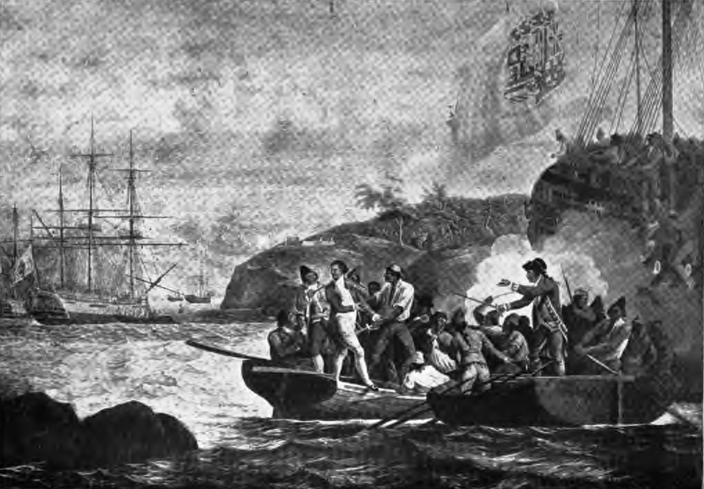
Santa Cruz de Nuca (or Nutca) was a Spanish colonial fort and settlement and the first European colony in what is now known as British Columbia. The settlement was founded on Vancouver Island in 1789 and abandoned in 1795, with its far northerly position making it the "high-water mark" of verified northerly Spanish settlement along the North American west coast. The colony was established with the Spanish aim of securing the entire west coast of the continent from Alaska southwards, for the Spanish crown. Due to the presence and activities of several British maritime fur trading ships in the same region, and the Russian colonization of Alaska further north, this Spanish attempt at making such a substantial claim for possession and conquest along the North American west coast failed. The colony was briefly abandoned between October 1789 and April 1790. In 1795 the colony was permanently abandoned following the settlement and signing of the Nootka Convention. This final Spanish ab ... [...More Info...] [...Related Items...] OR: [Wikipedia] [Google] [Baidu] |
Esteban José Martínez
Esteban () is a Spanish male given name, derived from Greek Στέφανος (Stéphanos) and related to the English names Steven and Stephen. Although in its original pronunciation the accent is on the penultimate syllable, English-speakers tend to pronounce it as a proparoxytone . People with the given name * Esteban Alvarado, Costa Rican goalkeeper * Esteban Andrés Suárez, Spanish football goalkeeper * Esteban Cambiasso, Argentine footballer * Esteban de la Fuente, Argentine basketball player * Esteban Fuertes, Argentine footballer * Esteban Granero, Spanish footballer * Esteban Guerrieri, Argentine racing driver * Esteban Gutiérrez, Mexican racing driver * Esteban Lazo Hernández, Cuban politician * Esteban Loaiza, Mexican retired baseball player * Esteban Navarro, Spanish novelist * Esteban Ocon, French racing driver * Esteban Pérez, Argentine basketball player * Esteban Solari, Argentine football player * Esteban Trapiello, Venezuelan businessman * Esteban Tuero, Ar ... [...More Info...] [...Related Items...] OR: [Wikipedia] [Google] [Baidu] |
Explorer
Exploration refers to the historical practice of discovering remote lands. It is studied by geographers and historians. Two major eras of exploration occurred in human history: one of convergence, and one of divergence. The first, covering most of ''Homo sapiens'' history, saw humans moving out of Africa, settling in new lands, and developing distinct cultures in relative isolation. Early explorers settled in Europe and Asia; 14,000 years ago, some crossed the Ice Age land bridge from Siberia to Alaska, and moved southbound to settle in the Americas. For the most part, these cultures were ignorant of each other's existence. The second period of exploration, occurring over the last 10,000 years, saw increased cross-cultural exchange through trade and exploration, and marked a new era of cultural intermingling, and more recently, convergence. Early writings about exploration date back to the 4th millennium B.C. in ancient Egypt. One of the earliest and most impactful thinkers of ... [...More Info...] [...Related Items...] OR: [Wikipedia] [Google] [Baidu] |
Navigator
A navigator is the person on board a ship or aircraft responsible for its navigation.Grierson, MikeAviation History—Demise of the Flight Navigator FrancoFlyers.org website, October 14, 2008. Retrieved August 31, 2014. The navigator's primary responsibility is to be aware of ship or aircraft position at all times. Responsibilities include planning the journey, advising the ship's captain or aircraft commander of estimated timing to destinations while en route, and ensuring hazards are avoided. The navigator is in charge of maintaining the aircraft or ship's nautical charts, nautical publications, and navigational equipment, and they generally have responsibility for meteorological equipment and communications. With the advent of satellite navigation, the effort required to accurately determine one's position has decreased by orders of magnitude, so the entire field has experienced a revolutionary transition since the 1990s with traditional navigation tasks, like performing c ... [...More Info...] [...Related Items...] OR: [Wikipedia] [Google] [Baidu] |
Spain
, image_flag = Bandera de España.svg , image_coat = Escudo de España (mazonado).svg , national_motto = ''Plus ultra'' (Latin)(English: "Further Beyond") , national_anthem = (English: "Royal March") , image_map = , map_caption = , image_map2 = , capital = Madrid , coordinates = , largest_city = Madrid , languages_type = Official language , languages = Spanish language, Spanish , ethnic_groups = , ethnic_groups_year = , ethnic_groups_ref = , religion = , religion_ref = , religion_year = 2020 , demonym = , government_type = Unitary state, Unitary Parliamentary system, parliamentary constitutional monarchy , leader_title1 = Monarchy of Spain, Monarch , leader_name1 = Felipe VI , leader_title2 = Prime Minister of Spain ... [...More Info...] [...Related Items...] OR: [Wikipedia] [Google] [Baidu] |
North-West Passage
The Northwest Passage (NWP) is the sea route between the Atlantic and Pacific oceans through the Arctic Ocean, along the northern coast of North America via waterways through the Canadian Arctic Archipelago. The eastern route along the Arctic coasts of Norway and Siberia is accordingly called the Northeast Passage (NEP). The various islands of the archipelago are separated from one another and from Mainland Canada by a series of Arctic waterways collectively known as the Northwest Passages, Northwestern Passages or the Canadian Internal Waters. For centuries, European explorers, beginning with Christopher Columbus in 1492, sought a navigable passage as a possible trade route to Asia, but were blocked by North, Central, and South America, by ice, or by rough waters (e.g. Tierra del Fuego). An ice-bound northern route was discovered in 1850 by the Irish explorer Robert McClure. Scotsman John Rae explored a more southerly area in 1854 through which Norwegian Roald Amundsen f ... [...More Info...] [...Related Items...] OR: [Wikipedia] [Google] [Baidu] |
HMS Resolution (1771)
HMS ''Resolution'' was a sloop of the Royal Navy, a converted merchant collier purchased by the Navy and adapted, in which Captain James Cook made his second and third voyages of exploration in the Pacific. She impressed him enough that he called her "the ship of my choice", and "the fittest for service of any I have seen". Purchase and refitting ''Resolution'' began her career as the North Sea collier ''Marquis of Granby'', launched at Whitby in 1770, and purchased by the Royal Navy in 1771 for £4,151 (equivalent to £ today). She was originally registered as HMS ''Drake'', but fearing this would upset the Spanish, she was soon renamed ''Resolution'', on 25 December 1771. She was fitted out at Deptford with the most advanced navigational aids of the day, including an azimuth compass made by Henry Gregory, ice anchors, and the latest apparatus for distilling fresh water from sea water. Her armament consisted of 12 6-pounder guns and 12 swivel guns. At his own expense Coo ... [...More Info...] [...Related Items...] OR: [Wikipedia] [Google] [Baidu] |
James Cook
James Cook (7 November 1728 Old Style date: 27 October – 14 February 1779) was a British explorer, navigator, cartographer, and captain in the British Royal Navy, famous for his three voyages between 1768 and 1779 in the Pacific Ocean and to New Zealand and Australia in particular. He made detailed maps of Newfoundland prior to making three voyages to the Pacific, during which he achieved the first recorded European contact with the eastern coastline of Australia and the Hawaiian Islands, and the first recorded circumnavigation of New Zealand. Cook joined the British merchant navy as a teenager and joined the Royal Navy in 1755. He saw action in the Seven Years' War and subsequently surveyed and mapped much of the entrance to the St. Lawrence River during the siege of Quebec, which brought him to the attention of the Admiralty and the Royal Society. This acclaim came at a crucial moment for the direction of British overseas exploration, and it led to his commission in ... [...More Info...] [...Related Items...] OR: [Wikipedia] [Google] [Baidu] |


