|
Yugawara, Kanagawa
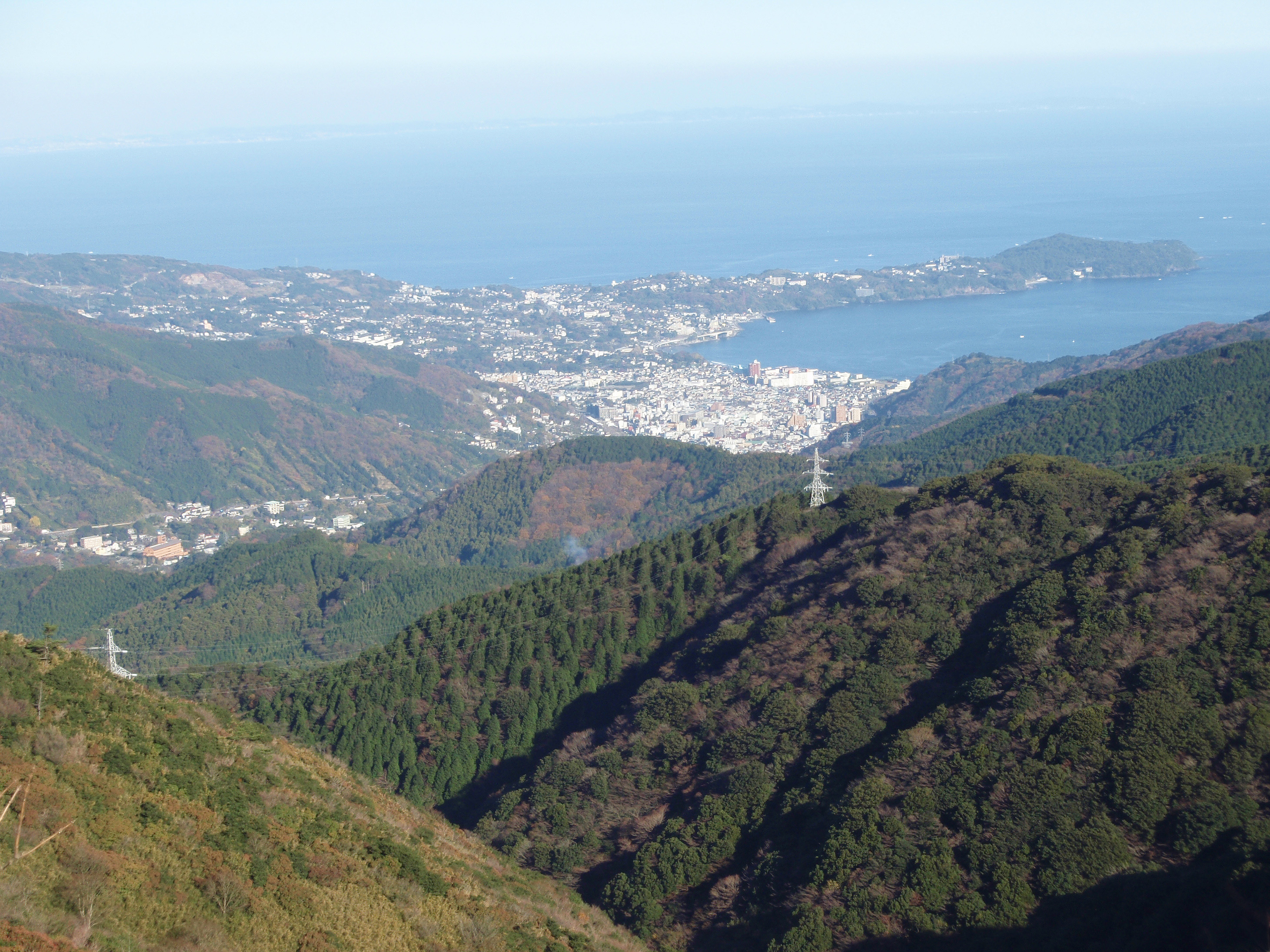
is a town located in Ashigarashimo District, Kanagawa Prefecture, Japan. , the town had an estimated population of 23,267 and a population density of 570 persons per km2. The total area of the town is . Geography Yugawara is located in the far southwestern corner of the prefecture. The center of the town is located in the lowlands between the southern foot of Mount Hakone and the Sagami Bay. Much of the terrain formed by an eroded Quaternary volcano. In the northeast, bordering Manazuru Town, are gentle foothills where residential areas and mandarin orange fields coexist. In the south, hot spring resorts and residential areas are clustered along the north side of the Chitose River. The coastline has a sandy beach with a length of about 700 meters, which is crowded with swimmers in the summer. Surrounding municipalities Kanagawa Prefecture * Odawara * Manazuru * Hakone Shizuoka Prefecture * Atami * Kannami Climate Yugawara has a Humid subtropical climate (Köppen ''Cfa'') c ... [...More Info...] [...Related Items...] OR: [Wikipedia] [Google] [Baidu] |
List Of Towns In Japan
A town (町; ''chō'' or ''machi'') is a local administrative unit in Japan. It is a local public body along with prefecture (''ken'' or other equivalents), city (''shi''), and village (''mura''). Geographically, a town is contained within a district. Note that the same word (町; ''machi'' or ''chō'') is also used in names of smaller regions, usually a part of a ward in a city. This is a legacy of when smaller towns were formed on the outskirts of a city, only to eventually merge into it. Towns See also * Municipalities of Japan * Japanese addressing system The Japanese addressing system is used to identify a specific location in Japan. When written in Japanese characters, addresses start with the largest geographical entity and proceed to the most specific one. When written in Latin characters, ad ... References {{reflist External links "Large_City_System_of_Japan";_graphic_shows_towns_compared_with_other_Japanese_city_types_at_p._1_[PDF_7_of_40/nowiki>">DF_7_of_4 ... [...More Info...] [...Related Items...] OR: [Wikipedia] [Google] [Baidu] |
Population
Population typically refers to the number of people in a single area, whether it be a city or town, region, country, continent, or the world. Governments typically quantify the size of the resident population within their jurisdiction using a census, a process of collecting, analysing, compiling, and publishing data regarding a population. Perspectives of various disciplines Social sciences In sociology and population geography, population refers to a group of human beings with some predefined criterion in common, such as location, race, ethnicity, nationality, or religion. Demography is a social science which entails the statistical study of populations. Ecology In ecology, a population is a group of organisms of the same species who inhabit the same particular geographical area and are capable of interbreeding. The area of a sexual population is the area where inter-breeding is possible between any pair within the area and more probable than cross-breeding with in ... [...More Info...] [...Related Items...] OR: [Wikipedia] [Google] [Baidu] |
Sagami Province
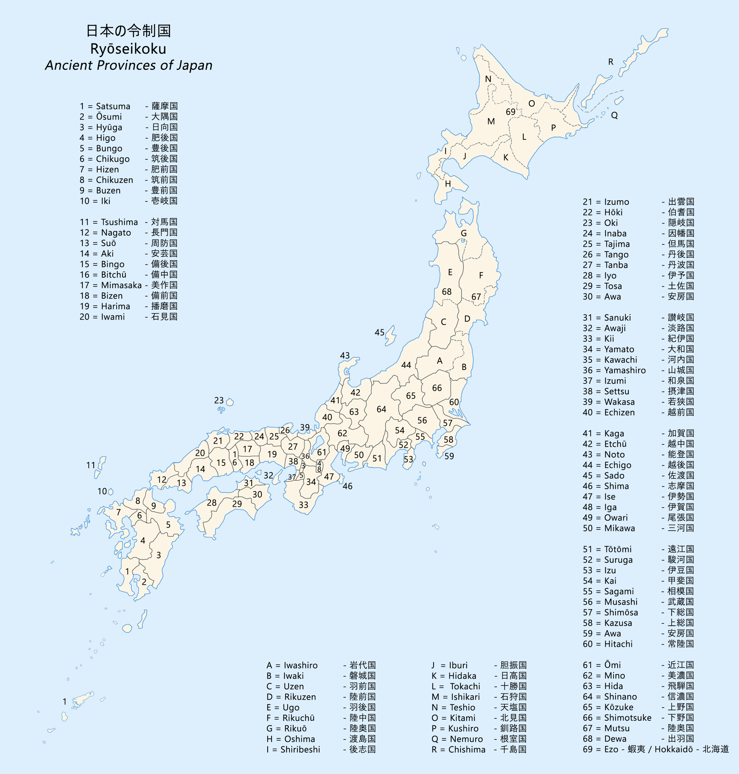
was a province of Japan located in what is today the central and western Kanagawa Prefecture. Nussbaum, Louis-Frédéric. (2005). "''Kanagawa''" at . Sagami Province bordered the provinces of Izu, Musashi, and Suruga. It had access to the Pacific Ocean through Sagami Bay. However, most of the present-day cities of Yokohama and Kawasaki, now part of Kanagawa Prefecture, were not in Sagami, but rather, in Musashi Province. Its abbreviated form name was . History Sagami was one of the original provinces of Japan established in the Nara period under the Taihō Code. The area has been inhabited since prehistoric times. Although remnants from the Japanese Paleolithic and Yayoi periods are scarce, remains from the Jōmon period are relatively plentiful. Kofun period remains are generally from the 1st – 4th centuries AD. Whether or not Sagami was originally part of Musashi prior to the Nara period is still a topic of controversy. The original capital of the province may have be ... [...More Info...] [...Related Items...] OR: [Wikipedia] [Google] [Baidu] |
Kamakura Period
The is a period of Japanese history that marks the governance by the Kamakura shogunate, officially established in 1192 in Kamakura by the first ''shōgun'' Minamoto no Yoritomo after the conclusion of the Genpei War, which saw the struggle between the Taira and Minamoto clans. The period is known for the emergence of the samurai, the warrior caste, and for the establishment of feudalism in Japan. During the early Kamakura period, the shogunate continued warfare against the Northern Fujiwara which was only defeated in 1189. Then, the authority to the Kamakura rulers waned in the 1190s and power was transferred to the powerful Hōjō clan in the early 13th century with the head of the clan as regent (Shikken) under the shogun which became a powerless figurehead. The later Kamakura period saw the invasions of the Mongols in 1274 and again in 1281. To reduce the amount of chaos, the Hōjō rulers decided to decentralize power by allowing two imperial lines – Northern and Southern ... [...More Info...] [...Related Items...] OR: [Wikipedia] [Google] [Baidu] |
Odawara
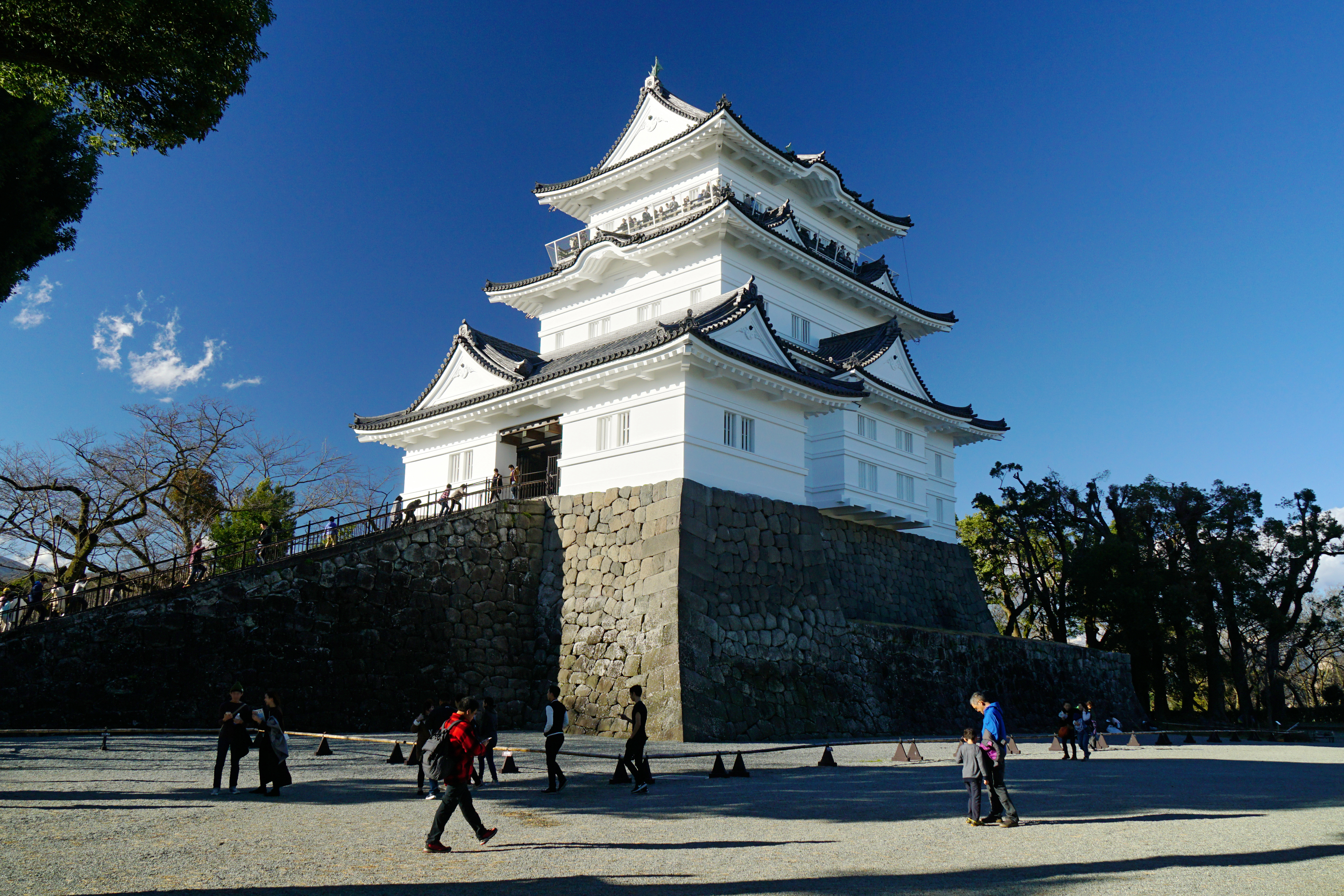
is a city in Kanagawa Prefecture, Japan. , the city had an estimated population of 188,482 and a population density of 1,700 persons per km2. The total area of the city is . Geography Odawara lies in the Ashigara Plains, in the far western portion of Kanagawa Prefecture at the southwestern tip of the Kantō region. It is bordered by the Hakone Mountains to the north and west, the Sakawa River to the east, and Sagami Bay of the Pacific Ocean to the south. Surrounding municipalities Kanagawa Prefecture * Minamiashigara * Ninomiya * Ōi, Kaisei, Nakai *Hakone, Hakone, Manazuru, Yugawara Climate Odawara has a humid subtropical climate (Köppen ''Cfa'') characterized by warm summers and cool winters with light to no snowfall. The average annual temperature in Odawara is 13.4 °C. The average annual rainfall is 2,144 mm with September as the wettest month. The temperatures are highest on average in August, at around 24.2 °C, and lowest in January, at around 2.9&nb ... [...More Info...] [...Related Items...] OR: [Wikipedia] [Google] [Baidu] |
Humid Subtropical Climate
A humid subtropical climate is a zone of climate characterized by hot and humid summers, and cool to mild winters. These climates normally lie on the southeast side of all continents (except Antarctica), generally between latitudes 25° and 40° and are located poleward from adjacent tropical climates. It is also known as warm temperate climate in some climate classifications. Under the Köppen climate classification, ''Cfa'' and ''Cwa'' climates are either described as humid subtropical climates or warm temperate climates. This climate features mean temperature in the coldest month between (or ) and and mean temperature in the warmest month or higher. However, while some climatologists have opted to describe this climate type as a "humid subtropical climate", Köppen himself never used this term. The humid subtropical climate classification was officially created under the Trewartha climate classification. In this classification, climates are termed humid subtropical when the ... [...More Info...] [...Related Items...] OR: [Wikipedia] [Google] [Baidu] |
Kannami, Shizuoka
is a town located in Tagata District, Shizuoka Prefecture, Japan. , the town had an estimated population of 37,782 in 16,401 households and a population density of 580 persons per km². The total area of the town was . Geography Kannami is located in an inland area in far eastern Shizuoka Prefecture, and the "root" of the Izu Peninsula, and in the southern foothills of the Hakone Mountains and the Tanzawa Mountains. The Kano River passes through the town. Neighboring municipalities *Shizuoka Prefecture ** Mishima **Atami **Numazu ** Izunokuni *Kanagawa Prefecture **Hakone ** Yugawara Demographics Per Japanese census data, the population of Kannami has been increasing over the past 50 years. Climate The city has a climate characterized by hot and humid summers, and relatively mild winters (Köppen climate classification ''Cfa''). The average annual temperature in Kannami is 14.4 °C. The average annual rainfall is 1999 mm with September as the wettest month. The ... [...More Info...] [...Related Items...] OR: [Wikipedia] [Google] [Baidu] |
Atami, Shizuoka
is a city located in Shizuoka Prefecture, Japan. , the city had an estimated population of 36,865 in 21,593 households and a population density of 600 persons per km2. The total area of the city is . Geography Atami is located in the far eastern corner of Shizuoka Prefecture at the northern end of Izu Peninsula. The city is on the steep slopes of a partially submerged volcanic caldera on the edge of Sagami Bay. The name "Atami" literally means "hot ocean," a reference to the town's famous ''onsen'' hot springs. The city boundaries include the offshore island of Hatsushima. Most of Atami is located within the Fuji-Hakone-Izu National Park. Warmed by the Kuroshio Current offshore, the area is known for its moderate maritime climate with hot, humid summers, and short winters. Surrounding municipalities *Shizuoka Prefecture **Kannami **Izunokuni ** Itō *Kanagawa Prefecture **Yugawara Demographics Per Japanese census data, the population of Atami has been in slow decline over ... [...More Info...] [...Related Items...] OR: [Wikipedia] [Google] [Baidu] |
Hakone, Kanagawa
is a town in Kanagawa Prefecture, Japan. , the town had a population of 11,293 and a population density of 122 persons per km². The total area of the town is . The town is a popular tourist destination due to its many hot springs and views of Mount Fuji. Geography Hakone is located in the mountains in the far west of the prefecture, on the eastern side of Hakone Pass. Most of the town is within the borders of the volcanically active Fuji-Hakone-Izu National Park, centered on Lake Ashi. Surrounding municipalities Kanagawa Prefecture *Odawara *Yugawara * Minami-ashigara Shizuoka Prefecture' *Gotemba * Susono *Mishima * Oyama *Kannami Climate Hakone has a Humid subtropical climate (Köppen ''Cfa'') characterized by warm summers and cool winters with light to no snowfall. The average annual temperature in Hakone is 13.3 °C. The average annual rainfall is 2221 mm with September as the wettest month. The temperatures are highest on average in August, at around 24.0 ... [...More Info...] [...Related Items...] OR: [Wikipedia] [Google] [Baidu] |
Manazuru, Kanagawa
is a town located in Kanagawa Prefecture, Japan. , the town had an estimated population of 6,949 and a population density of 1000 persons per km². The total area of the town is . Geography Located in the southeast of Mount Hakone, the consists of the small Manazuru Peninsula, which extends into Sagami Bay from the southeast to the northwest, sandwiched between Odawara City in the north and Yugawara Town in the south. The Manazuru Peninsula is a lava plateau with a steep coast and The town area is generally rugged with few flat areas. The urban area is at the base of the peninsula, with Manazuru Station to the northwest, Iwa Fishing Port and Iwo Beach to the east, and Manazuru Port to the southeast. There are many quarries in the mountains north of the city. Mandarin oranges are cultivated in the hills along the northern coast. The northwestern part of the town is part of a mountainous area that extends to the outer ring of the Hakone volcano. The town is within the Manazuru Han ... [...More Info...] [...Related Items...] OR: [Wikipedia] [Google] [Baidu] |
Odawara, Kanagawa
is a city in Kanagawa Prefecture, Japan. , the city had an estimated population of 188,482 and a population density of 1,700 persons per km2. The total area of the city is . Geography Odawara lies in the Ashigara Plains, in the far western portion of Kanagawa Prefecture at the southwestern tip of the Kantō region. It is bordered by the Hakone Mountains to the north and west, the Sakawa River to the east, and Sagami Bay of the Pacific Ocean to the south. Surrounding municipalities Kanagawa Prefecture * Minamiashigara * Ninomiya * Ōi, Kaisei, Nakai *Hakone, Hakone, Manazuru, Yugawara Climate Odawara has a humid subtropical climate (Köppen ''Cfa'') characterized by warm summers and cool winters with light to no snowfall. The average annual temperature in Odawara is 13.4 °C. The average annual rainfall is 2,144 mm with September as the wettest month. The temperatures are highest on average in August, at around 24.2 °C, and lowest in January, at around 2.9& ... [...More Info...] [...Related Items...] OR: [Wikipedia] [Google] [Baidu] |
Onsen
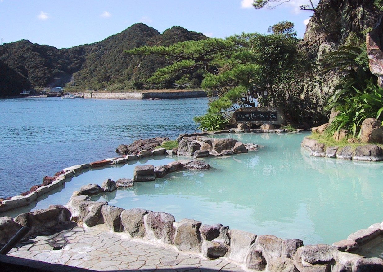
In Japan, are the country's hot springs and the bathing facilities and traditional inns around them. As a volcanically active country, Japan has many onsens scattered throughout all of its major islands. There are approximately 25,000 hot spring sources throughout Japan that provide hot mineral water to about 3,000 genuine onsen establishments. Onsens come in many types and shapes, including and . Baths may be either publicly run by a municipality or privately, often as part of a hotel, ''ryokan'', or . The presence of an onsen is often indicated on signs and maps by the symbol ♨ or the kanji (''yu'', meaning "hot water"). Sometimes the simpler hiragana character ゆ (''yu''), understandable to younger children, is used. Traditionally, onsens were located outdoors, although many inns have now built indoor bathing facilities as well. Nowadays, as most households have their own bath, the number of traditional public baths has decreased, but the number of sightseeing ho ... [...More Info...] [...Related Items...] OR: [Wikipedia] [Google] [Baidu] |


