|
Yorkshire Heritage Way
The Yorkshire Heritage Way is a footpath in northern England. It links the contrasting cities of Bradford in West Yorkshire and Ripon in North Yorkshire, and passes through two UNESCO World Heritage Sites: Saltaire, and Fountains Abbey and Studley Royal Park. The way was created in part to connect the Area of Outstanding Natural Beauty of Nidderdale with the urban area of Bradford, in line with the recommendations of the '' Glover Review'' that AONBs should be made more accessible to city-dwellers. It was designed by members of The Ramblers Lower Wharfedale group and the Burley Bridge Association. The trail was officially launched on 29 April 2022. An inaugural 4-day walk along the trail was arranged to arrive at Ripon Cathedral as it celebrated the 1,350th anniversary of its foundation. Route The way starts at Bradford Cathedral in the centre of Bradford in West Yorkshire, and passes through Saltaire, Shipley Glen and Burley Woodhead to arrive at Burley in Wharfedale. Here th ... [...More Info...] [...Related Items...] OR: [Wikipedia] [Google] [Baidu] |
Bradford
Bradford is a city and the administrative centre of the City of Bradford district in West Yorkshire, England. The city is in the Pennines' eastern foothills on the banks of the Bradford Beck. Bradford had a population of 349,561 at the 2011 census; the second-largest population centre in the county after Leeds, which is to the east of the city. It shares a continuous built-up area with the towns of Shipley, Silsden, Bingley and Keighley in the district as well as with the metropolitan county's other districts. Its name is also given to Bradford Beck. It became a West Riding of Yorkshire municipal borough in 1847 and received its city charter in 1897. Since local government reform in 1974, the city is the administrative centre of a wider metropolitan district, city hall is the meeting place of Bradford City Council. The district has civil parishes and unparished areas and had a population of , making it the most populous district in England. In the century leadin ... [...More Info...] [...Related Items...] OR: [Wikipedia] [Google] [Baidu] |
Burley In Wharfedale
Burley in Wharfedale is a village and (as just Burley) a civil parish in the City of Bradford in West Yorkshire, England. It is situated in the Wharfedale valley. The village is situated on the A65 road, approximately north-west from Leeds, north from Bradford, from Ilkley and from Otley. The hamlet of Burley Woodhead at the foot of Burley Moor is to the south-west. Etymology The name of Burley in Wharfedale is first attested in an eleventh-century copy of a charter issued in 972, as ''Burhleg''. It appears in the Domesday Book in the spellings ''Burgelei'', ''Burgelay'', ''Burghelai'', and ''Burghelay''. The comes from the Old English words ''burg'' ('fortification') and ''lēah'' ('open land in a wood'), and thus meant 'open land in a wood, characterised by a fortification'. The specification 'in Wharfedale', deployed to avoid ambiguity with the various other English places of the same name, is first attested during the reign of Edward I of England, in the forms ''Bu ... [...More Info...] [...Related Items...] OR: [Wikipedia] [Google] [Baidu] |
Footpaths In West Yorkshire
A footpath (also pedestrian way, walking trail, nature trail) is a type of thoroughfare that is intended for use only by pedestrians and not other forms of traffic such as motorized vehicles, bicycles and horses. They can be found in a wide variety of places, from the centre of cities, to farmland, to mountain ridges. Urban footpaths are usually paved, may have steps, and can be called alleys, lanes, steps, etc. National parks, nature preserves, conservation areas and other protected wilderness areas may have footpaths (trails) that are restricted to pedestrians. The term footpath can also describe a pavement/ sidewalk in some English-speaking countries (such as Australia, New Zealand, and Ireland). A footpath can also take the form of a footbridge, linking two places across a river. Origins and history Public footpaths are rights of way originally created by people walking across the land to work, market, the next village, church, and school. This includes Mass paths a ... [...More Info...] [...Related Items...] OR: [Wikipedia] [Google] [Baidu] |
Footpaths In North Yorkshire
A footpath (also pedestrian way, walking trail, nature trail) is a type of thoroughfare that is intended for use only by pedestrians and not other forms of traffic such as motorized vehicles, bicycles and horses. They can be found in a wide variety of places, from the centre of cities, to farmland, to mountain ridges. Urban footpaths are usually paved, may have steps, and can be called alleys, lanes, steps, etc. National parks, nature preserves, conservation areas and other protected wilderness areas may have footpaths (trails) that are restricted to pedestrians. The term footpath can also describe a pavement/ sidewalk in some English-speaking countries (such as Australia, New Zealand, and Ireland). A footpath can also take the form of a footbridge, linking two places across a river. Origins and history Public footpaths are rights of way originally created by people walking across the land to work, market, the next village, church, and school. This includes Mass paths a ... [...More Info...] [...Related Items...] OR: [Wikipedia] [Google] [Baidu] |
Ultramarathon
An ultramarathon, also called ultra distance or ultra running, is any footrace longer than the traditional marathon length of . Various distances are raced competitively, from the shortest common ultramarathon of to over . 50k and 100k are both World Athletics record distances, but some races are among the oldest and most prestigious events, especially in North America. Around 100 miles is typically the longest course distance raced in under 24 hours but there are also longer multi-day races of or more, sometimes raced in stages with breaks for sleep. While some ultras are road races, many take place on trails, leading to a large overlap with the sports of trail running and mountain running. Overview There are two main types of ultramarathon events: those that cover a specified distance or route, and those that last for a predetermined period of time (with the winner covering the most distance in that time). The most common distances are , , , and , although many races have ... [...More Info...] [...Related Items...] OR: [Wikipedia] [Google] [Baidu] |
Brimham Rocks
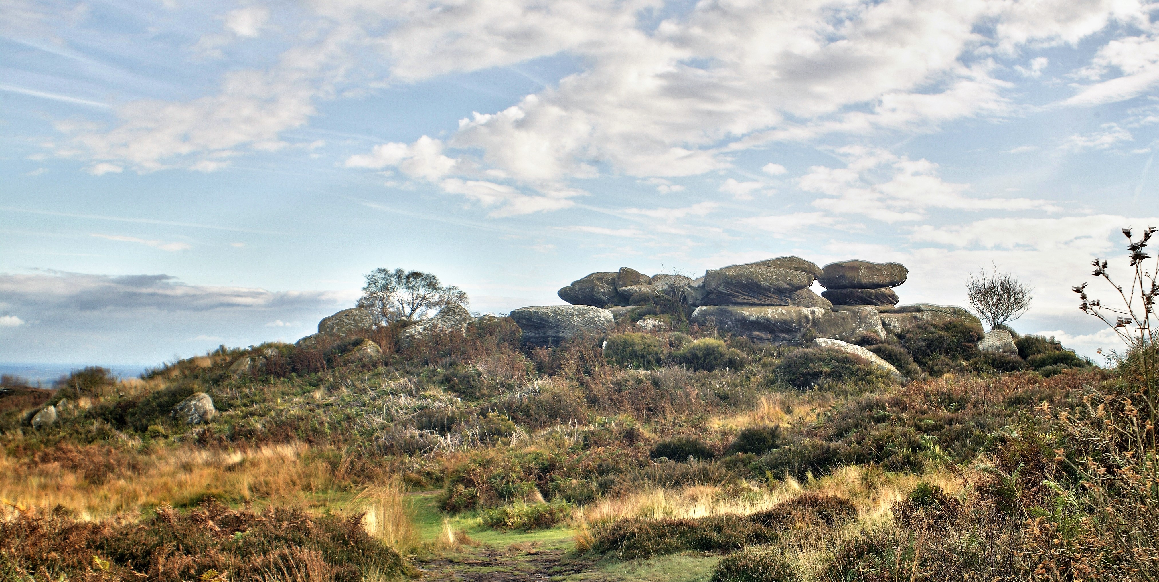
Brimham Rocks, once known as Brimham Crags, is a 183.9-hectare (454-acre) biological Site of Special Scientific Interest (SSSI) and Geological Conservation Review (GCR) site, 8 miles (13 km) north-west of Harrogate, North Yorkshire, England, on Brimham Moor in the Nidderdale Area of Outstanding Natural Beauty. The site, notified as SSSI in 1958, is an outcrop of Millstone Grit, with small areas of birch woodland and a large area of wet and dry heath. The site is known for its water- and weather-eroded rocks, which were formed over 325 million years ago and have assumed fantastic shapes. In the 18th and 19th centuries, antiquarians such as Hayman Rooke wondered whether they could have been at least partly carved by druids, an idea that ran concurrently with the popularity of James Macpherson's '' Fragments of Ancient Poetry'' of 1760, and a developing interest in New-Druidism. For up to two hundred years, some stones have carried fanciful names, such as Druid's Idol, Drui ... [...More Info...] [...Related Items...] OR: [Wikipedia] [Google] [Baidu] |
National Trust
The National Trust, formally the National Trust for Places of Historic Interest or Natural Beauty, is a charity and membership organisation for heritage conservation in England, Wales and Northern Ireland. In Scotland, there is a separate and independent National Trust for Scotland. The Trust was founded in 1895 by Octavia Hill, Sir Robert Hunter and Hardwicke Rawnsley to "promote the permanent preservation for the benefit of the Nation of lands and tenements (including buildings) of beauty or historic interest". It was given statutory powers, starting with the National Trust Act 1907. Historically, the Trust acquired land by gift and sometimes by public subscription and appeal, but after World War II the loss of country houses resulted in many such properties being acquired either by gift from the former owners or through the National Land Fund. Country houses and estates still make up a significant part of its holdings, but it is also known for its protection of wild lands ... [...More Info...] [...Related Items...] OR: [Wikipedia] [Google] [Baidu] |
Glasshouses, North Yorkshire
Glasshouses is a small village in Nidderdale, North Yorkshire, England. It lies south-east of Pateley Bridge on the east side of Nidderdale and has a recently rebuilt river bridge across the River Nidd. In 2019 it had an estimated population of 536. History Records about Glasshouses stretch as far back as 1386 and the name of the village is believed to have derived from the Old English ''Glas Hus'', which translates as the place where glass was made. Whilst there is no firm evidence of this, it was believed that glass for Fountains Abbey was made here. In the 16th century, lead was mined to the west and transported to the hamlet of Wilsill (east of Glasshouses) for smelting and onward transportation. The old twine mill, on the banks of the Nidd, was constructed between 1812 and 1814. The mill was used to produce flax, then hemp and latterly, rope. Local rumour has it that the mill supplied rope to the White Star Line and most notably, Glasshouse rope was used on the ''Titanic ... [...More Info...] [...Related Items...] OR: [Wikipedia] [Google] [Baidu] |
Thruscross Reservoir
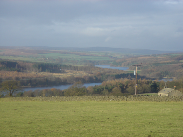
Thruscross Reservoir is the northernmost of four reservoirs in the Washburn valley, lying north of Otley and west of Harrogate in North Yorkshire, England, near the hamlet of Thruscross. It can be found on an unclassified road from the A59 road (where the road from Otley joins). Permission to construct the reservoir was granted via a water order in 1960 and Thruscross was completed in 1966, much later than the other three reservoirs which date back to the nineteenth century. The construction of the reservoir flooded the village of West End, which was already largely derelict following the decline of the flax industry. There is another hamlet close to the reservoir that retains the name of West End. The remains of a flax mill can be seen at the edge of the reservoir, and more of the village has been revealed at times of drought, such as the summers of 1989 and 1990. The work to build the reservoir included clearing trees, removing sacred items from the church and exhuming bodie ... [...More Info...] [...Related Items...] OR: [Wikipedia] [Google] [Baidu] |
Washburn Valley
The River Washburn is a river in Yorkshire, England. It originates high in the Yorkshire Dales and ends where it meets the River Wharfe. It lies within the Nidderdale Area of Outstanding Natural Beauty. Name The earliest recorded form of the river's name was ''Walkesburn'', from the early 12th century. The name is thought to come from an Old English personal name ''Walc'', not otherwise recorded, so means "stream of a man named Walc". Course The river's source is at Washburn Head, just south of Stump Cross Caverns and from there flows southwards via Thruscross Reservoir, Blubberhouses, Fewston Reservoir, Swinsty Reservoir and Lindley Wood Reservoir before joining the River Wharfe just north-west of Pool-in-Wharfedale. Reservoirs The Washburn has been dammed to a series of four reservoirs, all built to supply water to the city of Leeds. The lower three ( Lindley Wood, Swinsty and Fewston) were built at the end of the 19th century, while the fourth, Thruscross, was delayed u ... [...More Info...] [...Related Items...] OR: [Wikipedia] [Google] [Baidu] |
Blubberhouses
Blubberhouses is a small village and civil parishes in England, civil parish located in the Washburn Valley in the borough of Harrogate (borough), Harrogate in North Yorkshire, a county in the north of England. The population as at the 2011 Census was less than 100. Details are included in the civil parish of Fewston. It is situated to the south of the Yorkshire Dales national park, and to the north of a Roman road and Fewston Reservoir on the A59 road linking Harrogate to Skipton. History The name of the village derives from the Anglo-Saxon ''bluberhūs'' = "the house(s) which is/are at the bubbling stream", with a later regularised plural; the ''-um'' form came from the Anglo-Saxon dative plural case ''æt bluberhūsum'' = "at the houses which ...". Later forms of the name on record include "Bluburgh", "Bluborrow", and "Bluburhouse". The Anglican parish church, village church of St Andrew's was designed by Edward Buckton Lamb. It is part of the parish, ecclesiastical parish o ... [...More Info...] [...Related Items...] OR: [Wikipedia] [Google] [Baidu] |
Timble
Timble is a village in the Harrogate district of North Yorkshire, England. It is situated on the slopes of the Washburn valley, north of Otley and close to Swinsty and Fewston reservoirs. In 1988, the diaries of local man John Dickinson were published,Timble Man - Diaries of a Dalesman, by John Dickinson, edited by Ronald Harker (published 1988) providing considerable insight into the history of the village and the surrounding area. In the 17th century, the village was home to ''The Witches of Timble'', who were accused of witchcraft by local poet Edward Fairfax, and tried but acquitted twice at York.The Washburn by Tom Bradley (published 1895, reprinted 1988) The village has one pub, the ''Timble Inn''. It was closed in 2004 but was re-opened in September 2009 as a Free House following an extensive refurbishment. The Yorkshire Water Way goes through Timble. Etymology The name ''Timble'' may be of Brittonic origin and derived from the elements ''din'', "a hill fort", and ' ... [...More Info...] [...Related Items...] OR: [Wikipedia] [Google] [Baidu] |


