|
Yaak, Montana
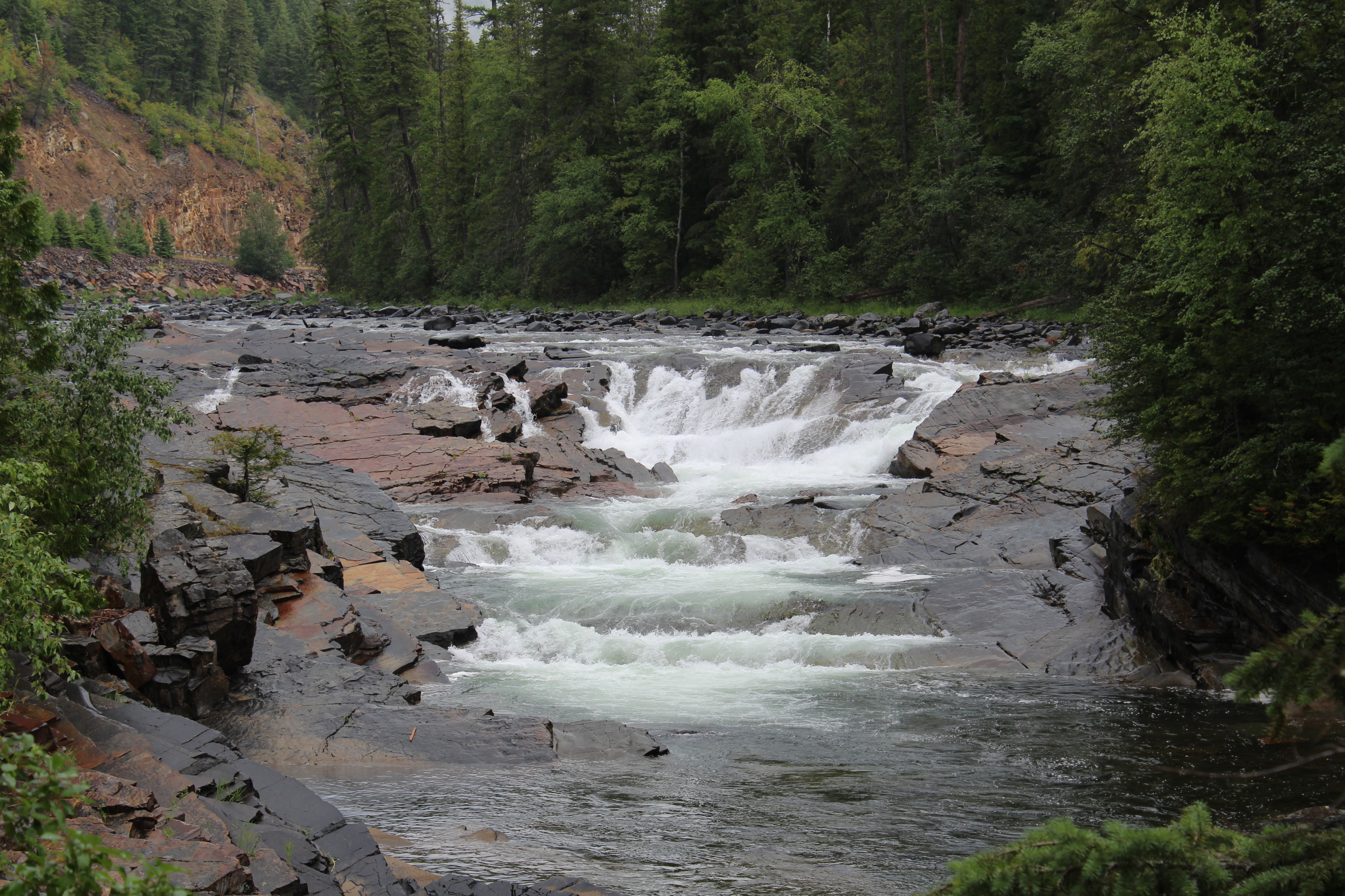
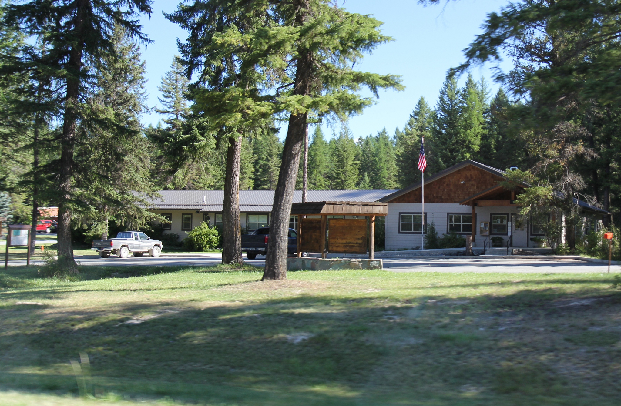
Yaak is an unincorporated community and census-designated place in Lincoln County, Montana, United States. It is located along the Yaak River, within the Kootenai National Forest. As of the 2020 census, its population was 338. Yaak has frequently been noted on lists of unusual place names. Yaak derives its name from the Yaak River. According to local lore, A’ak is a Kootenai name meaning “Arrow.” The Kootenai River forms the shape of a drawn bow; its tributary the Yaak River is its arrow. Homesteaders arrived shortly after the passage of the Forest Homestead Act of 1906. Demographics Climate This climatic region is typified by large seasonal temperature differences, with warm to hot (and often humid) summers and cold (sometimes severely cold) winters. According to the Köppen Climate Classification system, Yaak has a humid continental climate A humid continental climate is a climatic region defined by Russo-German climatologist Wladimir Köppen in 1900, typified ... [...More Info...] [...Related Items...] OR: [Wikipedia] [Google] [Baidu] |
Census-designated Place
A census-designated place (CDP) is a concentration of population defined by the United States Census Bureau for statistical purposes only. CDPs have been used in each decennial census since 1980 as the counterparts of incorporated places, such as self-governing cities, towns, and villages, for the purposes of gathering and correlating statistical data. CDPs are populated areas that generally include one officially designated but currently unincorporated community, for which the CDP is named, plus surrounding inhabited countryside of varying dimensions and, occasionally, other, smaller unincorporated communities as well. CDPs include small rural communities, edge cities, colonias located along the Mexico–United States border, and unincorporated resort and retirement communities and their environs. The boundaries of any CDP may change from decade to decade, and the Census Bureau may de-establish a CDP after a period of study, then re-establish it some decades later. Most unin ... [...More Info...] [...Related Items...] OR: [Wikipedia] [Google] [Baidu] |
Yaak River
The Yaak River (spelled Yahk River in Canada) is a tributary of the Kootenai River in Montana. Course The Yaak River originates near Yahk Mountain, in the Yahk Range, part of the Purcell Mountains, in southeast British Columbia. The river flows south, crossing into Lincoln County, Montana. It receives the East Fork Yaak River, then the West Fork Yaak River (also called the West Yahk River). The West Fork originates in Montana near Rock Candy Mountain, flows northeast into British Columbia, then southeast back into Montana to join the main Yaak River. Below the West Fork confluence, the Yaak River receives the South Fork Yaak River before curving broadly west, then south, receiving numerous tributary creeks such as Spread Creek, Hellroaring Creek, and Burnt Creek (also called Burnt Grizzly Bear Creek), before flowing into the Kootenai River near Yaak Mountain and the small city of Troy, Montana. In Montana, the Yaak River and its tributaries mostly lie within Kootenai National ... [...More Info...] [...Related Items...] OR: [Wikipedia] [Google] [Baidu] |
Footnotes
A note is a string of text placed at the bottom of a page in a book or document or at the end of a chapter, volume, or the whole text. The note can provide an author's comments on the main text or citations of a reference work in support of the text. Footnotes are notes at the foot of the page while endnotes are collected under a separate heading at the end of a chapter, volume, or entire work. Unlike footnotes, endnotes have the advantage of not affecting the layout of the main text, but may cause inconvenience to readers who have to move back and forth between the main text and the endnotes. In some editions of the Bible, notes are placed in a narrow column in the middle of each page between two columns of biblical text. Numbering and symbols In English, a footnote or endnote is normally flagged by a superscripted number immediately following that portion of the text the note references, each such footnote being numbered sequentially. Occasionally, a number between brack ... [...More Info...] [...Related Items...] OR: [Wikipedia] [Google] [Baidu] |
Humid Continental Climate
A humid continental climate is a climatic region defined by Russo-German climatologist Wladimir Köppen in 1900, typified by four distinct seasons and large seasonal temperature differences, with warm to hot (and often humid) summers and freezing cold (sometimes severely cold in the northern areas) winters. Precipitation is usually distributed throughout the year but often do have dry seasons. The definition of this climate regarding temperature is as follows: the mean temperature of the coldest month must be below or depending on the isotherm, and there must be at least four months whose mean temperatures are at or above . In addition, the location in question must not be semi-arid or arid. The cooler ''Dfb'', ''Dwb'', and ''Dsb'' subtypes are also known as hemiboreal climates. Humid continental climates are generally found between latitudes 30° N and 60° N, within the central and northeastern portions of North America, Europe, and Asia. They are rare and isolat ... [...More Info...] [...Related Items...] OR: [Wikipedia] [Google] [Baidu] |
Köppen Climate Classification
The Köppen climate classification is one of the most widely used climate classification systems. It was first published by German-Russian climatologist Wladimir Köppen (1846–1940) in 1884, with several later modifications by Köppen, notably in 1918 and 1936. Later, the climatologist Rudolf Geiger (1894–1981) introduced some changes to the classification system, which is thus sometimes called the Köppen–Geiger climate classification system. The Köppen climate classification divides climates into five main climate groups, with each group being divided based on seasonal precipitation and temperature patterns. The five main groups are ''A'' (tropical), ''B'' (arid), ''C'' (temperate), ''D'' (continental), and ''E'' (polar). Each group and subgroup is represented by a letter. All climates are assigned a main group (the first letter). All climates except for those in the ''E'' group are assigned a seasonal precipitation subgroup (the second letter). For example, ''Af'' indi ... [...More Info...] [...Related Items...] OR: [Wikipedia] [Google] [Baidu] |
Climate
Climate is the long-term weather pattern in an area, typically averaged over 30 years. More rigorously, it is the mean and variability of meteorological variables over a time spanning from months to millions of years. Some of the meteorological variables that are commonly measured are temperature, humidity, atmospheric pressure, wind, and precipitation. In a broader sense, climate is the state of the components of the climate system, including the atmosphere, hydrosphere, cryosphere, lithosphere and biosphere and the interactions between them. The climate of a location is affected by its latitude/longitude, terrain, altitude, land use and nearby water bodies and their currents. Climates can be classified according to the average and typical variables, most commonly temperature and precipitation. The most widely used classification scheme was the Köppen climate classification. The Thornthwaite system, in use since 1948, incorporates evapotranspiration along with temperature ... [...More Info...] [...Related Items...] OR: [Wikipedia] [Google] [Baidu] |
Kootenai
The Kutenai ( ), also known as the Ktunaxa ( ; ), Ksanka ( ), Kootenay (in Canada) and Kootenai (in the United States), are an indigenous people of Canada and the United States. Kutenai bands live in southeastern British Columbia, northern Idaho, and western Montana. The Kutenai language is a language isolate, thus unrelated to the languages of neighboring peoples or any other known language. Four bands form the Ktunaxa Nation in British Columbia. The Ktunaxa Nation was historically closely associated with the Shuswap Indian Band through tribal association and intermarriage. Two federally recognized tribes represent Kutenai people in the U.S.: the Kootenai Tribe of Idaho and the Confederated Salish and Kootenai Tribes in Montana, a confederation also including Bitterroot Salish and Pend d'Oreilles bands. Kootenay Around 40 variants of the name ''Kutenai'' have been attested since 1820; two others are also in current use. ''Kootenay'' is the common spelling in British Colum ... [...More Info...] [...Related Items...] OR: [Wikipedia] [Google] [Baidu] |
Place Names Considered Unusual
Unusual place names are names for cities, towns, and other regions which are considered non-ordinary in some manner. This can include place names which are also offensive words, inadvertently humorous or highly charged words, as well as place names of unorthodox spelling and pronunciation, including especially short or long names. These names often have an unintended effect or double-meaning when read by someone who speaks another language. Profane, humorous, and highly charged words A number of settlements have names that are offensive or humorous in other languages, such as Rottenegg or Fucking (renamed to Fugging in 2021) in Austria, or Fjuckby in Sweden, where the name can be associated with the word "fuck". Although as a place name ''Fucking'' is benign in German, in English the word is usually vulgar. Similarly, when they hear of the French town of Condom, English speakers will likely associate it with condoms. Hel, Poland is a Polish seaside resort on the Hel Peninsu ... [...More Info...] [...Related Items...] OR: [Wikipedia] [Google] [Baidu] |
Kootenai National Forest
The Kootenai National Forest is a national forest located in the far northwestern section of Montana and the northeasternmost lands in the Idaho panhandle in the United States, along the Canada–US border. Of the administered by the forest, less than 3 percent is located in the state of Idaho. Forest headquarters are located in Libby, Montana. There are local ranger district offices in Eureka, Fortine, Libby, Trout Creek, and Troy, Montana. About 53 percent of the Cabinet Mountains Wilderness is located within the forest, with the balance lying in neighboring Kaniksu National Forest. Snowshoe Peak in the Cabinet Mountains Wilderness, at , is the highest peak within the forest. Mountain ranges included in the forest include the Whitefish, Purcell, Bitterroot, Salish, and Cabinet ranges. The Pacific Northwest National Scenic Trail traverses the Forest. More than of the trail are within the Kootenai. The Kootenai and the Clark Fork rivers are the major ri ... [...More Info...] [...Related Items...] OR: [Wikipedia] [Google] [Baidu] |
Census-designated Place
A census-designated place (CDP) is a concentration of population defined by the United States Census Bureau for statistical purposes only. CDPs have been used in each decennial census since 1980 as the counterparts of incorporated places, such as self-governing cities, towns, and villages, for the purposes of gathering and correlating statistical data. CDPs are populated areas that generally include one officially designated but currently unincorporated community, for which the CDP is named, plus surrounding inhabited countryside of varying dimensions and, occasionally, other, smaller unincorporated communities as well. CDPs include small rural communities, edge cities, colonias located along the Mexico–United States border, and unincorporated resort and retirement communities and their environs. The boundaries of any CDP may change from decade to decade, and the Census Bureau may de-establish a CDP after a period of study, then re-establish it some decades later. Most unin ... [...More Info...] [...Related Items...] OR: [Wikipedia] [Google] [Baidu] |


