|
Yugra
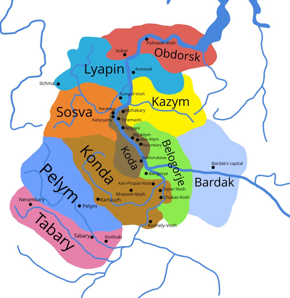
Yugra or Iuhra (Old Russian Югра ''Jugra''; Byzantine Greek Οὔγγροι ''Oὔggroi''; la, Ongariae ) was a collective name for lands and peoples in the region to the east of the northern (modern north-west ), in the n annals of the 12th–17th centuries. During this period the region was inhabited by ... [...More Info...] [...Related Items...] OR: [Wikipedia] [Google] [Baidu] |
Khanty-Mansi Autonomous Okrug–Yugra
Khanty-Mansi Autonomous Okrug–Yugra (Russian and Mansi: Ханты-Мансийский автономный округ — Югра, ''Khanty-Mansiysky avtonomny okrug — Yugra;'' Khanty: Хӑнты-Мансийской Aвтономной Округ) or Khantia-Mansia is a federal subject of Russia (an autonomous okrug of Tyumen Oblast). It has a population of 1,532,243 as of the 2010 Census. The peoples native to the region are the Khanty and the Mansi, known collectively as Ob-Ugric people, but today the two groups only constitute 2.1% of the region's population. The local languages, Khanty and Mansi, enjoy special status in the autonomous okrug and along with their distant relative Hungarian are part of the Ugric branch of the Finno-Ugric languages. Russian remains the only official language. In 2012, the majority (51%) of the oil produced in Russia came from Khanty-Mansi Autonomous Okrug, giving the region great economic importance in Russia and the world. It border ... [...More Info...] [...Related Items...] OR: [Wikipedia] [Google] [Baidu] |
Ural Mountains
The Ural Mountains ( ; rus, Ура́льские го́ры, r=Uralskiye gory, p=ʊˈralʲskʲɪjə ˈɡorɨ; ba, Урал тауҙары) or simply the Urals, are a mountain range that runs approximately from north to south through western Russia, from the coast of the Arctic Ocean to the river Ural and northwestern Kazakhstan.Ural Mountains Encyclopædia Britannica on-line The mountain range forms part of the conventional boundary between the regions of and |
Khanty People
The Khanty (Khanty: ханти, ''hanti''), also known in older literature as Ostyaks (russian: остяки) are a Ugric indigenous people, living in Khanty–Mansi Autonomous Okrug, a region historically known as "Yugra" in Russia, together with the Mansi. In the autonomous okrug, the Khanty and Mansi languages are given co-official status with Russian. In the 2010 Census, 30,943 persons identified themselves as Khanty. Of those, 26,694 were resident in Tyumen Oblast, of whom 17,128 were living in Khanty–Mansi Autonomous Okrug and 8,760—in Yamalo-Nenets Autonomous Okrug. 873 were residents of neighbouring Tomsk Oblast, and 88 lived in the Komi Republic. Ethnonym Since the Khanty language has about 10 dialects which can be united in 3 main branches, there are several slightly different words used by these people to describe themselves: *''Khanti, Khante'' (in North) *''Khande'' (in South) *''Kantek, Kantakh'' (in East) All these words mean ''Human''. They also call ... [...More Info...] [...Related Items...] OR: [Wikipedia] [Google] [Baidu] |
Golden Lady Of The Obians
The Golden Woman, Golden Hag, Golden Lady (russian: Золотая баба, ''zolotaya baba'', archaic name: Злата баба, ''zlata baba'', la, aurea anus)Roman Krzywy(The Golden Woman – a Pagan Sanctuary at the Confines of the Tsarist State) ''Religie i kościoły'', Museum of King Jan III's Palace at Wilanów. Retrieved 12 January 2014. is a legendary idol, an alleged item of worship of the indigenous peoples of Northeastern Europe/Northwestern Siberia. Early references about it are contradictory, both in its geographical location and in description. Maciej Miechowita in his ''Tractatus de duabus Sarmatis Europiana et Asiana et de contentis in eis'' (1517) described it as follows: Accipiat quinto, quod post terram Viatka nuncupatam in Scythiam penetrando iacet magnum idolum Zlota baba, quod interpretatum sonat aurea anus seu vetula, quod gentes vicinae colunt et venerantur, nec aliquis in proximo gradiens aut feras agitando et in venatione sectando vacuus et sine obl ... [...More Info...] [...Related Items...] OR: [Wikipedia] [Google] [Baidu] |
Mansi People
The Mansi (Mansi: Мāньси / Мāньси мāхум, ''Māńsi / Māńsi māhum'', ) are a Ugric indigenous people living in Khanty–Mansia, an autonomous okrug within Tyumen Oblast in Russia. In Khanty–Mansia, the Khanty and Mansi languages have co-official status with Russian. The Mansi language is one of the postulated Ugric languages of the Uralic family. The Mansi people were formerly known as the Voguls. Together with the Khanty people, the Mansi are politically represented by the Association to Save Yugra, an organisation founded during Perestroika of the late 1980s. This organisation was among the first regional indigenous associations in Russia. Demographics According to the 2010 census, there were 12,269 Mansi in Russia. History The ancestors of Mansi people populated the areas west of the Urals. Mansi findings have been unearthed in the vicinity of Perm. In the first millennium BC, they migrated to Western Siberia where they assimilated with the nativ ... [...More Info...] [...Related Items...] OR: [Wikipedia] [Google] [Baidu] |
Ugric Languages
The Ugric or Ugrian languages ( or ) are a proposed branch of the Uralic language family. The name Ugric is derived from Ugrians, an archaic exonym for the Magyars (Hungarians) and Yugra, a region in northwest Russia. Ugric includes three subgroups: Hungarian, Khanty, and Mansi. The last two have traditionally been considered single languages, though their main dialects are sufficiently distinct that they may also be considered small subfamilies of three to four languages each. A common Proto-Ugric language is posited to have been spoken from the end of the 3rd millennium BC until the first half of the 1st millennium BC, in Western Siberia, east of the southern Ural Mountains. Of the three languages, Khanty and Mansi have traditionally been set apart from Hungarian as Ob-Ugric, though features uniting Mansi and Hungarian in particular are known as well. The Ugric language family was first noticed by Pope Pius II in his ''Cosmographia'' (1458), when he wr ... [...More Info...] [...Related Items...] OR: [Wikipedia] [Google] [Baidu] |
Cracow University
The Jagiellonian University (Polish: ''Uniwersytet Jagielloński'', UJ) is a public research university in Kraków, Poland. Founded in 1364 by King Casimir III the Great, it is the oldest university in Poland and the 13th oldest university in continuous operation in the world. It is regarded as Poland's most prestigious academic institution. The university has been viewed as a guardian of Polish culture, particularly for continuing operations during the partitions of Poland and the two World Wars, as well as a significant contributor to the intellectual heritage of Europe. The campus of the Jagiellonian University is centrally located within the city of Kraków. The university consists of thirteen main faculties, in addition to three faculties composing the Collegium Medicum. It employs roughly 4,000 academics and provides education to more than 35,000 students who study in 166 fields. The main language of instruction is Polish, although around 30 degrees are offered in Englis ... [...More Info...] [...Related Items...] OR: [Wikipedia] [Google] [Baidu] |
Sigismund Von Herberstein
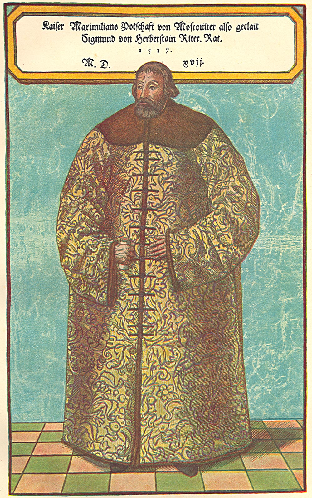
Siegmund (Sigismund) Freiherr von Herberstein (or Baron Sigismund von Herberstein; 23 August 1486 – 28 March 1566) was a Carniolan diplomat, writer, historian and member of the Holy Roman Empire Imperial Council. He was most noted for his extensive writing on the geography, history and customs of Russia, and contributed greatly to early Western European knowledge of that area. Early life Herberstein was born in 1486 in Vipava (german: Wippach) in the Duchy of Carniola, now in Slovenia, then part of the Habsburg monarchy. His parents were Leonhard von Herberstein and Barbara von Lueg, members of the prominent German-speaking family which had already resided in Herberstein Castle for nearly 200 years. Little is known of his early life apart from the fact that he became familiar with the Slovene language spoken in the region. This knowledge became significant later in his life. In 1499, he entered the University of Vienna to study philosophy and law. In 1506, he entered the army as ... [...More Info...] [...Related Items...] OR: [Wikipedia] [Google] [Baidu] |
Gerhard Mercator
Gerardus Mercator (; 5 March 1512 – 2 December 1594) was a 16th-century geographer, cosmographer and cartographer from the County of Flanders. He is most renowned for creating the 1569 world map based on a new projection which represented sailing courses of constant bearing (rhumb lines) as straight lines—an innovation that is still employed in nautical charts. Mercator was a highly influential pioneer in the history of cartography. Monmonier, Mark: ''Rhumb Lines and Map Wars: A Social History of the Mercator Projection''. (Chicago: University of Chicago Press, 2004)Van der Krogt, Peter (2015), 'Chapter 6: Gerhard Mercator and his Cosmography: How the 'Atlas' became an Atlas,'; in: Gerhard Holzer, et al. (eds.), ''A World of Innovation: Cartography in the Time of Gerhard Mercator''. (Newcastle upon Tyne: Cambridge Scholars Publishing, 2015), pp. 112–130 Along with Gemma Frisius and Abraham Ortelius, he is generally considered one of the founders of the Netherlandish scho ... [...More Info...] [...Related Items...] OR: [Wikipedia] [Google] [Baidu] |
Map Of Yugra
A map is a symbolic depiction emphasizing relationships between elements of some space, such as Physical body, objects, regions, or themes. Many maps are static, fixed to paper or some other durable medium, while others are dynamic or interactive. Although most commonly used to depict geography, maps may represent any space, real or fictional, without regard to Context (language use), context or Scale (map), scale, such as in brain mapping, DNA mapping, or computer network topology mapping. The space being mapped may be two dimensional, such as the surface of the earth, three dimensional, such as the interior of the earth, or even more abstract spaces of any dimension, such as arise in modeling phenomena having many independent variables. Although the earliest maps known are of the heavens, geographic maps of territory have a very long tradition and exist from ancient times. The word "map" comes from the , wherein ''mappa'' meant 'napkin' or 'cloth' and ''mundi'' 'the world'. ... [...More Info...] [...Related Items...] OR: [Wikipedia] [Google] [Baidu] |


.jpg)

