|
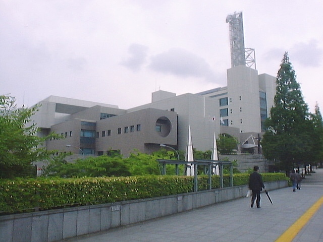
Yokohama City Council
The is the legislature of Yokohama City. Overview *Members: 86 *Term: 4 years *Voting System: :ja:中選挙区制, Medium‐size constituency system (Single non-transferable vote) *:ja:議長, President: Tomio Shimizu (LDP) *Vice-President: Masaharu Takahashi (Komeito) Current composition As of 2021, the city council was composed as follows: Electoral districts Representatives' compensation and benefits References External links Yokohama City Council {{Authority control Yokohama City councils in Japan ... [...More Info...] [...Related Items...] OR: [Wikipedia] [Google] [Baidu] |
Kanagawa-ku, Yokohama
is one of the 18 wards of the city of Yokohama in Kanagawa Prefecture, Japan. As of 2010, the ward had an estimated population of 230,401 and a density of 9,650 persons per km2. The total area was 23.88 km2. Geography Kanagawa is located in eastern Kanagawa Prefecture, and northeast of the geographic center of the city of Yokohama. Surrounding municipalities * Tsurumi Ward * Nishi Ward * Kōhoku Ward * Midori Ward * Hodogaya Ward History Under the Nara period Ritsuryō system, the area that is now Kanagawa Ward became part of Tachibana District in Musashi Province. During the Edo period, the area was ''tenryō'' territory controlled directly by the Tokugawa shogunate, but administered through various ''hatamoto''. The area prospered in the Edo period as Kanagawa-juku, a post station on the Tōkaidō connecting Edo with Kyoto. During the Bakumatsu period, Kanagawa was the location of the signing of the Convention of Kanagawa, which ended Japan’s national isolation poli ... [...More Info...] [...Related Items...] OR: [Wikipedia] [Google] [Baidu] |
Sakae-ku, Yokohama
is one of the 18 wards of the city of Yokohama in Kanagawa Prefecture, Japan. As of 2010, the ward had an estimated population of 124,845 and a density of 6,750 persons per km². The total area was 18.55 km². Geography Sakae Ward is located in eastern Kanagawa Prefecture, and on the southwestern borders of the city of Yokohama. The area is largely flatland, with scattered small hills. Surrounding municipalities * Isogo Ward * Kanazawa Ward * Totsuka Ward * Konan Ward *Kamakura, Kanagawa History The area around present-day Sakae Ward has been inhabited continuously for thousands of years. Archaeologists have found stone tools from the Japanese Paleolithic period and ceramic shards from the Jōmon period, house ruins from the Yayoi period and tombs from the Kofun period at numerous locations in the area. Under the Nara period Ritsuryō system, it became part of Kamakura District in Sagami Province. By the Kamakura period, much of the area was farmland supporting the populati ... [...More Info...] [...Related Items...] OR: [Wikipedia] [Google] [Baidu] |
Totsuka-ku, Yokohama
is one of the 18 wards of the city of Yokohama in Kanagawa Prefecture, Japan. As of 2010, the ward had an estimated population of 273,418 and a density of 7,640 persons per km2. The total area was 35.70 km2. Geography Totsuka Ward is located in eastern Kanagawa Prefecture, and in the center-western area of the city of Yokohama. The area is largely flatland, with scattered small hills. The Kashio River passes through the Ward. Surrounding municipalities * Sakae Ward * Hodagaya Ward *Minami Ward * Asahi Ward * Kōnan Ward * Izumi Ward *Kamakura * Fujisawa History The area around present-day Totsuka Ward has been inhabited for thousands of years. Archaeologists have found ceramic shards from the Jōmon period at numerous locations in the area. There are numerous keyhole tombs from the Kofun period in Totsuka, including one on the grounds of Tomizuka Hachiman Shrine, from which the ward's name is derived. Under the Nara period Ritsuryō system, it became part of Kamakura Dis ... [...More Info...] [...Related Items...] OR: [Wikipedia] [Google] [Baidu] |
Tsuzuki-ku, Yokohama
is one of the 18 wards of the city of Yokohama in Kanagawa Prefecture, Japan. As of 2010, the ward had an estimated population of 199,258 and a density of 7,130 persons per km². The total area was 27.93 km². Geography Tsuzuki Ward is located in eastern Kanagawa Prefecture, and north of the geographic center of the city of Yokohama. Surrounding municipalities * Kōhoku Ward * Midori Ward * Aoba Ward History The area around present-day Tsuzuki Ward was formerly part of Tsutsuki District in Musashi Province. During the Edo period, it was a rural region classified as ''tenryō'' territory controlled directly by the Tokugawa shogunate, but administered through various ''hatamoto''. After the Meiji Restoration, the area became part of the new Kanagawa Prefecture. In the cadastral reform of April 1, 1889, the area was divided into numerous villages. In April 1939, the area was annexed by the neighboring city of Yokohama, becoming part of Kōhoku Ward. In a major administrative ... [...More Info...] [...Related Items...] OR: [Wikipedia] [Google] [Baidu] |
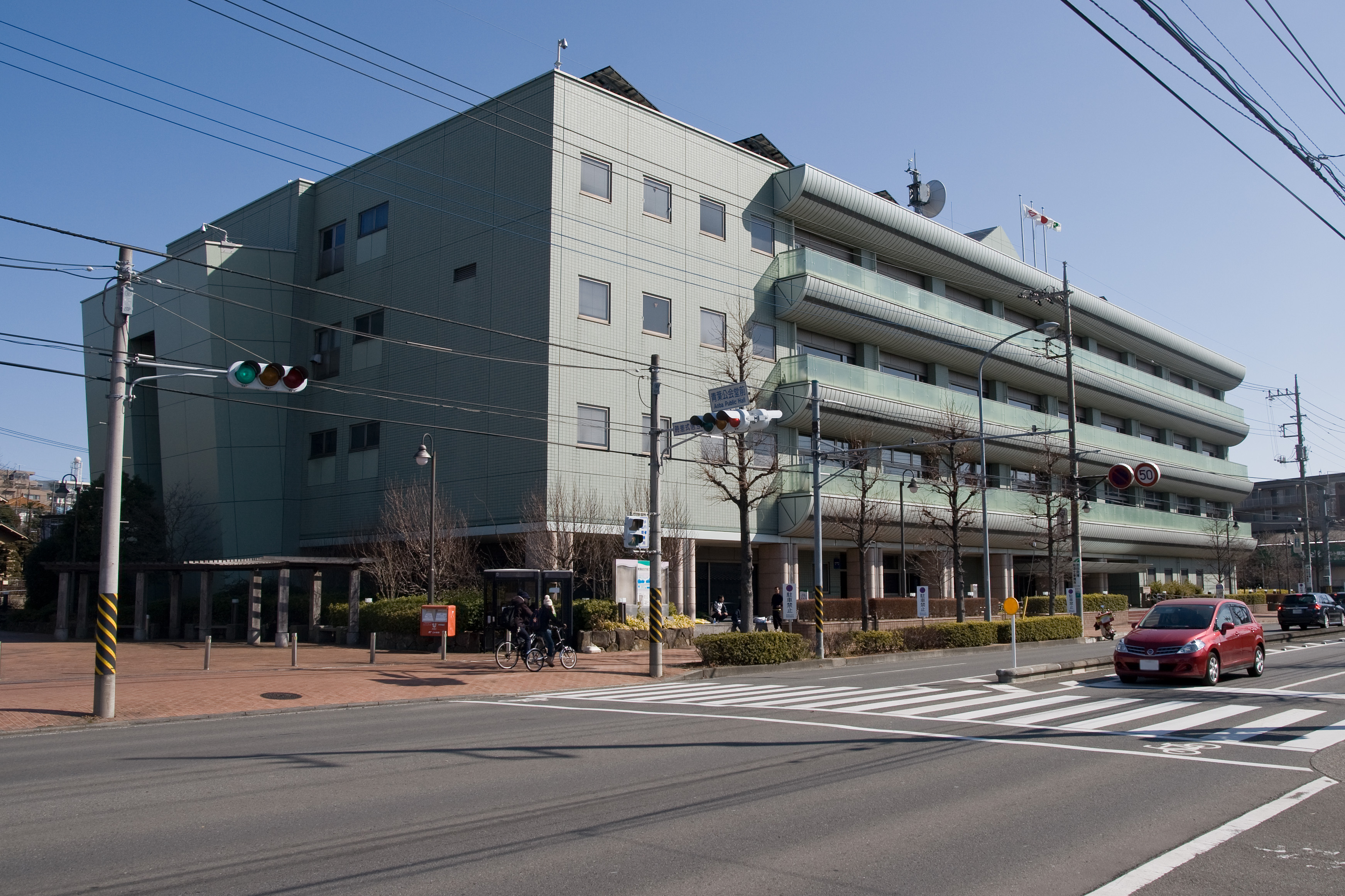
Aoba-ku, Yokohama
is one of the 18 wards of the city of Yokohama in Kanagawa Prefecture, Japan. As of 2010, the ward had an estimated population of 302,643 and a density of 8,610 persons per km². The total area was 35.14 km². Geography Aoba is located in eastern Kanagawa Prefecture, and in the northwest corner of the city of Yokohama. The area is largely flatland, with scattered small hills. Surrounding municipalities * Midori Ward * Tsuzuki Ward * Kawasaki *Machida, Tokyo History The area around present-day Aoba Ward was formerly part of Tsutsuki District in Musashi Province. During the Edo period, it was a rural region classified as ''tenryō'' territory controlled directly by the Tokugawa shogunate, but administered through various ''hatamoto''. After the Meiji Restoration, the area became part of the new Kanagawa Prefecture in 1868. In the cadastral reform of April 1, 1889, the area was divided into the villages of . During the Meiji period, the area was a center for sericulture. On ... [...More Info...] [...Related Items...] OR: [Wikipedia] [Google] [Baidu] |
Midori-ku, Yokohama
is one of the 18 wards of the city of Yokohama in Kanagawa Prefecture, Japan. As of 2010, the ward had an estimated population of 176,038 and a density of 6,900 persons per km². The total area was 25.42 km². Geography Midori Ward is located in eastern Kanagawa Prefecture, and on the northwest borders of the city of Yokohama. Except for the northeast portion, much of the area is hilly and relatively sparsely populated compared to other parts of the city. The flatter northeast portion is located on the Tsurumi River basin, with the river serving as a ward boundary with Tsuzuki-ku. Surrounding municipalities * Seya Ward * Kanagawa Ward * Kohoku Ward * Aoba Ward * Hodogaya Ward * Asahi Ward * Tsuzuki Ward *Machida, Tokyo History The area around present-day Midori Ward was formerly part of Tsuzuki District in Musashi Province. During the Edo period, it was a rural region classified as ''tenryō'' territory controlled directly by the Tokugawa shogunate, but administered throu ... [...More Info...] [...Related Items...] OR: [Wikipedia] [Google] [Baidu] |
Kōhoku-ku, Yokohama
is one of the 18 wards of the city of Yokohama in Kanagawa Prefecture, Japan. As of March 1, 2012, the ward had an estimated population of 332,488, with 156,198 households and a population density of 10,588.79 persons per km². The total area was 31.40 km². Kōhoku Ward has the largest population of Yokohama's 18 wards, and ranks second to Naka Ward in the total number of workplaces. Geography Kōhoku Ward is located in eastern Kanagawa Prefecture, and on the northeastern borders of the city of Yokohama. Surrounding municipalities * Tsurumi Ward * Kanagawa Ward * Midori Ward * Tsuzuki Ward *Kawasaki, Kanagawa History The area around present-day Kōhoku Ward was formerly part of Tsuzuki District in Musashi Province. During the Edo period, it was a rural region classified as ''tenryō'' territory controlled directly by the Tokugawa shogunate, but administered through various ''hatamoto''. After the Meiji Restoration, the area became part of the new Kanagawa Prefecture in 1 ... [...More Info...] [...Related Items...] OR: [Wikipedia] [Google] [Baidu] |
Kanazawa-ku, Yokohama
is one of the 18 wards of the city of Yokohama in Kanagawa Prefecture, Japan. As of 2010, the ward had an estimated population of 209,565 and a density of 6,760 persons per km². The total area was . The ward symbol, established 1987, expresses the image of sea, waves, and a sea gull. History The area around present-day Kanazawa Ward has been inhabited for thousands of years. Archaeologists have found stone tools from the Japanese Paleolithic period and ceramic shards from the Jōmon period at numerous locations in the area. Under the Nara period Ritsuryō system, it became part of Kuraki District in Musashi Province. By the Kamakura period it was part of a '' shōen'' controlled by the Hōjō clan, who established a major seaport for the Kamakura shogunate at Mutsuura, and a noted library and educational center at Kanazawa Bunko. During the Edo period, much of the area was part of the ''tenryō'' territory in Musashi Province controlled directly by the Tokugawa shogunat ... [...More Info...] [...Related Items...] OR: [Wikipedia] [Google] [Baidu] |
Isogo-ku, Yokohama
is one of the 18 wards of the city of Yokohama in Kanagawa Prefecture, Japan. As of 2010, the ward has an estimated population of 163,406 and a population density of 8,520 persons per km2. The total area is 19.17 km2. Geography Isogo is located in eastern Kanagawa Prefecture, and in the southeast corner of the city of Yokohama. The area is largely flatland, with scattered small hills. The Ward is bordered to the east by Negishi Bay, a minor bay on the coast of larger Tokyo Bay. Surrounding municipalities * Naka Ward *Minami Ward * Kanazawa Ward * Sakae Ward * Kōnan-ku History During the Edo period, area around present-day Isogo Ward was formerly part of the ''tenryō'' territory in Sagami Province controlled directly by the Tokugawa shogunate, but administered through various ''hatamoto''. The area consisted of small fishing villages, noted primarily for their catch of Sea cucumber. After the Meiji Restoration, the area became part of Kuraki District in the new Kanagawa ... [...More Info...] [...Related Items...] OR: [Wikipedia] [Google] [Baidu] |
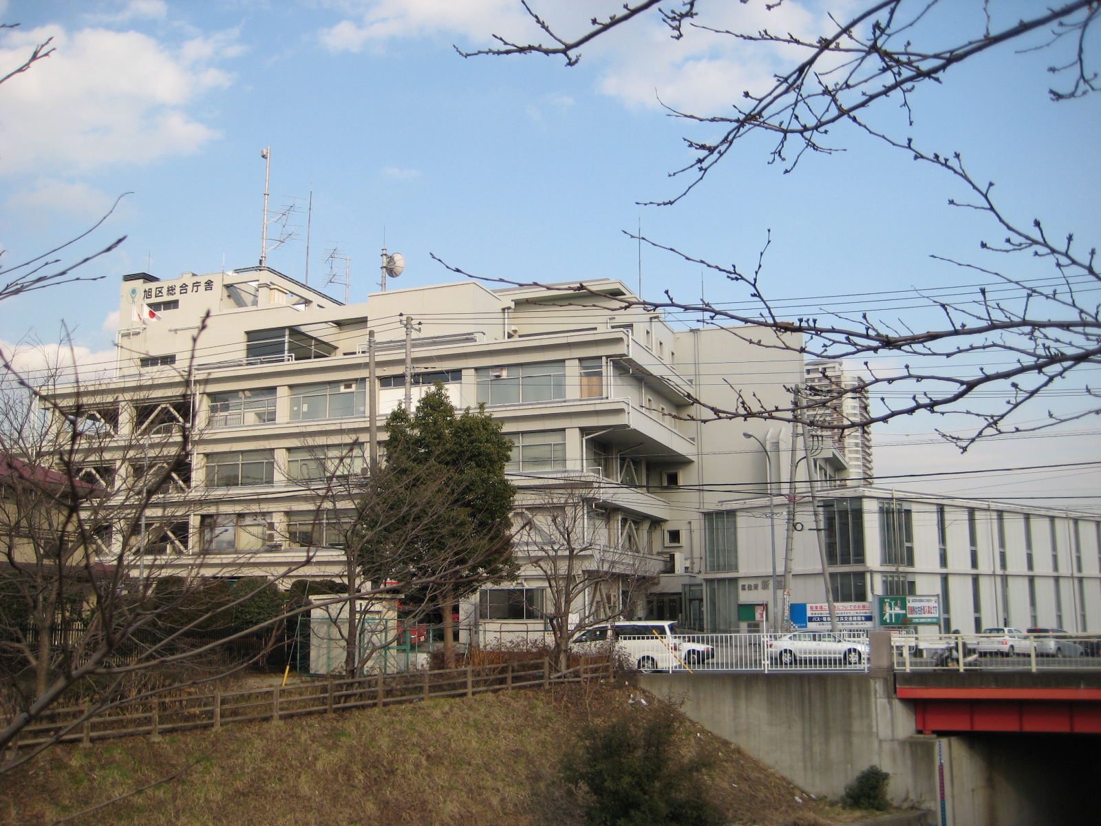
Asahi-ku, Yokohama
is one of the 18 wards of the city of Yokohama in Kanagawa Prefecture, Japan. As of 2010, the ward has an estimated population of 249,045 and a population density of 7,600 persons per km². The total area is 32.77 km². Geography Asahi is located in eastern Kanagawa Prefecture, and on the northwest borders of the city of Yokohama. Surrounding municipalities * Seya Ward * Totsuka Ward * Midori Ward * Izumi Ward * Hodogaya Ward History The area around present-day Asahi Ward was formerly part of Tsuzuki District in Musashi Province. By the Heian period it was part of a huge ''shōen'' administered by the Hangaya clan, a subsidiary of the Hatakeyama clan. During the Edo period, it was a rural region classified as ''tenryō'' territory controlled directly by the Tokugawa shogunate, but administered through various ''hatamoto''. After the Meiji Restoration, the area became part of the new Kanagawa Prefecture in 1868. In the cadastral reform of April 1, 1889, the area was divi ... [...More Info...] [...Related Items...] OR: [Wikipedia] [Google] [Baidu] |
Hodogaya-ku, Yokohama
is one of the 18 wards of the city of Yokohama in Kanagawa Prefecture, Japan. As of 2010, Hodogaya Ward had an estimated population of 205,887 and a density of . The total area was . Geography Hodogaya Ward is located in eastern Kanagawa Prefecture, and near the geographic center of the city of Yokohama. The area is largely flatland, with scattered small hills. Surrounding municipalities * Kanagawa Ward * Nishi Ward *Minami Ward * Asahi Ward * Totsuka Ward * Midori Ward History The area around present-day Hodogaya has been inhabited for thousands of years. Archaeologists have found stone tools from the Japanese Paleolithic period and ceramic shards from the Jōmon period at numerous locations in the area. Under the Nara period Ritsuryō system, it became part of Tachibana District and Tsutsuki District in Musashi Province. By the Heian period it was part of a huge ''shōen'' controlled by Ise Shrine and administered by the Hangaya clan, a subsidiary of the Hatakeyama clan. By th ... [...More Info...] [...Related Items...] OR: [Wikipedia] [Google] [Baidu] |


