|
Yenston
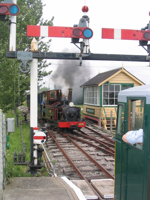
Yenston is a small hamlet in Somerset within the Parish of Henstridge. Located on the A357, the hamlet is located between Templecombe and Henstridge. Over the years the hamlet has seen a number of changes. Back in the 1950s, the village had 3 pubs, a Methodist Church and a Village Shop Since then the pubs and shop have changed into dwellings, the village life is based around homelife. Yenston's major feature is the Gartell Light Railway, which allows you to travel behind Steam & Diesel hauled trains on the old Somerset & Dorset Joint Railway through the heart of Blackmore Vale. The Gartell Railway is open on a limited calendar. Other features of the village consist of the Yenston Stone (created in 2000) and the red telephone box The red telephone box, a telephone kiosk for a public telephone designed by Sir Giles Gilbert Scott, is a familiar sight on the streets of the United Kingdom, Malta, Bermuda and Gibraltar. Despite a reduction in their numbers in recent years, ... [...More Info...] [...Related Items...] OR: [Wikipedia] [Google] [Baidu] |
Henstridge
Henstridge is a village and civil parish in Somerset, England, situated east of Sherborne in the South Somerset district, near the border with Dorset. The parish includes the hamlet of Yenston. In 2011, the village had a population of 1,814. History The village name means "the ridge where stallions are kept". The parish was part of the hundred of Horethorne. Yenston Priory was a 16th-century house of Benedictine monks. Governance The parish council has responsibility for local issues, including setting an annual precept (local rate) to cover the council's operating costs and producing annual accounts for public scrutiny. The parish council evaluates local planning applications and works with the local police, district council officers, and neighbourhood watch groups on matters of crime, security, and traffic. The parish council's role also includes initiating projects for the maintenance and repair of parish facilities, as well as consulting with the district council on th ... [...More Info...] [...Related Items...] OR: [Wikipedia] [Google] [Baidu] |
Gartell Light Railway
The Gartell Light Railway is a privately run narrow gauge railway located at Yenston in the Blackmore Vale, south of Templecombe, in Somerset, England. It operates a narrow gauge railway running for , partly along the track of the old Somerset and Dorset Joint Railway. The railway has 4 stations - Common Lane, Pinesway Junction, Park Lane and Tower View. The railway is controlled using a comprehensive signalling system operated from two signalboxes - Common lane and Pinesway Junction. Both signalboxes control a mix of semaphore and colour light signals with mechanically operated points. The railway is open to the public on selected dates through the year when it normally operates an intensive 3 train operation with departures from Common Lane station every 20 minutes through the day between 10:30 and 16:30. The route of the GLR * Park Lane * Pinesway Junction * Tower View Locomotives See also * British narrow gauge railways There were more than a thousand British na ... [...More Info...] [...Related Items...] OR: [Wikipedia] [Google] [Baidu] |
Somerset
( en, All The People of Somerset) , locator_map = , coordinates = , region = South West England , established_date = Ancient , established_by = , preceded_by = , origin = , lord_lieutenant_office =Lord Lieutenant of Somerset , lord_lieutenant_name = Mohammed Saddiq , high_sheriff_office =High Sheriff of Somerset , high_sheriff_name = Mrs Mary-Clare Rodwell (2020–21) , area_total_km2 = 4171 , area_total_rank = 7th , ethnicity = 98.5% White , county_council = , unitary_council = , government = , joint_committees = , admin_hq = Taunton , area_council_km2 = 3451 , area_council_rank = 10th , iso_code = GB-SOM , ons_code = 40 , gss_code = , nuts_code = UKK23 , districts_map = , districts_list = County council area: , MPs = * Rebecca Pow (C) * Wera Hobhouse ( LD) * Liam Fox (C) * David Warburton (C) * Marcus Fysh (C) * Ian Liddell-Grainger (C) * James Heappey (C) * Jacob Rees-Mogg (C) * John Penrose (C) , police = Avon and Somerset Police ... [...More Info...] [...Related Items...] OR: [Wikipedia] [Google] [Baidu] |
Templecombe
Templecombe is a village in Somerset, England, situated on the A357 road five miles south of Wincanton, east of Yeovil, and west of Salisbury. The village has a population of 1,560. Along with the hamlet of Combe Throop, it forms the parish of Abbas and Templecombe. History Prior to the Norman Conquest Combe was held by Leofwine Godwinson. One part of the village was known as Abbas Combe which was recorded in the ''Domesday Book'' of 1086–7 as ''Cumbe'', when it was held by the church of St Edward, Shaftesbury. The other manor within the parish was held by Godwinson, but after the Norman Conquest, was given to Bishop Odo of Bayeux. It was his descendant Serlo FitzOdo who granted it to the Knights Templar. The parish was part of the Hundred of Horethorne. Templecombe derives its name from ''Combe Templariorum'', after the Knights Templar who established Templecombe Preceptory in the village in 1185. After they were suppressed in 1312 it was granted to the Knights Hosp ... [...More Info...] [...Related Items...] OR: [Wikipedia] [Google] [Baidu] |
Methodist Church
Methodism, also called the Methodist movement, is a group of historically related Christian denomination, denominations of Protestantism, Protestant Christianity whose origins, doctrine and practice derive from the life and teachings of John Wesley. George Whitefield and John's brother Charles Wesley were also significant early leaders in the movement. They were named ''Methodists'' for "the methodical way in which they carried out their Christian faith". Methodism originated as a Christian revival, revival movement within the 18th-century Church of England and became a separate denomination after Wesley's death. The movement spread throughout the British Empire, the United States, and beyond because of vigorous Christian mission, missionary work, today claiming approximately 80 million adherents worldwide. Wesleyan theology, which is upheld by the Methodist churches, focuses on sanctification and the transforming effect of faith on the character of a Christians, Christian ... [...More Info...] [...Related Items...] OR: [Wikipedia] [Google] [Baidu] |
Steam Train
A steam locomotive is a locomotive that provides the force to move itself and other vehicles by means of the expansion of steam. It is fuelled by burning combustible material (usually coal, oil or, rarely, wood) to heat water in the locomotive's boiler to the point where it becomes gaseous and its volume increases 1,700 times. Functionally, it is a steam engine on wheels. In most locomotives, the steam is admitted alternately to each end of its cylinders, in which pistons are mechanically connected to the locomotive's main wheels. Fuel and water supplies are usually carried with the locomotive, either on the locomotive itself or in a tender coupled to it. Variations in this general design include electrically-powered boilers, turbines in place of pistons, and using steam generated externally. Steam locomotives were first developed in the United Kingdom during the early 19th century and used for railway transport until the middle of the 20th century. Richard Trevithick bui ... [...More Info...] [...Related Items...] OR: [Wikipedia] [Google] [Baidu] |
Diesel Locomotive
A diesel locomotive is a type of railway locomotive in which the prime mover is a diesel engine. Several types of diesel locomotives have been developed, differing mainly in the means by which mechanical power is conveyed to the driving wheels. Early internal combustion locomotives and railcars used kerosene and gasoline as their fuel. Rudolf Diesel patented his first compression-ignition engine in 1898, and steady improvements to the design of diesel engines reduced their physical size and improved their power-to-weight ratios to a point where one could be mounted in a locomotive. Internal combustion engines only operate efficiently within a limited power band, and while low power gasoline engines could be coupled to mechanical transmissions, the more powerful diesel engines required the development of new forms of transmission. This is because clutches would need to be very large at these power levels and would not fit in a standard -wide locomotive frame, or wear too quic ... [...More Info...] [...Related Items...] OR: [Wikipedia] [Google] [Baidu] |
Somerset & Dorset Joint Railway
The Somerset and Dorset Joint Railway, also known as the S&D, SDJR or S&DJR, was an England, English railway line connecting Bath, Somerset, Bath (in north-east Somerset) and Bournemouth (now in south-east Dorset but then in Hampshire), with a branch from Evercreech Junction railway station, Evercreech Junction to Burnham-on-Sea and Bridgwater. Strictly speaking, the main line ran from Bath Junction to Broadstone, Dorset, Broadstone, as the line between Broadstone and Bournemouth was owned by the London and South Western Railway, while the line between Bath Junction and Bath was owned by the Midland Railway. The line was used for freight and local passenger traffic over the Mendip Hills, and for weekend holiday traffic to Bournemouth. Criticised as the "Slow and Dirty" or the "Slow and Doubtful", it closed in 1966 as part of the Beeching axe despite protests from the local community. Overview The Somerset and Dorset Railway (S&D) was created in 1862, as an amalgamation of t ... [...More Info...] [...Related Items...] OR: [Wikipedia] [Google] [Baidu] |
Blackmore Vale
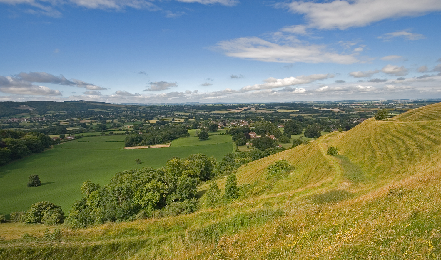
The Blackmore Vale (; less commonly spelt ''Blackmoor'') is a vale, or wide valley, in north Dorset, and to a lesser extent south Somerset and southwest Wiltshire in southern England. Geography The vale is part of the Stour valley, part of the Dorset AONB and part of the natural region known as the Blackmoor Vale and Vale of Wardour. To the south and east, the vale is clearly delimited by the steep escarpments of two areas of higher chalk downland, the Dorset Downs to the south, and Cranborne Chase to the east. To the north and west, the definitions of the vale are more ambiguous, as the landscape changes more gradually around the upper reaches of the Stour and its tributaries. One definition places the boundary along the watershed between the Stour and neighbouring valleys of the Yeo to the west and Brue to the north. A narrower definition places the limits of the vale close to the county boundary and villages like Bourton, where the landscape transitions to hillier greensa ... [...More Info...] [...Related Items...] OR: [Wikipedia] [Google] [Baidu] |

.jpg)


