|
Yeliyur
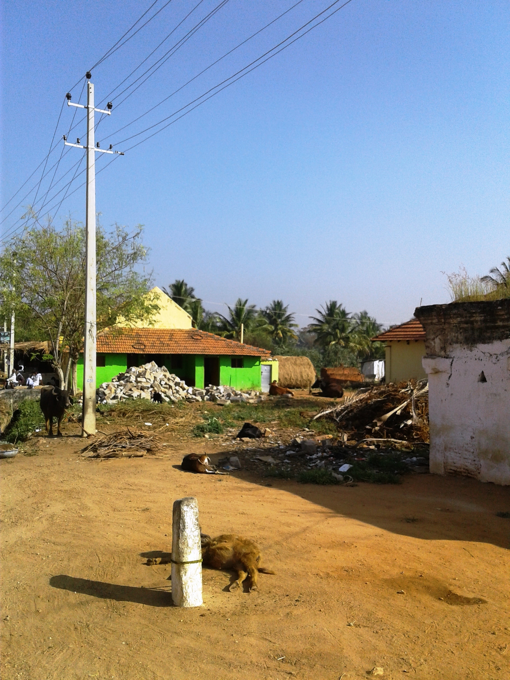
Yeliyur is a village in Mandya district, Karnataka state, India. It lies from the city of Mandya. Transportation Yeliyur has a passenger railway station on the Mysore–Bangalore railway line. Economy The economy is chiefly agrarian. Cultivation is dependent upon irrigation from canals fed by the Cauvery river. Syndicate bank has opened a branch here. There is a post office and the postal code is 571402. See also * Jakkanahalli * Chinya * Naganahalli * Pandavapura * Byadarahalli Byadarahalli is a village in the Mandya district of Karnataka, India. Location Byadarahalli is located between Mysore and Bangalore. Access Byadarahalli has a railway station where only slow trains stop. Buses are available from Mandya. Pos ... References Villages in Mandya district {{Mandya-geo-stub ... [...More Info...] [...Related Items...] OR: [Wikipedia] [Google] [Baidu] |
Naganahalli
Naganahalli is a small village in Mysuru district of Karnataka state, India. Location Naganahalli is located near Metgully township outside the ringroad near Mysore city. The village is on Mysore-Bangalore highway. Post office There is a post office in the village and the postal code is 570003. Transportation There is a railway station in Naganahalli which comes under Mysore - Bangalore line. Only a few slow trains stop here. Watershed project Naganahalli Watershed project is a program of the provincial government to irrigate 370 hectares of land in Naganahalli area. Prevention of soil erosion and check dams, culverts, farm ponds and bunds are some of the initiatives of this project. See also * * Pandavapura * Chandagiri Koppal * Byadarahalli * Yeliyur * Mandya Mandya is a city in the state of Karnataka. It is the headquarter of Mandya district and is located from Mysore and from Bangalore. Sugar factories contribute to the major economic output. It is also c ... [...More Info...] [...Related Items...] OR: [Wikipedia] [Google] [Baidu] |
Jakkanahalli
Jakkanahalli is a small village in Mandya district of Karnataka state, India. Location Jakkanahalli is located between Nagamangala and Pandavapura near to Melukote. Post office There is a post office in Jakkanahalli and the pin code is 571431. Distance Jakkanahalli is about 32 km from the district headquarters of Mandya and 20 km from the nearest town of Pandavapura. It is 122 km from Bangalore, the state capital. Jakkanahalli Pin code is 571807 and postal head office is Kirangoor . Villages and suburbs * Chinya - 6 km * G.Malligere - 8 km * Halebeedu - 8 km * Muthegere - 13 km * Haralahalli - 13 km Railway Station The nearest railway station is pandavapura at a distance of 18 km. Education Vijaya College, Pandavapura. Kitturu Rani Channamma School, Halebeedu. B.Capital School, Manikana Hally. Morarji HP School, Pandavapura. Vidyanikethana Highschool, Y.H.Koppalu. See also * Yeliyur Yeliyur is a village in Mandya district, Karna ... [...More Info...] [...Related Items...] OR: [Wikipedia] [Google] [Baidu] |
Pandavapura
Pandavapura is a Municipality Town in Mandya district in the Indian state of Karnataka. Geography Pandavapura is located at . It has an average elevation of 709 metres (2326 feet). Demographics India census, Pandavapura had a population of 18,236. Males constitute 51% of the population and females 49%. Pandavapura has an average literacy rate of 67%, higher than the national average of 59.5%: male literacy is 72%, and female literacy is 62%. In Pandavapura, 12% of the population is under 6 years of age. History The name Pandavapura means "Town of Pandavas". Mythology states that the Pandavas during their period of exile stayed here for some time, and Kunti, mother of the Pandavas, liked the hillock so much that it became one of her favorite haunts. The town is also named after the Pandavas because of their brief stay in this region. The name "French Rock" dates back to India's Pre-Independence days, the place was used as the camping ground by the F ... [...More Info...] [...Related Items...] OR: [Wikipedia] [Google] [Baidu] |
Byadarahalli
Byadarahalli is a village in the Mandya district of Karnataka, India. Location Byadarahalli is located between Mysore and Bangalore. Access Byadarahalli has a railway station where only slow trains stop. Buses are available from Mandya. Post office There is a post office in the village with the pincode being 571434. See also * Mandya * Naganahalli * Pandavapura * * Yeliyur Yeliyur is a village in Mandya district, Karnataka state, India. It lies from the city of Mandya. Transportation Yeliyur has a passenger railway station on the Mysore–Bangalore railway line. Economy The economy is chiefly agrarian. Cultiv ... References {{Reflist Villages in Mandya district ... [...More Info...] [...Related Items...] OR: [Wikipedia] [Google] [Baidu] |
Mandya District
Mandya District is an administrative district of Karnataka, India. The district is bordered on the south by Mysore district, Mysore and Chamarajanagar district, Chamarajangar districts, on the west by Hassan District, on the north by Tumkur District and on the east by Ramanagara district. The district Mandya was carved out of larger Mysore district in the year 1939. Mandya is the main town in Mandya District. As of 2011, the district population was 1,808,680 (of which 16.03% was urban). Geography Mandya district is located between north latitude 12°13' to 13°04' N and east longitude 76°19' to 77°20' E. It is bounded by Mysore district to the west and southwest, Tumkur district to the northeast, Chamrajnagar district to the south, Hassan district to the northwest, and Ramanagar district to the east. It has an area of . The administrative center of Mandya District is Mandya City. Rivers Mandya District has five rivers: Kaveri River and four tributaries main Hemavathi, Shims ... [...More Info...] [...Related Items...] OR: [Wikipedia] [Google] [Baidu] |
Karnataka
Karnataka (; ISO: , , also known as Karunāḍu) is a state in the southwestern region of India. It was formed on 1 November 1956, with the passage of the States Reorganisation Act. Originally known as Mysore State , it was renamed ''Karnataka'' in 1973. The state corresponds to the Carnatic region. Its capital and largest city is Bengaluru. Karnataka is bordered by the Lakshadweep Sea to the west, Goa to the northwest, Maharashtra to the north, Telangana to the northeast, Andhra Pradesh to the east, Tamil Nadu to the southeast, and Kerala to the southwest. It is the only southern state to have land borders with all of the other four southern Indian sister states. The state covers an area of , or 5.83 percent of the total geographical area of India. It is the sixth-largest Indian state by area. With 61,130,704 inhabitants at the 2011 census, Karnataka is the eighth-largest state by population, comprising 31 districts. Kannada, one of the classical languages of India, ... [...More Info...] [...Related Items...] OR: [Wikipedia] [Google] [Baidu] |
Mandya
Mandya is a city in the state of Karnataka. It is the headquarter of Mandya district and is located from Mysore and from Bangalore. Sugar factories contribute to the major economic output. It is also called Sugar city (which in Kannada means Sakkare nagara) because sugarcane is a major crop. Mandya city has district offices premises. Currently the city is having 35 municipal wards of Mandya city municipal corporation. History There is a brief history of 75 years to Mandya. Mandya celebrated it 75th year (Amrutha Mahothsava) in 2015. The magnificent KRS dam was built by Krishna Raja Wadiyar IV and M. Visvesvaraya in Mandya. There are a lot of historical places of importance in Mandya. In 2016, Archaeological Survey of India (ASI) excavated another statue of Bahubali, a much revered figure among Jains. He was the son of Adinath, the first tirthankara of Jainism, and the younger brother of Bharata Chakravartin, identified with the 3rd – 9th centuries in Arthipura, ... [...More Info...] [...Related Items...] OR: [Wikipedia] [Google] [Baidu] |
Cauvery
The Kaveri (also known as Cauvery, the anglicized name) is one of the major Indian rivers flowing through the states of Karnataka and Tamil Nadu. The Kaveri river rises at Talakaveri in the Brahmagiri (hill), Karnataka, Brahmagiri range in the Western Ghats, Kodagu district of the state of Karnataka, at an elevation of 1,341 m above mean sea level and flows for about 800 km before its outfall into the Bay of Bengal. It reaches the sea in Puhar, Mayiladuthurai, Poompuhar in Mayiladuthurai district, Mayiladuthurai district. It is the third largest river after Godavari River, Godavari and Krishna River, Krishna in South India, southern India, and the largest in the State of Tamil Nadu, which, on its course, bisects the state into north and south. In ancient Tamil literature, the river was also called Ponni (the golden maid, in reference to the fine silt it deposits). The Kaveri is a sacred river to the people of South India and is worshipped as the Goddess Kaveriamma (Moth ... [...More Info...] [...Related Items...] OR: [Wikipedia] [Google] [Baidu] |
Chinya
Chinya is a small village in Mandya district of Karnataka state, India. Location Chinya is located between Nagamangala and Pandavapura. It is very near to Melukote town. Post Office There is a post office in Chinya and the pin code is 571434. Economy Chinya is a village of agrarian economy. Vijaya Bank Vijaya Bank was a PSU bank which was merged with Bank of Baroda on 1 April 2019 with its head office in Bangalore, Karnataka, India. It was one of the nationalised banks in India. The bank offered a wide range of financial products and service ... has a branch here. References Villages in Mandya district {{Mandya-geo-stub ... [...More Info...] [...Related Items...] OR: [Wikipedia] [Google] [Baidu] |


