|
Yei Airport
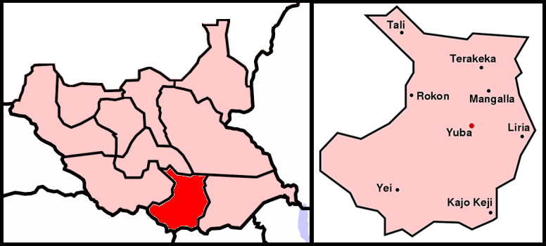
Yei Airport is an airport serving Yei in South Sudan. Location Yei Airport is located in Yei County in Yei River State, in the city of Yei, in the southwestern part of South Sudan, near the International borders with Uganda and the Democratic Republic of the Congo. The airport is located northeast of the central business district, on the road to Juba. This location lies approximately , by air, southwest of Juba International Airport, the largest airport in South Sudan. The geographic coordinates of this airport are: 4° 7' 57.00"N, 30° 43' 17.00"E (Latitude: 4.132500; Longitude: 30.721390). Yei Airport is situated above sea level. The airport has a single unpaved runway, the dimensions of which are not publicly known at this time. Airlines and destinations See also * Yei, South Sudan Yei is a medium-sized city in South Sudan's southwest. It lies close to the borders of two of the country's trading partners, Uganda and the Democratic Republic of the Congo. It is a busi ... [...More Info...] [...Related Items...] OR: [Wikipedia] [Google] [Baidu] |
Public Airport
An airport is an aerodrome with extended facilities, mostly for commercial air transport. Airports usually consists of a landing area, which comprises an aerially accessible open space including at least one operationally active surface such as a runway for a plane to take off and to land or a helipad, and often includes adjacent utility buildings such as control towers, hangars and terminals, to maintain and monitor aircraft. Larger airports may have airport aprons, taxiway bridges, air traffic control centres, passenger facilities such as restaurants and lounges, and emergency services. In some countries, the US in particular, airports also typically have one or more fixed-base operators, serving general aviation. Operating airports is extremely complicated, with a complex system of aircraft support services, passenger services, and aircraft control services contained within the operation. Thus airports can be major employers, as well as important hubs for tourism ... [...More Info...] [...Related Items...] OR: [Wikipedia] [Google] [Baidu] |
Runway
According to the International Civil Aviation Organization (ICAO), a runway is a "defined rectangular area on a land aerodrome prepared for the landing and takeoff of aircraft". Runways may be a man-made surface (often asphalt concrete, asphalt, concrete, or a mixture of both) or a natural surface (sod, grass, soil, dirt, gravel, ice, sand or road salt, salt). Runways, as well as taxiways and Airport apron, ramps, are sometimes referred to as "tarmac", though very few runways are built using Tarmacadam, tarmac. Takeoff and landing areas defined on the surface of water for seaplanes are generally referred to as waterways. Runway lengths are now International Civil Aviation Organization#Use of the International System of Units, commonly given in meters worldwide, except in North America where feet are commonly used. History In 1916, in a World War I war effort context, the first concrete-paved runway was built in Clermont-Ferrand in France, allowing local company Michelin to ... [...More Info...] [...Related Items...] OR: [Wikipedia] [Google] [Baidu] |
List Of Airports In South Sudan
This is a list of airports in South Sudan, sorted by location. South Sudan, officially the Republic of South Sudan, is a landlocked country in east-central Africa bordered by Ethiopia to the east, Kenya to the southeast, Uganda to the south, the Democratic Republic of the Congo to the southwest, the Central African Republic to the west, and Sudan to the north. South Sudan's capital and largest city is Juba. The country is divided into 10 states. __TOC__ Airports Airport names shown in bold indicate the airport has scheduled service on commercial airlines. * - International airports See also * Transport in South Sudan * List of airports by ICAO code: H#HS - Sudan and South Sudan * List of airports in Sudan * Wikipedia:WikiProject Aviation/Airline destination lists: Africa#Sudan References * - includes IATA codes * Great Circle Mapper: Airports in South Sudan- IATA and ICAO codes World Aero Data: Airports in Sudan- ICAO codes List of Sudan Airports with Google ... [...More Info...] [...Related Items...] OR: [Wikipedia] [Google] [Baidu] |
Equatoria
Equatoria is a region of southern South Sudan, along the upper reaches of the White Nile. Originally a province of Anglo-Egyptian Sudan, it also contained most of northern parts of present-day Uganda, including Lake Albert and West Nile. It was an idealistic effort to create a model state in the interior of Africa that never consisted of more than a handful of adventurers and soldiers in isolated outposts. Equatoria was established by Samuel Baker in 1870. Charles George Gordon took over as governor in 1874, followed by Emin Pasha in 1878. The Mahdist Revolt put an end to Equatoria as an Egyptian outpost in 1889. Later British Governors included Martin Willoughby Parr. Important settlements in Equatoria included Lado, Gondokoro, Dufile and Wadelai. The last two parts of Equatoria, Lake Albert and West Nile are now situated in Uganda. Under Anglo-Egyptian Sudan, most of Equatoria became one of the eight original provinces. The region of Bahr el Ghazal was split from Equat ... [...More Info...] [...Related Items...] OR: [Wikipedia] [Google] [Baidu] |
Central Equatoria
Central Equatoria is a state in South Sudan. With an area of , it is the smallest of the original South Sudanese states. Its previous name was Bahr al-Jabal (also Bahr-el-Jebel), named after a tributary of the White Nile that flows through the state. It was renamed Central Equatoria in the first Interim Legislative Assembly on 1 April 2005 under the government of Southern Sudan. Central Equatoria seceded from Sudan as part of the Republic of South Sudan on 9 July 2011. The state's capital, Juba, is also the national capital of South Sudan. On October 2, 2015, the state was split into three states: Jubek, Terekeka, and Yei River. The state of Central Equatoria was re-established by a peace agreement signed on 22 February 2020. Administrative divisions Central Equatoria, like other states in South Sudan, is subdivided into counties, which are further divided into Payams, then Bomas. Each county is led by a County Commissioner, appointed by the State Governor in consultation wi ... [...More Info...] [...Related Items...] OR: [Wikipedia] [Google] [Baidu] |
Entebbe International Airport
Entebbe International Airport is the only international airport in Uganda. It is located about southwest of the town of Entebbe, on the northern shores of Lake Victoria. This is approximately by road south-west of the central business district of Kampala, the capital city of Uganda. The headquarters of the Civil Aviation Authority of Uganda have been relocated to a new block off the airport highway (Entebbe–Kampala Expressway and Tunnel Road), but adjacent to the airport terminals. History The airport was opened by the British Colonial authorities. On 10 November 1951, the airport was formally reopened after its facilities had been extended. Runway 12/30 was now , in preparation for services by the de Havilland Comet. The new main terminal building of the airport was designed by Yugoslav Montenegrin architect Aleksandar Keković and built by Energoprojekt holding in 1972-1973 period. The Old Entebbe airport is used by Uganda's military forces. It was the scene of a host ... [...More Info...] [...Related Items...] OR: [Wikipedia] [Google] [Baidu] |
Arua Airport
Arua Airport is a civilian airport serving the city of Arua in the Northern Region of Uganda. , it is one of the 47 airports in the country. Location The airport is from Uganda's border with the Democratic Republic of the Congo (DRC) and about from the border between Uganda and South Sudan. It is approximately by air north-west of Entebbe International Airport, Uganda's largest airport. The coordinates of Arua Airport are: 03°02'50.0"N, 30°54'44.0"E (Latitude:3.047222; Longitude:30.912222). Overview Arua Airport's strategic location makes Arua Airport an important center for passenger and cargo air traffic between Uganda and its two neighbors, the DRC and South Sudan. It the second-busiest airport in Uganda, after Entebbe International Airport. Airlines and destinations Planned improvements In July 2009, the Civil Aviation Authority of Uganda, which owns and operates Arua Airport, publicly announced that it had started to upgrade the airport to international standards. ... [...More Info...] [...Related Items...] OR: [Wikipedia] [Google] [Baidu] |
Eagle Air (Uganda)
Eagle Air is an airline based in Kampala, Uganda. It operates regional scheduled services and charter flights across East and Central Africa. Its main base is Entebbe International Airport, and it also maintains a second hub at Arua Airport, in the Northern Region of the country. History The airline was established in June 1994 and started operations in November 1994. It is owned by Tony Rubombora (62.5%), Managing Director, and Charles Muthama (37.5%), Chairman. It had over 50 employees as of March 2011. In 2006, the airline started operations to Uganda's national parks. That same year, South Sudan banned Eagle Air from operations to the airport in Yei, alleging violations of the country's aviation regulations. In 2008, the airline temporarily suspended operations due to a fuel shortage in Uganda, that arose out of the political violence in Kenya, following the 2007 presidential elections. Services Eagle Air offers scheduled and chartered flights to domestic and certain reg ... [...More Info...] [...Related Items...] OR: [Wikipedia] [Google] [Baidu] |
Juba Airport
Juba () is the Capital city, capital and largest city of South Sudan. The city is situated on the White Nile and also serves as the capital of the Central Equatoria, Central Equatoria State. It is the world's newest capital city to be elevated as such, and had a population of 525,953 in 2017. It has an area of , with the metropolitan area covering . Juba was established in 1920–21 by the Church Missionary Society (CMS) in a small Bari people, Bari village, also called Juba. The city was made as the capital of Mongalla Province in the late 1920s. The growth of the town accelerated following the signing of the Comprehensive Peace Agreement in 2005, which made Juba the capital of the Autonomous Government of Southern Sudan. Juba became the capital of South Sudan in 2011 after its independence, but influential parties wanted Ramciel to be the capital. The government announced the move of the capital to Ramciel, but it is yet to occur. History Under the Khedivate of Egypt, Juba ... [...More Info...] [...Related Items...] OR: [Wikipedia] [Google] [Baidu] |
Civilian
Civilians under international humanitarian law are "persons who are not members of the armed forces" and they are not "combatants if they carry arms openly and respect the laws and customs of war". It is slightly different from a non-combatant, because some non-combatants are not civilians (for example, military chaplains who are attached to the belligerent party or military personnel who are serving with a neutral country). Civilians in the territories of a party to an armed conflict are entitled to certain privileges under the customary laws of war and international treaties such as the Fourth Geneva Convention. The privileges that they enjoy under international law depends on whether the conflict is an internal one (a civil war) or an international one. In some nations, uniformed members of civilian police or fire departments colloquially refer to members of the public as civilians. Etymology The word "civilian" goes back to the late 14th century and is from Old French '' ... [...More Info...] [...Related Items...] OR: [Wikipedia] [Google] [Baidu] |
Central Business District
A central business district (CBD) is the commercial and business centre of a city. It contains commercial space and offices, and in larger cities will often be described as a financial district. Geographically, it often coincides with the "city centre" or "downtown". However, these concepts are not necessarily synonymous: many cities have a central ''business'' district located away from its commercial and or cultural centre and or downtown/city centre, and there may be multiple CBDs within a single urban area. The CBD will often be characterised by a high degree of accessibility as well as a large variety and concentration of specialised goods and services compared to other parts of the city. For instance, Midtown Manhattan, New York City, is the largest central business district in the city and in the United States. London's city centre is usually regarded as encompassing the historic City of London and the medieval City of Westminster, while the City of London and the transform ... [...More Info...] [...Related Items...] OR: [Wikipedia] [Google] [Baidu] |
Democratic Republic Of The Congo
The Democratic Republic of the Congo (french: République démocratique du Congo (RDC), colloquially "La RDC" ), informally Congo-Kinshasa, DR Congo, the DRC, the DROC, or the Congo, and formerly and also colloquially Zaire, is a country in Central Africa. It is bordered to the northwest by the Republic of the Congo, to the north by the Central African Republic, to the northeast by South Sudan, to the east by Uganda, Rwanda, and Burundi, and by Tanzania (across Lake Tanganyika), to the south and southeast by Zambia, to the southwest by Angola, and to the west by the South Atlantic Ocean and the Cabinda exclave of Angola. By area, it is the second-largest country in Africa and the 11th-largest in the world. With a population of around 108 million, the Democratic Republic of the Congo is the most populous officially Francophone country in the world. The national capital and largest city is Kinshasa, which is also the nation's economic center. Centered on the Cong ... [...More Info...] [...Related Items...] OR: [Wikipedia] [Google] [Baidu] |


.jpg)