|
Yarra Hills Secondary College
Yarra Hills Secondary College (formerly Pembroke Secondary College) is a secondary school in the outer eastern suburbs of Melbourne, Australia Melbourne ( ; Boonwurrung/Woiwurrung: ''Narrm'' or ''Naarm'') is the capital and most populous city of the Australian state of Victoria, and the second-most populous city in both Australia and Oceania. Its name generally refers to a metropol .... The school has two campuses, one located in Mount Evelyn and the other located in Mooroolbark. History Pembroke High School opened in 1968 with 86 students and four teachers in temporary accommodation at Croydon West High School. In February 1970, the school opened on its Cambridge Road site. The school was officially opened by the Governor of Victoria - Sir Rohan Delacombe on 14 November 1972.''Pembroke High School 1968-1988 A Brief History'', booklet created for the school's 20th anniversary. A merger with Mooroolbark Secondary College followed by a merger with Mt Evelyn Secondary Colle ... [...More Info...] [...Related Items...] OR: [Wikipedia] [Google] [Baidu] |
Mooroolbark, Victoria
Mooroolbark is a suburb of Melbourne, Victoria, Australia, 31 km north-east of Melbourne's central business district, located within the Shire of Yarra Ranges local government area. Mooroolbark recorded a population of 23,059 at the . Mooroolbark is at an elevation of approximately 93 metres. History "Mooroolbark" has been popularly believed for some time to have the meaning "red earth", leading to extensive use of that meaning in the community. More recently it has been suggested that "Mooroolbik" is the name given by the local Wurundjeri Aboriginal people ("moorool" meaning great water and "bik" meaning place). An alternative meaning of Mooroolbark being "the place where the wide waters meet" is recorded by Museum Victoria. Another meaning recorded is "red bark". The Parish of Mooroolbark was surveyed in 1855, with a township originally called Brushy Creek standing where North Croydon is today. The name "Mooroolbark" was to be popularised with eventual European settlem ... [...More Info...] [...Related Items...] OR: [Wikipedia] [Google] [Baidu] |
Mount Evelyn, Victoria
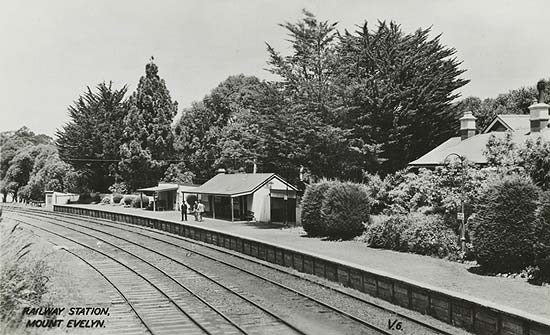
Mount Evelyn is a suburb in Melbourne, Victoria, Australia, 37 km north-east of Melbourne's central business district, located within the Shire of Yarra Ranges local government area. Mount Evelyn recorded a population of 9,799 at the 2021 census. History Mount Evelyn nestles in a right-angled bend of the Olinda Creek, a large, permanent creek known originally as Running Creek. Different parts of the current Mount Evelyn area were first known as Olinda Vale, Billygoat Hill, McKillop/Valinda and South Wandin. The Post Office opened on 15 February 1904 as Valinda (derived from Olinda Vale). The name was changed to Evelyn (the name of the county) in 1908, then to Mount Evelyn in 1913. The town experienced a boom in the early 1930s due to the construction of the nearby Silvan Dam and Mount Evelyn Aqueduct, but was greatly affected by the depression of the same period once this project was completed in 1932. The railway line was closed in 1965, just before the area exper ... [...More Info...] [...Related Items...] OR: [Wikipedia] [Google] [Baidu] |

