|
Yarlung Zangbo
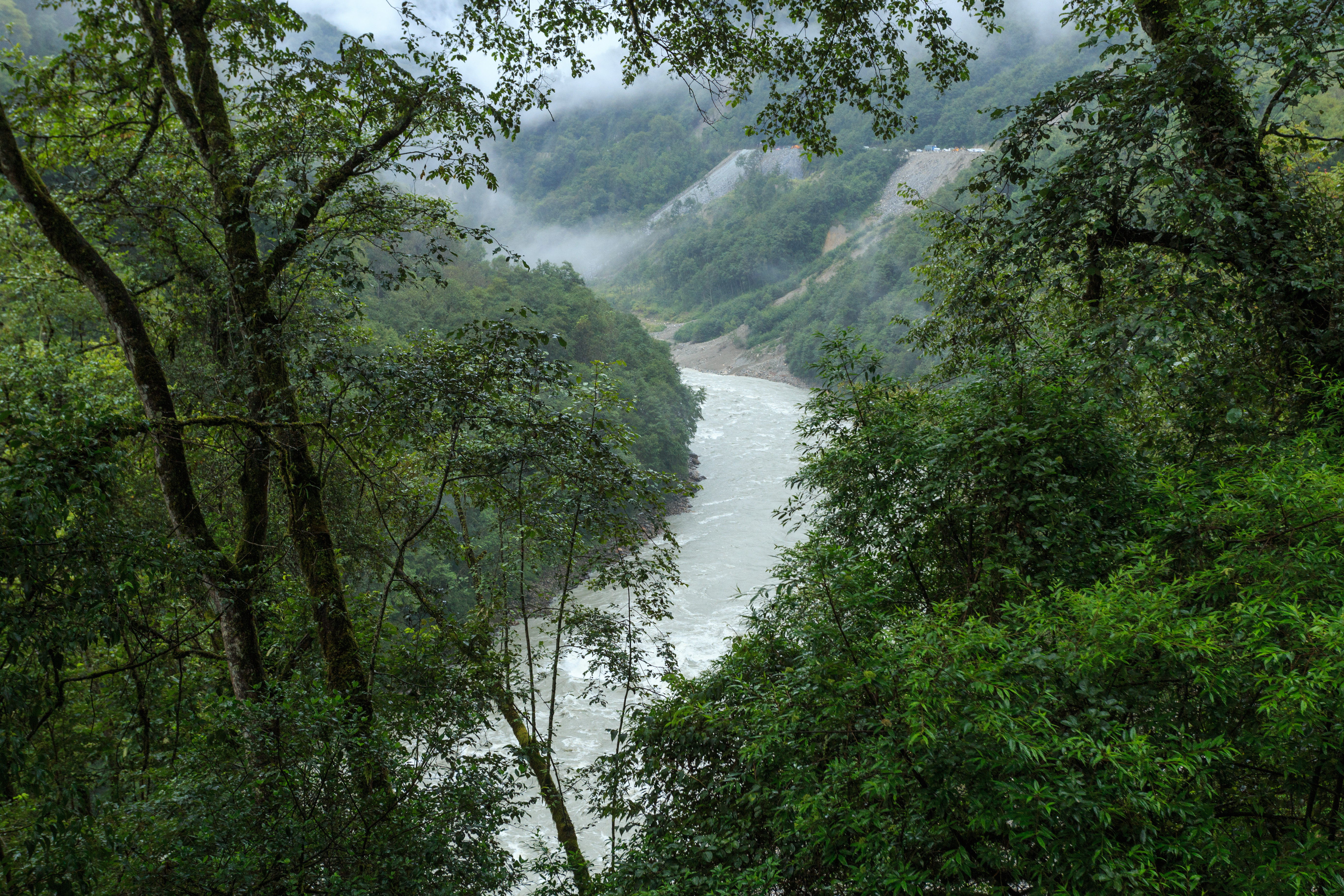
The Yarlung Tsangpo, also called Yarlung Zangbo () is the upper stream of the Brahmaputra River located in the Tibet Autonomous Region, China. It is the longest river of Tibet and the fifth longest in China. The upper section is also called Dangque Zangbu meaning "Horse River." Originating at Angsi Glacier in western Tibet, southeast of Mount Kailash and Lake Manasarovar, it later forms the South Tibet Valley and Yarlung Tsangpo Grand Canyon before passing into the state of Arunachal Pradesh, India. Downstream from Arunachal Pradesh the river becomes far wider and is called the Siang. After reaching Assam, the river is known as Brahmaputra. From Assam, the river enters Bangladesh at Ramnabazar. From there until about 200 years ago it used to flow eastward and joined the Meghna River near Bhairab Upazila. This old channel has been gradually dying. At present the main channel of the river is called Jamuna River, which flows southward to meet the Ganges, which in Bangladesh is call ... [...More Info...] [...Related Items...] OR: [Wikipedia] [Google] [Baidu] |
Shigatse Prefecture
Shigatse, officially known as Xigazê (; Nepali: ''सिगात्से''), is a prefecture-level city of the Tibet Autonomous Region of the People's Republic of China. Its area of jurisdiction, with an area of , corresponds to the historical Tsang region of Tibet. Overview The administrative center of the prefecture-level city is the Samzhubzê District. It is roughly equivalent to the historical Shigatse urban center, the second-largest city in Tibet, located about southwest of Lhasa and home to the Tashilhunpo Monastery, traditionally the seat of the Panchen Lama. Some of the towns in the prefecture are: Gyantse (Gyantse County), Tingri (Tingri County), and Nyalam (Nyalam County). On 11 July 2014 Shigatse Prefecture was upgraded into a prefecture-level city (the same status as Lhasa). Transport Rail The Lhasa–Xigazê Railway connects Xigazê Railway Station with Lhasa and further connects with Qinghai via Qinghai–Tibet Railway. It takes about 3 hours t ... [...More Info...] [...Related Items...] OR: [Wikipedia] [Google] [Baidu] |
Brahmaputra
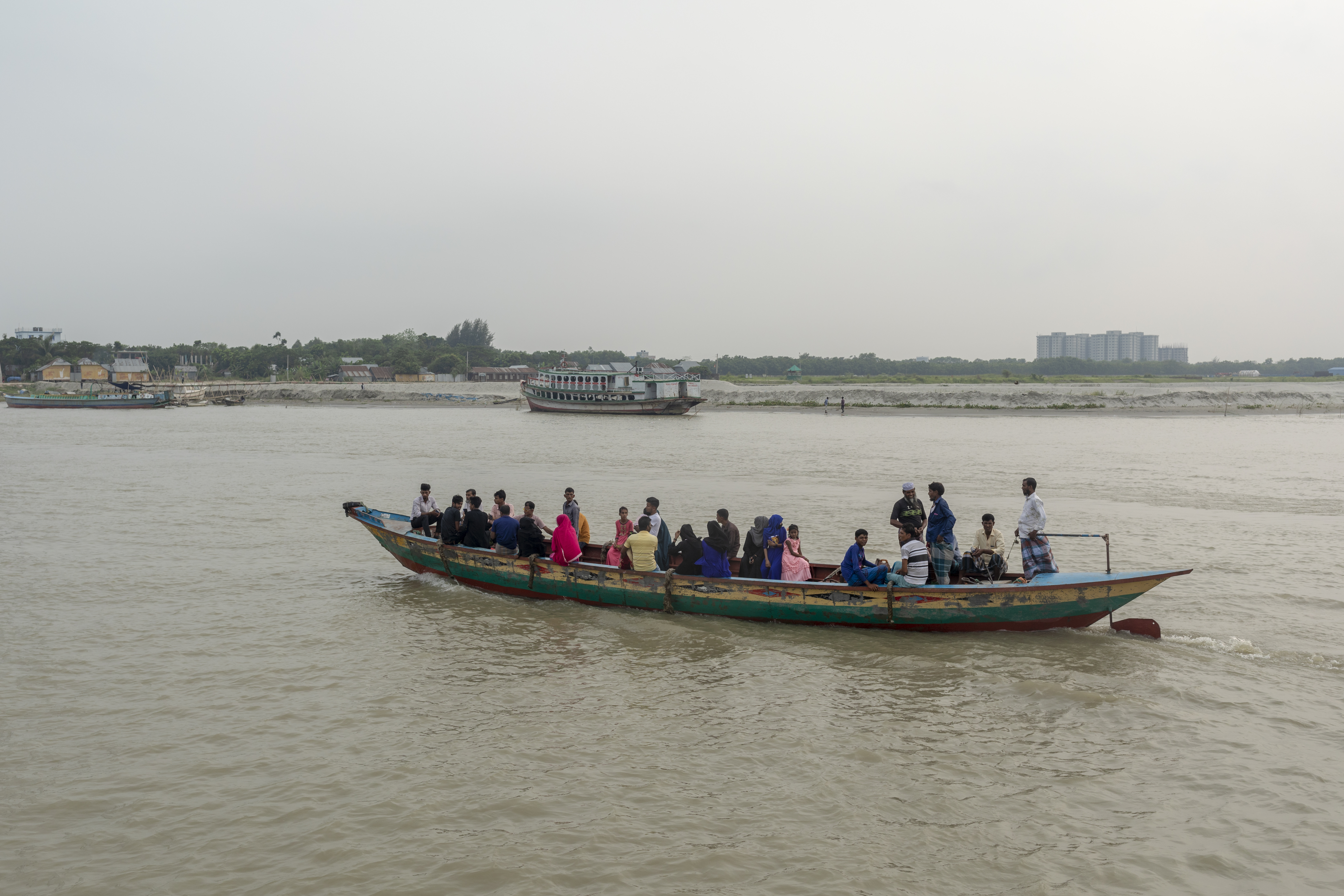
The Brahmaputra is a trans-boundary river which flows through Tibet, northeast India, and Bangladesh. It is also known as the Yarlung Tsangpo in Tibetan, the Siang/Dihang River in Arunachali, Luit in Assamese, and Jamuna River in Bangla. It is the 9th largest river in the world by discharge, and the 15th longest. With its origin in the Manasarovar Lake region, near Mount Kailash, on the northern side of the Himalayas in Burang County of Tibet where it is known as the Yarlung Tsangpo River, It flows along southern Tibet to break through the Himalayas in great gorges (including the Yarlung Tsangpo Grand Canyon) and into Arunachal Pradesh. It flows southwest through the Assam Valley as the Brahmaputra and south through Bangladesh as the Jamuna (not to be confused with the Yamuna of India). In the vast Ganges Delta, it merges with the Ganges, popularly known as the Padma in Bangladesh, and becomes the Meghna and ultimately empties into the Bay of Bengal. About long, the Bra ... [...More Info...] [...Related Items...] OR: [Wikipedia] [Google] [Baidu] |
Desert
A desert is a barren area of landscape where little precipitation occurs and, consequently, living conditions are hostile for plant and animal life. The lack of vegetation exposes the unprotected surface of the ground to denudation. About one-third of the land surface of the Earth is arid or semi-arid. This includes much of the polar regions, where little precipitation occurs, and which are sometimes called polar deserts or "cold deserts". Deserts can be classified by the amount of precipitation that falls, by the temperature that prevails, by the causes of desertification or by their geographical location. Deserts are formed by weathering processes as large variations in temperature between day and night put strains on the rocks, which consequently break in pieces. Although rain seldom occurs in deserts, there are occasional downpours that can result in flash floods. Rain falling on hot rocks can cause them to shatter, and the resulting fragments and rubble strewn over the ... [...More Info...] [...Related Items...] OR: [Wikipedia] [Google] [Baidu] |
Parlung Tsangpo
Parlung Tsangpo or Parlung Zangbo (; ), also known as Palongzangbu River, is a river in Nyingchi, Tibet, China. It is the largest tributary on the left side of Yarlung Tsangpo. Its source is the Arza Gongla Glacier, at an elevation of 4900m. It first flows north into Ngagung Tso, then turn northwest to Rakwa Tso Rakwa Tso (; ), also known as Rawu Tso or Ranwu Lake, is a lake in Baxoi County, Chamdo Prefecture, Tibet Autonomous Region, China, to the north of Arza Gongla Glacier, and to the south of Ngagung Tso. The lake covers an area of , and has an ele .... It joins Yarlung Tsangpo near Bomê. The total length of Parlung Tsangpo is 266 km, and the drop of elevation is 3360m. The drainage basin covers an area of 23,800 square kilometers. The lower part of Parlung flows through the Parlung Tsangpo Valley, which is among the deepest in the world. References Rivers of Tibet Tributaries of the Brahmaputra River {{China-river-stub ... [...More Info...] [...Related Items...] OR: [Wikipedia] [Google] [Baidu] |
Tributary
A tributary, or affluent, is a stream or river that flows into a larger stream or main stem (or parent) river or a lake. A tributary does not flow directly into a sea or ocean. Tributaries and the main stem river drain the surrounding drainage basin of its surface water and groundwater, leading the water out into an ocean. The Irtysh is a chief tributary of the Ob river and is also the longest tributary river in the world with a length of . The Madeira River is the largest tributary river by volume in the world with an average discharge of . A confluence, where two or more bodies of water meet, usually refers to the joining of tributaries. The opposite to a tributary is a distributary, a river or stream that branches off from and flows away from the main stream. PhysicalGeography.net, Michael Pidwirny & S ... [...More Info...] [...Related Items...] OR: [Wikipedia] [Google] [Baidu] |
Yarlung Tsangpo River Tibet , a river in Tibet and upper course of the Brahmaputra
{{Disambig ...
Yarlung can refer to: *Yarlung Kingdom, see also: Tibetan empire * Yarlung Dynasty, see also: List of emperors of Tibet *Yarlung Valley, formed by the Yarlung River and refers especially to the district where it joins with the Chongye River, and broadens out into a large plain about 2 km wide, before they flow north into the Yarlung Tsangpo River or Brahmaputra *Yarlung River, also called Yarlung Tsangpo River The Yarlung Tsangpo, also called Yarlung Zangbo () is the upper stream of the Brahmaputra River located in the Tibet Autonomous Region, China. It is the longest river of Tibet and the fifth longest in China. The upper section is also called Da ... [...More Info...] [...Related Items...] OR: [Wikipedia] [Google] [Baidu] |
Yarlung Tsangpo Map , a river in Tibet and upper course of the Brahmaputra
{{Disambig ...
Yarlung can refer to: *Yarlung Kingdom, see also: Tibetan empire * Yarlung Dynasty, see also: List of emperors of Tibet *Yarlung Valley, formed by the Yarlung River and refers especially to the district where it joins with the Chongye River, and broadens out into a large plain about 2 km wide, before they flow north into the Yarlung Tsangpo River or Brahmaputra *Yarlung River, also called Yarlung Tsangpo River The Yarlung Tsangpo, also called Yarlung Zangbo () is the upper stream of the Brahmaputra River located in the Tibet Autonomous Region, China. It is the longest river of Tibet and the fifth longest in China. The upper section is also called Da ... [...More Info...] [...Related Items...] OR: [Wikipedia] [Google] [Baidu] |
Yarlung Tsangpo - Tibet - 02 , a river in Tibet and upper course of the Brahmaputra
{{Disambig ...
Yarlung can refer to: *Yarlung Kingdom, see also: Tibetan empire * Yarlung Dynasty, see also: List of emperors of Tibet *Yarlung Valley, formed by the Yarlung River and refers especially to the district where it joins with the Chongye River, and broadens out into a large plain about 2 km wide, before they flow north into the Yarlung Tsangpo River or Brahmaputra *Yarlung River, also called Yarlung Tsangpo River The Yarlung Tsangpo, also called Yarlung Zangbo () is the upper stream of the Brahmaputra River located in the Tibet Autonomous Region, China. It is the longest river of Tibet and the fifth longest in China. The upper section is also called Da ... [...More Info...] [...Related Items...] OR: [Wikipedia] [Google] [Baidu] |
Tibetan Plateau
The Tibetan Plateau (, also known as the Qinghai–Tibet Plateau or the Qing–Zang Plateau () or as the Himalayan Plateau in India, is a vast elevated plateau located at the intersection of Central, South and East Asia covering most of the Tibet Autonomous Region, most of Qinghai, western half of Sichuan, Southern Gansu provinces in Western China, southern Xinjiang, Bhutan, the Indian regions of Ladakh and Lahaul and Spiti (Himachal Pradesh) as well as Gilgit-Baltistan in Pakistan, northwestern Nepal, eastern Tajikistan and southern Kyrgyzstan. It stretches approximately north to south and east to west. It is the world's highest and largest plateau above sea level, with an area of (about five times the size of Metropolitan France). With an average elevation exceeding and being surrounded by imposing mountain ranges that harbor the world's two highest summits, Mount Everest and K2, the Tibetan Plateau is often referred to as "the Roof of the World". The Tibetan Plateau ... [...More Info...] [...Related Items...] OR: [Wikipedia] [Google] [Baidu] |
Padma River
The Padma ( bn, পদ্মা ''Pôdma'') is a major river in Bangladesh. It is the main distributary of the Ganges, flowing generally southeast for to its confluence with the Meghna River near the Bay of Bengal. The city of Rajshahi is situated on the banks of the river.Hossain ML, Mahmud J, Islam J, Khokon ZH and Islam S (eds.) (2005) Padma, Tatthyakosh Vol. 1 and 2, Dhaka, Bangladesh, p. 182 . Since 1966, over of land has been lost due to erosion of the Padma. History Etymology The Padma, Sanskrit for lotus flower, is a mentioned in Hindu mythology as a byname for the Goddess Lakshmi. The name ''Padma'' is given to the lower part of the course of the Ganges (Ganga) below the point of the off-take of the Bhagirathi River (India), another Ganges River distributary also known as the Hooghly River. Padma had, most probably, flowed through a number of channels at different times. Some authors contend that each distributary of the Ganges in its deltaic part is a remnan ... [...More Info...] [...Related Items...] OR: [Wikipedia] [Google] [Baidu] |
Ganges
The Ganges ( ) (in India: Ganga ( ); in Bangladesh: Padma ( )). "The Ganges Basin, known in India as the Ganga and in Bangladesh as the Padma, is an international river to which India, Bangladesh, Nepal and China are the riparian states." is a trans-boundary river of Asia which flows through India and Bangladesh. The river rises in the western Himalayas in the Indian state of Uttarakhand. It flows south and east through the Gangetic plain of North India, receiving the right-bank tributary, the Yamuna, which also rises in the western Indian Himalayas, and several left-bank tributaries from Nepal that account for the bulk of its flow. In West Bengal state, India, a feeder canal taking off from its right bank diverts 50% of its flow southwards, artificially connecting it to the Hooghly river. The Ganges continues into Bangladesh, its name changing to the Padma. It is then joined by the Jamuna, the lower stream of the Brahmaputra, and eventually the Meghna, forming the major ... [...More Info...] [...Related Items...] OR: [Wikipedia] [Google] [Baidu] |


