|
Yangang
Yangang is a small town in South Sikkim district of the Indian state of Sikkim. Yangang is the projected site for the construction of a Sikkim University Sikkim University is a central university established under an Act of Parliament of India. It is in Gangtok. The campus is expected to be built at Yangang in South Sikkim district, about from Gangtok. Its first chancellor was M. S. Swaminatha ... campus. Yangang is also the birthplace of the former Chief Minister of Sikkim (1994 - 2019), Shri Pawan Kumar Chamling. The state's largest police training center is in Yangang. Yangang has a number of natural tourism resources including Mainam Hill (popularly known as Bhalay-Dhunga), Tig-Day Cho lake, Neya Khola Falls, Mahadev Than, Yangang Monastery, Gurung Monastery, Lepcha Monastery, Ramitay Bhir. Yangang will be soon have projects carried out in it such as the Ropeway to Bhalay Dhunga, Sky Walk at Bhalay Dhunga, Lepcha Heritage Center, and the Cultural Park. Notable People ... [...More Info...] [...Related Items...] OR: [Wikipedia] [Google] [Baidu] |
Pawan Kumar Chamling
Pawan Kumar Chamling (born 22 September 1949) is an Indian politician and the former Chief Minister of Sikkim. Chamling is the Founding President of the Sikkim Democratic Front, which governed the state for five successive terms since 1994. Chamling's 24.4 year stint (December 1994 to May 2019) is the longest ever by a chief minister of any Indian state, surpassing Jyoti Basu's 23 years in West Bengal. Prior to establishing the Sikkim Democratic Front, Chamling served as Minister for Industries, Information and Public Relations from 1989 to 1992 in Nar Bahadur Bhandari's cabinet. Personal life Chamling was born in Yangang, South Sikkim to Nepali parents Ash Bahadur Chamling and Asha Rani Chamling. Chamling is also a prolific Nepali language writer, and recipient of the ''Bhanu Puraskar'' (2010) awarded by Sikkim Sahitya Parishad. He writes under the pen name Pawan Chamling. Mr. Chamling has two wives an 8 children (4 sons and 4 daughters). Political career Chamling was el ... [...More Info...] [...Related Items...] OR: [Wikipedia] [Google] [Baidu] |
Sikkim
Sikkim (; ) is a state in Northeastern India. It borders the Tibet Autonomous Region of China in the north and northeast, Bhutan in the east, Province No. 1 of Nepal in the west and West Bengal in the south. Sikkim is also close to the Siliguri Corridor, which borders Bangladesh. Sikkim is the least populous and second smallest among the Indian states. Situated in the Eastern Himalaya, Sikkim is notable for its biodiversity, including alpine and subtropical climates, as well as being a host to Kangchenjunga, the highest peak in India and third highest on Earth. Sikkim's capital and largest city is Gangtok. Almost 35% of the state is covered by Khangchendzonga National Park – a UNESCO World Heritage Site. The Kingdom of Sikkim was founded by the Namgyal dynasty in the 17th century. It was ruled by Buddhist priest-kings known as the Chogyal. It became a princely state of British India in 1890. Following Indian independence, Sikkim continued its protectorate status with ... [...More Info...] [...Related Items...] OR: [Wikipedia] [Google] [Baidu] |
South Sikkim District
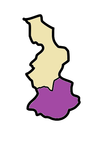
Namchi District is a district of the Indian state of Sikkim. Its headquarters is at Namchi. Geography South Sikkim lies at an altitude of 400 to 2000 metres and has a temperate climate for most of the year. Major urban centres include Namchi, Ravangla, Jorethang and Melli. Assembly Constituencies The district was previously divided into eight assembly constituencies. * Barfung (BL) * Poklok-Kamrang * Namchi-Singhithang *Melli * Namthang-Rateypani * Temi-Namphing * Rangang-Yangang *Tumen-Lingi (BL) National protected area *Maenam Wildlife Sanctuary Economy South Sikkim is the most industrialised district in the state, owing to the availability of flat land. Since the geology is stable the roads are in good condition as compared to other parts of the state which suffer from landslides. The district is also known for Sikkim tea, which is grown near Namchi. Demographics According to the 2011 census South Sikkim district has a population of 146,850, roughly equal to ... [...More Info...] [...Related Items...] OR: [Wikipedia] [Google] [Baidu] |
South Sikkim
Namchi District is a district of the Indian state of Sikkim. Its headquarters is at Namchi. Geography South Sikkim lies at an altitude of 400 to 2000 metres and has a temperate climate for most of the year. Major urban centres include Namchi, Ravangla, Jorethang and Melli. Assembly Constituencies The district was previously divided into eight assembly constituencies. * Barfung (BL) * Poklok-Kamrang * Namchi-Singhithang *Melli * Namthang-Rateypani * Temi-Namphing * Rangang-Yangang *Tumen-Lingi (BL) National protected area *Maenam Wildlife Sanctuary Economy South Sikkim is the most industrialised district in the state, owing to the availability of flat land. Since the geology is stable the roads are in good condition as compared to other parts of the state which suffer from landslides. The district is also known for Sikkim tea, which is grown near Namchi. Demographics According to the 2011 census South Sikkim district has a population of 146,850, roughly equal to ... [...More Info...] [...Related Items...] OR: [Wikipedia] [Google] [Baidu] |
Sikkim University
Sikkim University is a central university established under an Act of Parliament of India. It is in Gangtok. The campus is expected to be built at Yangang in South Sikkim district, about from Gangtok. Its first chancellor was M. S. Swaminathan; Mahendra P. Lama was the first vice chancellor. In 2008 the university started from four departments — Social System and Anthropology; Peace and Conflict Studies and Management; International Relations/Politics; and Microbiology. The university offers traditional courses in humanities, physical and life sciences, and forestry along with non-traditional courses that are unique and related to the state including subjects like ethnic history, mountain studies, border studies, and hill music and culture. All the colleges in the state of Sikkim are affiliated to this university. Schools The university has the following schools, departments and centres of studies: * School of Social Sciences **Department of Economics **Department of Histo ... [...More Info...] [...Related Items...] OR: [Wikipedia] [Google] [Baidu] |
India
India, officially the Republic of India (Hindi: ), is a country in South Asia. It is the seventh-largest country by area, the second-most populous country, and the most populous democracy in the world. Bounded by the Indian Ocean on the south, the Arabian Sea on the southwest, and the Bay of Bengal on the southeast, it shares land borders with Pakistan to the west; China, Nepal, and Bhutan to the north; and Bangladesh and Myanmar to the east. In the Indian Ocean, India is in the vicinity of Sri Lanka and the Maldives; its Andaman and Nicobar Islands share a maritime border with Thailand, Myanmar, and Indonesia. Modern humans arrived on the Indian subcontinent from Africa no later than 55,000 years ago., "Y-Chromosome and Mt-DNA data support the colonization of South Asia by modern humans originating in Africa. ... Coalescence dates for most non-European populations average to between 73–55 ka.", "Modern human beings—''Homo sapiens''—originated in Africa. Then, int ... [...More Info...] [...Related Items...] OR: [Wikipedia] [Google] [Baidu] |
Postal Index Number
A Postal Index Number (PIN; sometimes redundantly a PIN code) refers to a six-digit code in the Indian postal code system used by India Post. On 15 August 2022, the PIN system celebrated its 50th anniversary. History The PIN system was introduced on 15 August 1972 by Shriram Bhikaji Velankar, an additional secretary in the Government of India's Ministry of Communications. The system was introduced to simplify the manual sorting and delivery of mail by eliminating confusion over incorrect addresses, similar place names, and different languages used by the public. PIN structure The first digit of a PIN indicates the zone, the second indicates the sub-zone, and the third, combined with the first two, indicates the sorting district within that zone. The final three digits are assigned to individual post offices within the sorting district. Postal zones There are nine postal zones in India, including eight regional zones and one functional zone (for the Indian Army). The f ... [...More Info...] [...Related Items...] OR: [Wikipedia] [Google] [Baidu] |
Indian Standard Time
Indian Standard Time (IST), sometimes also called India Standard Time, is the time zone observed throughout India, with a time offset of UTC+05:30. India does not observe daylight saving time or other seasonal adjustments. In military and aviation time, IST is designated E* ("Echo-Star"). It is indicated as Asia/Kolkata in the IANA time zone database. History After Independence in 1947, the Union government established IST as the official time for the whole country, although Kolkata and Mumbai retained their own local time (known as Calcutta Time and Bombay Time) until 1948 and 1955, respectively. The Central observatory was moved from Chennai to a location at Shankargarh Fort in Allahabad district, so that it would be as close to UTC+05:30 as possible. Daylight Saving Time (DST) was used briefly during the China–India War of 1962 and the Indo-Pakistani Wars of 1965 and 1971. Calculation Indian Standard Time is calculated from the clock tower in Mirzapur nearly exa ... [...More Info...] [...Related Items...] OR: [Wikipedia] [Google] [Baidu] |
Sunwar Language
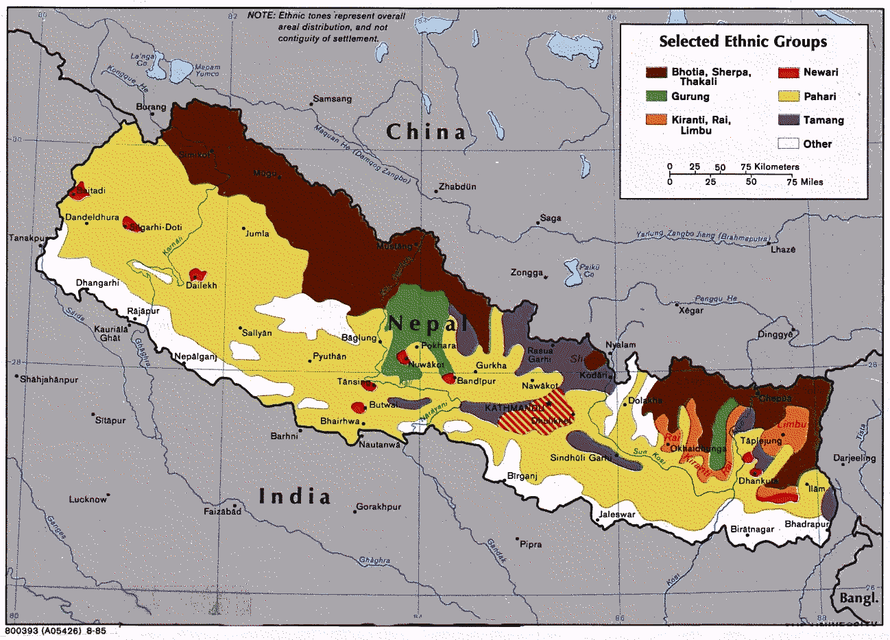
Sunuwar, Sunuwar, or Kõinch (; ; other spellings are Koinch and Koincha), is a Kiranti language spoken in Nepal and India by the Sunuwar people. It was first comprehensively attested by the Himalayan Languages Project. It is also known as Kõits Lo ( ; ), Kiranti-Kõits ( ; ), Mukhiya ( ; ). The Sunwar language is one of the smaller members of the Tibeto-Burman language family. About 40,000 speakers are residing in eastern Nepal. Names The language is commonly known as ''Koic,'' for many ethnic Sunwar and Sunwar speakers also refer to the language as “''Sunuwar, Kõinch'' '', Koinch'' or ''Koincha'' (कोँइच); ''Kõits Lo'' (कोँइच लो), ''Kiranti-Kõits'' (किराँती-कोँइच) or ''Mukhiya'' (मुखिया).” Moreover, most Sunwar speakers have the surname (सुनुवार), ''Sunuvār'' in Latin script. Many affiliated Sunwar with Sunar; they share the initial syllable, ''sun'', “gold,” in Nepali, similar to the S ... [...More Info...] [...Related Items...] OR: [Wikipedia] [Google] [Baidu] |
Tamang Language
Tamang (Devanagari: तामाङ; ''tāmāng'') is a term used to collectively refer to a dialect cluster spoken mainly in Nepal, Sikkim, West Bengal (Darjeeling) and North-Eastern India. It comprises Eastern Tamang, Northwestern Tamang, Southwestern Tamang, Eastern Gorkha Tamang, and Western Tamang. Lexical similarity between Eastern Tamang (which is regarded as the most prominent) and other Tamang languages varies between 81% to 63%. For comparison, lexical similarity between Spanish and Portuguese, is estimated at 89%. Ethnologue report for Spanish Dialects ''Ethnologue'' divides Tamang into the following varieties due to mutual unintelligibility. *Eastern Tamang: 759,000 in Nepal (2000 WCD). Population total all countries: 773,000. Sub-dialects are as follows. **Outer-Eastern Tamang (Sailung Tamang) **Central-Eastern Tamang (Temal Tamang) **Southwestern Tamang (Kath-Bhotiya, Lama Bhote, Murmi, Rongba, Sain, Tamang Gyoi, Tamang Gyot, Tamang Lengmo, Tamang Tam) *Western T ... [...More Info...] [...Related Items...] OR: [Wikipedia] [Google] [Baidu] |
States And Territories Of India
India is a federal union comprising 28 states and 8 union territories, with a total of 36 entities. The states and union territories are further subdivided into districts and smaller administrative divisions. History Pre-independence The Indian subcontinent has been ruled by many different ethnic groups throughout its history, each instituting their own policies of administrative division in the region. The British Raj mostly retained the administrative structure of the preceding Mughal Empire. India was divided into provinces (also called Presidencies), directly governed by the British, and princely states, which were nominally controlled by a local prince or raja loyal to the British Empire, which held ''de facto'' sovereignty ( suzerainty) over the princely states. 1947–1950 Between 1947 and 1950 the territories of the princely states were politically integrated into the Indian union. Most were merged into existing provinces; others were organised into ... [...More Info...] [...Related Items...] OR: [Wikipedia] [Google] [Baidu] |
Sherpa Language
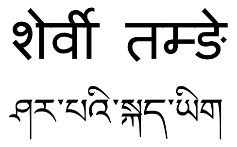
Sherpa (also Sharpa, Xiaerba, or Sherwa) is a Tibetic language spoken in Nepal and the Indian state of Sikkim, mainly by the Sherpa. The majority speakers of the Sherpa language live in the Khumbu region of Nepal, spanning from the Chinese (Tibetan) border in the east to the Bhotekosi River in the west. About 200,000 speakers live in Nepal (2001 census), some 20,000 in Sikkim (1997) and some 800 in Tibetan Autonomous Region (1994). Sherpa is a subject-object-verb (SOV) language. Sherpa is predominantly a spoken language, although it is occasionally written using either the Devanagari or Tibetan script. Phonology Sherpa is a tonal language. Sherpa has the following consonants: Consonants * Stop sounds can be unreleased in word-final position. * Palatal sounds can neutralize to velar sounds when preceding . * can become a retroflex nasal when preceding a retroflex stop. * can have an allophone of when occurring in fast speech. Vowels * Vowel sounds have the ... [...More Info...] [...Related Items...] OR: [Wikipedia] [Google] [Baidu] |


