|
Yanam District
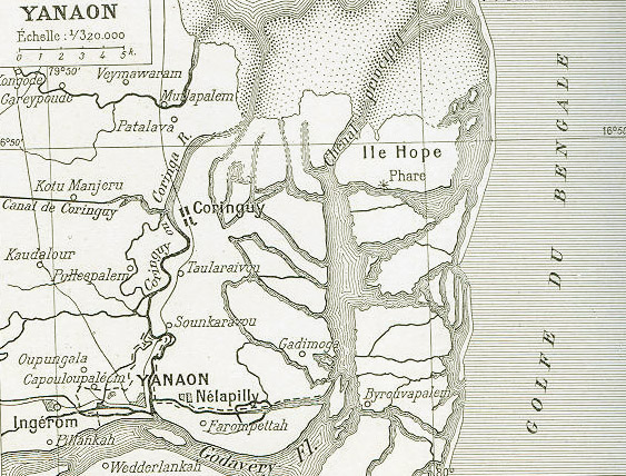
Yanam district is one of the four districts of the Union Territory of Puducherry (union territory), Puducherry in India. Geography Yanam district occupies an area of , It is located south of Kakinada port on the north bank of Godavari river, slightly inland. It is bordered and surrounded by Konaseema district on South and Kakinada district on north (Districts of Andhra State) Revenue villages Apart from the town of Yanam itself, the following villages fall under the district's jurisdiction: * Agraharam * Darialatippa * Farampeta * Francetippa * Guerempeta * Kanakalapeta * Kurasampeta * Mettakur Demographics According to the 2011 census of India, 2011 census Yanam district has a Demographics of India, population of 55,626, roughly equal to the island of Greenland. This gives it a ranking of 629th in India (out of a total of Districts of India, 640). The district has a population density of . Its Family planning in India, population growth rate over the decade 2001-2011 ... [...More Info...] [...Related Items...] OR: [Wikipedia] [Google] [Baidu] |
2011 Census Of India
The 2011 Census of India or the 15th Indian Census was conducted in two phases, house listing and population enumeration. The House listing phase began on 1 April 2010 and involved the collection of information about all buildings. Information for National Population Register (NPR) was also collected in the first phase, which will be used to issue a 12-digit unique identification number to all registered Indian residents by Unique Identification Authority of India. The second population enumeration phase was conducted between 9 and 28 February 2011. Census has been conducted in India since 1872 and 2011 marks the first time biometric information was collected. According to the provisional reports released on 31 March 2011, the Indian population increased to 1.21 billion with a decadal growth of 17.70%. Adult literacy rate increased to 74.04% with a decadal growth of 9.21%. The motto of the census was 'Our Census, Our future'. Spread across 28 states and 8 union territories, t ... [...More Info...] [...Related Items...] OR: [Wikipedia] [Google] [Baidu] |
East Godavari District
East Godavari is a district in the Coastal Andhra region of Andhra Pradesh, India. Its district headquarters is at Rajahmundry. As of census 2011, it became the most populous district of the state with a population of 5,151,549. In the Madras Presidency, the District of Rajahmundry was created in 1823. It was reorganised in 1859 and was bifurcated into Godavari and Krishna districts. During British rule, Rajahmundry was the headquarters of Godavari District, which was further bifurcated into East Godavari and West Godavari districts in 1925. When the Godavari district was divided, Kakinada became the headquarters of East Godavari and Eluru became headquarters of West Godavari. In November 1956, Andhra Pradesh was formed by merging Andhra State with the Telugu-speaking areas of the Hyderabad State. In 1959, the Bhadrachalam revenue division, consisting of Bhadrachalam and Naguru Taluqs (2 Taluqas in 1959 but later subdivided into Wajedu, Venkatapruram, Charla, Dummugudem, Bhadrach ... [...More Info...] [...Related Items...] OR: [Wikipedia] [Google] [Baidu] |
Puducherry District
The Puducherry district, also known by its former name Pondicherry district, is one of the four districts of the union territory of Puducherry in South India. The district occupies an area of , spread over 11 non-contiguous enclaves lying on or near the Bay of Bengal within a compact area in the state of Tamil Nadu. According to the 2011 census, the district has a population of 950,289. Administrative divisions For administrative purpose, the union territory of Puducherry is divided into eight taluks. Four of these, viz. Puducherry, Uzhavarkarai, Villianur and Bahour, together constitute Puducherry district. Among these four, only Ozhukarai taluk does not contain any rural area. The rural areas under the other three taluks are further divided commune panchayats (CP) or simply communes. Rural area of Puducherry taluk is covered by a single communeAriyankuppam, whereas Villianur taluk has two communes, viz. Villianur and Mannadipet, and rural area of Bahour taluk consists o ... [...More Info...] [...Related Items...] OR: [Wikipedia] [Google] [Baidu] |
Mahe District
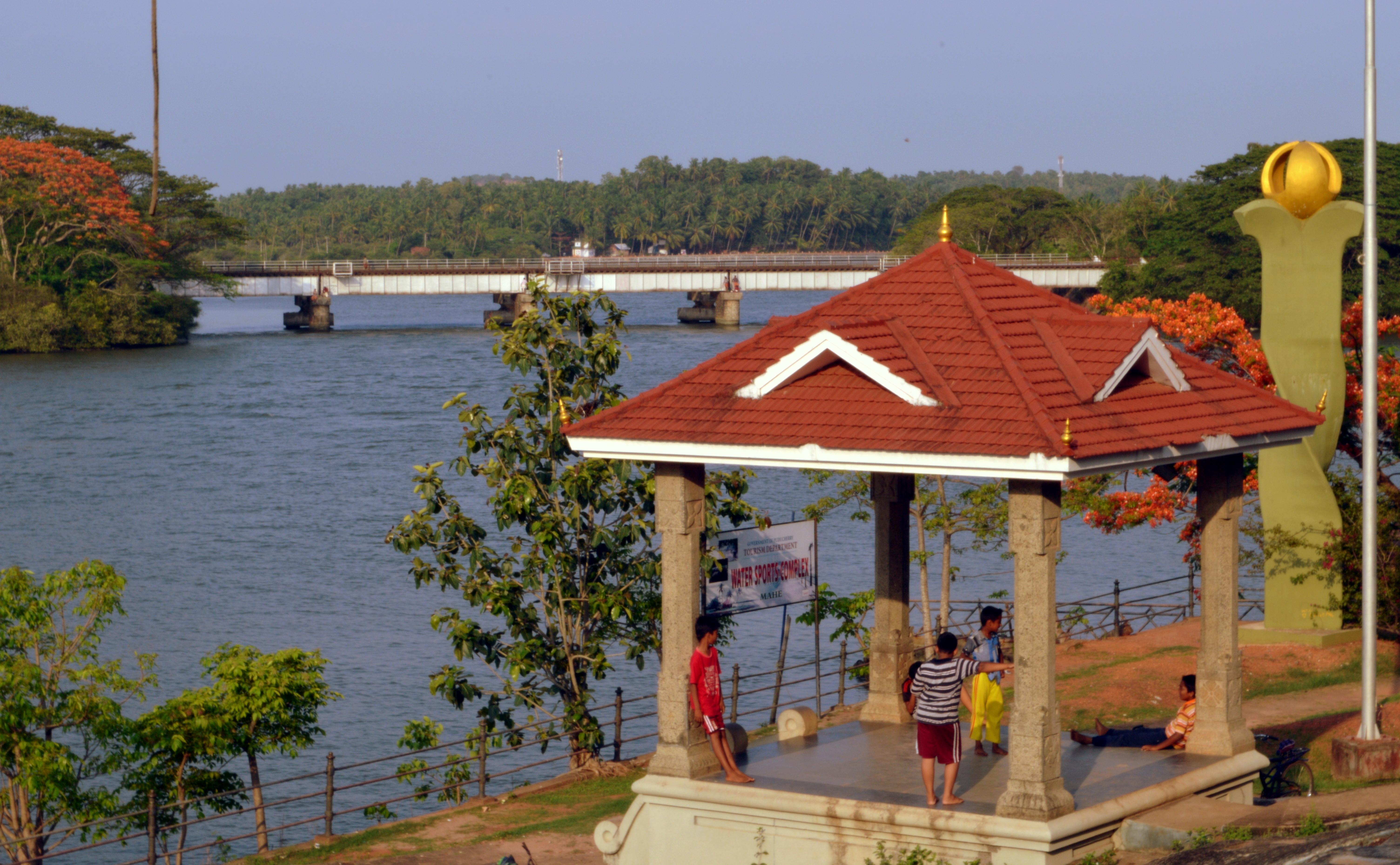
Mahé district ( ml, മയ്യഴി ജില്ല) is one of the four districts of the union territory of Puducherry, India. It consists of the whole of the Mahé region. Mahé is the smallest district of India by size. The total area of Mahé district is surrounded by North Malabar of Kerala State. Three sides by Kannur District and one side by Kozhikode District. Geographically Mahé district is part of North Malabar. It is the sixth least populous district in the country (out of 773). Geography Mahé district occupies an area of . Demographics According to the 2011 census Mahé district has a population of 41,816, roughly equal to the nation of Liechtenstein. This gives it a ranking of 635th in India (out of a total of 640). The district has a population density of . Its population growth rate over the decade 2001-2011 was 13.86%. Mahé has a sex ratio of 1,176 females for every 1,000 males, and a literacy rate of 98.35%. Religion Hinduism is the majority reli ... [...More Info...] [...Related Items...] OR: [Wikipedia] [Google] [Baidu] |
Karaikal District
Karaikal district ( French: ''District de Karikal'') is one of the four districts of the Union Territory of Puducherry in India. Geography Karaikal district occupies an area of . Karaikal is a small coastal enclave of territory which was formerly part of French India. Together with the other former French enclaves of Pondicherry, Yanam, and Mahé, Karaikal forms the Union Territory of Puducherry. Karaikal is bounded on the North by Mayiladuthurai district, on the South by Nagapattinam district of Tamil Nadu state, on the west by Tiruvarur district (also belonging to Tamil Nadu), and on the East by the Bay of Bengal. Demographics According to the 2011 census Karaikal district has a population of 200,222, roughly equal to the nation of Samoa. This gives it a ranking of 589th in India (out of a total of 640). The district has a population density of . Its population growth rate over the decade 2001-2011 was 17.29%. Karaikal has a sex ratio of 1048 females for every 100 ... [...More Info...] [...Related Items...] OR: [Wikipedia] [Google] [Baidu] |
Yanam Municipality
Yanam Municipality (''Municipalité de Yanaon'') was created by a French Metropolitan Decree dated 12 March 1880. Yanaon municipality had 12 seats (''Sièges''). Citizens from each ward elect one representative for Yanam Municipal Council (''Conseil Municipal de Yanaon)''. The term of office is six years. General information The Yanam Municipality is acting according to the Pondicherry Municipalities Act of 1973 which had been introduced by the Government and in effect since 26-01-1974. The Municipality is functioning under the purview of Municipal Council. In the absence of an elected local body, the Special Officer (Regional Administrator), appointed by the Government, is exercising all the powers and functions of the Municipal Council. The Commissioner, who has also been appointed by the Government, is the Chief Executive of the Municipality and also acts as the Registrar of Births and Deaths of the Municipality. Overall control and supervision is by the Director, L.A.D., Po ... [...More Info...] [...Related Items...] OR: [Wikipedia] [Google] [Baidu] |
Yanam (India)
Yanam (Telugu: ''యానాం'') is a town located in the Yanam district in Puducherry. It has a population of 35,000 and is entirely surrounded by Andhra Pradesh. It was formerly a French colony for nearly 200 years, and, though united with India in 1954, is still sometimes known as "French Yanam". It possesses a blend of French culture and the Telugu culture, nicknamed '' Frelugu''. During French rule, the Tuesday market (''Marché du mardi'' or ''Mangalavaram Santa'') at Yanam was popular among the Telugu people in the Madras Presidency, who visited Yanam to buy foreign and smuggled goods during Yanam People's Festival held in January. After implementation of the Child Marriage Restraint Act, 1929 in British India, Telugu people often traveled to Yanam to conduct child marriages, which remained legal under the French administration. History There was a rumour among some natives that Yanaon was a Dutch colony prior to French takeover in the 1720s but there are no subs ... [...More Info...] [...Related Items...] OR: [Wikipedia] [Google] [Baidu] |
Literacy In India
Literacy in India is a key for social-economic progress. The 2011 census, indicated a 2001–2011 literacy growth of 97.2%, which is slower than the growth seen during the previous decade. An old analytical 1990 study estimated that it would take until 2060 for India to achieve universal literacy at then-current rate of progress. Census of India pegged average literacy rate to be 73% in 2011 while National Statistical Commission surveyed literacy to be 77.7% in 2017–18. Literacy rate in urban areas was higher 87.7% than rural areas with 73.5%. There is a widgender disparity in the literacy rate in Indiaand effective literacy rates (age 7 and above) was 84.7% for men and 70.3% for women. The low female literacy rate has a dramatically negative impact on family planning and population stabillisation efforts in India. Studies have indicated that female literacy is a strong predictor of the use of contraception among married Indian couples, even when women do not otherwise have ec ... [...More Info...] [...Related Items...] OR: [Wikipedia] [Google] [Baidu] |
Women In India
The status of women in India has been subject to many changes over the span of recorded Indian history. Their position in society deteriorated early in India's ancient period, especially in the Indo-Aryan speaking regions, and their subordination continued to be reified well into India's early modern period. During the British East India Company rule (1757–1857), and the British Raj (1858–1947), measures aiming at amelioration were enacted, including Bengal Sati Regulation, 1829, Hindu Widows' Remarriage Act, 1856, Female Infanticide Prevention Act, 1870, and Age of Consent Act, 1891. The Indian constitution prohibits discrimination based on sex and empowers the government to undertake special measures for them. Women's rights under the Constitution of India mainly include equality, dignity, and freedom from discrimination; additionally, India has various statutes governing the rights of women. Several women have served in various senior official positions in the Indian g ... [...More Info...] [...Related Items...] OR: [Wikipedia] [Google] [Baidu] |
Sex Ratio
The sex ratio (or gender ratio) is usually defined as the ratio of males to females in a population. As explained by Fisher's principle, for evolutionary reasons this is typically about 1:1 in species which reproduce sexually. Many species deviate from an even sex ratio, either periodically or permanently. Examples include parthenogenic species, periodically mating organisms such as aphids, some eusocial wasps, bees, ants, and termites. The human sex ratio is of particular interest to anthropologists and demographers. In human societies, sex ratios at birth may be considerably skewed by factors such as the age of mother at birth and by sex-selective abortion and infanticide. Exposure to pesticides and other environmental contaminants may be a significant contributing factor as well. As of 2014, the global sex ratio at birth is estimated at 107 boys to 100 girls (1,000 boys per 934 girls).. Types In most species, the sex ratio varies according to the age profile of the populat ... [...More Info...] [...Related Items...] OR: [Wikipedia] [Google] [Baidu] |
Family Planning In India
Family planning in India is based on efforts largely sponsored by the Indian government. From 1965 to 2009, contraceptive usage has more than tripled (from 13% of married women in 1970 to 48% in 2009) and the fertility rate has more than halved (from 5.7 in 1966 to 2.4 in 2012), but the national fertility rate in absolute numbers remains high, causing concern for long-term population growth. India adds up to 1,000,000 people to its population every 20 days. Extensive family planning has become a priority in an effort to curb the projected population of two billion by the end of the twenty-first century. In 2016, the total fertility rate of India was 2.30 births per woman and 15.6 million abortions performed, with an abortion rate of 47.0 abortions per 1000 women aged between 15 and 49 years. With high abortions rates follows a high number of unintended pregnancies, with a rate of 70.1 unintended pregnancies per 1000 women aged 15–49 years. Overall, the abortions occurring in ... [...More Info...] [...Related Items...] OR: [Wikipedia] [Google] [Baidu] |


