|
Yadkin River
The Yadkin River is one of the longest rivers in North Carolina, flowing . It rises in the northwestern portion of the state near the Blue Ridge Parkway's Thunder Hill Overlook. Several parts of the river are impounded by dams for water, power, and flood control. The river becomes the Pee Dee River at the confluence of the Uwharrie River south of the community of Badin and east of the town of Albemarle. The river then flows into South Carolina near Cheraw, which is at the Fall Line. The entirety of the Yadkin River and the Great Pee Dee River is part of the Yadkin-Pee Dee River Basin. Etymology The meaning of the word Yadkin, derived from ''Yattken'', or ''Yattkin'', a Siouan Indian word, is unknown. In Siouan terminology it may mean "big tree" or "place of big trees." Alternate names include: :Adkin River :Atkin River :Big Yadkin River :Reatkin River :Sapona River :Yatkin River Yadkin County, North Carolina, and its county seat, the town of Yadkinville, are named af ... [...More Info...] [...Related Items...] OR: [Wikipedia] [Google] [Baidu] |
Elkin, North Carolina
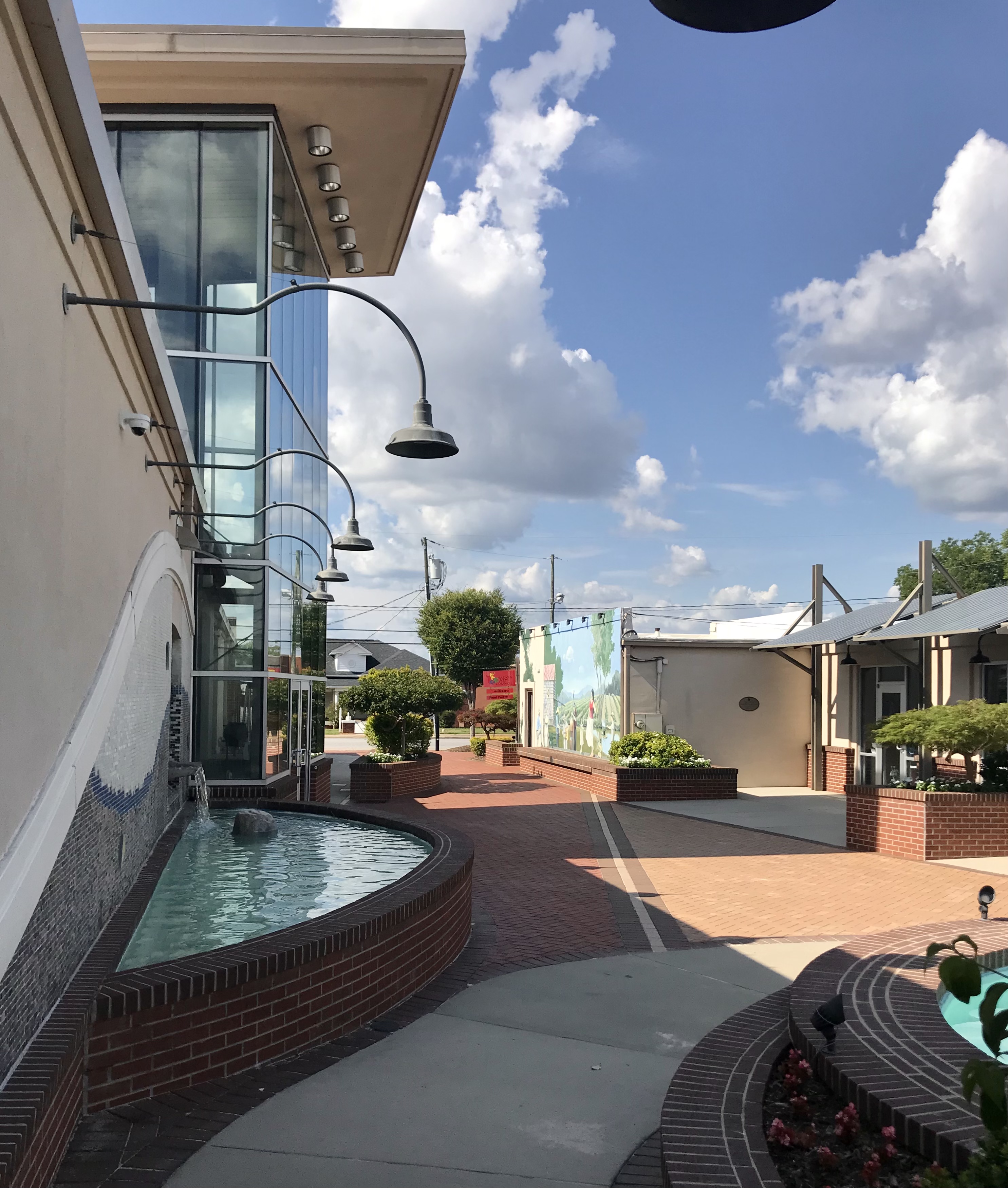
Elkin is a town in Surry and Wilkes counties in the U.S. state of North Carolina, along the Yadkin River. Elkin shares its name with the surrounding township of Elkin Township. The population was 4,083 at the 2020 census. Geography Elkin is located at (36.257709, -80.851296). According to the United States Census Bureau, the town has a total area of 6.3 square miles (16.4 km2), of which 6.2 square miles (16.2 km2) is land and 0.1 square mile (0.2 km2) (1.10%) is water. Elkin is approximately 15 minutes south of Stone Mountain State Park, and 20 minutes from the entrance of the Blue Ridge Parkway off Hwy 21 (heading towards Sparta). Elkin enjoys mild weather patterns and extremely clean air. Its downtown is also situated along the Yadkin River, and offers a paddlers boat ramp and small camp site. Six local outfitters provide supplies for anyone interested in floating on the Yadkin to or from Elkin. There are also numerous vineyards in the Y ... [...More Info...] [...Related Items...] OR: [Wikipedia] [Google] [Baidu] |
Flood Control
Flood control methods are used to reduce or prevent the detrimental effects of flood waters."Flood Control", MSN Encarta, 2008 (see below: Further reading). Flood relief methods are used to reduce the effects of flood waters or high water levels. Flooding can be caused by a mix of both natural processes, such as extreme weather upstream, and human changes to waterbodies and runoff. Though building hard infrastructure to prevent flooding, such as flood walls, can be effective at managing flooding, increased best practice within landscape engineering is to rely more on soft infrastructure and natural systems, such as marshes and flood plains, for handling the increase in water. For flooding on coasts, coastal management practices have to not only handle changes water flow, but also natural processes like tides. Flood control and relief is a particularly important part of climate change adaptation and climate resilience, both sea level rise and changes in the weather (climate cha ... [...More Info...] [...Related Items...] OR: [Wikipedia] [Google] [Baidu] |
Scots-Irish American
Scotch-Irish (or Scots-Irish) Americans are American descendants of Ulster Protestants who emigrated from Ulster in northern Ireland to America during the 18th and 19th centuries, whose ancestors had originally migrated to Ireland mainly from the Scottish Lowlands and Northern England in the 17th century. In the 2017 American Community Survey, 5.39 million (1.7% of the population) reported Scottish ancestry, an additional 3 million (0.9% of the population) identified more specifically with Scotch-Irish ancestry, and many people who claim "American ancestry" may actually be of Scotch-Irish ancestry. The term ''Scotch-Irish'' is used primarily in the United States,Leyburn 1962, p. 327. with people in Great Britain or Ireland who are of a similar ancestry identifying as Ulster Scots people. Many left for America but over 100,000 Scottish Presbyterians still lived in Ulster in 1700. Many English-born settlers of this period were also Presbyterians. When King Charles I attempted ... [...More Info...] [...Related Items...] OR: [Wikipedia] [Google] [Baidu] |
American Revolution
The American Revolution was an ideological and political revolution that occurred in British America between 1765 and 1791. The Americans in the Thirteen Colonies formed independent states that defeated the British in the American Revolutionary War (1775–1783), gaining independence from the British Crown and establishing the United States of America as the first nation-state founded on Enlightenment principles of liberal democracy. American colonists objected to being taxed by the Parliament of Great Britain, a body in which they had no direct representation. Before the 1760s, Britain's American colonies had enjoyed a high level of autonomy in their internal affairs, which were locally governed by colonial legislatures. During the 1760s, however, the British Parliament passed a number of acts that were intended to bring the American colonies under more direct rule from the British metropole and increasingly intertwine the economies of the colonies with those of Brit ... [...More Info...] [...Related Items...] OR: [Wikipedia] [Google] [Baidu] |
Tutelo
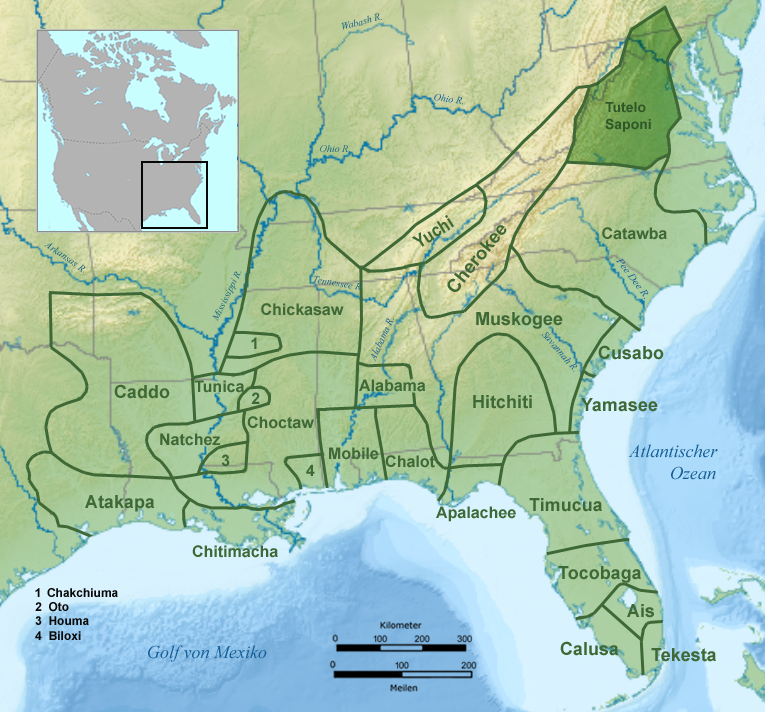
The Tutelo (also Totero, Totteroy, Tutera; Yesan in Tutelo) were Native Americans in the United States, Native American people living above the Atlantic Seaboard fall line, Fall Line in present-day Virginia and West Virginia. They spoke a Siouan dialect of the Tutelo language thought to be similar to that of their neighbors, the Monacan (tribe), Monacan and Manahoac nations. Under pressure from English settlers and Seneca people, Seneca Iroquois, they joined with other Virginia Siouan tribes in the late 17th century and became collectively known as the Nahyssan. By 1740, they had largely left Virginia and migrated north to seek protection from their former Iroquois opponents. They were adopted by the Cayuga people, Cayuga tribe of New York (state), New York in 1753. Ultimately, their descendants migrated into Canada. Name The English name ''Tutelo'' comes from the Algonquian variant of the name that the Iroquois used for all the Virginia Siouan tribes: Toderochrone(many variant s ... [...More Info...] [...Related Items...] OR: [Wikipedia] [Google] [Baidu] |
Cheraw
The Cheraw people, also known as the Saraw or Saura, were a Siouan-speaking tribe of indigenous people of the Southeastern Woodlands, in the Piedmont area of North Carolina near the Sauratown Mountains, east of Pilot Mountain and north of the Yadkin River. They lived in villages near the Catawba River.Rudes ''et al.'' 310 Their first European and African contact was with the Hernando De Soto Expedition in 1540. The early explorer John Lawson included them in the larger eastern-Siouan confederacy, which he called "the Esaw Nation."''Handbook of the American Indian North of Mexico'', 1906 After attacks in the late 17th century and early 18th century, they moved to the southeast around the Pee Dee River, where the Cheraw name became more widely used. They became extinct as a tribe, although some descendants survived as remnant peoples. Name Originally known as the Saraw, they became known by the name of one of their villages, Cheraw.Demallie 296 They are also known as the Chará ... [...More Info...] [...Related Items...] OR: [Wikipedia] [Google] [Baidu] |
Yadkinville
Yadkinville is a town in Yadkin County, North Carolina, United States. The population was 2,995 at the 2020 census. Located in the Piedmont Triad, it is the county seat and largest city of Yadkin County. History The area was chosen as the county seat with the founding of Yadkin County in 1850. It was first known as Wilson, in honor of Louis D. Wilson, a legislator who died in the Mexican War. However, the name was changed to Yadkinville in 1852 after it was discovered that another area, Wilson, North Carolina, already had the name. At the time the county seat was established, there was only one house in town. Yadkinville was incorporated in 1857. The first courthouse, a two-story brick building, was built in 1853 by William White of Hamptonville, North Carolina. The bricks were handmade on a farm north of town. The courthouse was torn down in 1958 and a new building was constructed. The Second Yadkin County Jail was listed on the National Register of Historic Places in 1988. Geog ... [...More Info...] [...Related Items...] OR: [Wikipedia] [Google] [Baidu] |
Yadkin County, North Carolina
Yadkin County is located in the U.S. state of North Carolina. As of the 2020 census, the population was 37,214. Its county seat is Yadkinville. Yadkin County is included in the Winston-Salem, NC Metropolitan Statistical Area, which is also included in the Greensboro-Winston-Salem- High Point, NC Combined Statistical Area. History The county was formed in 1850 from the part of Surry County south of the Yadkin River, for which it was named. Geography According to the U.S. Census Bureau, the county has a total area of , of which is land and (0.8%) is water. Yadkin County is located in the Piedmont region of central North Carolina. The Piedmont consists of rolling farmlands frequently broken by hills or valleys formed by streams. The extreme western section of the county contains the Brushy Mountains, a deeply eroded spur of the much higher Blue Ridge Mountains to the west. Yadkin County marks the eastern end of the Brushy Mountains range; none of the peaks rise more than 400 ... [...More Info...] [...Related Items...] OR: [Wikipedia] [Google] [Baidu] |
Siouan Languages
Siouan or Siouan–Catawban is a language family of North America that is located primarily in the Great Plains, Ohio and Mississippi valleys and southeastern North America with a few other languages in the east. Name Authors who call the entire family ''Siouan'' distinguish the two branches as '' Western Siouan'' and '' Eastern Siouan'' or as ''Siouan-proper'' and ''Catawban''. Others restrict the name "Siouan" to the western branch and use the name ''Siouan–Catawban'' for the entire family. Generally, however, the name "Siouan" is used without distinction. Family division Siouan languages can be grouped into the Western Siouan languages and Catawban languages. The Western Siouan languages can be divided into Missouri River languages (such as Crow and Hidatsa), Mandan, Mississippi River languages (such as Dakotan, Chiwere- Winnebago, and Dhegihan languages), and Ohio Valley Siouan branches. The Catawban languages consist only of Catawban and Woccon. Proto-Siouan Previou ... [...More Info...] [...Related Items...] OR: [Wikipedia] [Google] [Baidu] |
Cheraw, South Carolina
Cheraw ( , ) is a city on the Pee Dee River in Chesterfield County, South Carolina, United States. The population was 5,040 at the 2020 census. The greater Cheraw area in the zip code 29520 has a population of 13,689 according to the 2019 ACS data. It has been nicknamed "The Prettiest Town in Dixie". History Origins When the first Europeans arrived in the area it was inhabited by the Cheraw and Pee Dee American Indian tribes. The Cheraw lived near the waterfall hill, near present-day Cheraw, but by the 1730s they had been devastated by new infectious disease inadvertently carried by the European traders. Survivors joined the Catawba Confederacy for safety and left their name in history. Only a few scattered Cheraw families remained by the time of the American Revolution. A few European settlers entered their territory in the 1730s, and were then forced upriver when the Welsh came to claim the Welsh Baptist lands granted by the English government in the area around Society ... [...More Info...] [...Related Items...] OR: [Wikipedia] [Google] [Baidu] |


