|
Wyre Way
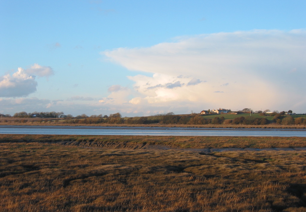
The Wyre Way is a series of hiking paths, largely within the Borough of Wyre, Lancashire, England. It is part of the Lancashire Coastal Way, established in 1991.''A History of Blackpool, the Fylde and South Wyre'' – Nick Moore (2018), p. 1003 It contains three routes, the most easterly of which ends near the source of the River Wyre in the Forest of Bowland. Route The first route runs between Fleetwood and |
Borough Of Wyre
Wyre is a local government district with borough status in Lancashire, England. The population of the non-metropolitan district at the 2011 census was 107,749. The district borders the unitary authority area of Blackpool as well as the districts of Lancaster, Ribble Valley, Fylde and Preston. The council is based in Poulton-le-Fylde. The district is named after the River Wyre, which runs through the district. The district is a rare contemporary example of a non-contiguous local government area. There are no road or rail connections between the parts of the borough divided by the River Wyre, and it is necessary to travel through the Fylde district in order to travel between the two divided parts of Wyre, or else use the passenger ferry between Fleetwood and Knott End. The borough also includes parts of Blackpool built-up area. History The district was created on 1 April 1974 under the Local Government Act 1972, as a non-metropolitan district covering the territory of fi ... [...More Info...] [...Related Items...] OR: [Wikipedia] [Google] [Baidu] |
Garstang
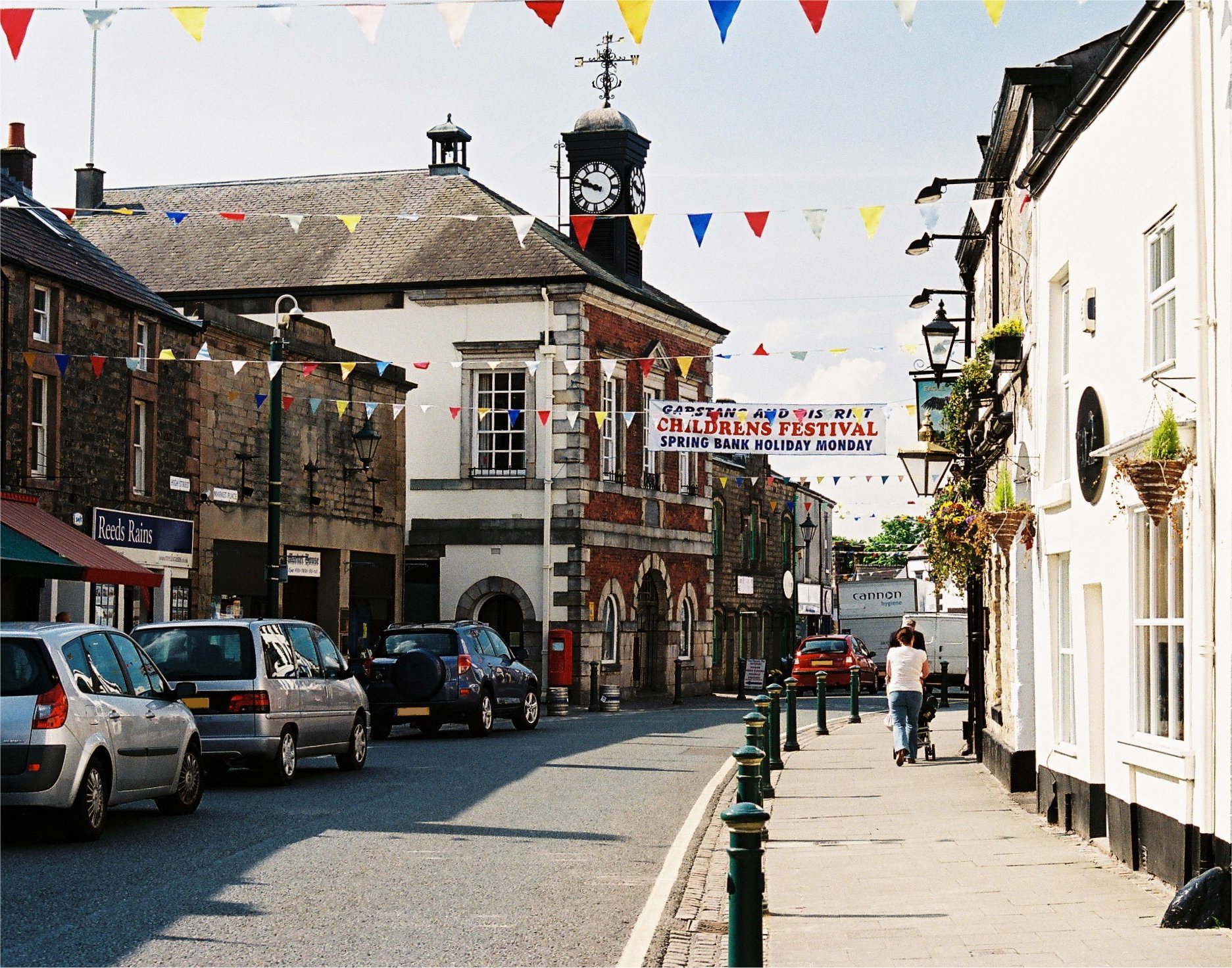
Garstang is an ancient market town and civil parish within the Wyre borough of Lancashire, England. It is north of the city of Preston and the same distance south of Lancaster. In 2011, the parish had a total resident population of 4,268; the larger Garstang Built-up Area, which includes the adjoining settlements of Bonds and Cabus, had population of 6,779. Garstang is famous for being the world's first ever Fairtrade Town. Etymology Garstang is mentioned in the Domesday Book as ''Cherestanc in 1086''. Later recordings of the name include Geresteng, Gairstang in 1195; Grestein, 1204; Gayrestan, 1236; Gayerstang, 1246; Gayrstang, 1274; Gayrestang, 1292. The original spelling of Garstang has several interpretations: "'gore by the boundary pole", "spear post", "triangular piece of land", "common land" or "meadowland". Possibly signifying the site of a meeting-space. The Old Norse derivation being 'geiri', a gore, from 'geirr', with 'stang' or 'stong', meaning "pole" or "bo ... [...More Info...] [...Related Items...] OR: [Wikipedia] [Google] [Baidu] |
Long-distance Footpaths In England
Long distance or Long-distance may refer to: *Long-distance calling *Long-distance operator *Long-distance relationship * Long-distance train *Long-distance anchor pylon, see dead-end tower Footpaths *Long-distance trail *European long-distance paths *Long Distance Routes, official term for footpaths in Scotland *List of long-distance footpaths *Long-distance footpaths in the United Kingdom *Long-distance trails in the United States *Long-distance trails in the Republic of Ireland Arts and media * ''Long Distance'' (Ivy album), 2001 * ''Long Distance'' (Runrig album), 1996 * "Long Distance" (song), a 2008 song by Brandy Norwood * "Long Distance" (Melanie Amaro song), 2012 *"Long Distance", by 8stops7 from the album ''Birth of a Cynic'' *Long Distance (film), a 1961 Australian television film *''Long Distance'', a 2015 IDW Publishing comics series Sports *Long-distance riding *Long-distance running *Long-distance swimming See also *"Long Distance Call", an episode of ' ... [...More Info...] [...Related Items...] OR: [Wikipedia] [Google] [Baidu] |
Over Wyresdale
Over Wyresdale is a civil parish and a parish of the Church of England in the City of Lancaster in the English county of Lancashire. It has a population of 348, decreasing to 316 at the 2011 Census. The parish includes the hamlets of Abbeystead, Lee, Lower Green Bank, Ortner, Marshaw and Tarnbrook. The parish church, Christ Church is located about a mile to the west of Abbeystead. The vast majority (around 16,000 acres) of the land in the parish lies within the Abbeystead Estate, which is the property of the Duke of Westminster, and which extends into neighbouring parishes to a total extent of approximately 23,000 acres. Of the hamlets, only Lower Green Bank does not form a part of the Abbeystead Estate. The only other significant landowner is the Leigh family. See also * Listed buildings in Over Wyresdale References Geography of the City of Lancaster Civil parishes in Lancashire {{Lancashire-geo-stub ... [...More Info...] [...Related Items...] OR: [Wikipedia] [Google] [Baidu] |
Shard Riverside Inn
Shard Riverside Inn is a public house and boutique hotel in the English village of Hambleton, Lancashire. Dating to 1766, it stands on the northern banks of the River Wyre, about east of Shard Bridge, for which it is named. The bridge used to be immediately to the west of the building, but a new structure (the third overall) was built in 1993, a few yards downstream, and its predecessor demolished. The building's address, Old Bridge Lane, references this. History In the early 19th century, the building was a ferryman's cottage known as Shard House. The slipway for the ferry still exists in front of the property.Walk Through Time – Shard Riverside Inn website Around fifty years later, in |
Wyre Estuary Country Park
Wyre Estuary Country Park is located in Thornton-Cleveleys, Lancashire, England. Established in 1991''A History of Blackpool, the Fylde and South Wyre'' – Nick Moore (2018), p. 1003 and covering , it is situated on the western banks of the long , near its mouth at the at . The Wyre estuary forms part of the southern boundary of |
Abbeystead
Abbeystead is a small hamlet located in the Forest of Bowland Area of Outstanding Natural Beauty, in Lancashire, England. Abbeystead lies close to the Trough of Bowland but even in medieval times, was considered part of Wyresdale rather than within the domain of that powerful local magnate, the Lord of Bowland, so-called Lord of the Fells. Abbeystead is located in the civil and ecclesiastical parish of Over Wyresdale. History Little is known of the history of Abbeystead before the Norman Conquest, except that it was occupied from at least the middle of the prehistoric period. Name The name is derived from "the site of the abbey" and relates to the short-lived presence of a house of Cistercian monks from Furness Abbey between c.1192 and 1204. One tradition sites the monks' house just below the junction of the Marshaw Wyre and the Tarnbrook Wyre, on the north side of the reservoir. Another places it around the site of the primary school. Structures Notable buildings in the ... [...More Info...] [...Related Items...] OR: [Wikipedia] [Google] [Baidu] |
Over Wyre
Over Wyre is the collective name given to a group of villages in Lancashire, England, situated on the Fylde, to the north and east of the River Wyre. The group is usually considered to include Hambleton, Stalmine, Knott End-on-Sea, Preesall, Pilling and Out Rawcliffe. The name distinguishes these villages from the larger southern part of the Fylde, between the Wyre and the Ribble, which includes the urban areas of Blackpool, Poulton-le-Fylde, Thornton, Cleveleys, Fleetwood and Lytham St Annes Lytham St Annes () is a seaside town in the Borough of Fylde in Lancashire, England. It is on the The Fylde, Fylde coast, directly south of Blackpool on the Ribble Estuary. The population at the United Kingdom Census 2011, 2011 census was 42,954 .... External links Over-Wyre and Knott End History and Topography Geography of the Borough of Wyre The Fylde {{Lancashire-geo-stub ... [...More Info...] [...Related Items...] OR: [Wikipedia] [Google] [Baidu] |
Wyre Estuary Ferry
The Wyre Estuary Ferry (colloquially known as the Fleetwood-to-Knott End Ferry) is a ferry crossing owned and operated by Wyre Marine Services in Fleetwood, Lancashire, England. The crossing of the River Wyre, which is funded by Lancashire County Council and Wyre Borough Council, takes around five minutes to complete. By road, the journey between the two points is , which takes around thirty-five minutes. The ferry operates daily between 7:45 AM and 5:45 PM, and can carry up to thirty-five passengers. No motorised vehicles are permitted. The current ferry is named the ''Wyre Rose''. It has 34 seats.'''' The crossing was established in 1841 by the Croft family, who operated it until 1893, when the Ferry Committee of the Improvement Act District of Fleetwood took it over. They leased the management of it to Newsham and Myerscroft. [...More Info...] [...Related Items...] OR: [Wikipedia] [Google] [Baidu] |
Lancashire
Lancashire ( , ; abbreviated Lancs) is the name of a historic county, ceremonial county, and non-metropolitan county in North West England. The boundaries of these three areas differ significantly. The non-metropolitan county of Lancashire was created by the Local Government Act 1972. It is administered by Lancashire County Council, based in Preston, and twelve district councils. Although Lancaster is still considered the county town, Preston is the administrative centre of the non-metropolitan county. The ceremonial county has the same boundaries except that it also includes Blackpool and Blackburn with Darwen, which are unitary authorities. The historic county of Lancashire is larger and includes the cities of Manchester and Liverpool as well as the Furness and Cartmel peninsulas, but excludes Bowland area of the West Riding of Yorkshire transferred to the non-metropolitan county in 1974 History Before the county During Roman times the area was part of the Bri ... [...More Info...] [...Related Items...] OR: [Wikipedia] [Google] [Baidu] |
Shard Bridge
Shard Bridge is a bridge in the English county of Lancashire. It spans the River Wyre, connecting Singleton, on the southern side of the river, to Hambleton, on its northern side (an area known locally as "Over Wyre"), carrying both automotive and pedestrian traffic of Shard Road (the A588). The word ''shard'' is a Roman term for "low crossing point on a river".''A History of Blackpool, the Fylde and south Wyre'', Nick Moore (2018), p. 21 The original bridge was built in 1864, and it went on to replace a ferry service between Stanah and Wardleys Creek further downstream to the west. The bridge was moved a few yards downstream in 1993 when the first of its two current iterations was constructed. Formerly a toll bridge, Shard Bridge is now a free municipal A municipality is usually a single administrative division having corporate status and powers of self-government or jurisdiction as granted by national and regional laws to which it is subordinate. The term ''municip ... [...More Info...] [...Related Items...] OR: [Wikipedia] [Google] [Baidu] |
Knott End-on-Sea
Knott End-on-Sea is a village in Lancashire, England, on the southern side of Morecambe Bay, across the Wyre estuary from Fleetwood. Knott End has a pub, the Bourne Arms, county library and golf club. Buses run regularly from Knott End and there is also a three-minute ferry crossing to Fleetwood. Knott End also has two clubs, The Squash and Knott End Working Men's Club. See also * Knott End Railway *Knott End-on-Sea railway station Knott End railway station served Knott End on Sea in Lancashire, England, with a ferry service to Fleetwood. The station opened in 1908 and closed for passengers in 1930 and for freight in 1950. History The station opened on 30 July 1908 by ... External links Preesall Town CouncilWyre Borough CouncilLancashire County CouncilLocal InformationOver-Wyre and Knott End History and TopographyVisit Poulton-le-Fylde, local photos and video Villages in Lancashire Geography of the Borough of Wyre The Fylde Populated coastal places in Lanc ... [...More Info...] [...Related Items...] OR: [Wikipedia] [Google] [Baidu] |


