|
Wymering
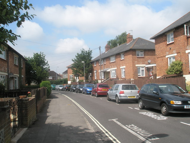
Wymering is a residential area of the city of Portsmouth in the English county of Hampshire. Unlike the majority of Portsmouth, it is located on the mainland rather than Portsea Island. Wymering was one of the estates held by Hampshire's biggest landowner Edward the Confessor immediately before the Norman conquest. Wymering is mentioned in the Domesday Book and was a small village in rural area until it was incorporated into Portsmouth in 1920. On incorporation into Portsmouth a 300-house council housing estate was built there, being completed by 1929. In addition to the mediaeval church, one building that did remain is Wymering Manor. The manor is the oldest building in Portsmouth. It has been a Youth Hostel A hostel is a form of low-cost, short-term shared sociable lodging where guests can rent a bed, usually a bunk bed in a dormitory, with shared use of a lounge and sometimes a kitchen. Rooms can be mixed or single-sex and have private or shared ba ... in its past but i ... [...More Info...] [...Related Items...] OR: [Wikipedia] [Google] [Baidu] |
Wymering Manor
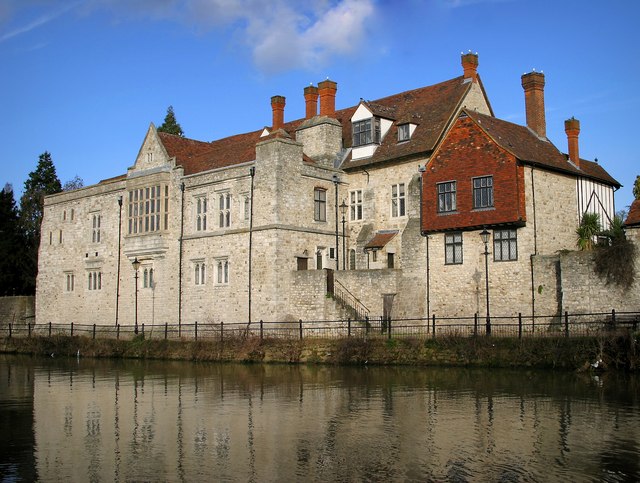
Wymering Manor is a Grade II* listed building, which is the oldest in the city of Portsmouth, England, and was the manor house of Wymering, a settlement mentioned in the Domesday Book of 1086. It is first recorded in 1042, when it was owned by King Edward the Confessor. After the Battle of Hastings it became the property of King William the Conqueror, until 1084. History A Roman settlement existed at Wymering from c.43 AD to 408 – a marshy coastline ran close to the present site of Wymering Manor and a Roman outpost camp was likely to have been sited there to defend Portchester Castle. Medieval In Saxon times, c.409, a tribal leader named Wimm lived near the shore of Paulsgrove Lake and may have included the land of Wymering Manor in his village. The first recorded occupant of Wymering Manor was William Mauduit who probably came across with the invasion of 1066 from his home in Normandy and was involved in local research for the Great Survey of 1086 – known as the Domesd ... [...More Info...] [...Related Items...] OR: [Wikipedia] [Google] [Baidu] |
Portsmouth
Portsmouth ( ) is a port and city in the ceremonial county of Hampshire in southern England. The city of Portsmouth has been a unitary authority since 1 April 1997 and is administered by Portsmouth City Council. Portsmouth is the most densely populated city in the United Kingdom, with a population last recorded at 208,100. Portsmouth is located south-west of London and south-east of Southampton. Portsmouth is mostly located on Portsea Island; the only English city not on the mainland of Great Britain. Portsea Island has the third highest population in the British Isles after the islands of Great Britain and Ireland. Portsmouth also forms part of the regional South Hampshire conurbation, which includes the city of Southampton and the boroughs of Eastleigh, Fareham, Gosport, Havant and Waterlooville. Portsmouth is one of the world's best known ports, its history can be traced to Roman times and has been a significant Royal Navy dockyard and base for centuries. Portsm ... [...More Info...] [...Related Items...] OR: [Wikipedia] [Google] [Baidu] |
Portsea Island
Portsea Island is a flat and low-lying natural island in area, just off the southern coast of Hampshire in England. Portsea Island contains the majority of the city of Portsmouth. Portsea Island has the third-largest population of all the islands in the British Isles after the mainlands of Great Britain and Ireland; it also has the highest population density of any British Isle, and Portsmouth has the highest population density of any city in the UK outside of London. To the east of Portsea Island lies Hayling Island, separated by Langstone Harbour. To the west is the peninsular mainland town of Gosport, separated by Portsmouth Harbour. To the south, it faces into the Spithead area of the wider Solent. A narrow tidal channel along the northern edge of Portsea Island, known as Portsbridge Creek, separates Portsea Island from the mainland. Three roads connect Portsea Island to the mainland road network; the M275 motorway, the A3 London Road (split on two separate bridge ... [...More Info...] [...Related Items...] OR: [Wikipedia] [Google] [Baidu] |
Maidstone Crescent - Geograph
Maidstone is the largest Town status in the United Kingdom, town in Kent, England, of which it is the county town. Maidstone is historically important and lies 32 miles (51 km) east-south-east of London. The River Medway runs through the centre of the town, linking it with Rochester, Kent, Rochester and the Thames Estuary. Historically, the river carried much of the town's trade as the centre of the agricultural county of Kent, known as the Garden of England. There is evidence of settlement in the area dating back before the Stone Age. The town, part of the borough of Maidstone, had an approximate population of 100,000 in 2019. Since World War II, the town's economy has shifted from heavy industry towards light industry and services. Toponymy Anglo-Saxon period of English history, Saxon charters dating back to ca. 975 show the first recorded instances of the town's name, ''de maeides stana'' and ''maegdan stane'', possibly meaning ''stone of the maidens'' or ''stone of the ... [...More Info...] [...Related Items...] OR: [Wikipedia] [Google] [Baidu] |
Residential
A residential area is a land used in which housing predominates, as opposed to industrial and commercial areas. Housing may vary significantly between, and through, residential areas. These include single-family housing, multi-family residential, or mobile homes. Zoning for residential use may permit some services or work opportunities or may totally exclude business and industry. It may permit high density land use or only permit low density uses. Residential zoning usually includes a smaller FAR (floor area ratio) than business, commercial or industrial/manufacturing zoning. The area may be large or small. Overview In certain residential areas, especially rural, large tracts of land may have no services whatever, such that residents seeking services must use a motor vehicle or other transportation, so the need for transportation has resulted in land development following existing or planned transport infrastructure such as rail and road. Development patterns may be re ... [...More Info...] [...Related Items...] OR: [Wikipedia] [Google] [Baidu] |
Hampshire
Hampshire (, ; abbreviated to Hants) is a ceremonial county, ceremonial and non-metropolitan county, non-metropolitan counties of England, county in western South East England on the coast of the English Channel. Home to two major English cities on its south coast, Southampton and Portsmouth, Hampshire is the 9th-most populous county in England. The county town of Hampshire is Winchester, located in the north of the county. The county is bordered by Dorset to the south-west, Wiltshire to the north-west, Berkshire to the north, Surrey to the north-east, and West Sussex to the south east. The county is geographically diverse, with upland rising to and mostly south-flowing rivers. There are areas of downland and marsh, and two national parks: the New Forest National Park, New Forest and part of the South Downs National Park, South Downs, which together cover 45 per cent of Hampshire. Settled about 14,000 years ago, Hampshire's recorded history dates to Roman Britain, when its chi ... [...More Info...] [...Related Items...] OR: [Wikipedia] [Google] [Baidu] |
Edward The Confessor
Edward the Confessor ; la, Eduardus Confessor , ; ( 1003 – 5 January 1066) was one of the last Anglo-Saxon English kings. Usually considered the last king of the House of Wessex, he ruled from 1042 to 1066. Edward was the son of Æthelred the Unready and Emma of Normandy. He succeeded Cnut the Great's son – and his own half-brother – Harthacnut. He restored the rule of the House of Wessex after the period of Danish rule since Cnut conquered England in 1016. When Edward died in 1066, he was succeeded by his wife's brother Harold Godwinson, who was defeated and killed in the same year by the Normans under William the Conqueror at the Battle of Hastings. Edward's young great-nephew Edgar the Ætheling of the House of Wessex was proclaimed king after the Battle of Hastings in 1066 but was never crowned and was peacefully deposed after about eight weeks. Historians disagree about Edward's fairly long 24-year reign. His nickname reflects the traditional image ... [...More Info...] [...Related Items...] OR: [Wikipedia] [Google] [Baidu] |
Domesday Book
Domesday Book () – the Middle English spelling of "Doomsday Book" – is a manuscript record of the "Great Survey" of much of England and parts of Wales completed in 1086 by order of King William I, known as William the Conqueror. The manuscript was originally known by the Latin name ''Liber de Wintonia'', meaning "Book of Winchester", where it was originally kept in the royal treasury. The '' Anglo-Saxon Chronicle'' states that in 1085 the king sent his agents to survey every shire in England, to list his holdings and dues owed to him. Written in Medieval Latin, it was highly abbreviated and included some vernacular native terms without Latin equivalents. The survey's main purpose was to record the annual value of every piece of landed property to its lord, and the resources in land, manpower, and livestock from which the value derived. The name "Domesday Book" came into use in the 12th century. Richard FitzNeal wrote in the ''Dialogus de Scaccario'' ( 1179) that the book ... [...More Info...] [...Related Items...] OR: [Wikipedia] [Google] [Baidu] |
Council House
A council house is a form of British public housing built by local authorities. A council estate is a building complex containing a number of council houses and other amenities like schools and shops. Construction took place mainly from 1919 after the Housing Act 1919 to the 1980s, with much less council housing built since then. There were local design variations, but they all adhered to local authority building standards. The Housing Acts of 1985 and 1988 facilitated the transfer of council housing to not-for-profit housing associations with access to private finance, and these new housing associations became the providers of most new public-sector housing. By 2003, 36.5% of the social rented housing stock was held by housing associations. History House design in the United Kingdom is defined by a series of Housing Acts, and public housing house design is defined by government directives and central governments' relationship with local authorities. From the first interventi ... [...More Info...] [...Related Items...] OR: [Wikipedia] [Google] [Baidu] |
Hostel
A hostel is a form of low-cost, short-term shared sociable lodging where guests can rent a bed, usually a bunk bed in a dormitory, with shared use of a lounge and sometimes a kitchen. Rooms can be mixed or single-sex and have private or shared bathrooms. Private rooms may also be available, but the property must offer dormitories to be considered a hostel. Hostels are popular forms of lodging for backpackers. They are part of the sharing economy. Benefits of hostels include lower costs and opportunities to meet people from different places, find travel partners, and share travel ideas. Some hostels, such as Zostel in India or Hostelling International, cater to a niche market of travelers. For example, one hostel might feature in-house social gatherings such as movie nights or communal dinners, another might feature local tours, one might be known for its parties, and another might have a quieter place to relax in serenity, or be located on the beach. Newer hostels focus on a mo ... [...More Info...] [...Related Items...] OR: [Wikipedia] [Google] [Baidu] |

2009.jpg)


