|
Wyaston
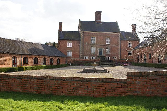
Wyaston is a hamlet in Derbyshire, England. It is located 3 miles south of Ashbourne, Derbyshire, Ashbourne. Wyaston is in the civil parish of Edlaston and Wyaston. This is southeast of Edlaston, both have a long history as separate Township, townships, yet they form a single, if dispersed village. The parish contains some of the highest land locally, the parish peak of is by the central road junction in Wyaston. A community hall is in use at Wyaston village. History The village was recorded in Domesday Book, Domesday, as ''Widerdestune'', meaning 'Wīgh(e)ard's farm'. It once was a township in the parish, and although less prominent because of the church at Edlaston, it eventually became the larger settlement, with 25 houses and 122 inhabitants by 1848. A key landowner of the time was William Greaves. Wyaston House was described at the time as a mansion and seat of Nathaniel Need. Wyaston Grove was occupied by Rev John Grundy. There was a Methodist chapel in the village u ... [...More Info...] [...Related Items...] OR: [Wikipedia] [Google] [Baidu] |
Edlaston And Wyaston
Edlaston and Wyaston is a civil parish within the Derbyshire Dales district, in the county of Derbyshire, England. The parish includes the villages of Edlaston and Wyaston. In 2011 the parish had a population of 220. It is north west of London, north west of the county city of Derby, and south of the market town of Ashbourne, Derbyshire, Ashbourne. Edlaston and Wyaston touches the parishes of Clifton and Compton, Osmaston, Derbyshire Dales, Osmaston, Rodsley, Shirley, Derbyshire, Shirley, Snelston and Yeaveley. There are seven listed buildings in Edlaston and Wyaston. Toponymy Edlaston: Appears to derive from 'Eadwulf's farm'. This was reported in Domesday Book, Domesday as ''Dulvestune'', before a recognisable modern form appearing in public records from the 12th century. Wyaston: Also in Domesday, as ''Widerdestune'', meaning 'Wīgh(e)ard's farm'. Edlaston and Wyaston, as an ecclesiastical and subsequent political entity, the two settlements have been combined as a pari ... [...More Info...] [...Related Items...] OR: [Wikipedia] [Google] [Baidu] |
Listed Buildings In Edlaston And Wyaston
Edlaston and Wyaston is a civil parish in the Derbyshire Dales district of Derbyshire, England. The parish contains seven listed buildings that are recorded in the National Heritage List for England. Of these, one is listed at Grade II*, the middle of the three grades, and the others are at Grade II, the lowest grade. The parish contains the villages of Edlaston and Wyaston Wyaston is a hamlet in Derbyshire, England. It is located 3 miles south of Ashbourne, Derbyshire, Ashbourne. Wyaston is in the civil parish of Edlaston and Wyaston. This is southeast of Edlaston, both have a long history as separate Township, ... and the surrounding area. The listed buildings consist of a church, a cross and two tombs in the churchyard, two houses, and farm buildings. __NOTOC__ Key Buildings References Citations Sources * * * * * * * * * {{DEFAULTSORT:Edlaston and Wyaston Lists of listed buildings in Derbyshire ... [...More Info...] [...Related Items...] OR: [Wikipedia] [Google] [Baidu] |
Edlaston
Edlaston is a village three miles south of Ashbourne in Derbyshire, just off the A515 road. It is in close proximity to the hamlet of Wyaston, and the civil parish is called Edlaston and Wyaston. It had a population of 220 at the 2011 Census. It is very rural as the land is light and stony with a clay subsoil, which is suitable for dairy pasture. The village consists of a few farms and cottages and a traditional stone built public house The Shire Horse on the outer east edge of the village. To the west of the village is Edlaston Hall. It and its outbuildings have been converted to multiple dwellings. History Edlaston is mentioned in Domesday book as "Dulvestune", and later "Edolveston", meaning "Eadwulf's farm". The manor of Edlaston was given to the prior and convent of Tutbury by Earl Ferrers, son of the founder. After the Reformation it was granted by Henry VIII in 1548 to William Paget, who a year afterwards sold it to Sir Edward Aston. Later it belonged to the Eyres of H ... [...More Info...] [...Related Items...] OR: [Wikipedia] [Google] [Baidu] |
Derbyshire Dales
Derbyshire Dales ( ) is a local government district in Derbyshire, England. The population at the 2011 Census was 71,116. Much of it is in the Peak District, although most of its population lies along the River Derwent. The borough borders the districts of High Peak, Amber Valley, North East Derbyshire and South Derbyshire in Derbyshire, Staffordshire Moorlands and East Staffordshire in Staffordshire and Sheffield in South Yorkshire. The district also lies within the Sheffield City Region, and the district council is a non-constituent partner member of the Sheffield City Region Combined Authority. A significant amount of the working population is employed in Sheffield and Chesterfield. The district offices are at Matlock Town Hall in Matlock. It was formed on 1 April 1974, originally under the name of West Derbyshire. The district adopted its current name on 1 January 1987. The district was a merger of Ashbourne, Bakewell, Matlock and Wirksworth urban districts alon ... [...More Info...] [...Related Items...] OR: [Wikipedia] [Google] [Baidu] |
Derbyshire
Derbyshire ( ) is a ceremonial county in the East Midlands, England. It includes much of the Peak District National Park, the southern end of the Pennine range of hills and part of the National Forest. It borders Greater Manchester to the north-west, West Yorkshire to the north, South Yorkshire to the north-east, Nottinghamshire to the east, Leicestershire to the south-east, Staffordshire to the west and south-west and Cheshire to the west. Kinder Scout, at , is the highest point and Trent Meadows, where the River Trent leaves Derbyshire, the lowest at . The north–south River Derwent is the longest river at . In 2003, the Ordnance Survey named Church Flatts Farm at Coton in the Elms, near Swadlincote, as Britain's furthest point from the sea. Derby is a unitary authority area, but remains part of the ceremonial county. The county was a lot larger than its present coverage, it once extended to the boundaries of the City of Sheffield district in South Yorkshire where it cov ... [...More Info...] [...Related Items...] OR: [Wikipedia] [Google] [Baidu] |
Ashbourne, Derbyshire
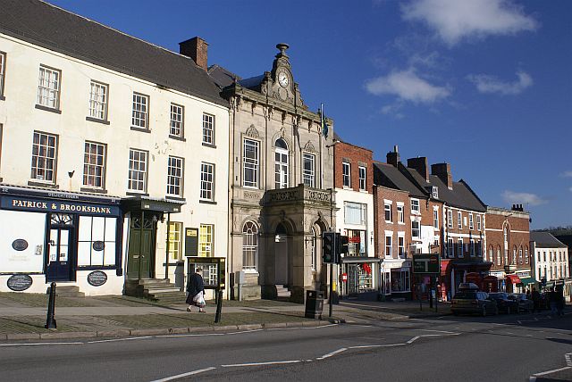
Ashbourne is a market town in the Derbyshire Dales district in Derbyshire, England. Its population was measured at 8,377 in the 2011 census and was estimated to have grown to 9,163 by 2019. It has many historical buildings and independent shops. The town offers a historic annual Shrovetide football match. Its position near the southern edge of the Peak District makes it the closest town to Dovedale, to which Ashbourne is sometimes referred to as the gateway. The town is west of Derby, south-east of Buxton, east of Stoke-on-Trent, south-south-east of Manchester, south-west of Sheffield and north of Lichfield. Nearby towns include Matlock, Uttoxeter, Leek, Cheadle and Bakewell. History The town's name derives from the Old English ''æsc-burna'' meaning "stream with ash trees". Ashbourne was granted a market charter in 1257. In medieval times it was a frequent rest stop for pilgrims walking "St Non's Way" to the shrine of Saint Fremund at Dunstable in Bedfordshire. T ... [...More Info...] [...Related Items...] OR: [Wikipedia] [Google] [Baidu] |
Civil Parish
In England, a civil parish is a type of administrative parish used for local government. It is a territorial designation which is the lowest tier of local government below districts and counties, or their combined form, the unitary authority. Civil parishes can trace their origin to the ancient system of ecclesiastical parishes, which historically played a role in both secular and religious administration. Civil and religious parishes were formally differentiated in the 19th century and are now entirely separate. Civil parishes in their modern form came into being through the Local Government Act 1894, which established elected parish councils to take on the secular functions of the parish vestry. A civil parish can range in size from a sparsely populated rural area with fewer than a hundred inhabitants, to a large town with a population in the tens of thousands. This scope is similar to that of municipalities in Continental Europe, such as the communes of France. However, ... [...More Info...] [...Related Items...] OR: [Wikipedia] [Google] [Baidu] |


