|
Wornall Road
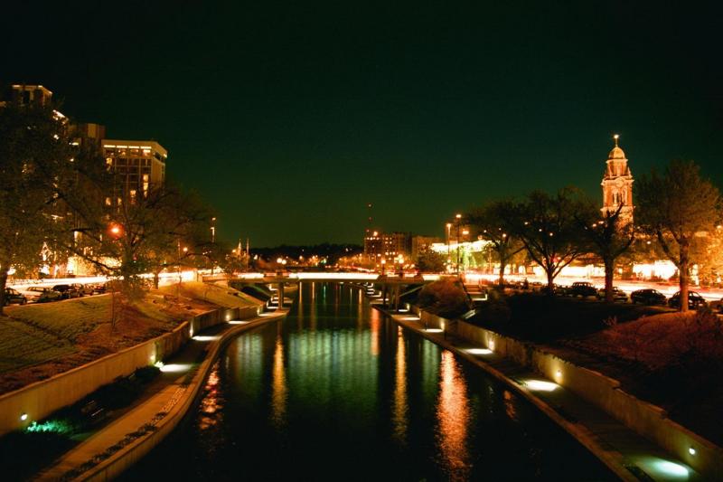
Wornall Road is a major north–south road in Kansas City, Missouri. It is named for John Bristow Wornall, an early settler of Kansas City, whose estate still stands today as a museum. Route description Wornall Road begins at 42nd Street in the Old Westport neighborhood. This section dead-ends after one block, interrupted by the campus of St. Luke's Hospital. Wornall then picks back up on the other side, extending to 47th Street on the Plaza. After a one-block interruption in the Plaza (where the road is named Broadway Street), Wornall Road begins in earnest after it crosses Brush Creek and Ward Parkway at the south end of the Plaza. Upon leaving the Plaza, Wornall Road climbs up a hill and passes by Loose Park. Between Ward Parkway and Gregory Boulevard (formerly 71st Street), Wornall is a largely residential street, passing through the up-market neighborhoods of Country Club District and Brookside. It is along this stretch (at the corner with 61st Terrace) that the Wornall ... [...More Info...] [...Related Items...] OR: [Wikipedia] [Google] [Baidu] |
Kansas City, Missouri
Kansas City (abbreviated KC or KCMO) is the largest city in Missouri by population and area. As of the 2020 census, the city had a population of 508,090 in 2020, making it the 36th most-populous city in the United States. It is the central city of the Kansas City metropolitan area, which straddles the Missouri–Kansas state line and has a population of 2,392,035. Most of the city lies within Jackson County, with portions spilling into Clay, Cass, and Platte counties. Kansas City was founded in the 1830s as a port on the Missouri River at its confluence with the Kansas River coming in from the west. On June 1, 1850, the town of Kansas was incorporated; shortly after came the establishment of the Kansas Territory. Confusion between the two ensued, and the name Kansas City was assigned to distinguish them soon after. Sitting on Missouri's western boundary with Kansas, with Downtown near the confluence of the Kansas and Missouri Rivers, the city encompasses about , making ... [...More Info...] [...Related Items...] OR: [Wikipedia] [Google] [Baidu] |
Brookside, Kansas City
Brookside is a collection of neighborhoods located in Kansas City, Missouri, bounded by 55th Street on the North, Gregory on the South, Ward Parkway on the West, and Troost on the East. The neighborhood contains the Brookside Shopping District. Brookside makes up one portion of the Country Club District, the largest contiguous master-planned community in the United States. Brookside, and the Country Club District, was designed by J.C. Nichols. The John Wornall House is a local landmark on the National Register of Historic Places located in Brookside. See also * Armour Hills, Kansas City, Missouri *Neighborhoods of Kansas City, Missouri and Kansas City, Kansas The list of neighborhoods of Kansas City, Missouri has nearly 240 neighborhoods. The list includes only Kansas City, Missouri and not the entire Kansas City metropolitan area, such as Kansas City, Kansas. Kansas City, Missouri Kansas City, Missou ... References Brookside Map External links Brookside Kansas City Websi ... [...More Info...] [...Related Items...] OR: [Wikipedia] [Google] [Baidu] |
Missouri Route 150
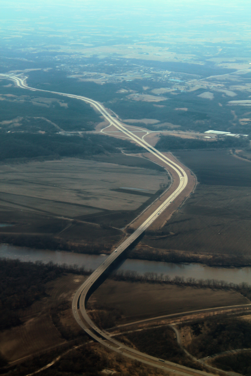
Route 150 is a highway on the south side of the Kansas City, Missouri Metro Area. It runs east from the Kansas–Missouri state border to US 50 in Lone Jack, its length totaling to around 25.6 miles. Route description In the west, Route 150 begins as it crosses from Kansas into Missouri. The highway initially heads southeastward, but soon turns towards the east and passes along the northern boundary of the former Richards-Gebaur Air Force Base. It has an interchange with I-49/US 71 and takes on the name East 147th Street. Continuing east, it then transitions into East Outer Belt Road before meeting an interchange with Route 291. Route 150 bypasses the James A. Reed Memorial Wildlife Area to the south, and its local name changes several times. East of Greenwood, it has a short concurrency with Route 7. The roughly half-mile south–north concurrency ends when Route 150 bears east through rural land. It turns due north on South Bynum Road once in Lone Jack and eventually term ... [...More Info...] [...Related Items...] OR: [Wikipedia] [Google] [Baidu] |
Martin City, Missouri
Martin City is a neighborhood of Kansas City located along the Missouri and Kansas border in Jackson County. The neighborhood was at one time its own, unincorporated town before it was annexed by the City of Kansas City, Missouri in 1963. The Martin City neighborhood is generally defined as being east of the Kansas state line, south of Blue Ridge Boulevard in areas west and north of the Blue River. It is part of the Kansas City metropolitan area. History The town of Martin City, Missouri, was located in the vicinity of 135th and Holmes Streets in present-day Kansas City, Missouri and was originally named Tilden. It was platted January 4, 1887 by E.L. Martin and John H. Lipscomb. The town of Tilden was named for Samuel Jones Tilden, a presidential candidate who was defeated by Rutherford B. Hayes in 1876 (he lost by one electoral vote). In 1895, due to the existence of another town of Tilden in Dallas County, Missouri, the town was renamed to Martin City. The name Martin Cit ... [...More Info...] [...Related Items...] OR: [Wikipedia] [Google] [Baidu] |
Avila University
Avila University is a private Roman Catholic university in Kansas City, Missouri. It is sponsored by the Sisters of St. Joseph of Carondelet and offers bachelor's degrees and master's degrees. Its 13 buildings are situated on a campus of in Kansas City. The school enrolled 1,527 students in 2019. History In 1916, on the same campus at 5600 Main Street as St. Teresa's Academy, the Sisters of St. Joseph of Carondelet founded the College of Saint Teresa. St. Teresa's College was founded as a two-year college for women only. The first graduates of St. Teresa's College received their degrees in 1918. In 1939, Kansas City Bishop Edwin O'Hara announced that St. Teresa's junior college would be expanded to a full four-year college, and the college would be housed in its own building on the campus. In 1940, ground was broken for Donnelly Hall, and it opened for classes in 1941. The first four-year graduating class received their degrees in 1942. In 1948, the college established a de ... [...More Info...] [...Related Items...] OR: [Wikipedia] [Google] [Baidu] |
Waldo, Kansas City
Waldo is a neighborhood located on the southside of Kansas City, Missouri, that has continued to maintain its own unique character, even though it was annexed by Kansas City in 1909. Waldo's boundaries are Gregory Boulevard on the north to 85th Street on the south, and Holmes Street on the east to State Line on the west. History In 1841, David Waldo of Gasconade County, Missouri, was convinced by some friends to purchase land in Jackson County, Missouri. Waldo purchased that ran from what is now Gregory to 91st Street and State Line to Holmes. In 1860 a rail line was established between Westport and Dodson, and a main stop was located in Waldo. When the rail line was converted to street cars in 1907, a brick station was built at the Waldo location, and it became known as the Grand Central Station of Waldo. Waldo was annexed by Kansas City in 1909, which pushed the southern city limit from 49th Street to 77th Street. Business began to grow around the station, including Elme ... [...More Info...] [...Related Items...] OR: [Wikipedia] [Google] [Baidu] |
Interstate 435
Interstate 435 (I-435) is an Interstate Highway beltway that encircles much of the Kansas City metropolitan area within the states of Kansas and Missouri in the United States. Route description I-435, a loop route of I-35, is long and intersects with nearly every other Interstate Highway in the Kansas City area (except for I-635 and I-670). An additional near Kansas City International Airport is signed along with I-29 and U.S. Route 71 (US 71), making I-435 the second-longest complete beltway numbered as a single Interstate Highway in the US and seventh longest in the world after I-275 in Cincinnati, Ohio, at ; Beltway 8 in Houston, Texas, at ; Bundesautobahn 10 in Berlin at ; and M25 motorway in London at ; as well as 7th and 8th ring roads in Beijing. The majority——of I-435 is within the state of Missouri, and most of that roadway lies within the city limits of Kansas City. The first/last exit is at I-435's parent route, I-35, in Lenexa, Kansas. Go ... [...More Info...] [...Related Items...] OR: [Wikipedia] [Google] [Baidu] |
Ranch-style House
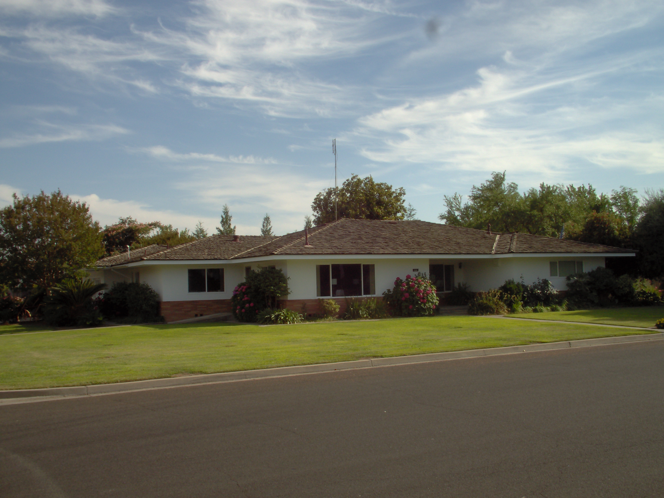
Ranch (also known as American ranch, California ranch, rambler, or rancher) is a domestic architectural style that originated in the United States. The ranch-style house is noted for its long, close-to-the-ground profile, and wide open layout. The style fused modernist ideas and styles with notions of the American Western period of wide open spaces to create a very informal and casual living style. While the original ranch style was informal and basic in design, ranch-style houses built in the United States (particularly in the Sun Belt region) from around the early 1960s increasingly had more dramatic features such as varying roof lines, cathedral ceilings, sunken living rooms, and extensive landscaping and grounds. First appearing as a residential style in the 1920s, the ranch was extremely popular with the booming post-war middle class of the 1940s to the 1970s. The style is often associated with tract housing built at this time, particularly in the southwest United States, ... [...More Info...] [...Related Items...] OR: [Wikipedia] [Google] [Baidu] |
Country Club District
The Country Club District is the name of a group of neighborhoods comprising a historic upscale residential district in Kansas City, developed by noted real estate developer J.C. Nichols. The district was developed in stages between 1906 and 1950, and today is home to approximately 60,000 and includes such well-known Kansas City neighborhoods as Sunset Hill and Brookside in Missouri, Mission Hills, Fairway, and the oldest parts of Prairie Village in Kansas, making it the largest planned community built by a single developer in the United States. Ward Parkway, a wide, manicured boulevard, traverses the district running south from the Country Club Plaza, the first suburban shopping district in the United States. History J.C. Nichols began developing the district in 1906 with a neighborhood he called Bismarck Place. As his development expanded to include Countryside, he began to develop a master plan, which he dubbed the Country Club District because of its proximity to what was t ... [...More Info...] [...Related Items...] OR: [Wikipedia] [Google] [Baidu] |
Missouri
Missouri is a U.S. state, state in the Midwestern United States, Midwestern region of the United States. Ranking List of U.S. states and territories by area, 21st in land area, it is bordered by eight states (tied for the most with Tennessee): Iowa to the north, Illinois, Kentucky and Tennessee to the east, Arkansas to the south and Oklahoma, Kansas and Nebraska to the west. In the south are the Ozarks, a forested highland, providing timber, minerals, and recreation. The Missouri River, after which the state is named, flows through the center into the Mississippi River, which makes up the eastern border. With more than six million residents, it is the List of U.S. states and territories by population, 19th-most populous state of the country. The largest urban areas are St. Louis, Kansas City, Missouri, Kansas City, Springfield, Missouri, Springfield and Columbia, Missouri, Columbia; the Capital city, capital is Jefferson City, Missouri, Jefferson City. Humans have inhabited w ... [...More Info...] [...Related Items...] OR: [Wikipedia] [Google] [Baidu] |
Loose Park
Loose Park is the third largest park in Kansas City, Missouri, located at 51st Street and Wornall Road. It has a lake, a shelter house, Civil War markers, tennis courts, a water park, picnic areas, and a Rose Garden. The Rose Garden hosts all types of outdoor special events including theatrical performances and wedding ceremonies. The Japanese Tea Room and Garden is a small traditional Japanese garden conceived as a cultural exchange between the sister cities of Kurashiki, Japan and Kansas City, Missouri. History The original pasture belonged to Kansas City pioneer Seth Ward. During the Battle of Westport in American Civil War Confederate General Sterling Price is said to have to commanded his forces from gun emplacements on what became the south end of the park. In 1897, Ward leased the land to the Kansas City Country Club for its first golf course. In 1907 J.C. Nichols bought land around the course to form the Country Club District and Country Club Plaza. In 1925 when the ... [...More Info...] [...Related Items...] OR: [Wikipedia] [Google] [Baidu] |
Ward Parkway
Ward Parkway is a boulevard in Kansas City, Missouri, United States, near the Kansas-Missouri state line. Ward Parkway begins at Brookside Boulevard on the eastern edge of the Country Club Plaza and continues westward along Brush Creek as U.S. Route 56 until it turns southward across the creek just before the Kansas-Missouri state line. It then continues south for four miles, terminating at Wornall Road near West 95th Street. Ward Parkway has a wide, landscaped median, which is decorated with fountains and statuary. Many of Kansas City's finest large houses are along Ward Parkway in the Country Club District. The street name derives from the family of pioneer Seth E. Ward who owned property on both sides of the parkway and whose house at 1032 West 55th St. is on the National Register of Historic Places. Location *Northern terminus: Brookside Blvd./Volker Blvd. *Southern terminus: Wornall Road History Ward Parkway was created as part of developer J.C. Nichols's overa ... [...More Info...] [...Related Items...] OR: [Wikipedia] [Google] [Baidu] |


