|
Wisley
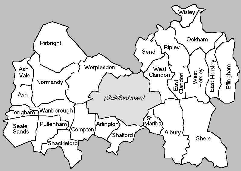
__NOTOC__ Wisley is a village and civil parish in Surrey, England between Cobham and Woking, in the Borough of Guildford. It is the home of the Royal Horticultural Society's Wisley Garden. The River Wey runs through the village and Ockham and Wisley Commons form a large proportion of the parish on a high acid heathland, which is a rare soil type providing for its own types of habitat. It has a standard weather monitoring station, which has recorded some national record high temperatures. Geography Wisley gives its name to the nearby road intersection of the A3 Portsmouth Road (which runs across much land of the village) and the London Orbital M25 motorway, Junction 10. The village is equidistant between Cobham and Woking, in the Borough of Guildford. It is the home of the Royal Horticultural Society's Wisley Garden. The River Wey forms part of the western part of the village, but is partly on both banks within Pyrford. Ockham and Wisley Commons form a large proportion of t ... [...More Info...] [...Related Items...] OR: [Wikipedia] [Google] [Baidu] |
Wisley Garden
RHS Garden Wisley is a garden run by the Royal Horticultural Society in Wisley, Surrey, south of London. It is one of five gardens run by the society, the others being Harlow Carr, Hyde Hall, Rosemoor, and Bridgewater (which opened on 18 May 2021). Wisley is the second most visited paid entry garden in the United Kingdom after the Royal Botanic Gardens, Kew, with 1,232,772 visitors in 2019. History Wisley was founded by Victorian businessman and RHS member George Ferguson Wilson, who purchased a 60-acre (243,000 m²) site in 1878. He established the "Oakwood Experimental Garden" on part of the site, where he attempted to "make difficult plants grow successfully". Wilson died in 1902 and Oakwood (which was also known as Glebe FarmBrent Elliott: The Royal Horticultural Society, A History 1804-2004. Published by Phillimore & Co. Ltd. .) was purchased by Sir Thomas Hanbury, the creator of the celebrated garden La Mortola on the Italian Riviera. He gave the Wisley site to the ... [...More Info...] [...Related Items...] OR: [Wikipedia] [Google] [Baidu] |
Ockham And Wisley Commons
Ockham and Wisley Commons is a biological Site of Special Scientific Interest east of Woking in Surrey. It is also a Local Nature Reserve and part of the Thames Basin Heaths Special Protection Area. It is part of the slightly larger area of Wisley & Ockham Commons & Chatley Heath nature reserve, which is owned by Surrey County Council and managed by the Surrey Wildlife Trust. This site is mainly heathland but it also has areas of open water, bog, woodland and scrub. It has a rich flora and it is of national importance for true flies and for dragonflies and damselflies. Rare species include the white-faced darter The white-faced darter or small whiteface (''Leucorrhinia dubia'') is a dragonfly belonging to the genus '' Leucorrhinia'' in the family Libellulidae, characterised by red and black markings and a distinctive white patch on the head. It is foun ... dragonfly and the '' Thyridanthrax fenestratus'' bee fly. There is public access to the site. References {{L ... [...More Info...] [...Related Items...] OR: [Wikipedia] [Google] [Baidu] |
Royal Horticultural Society
The Royal Horticultural Society (RHS), founded in 1804 as the Horticultural Society of London, is the UK's leading gardening charity. The RHS promotes horticulture through its five gardens at Wisley (Surrey), Hyde Hall (Essex), Harlow Carr (North Yorkshire), Rosemoor (Devon) and Bridgewater (Greater Manchester); flower shows including the Chelsea Flower Show, Hampton Court Palace Flower Show, Tatton Park Flower Show and Cardiff Flower Show; community gardening schemes; Britain in Bloom and a vast educational programme. It also supports training for professional and amateur gardeners. the president was Keith Weed and the director general was Sue Biggs CBE. History Founders The creation of a British horticultural society was suggested by John Wedgwood (son of Josiah Wedgwood) in 1800. His aims were fairly modest: he wanted to hold regular meetings, allowing the society's members the opportunity to present papers on their horticultural activities and discoveries, to enc ... [...More Info...] [...Related Items...] OR: [Wikipedia] [Google] [Baidu] |
Surrey
Surrey () is a ceremonial and non-metropolitan county in South East England, bordering Greater London to the south west. Surrey has a large rural area, and several significant urban areas which form part of the Greater London Built-up Area. With a population of approximately 1.2 million people, Surrey is the 12th-most populous county in England. The most populated town in Surrey is Woking, followed by Guildford. The county is divided into eleven districts with borough status. Between 1893 and 2020, Surrey County Council was headquartered at County Hall, Kingston-upon-Thames (now part of Greater London) but is now based at Woodhatch Place, Reigate. In the 20th century several alterations were made to Surrey's borders, with territory ceded to Greater London upon its creation and some gained from the abolition of Middlesex. Surrey is bordered by Greater London to the north east, Kent to the east, Berkshire to the north west, West Sussex to the south, East Sussex to ... [...More Info...] [...Related Items...] OR: [Wikipedia] [Google] [Baidu] |
Pyrford
Pyrford is a village in the borough of Woking in Surrey, England. It is on the left bank of the River Wey, around east of the town of Woking and just south of West Byfleet; the M25 motorway is northeast of the edge of the former parish. The village sits on raised mixed heath soil, and has historical links with the abbey at Westminster, in whose possession it remained between the Norman conquest in 1066 and the Dissolution of the Monasteries nearly five hundred years later. Geography At the foot of slopes in the south of the area are agricultural flood plain pasture meadows bisected by the River Wey Navigation; the actual border is the River Wey itself (though slightly inaccurate as based on meanders as they were before 1820). Roads passing through the village include the B367 (Upshott Lane/Church Hill) and B382 (Old Woking Road). Open areas in the south and east of the village are designated Metropolitan Green Belt. History and use in the arts The current village name 'Py ... [...More Info...] [...Related Items...] OR: [Wikipedia] [Google] [Baidu] |
A3 Road
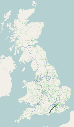
The A3, known as the Portsmouth Road or London Road in sections, is a major road connecting the City of London and Portsmouth passing close to Kingston upon Thames, Guildford, Haslemere and Petersfield. For much of its length, it is classified as a trunk road and therefore managed by National Highways. Almost all of the road has been built to dual carriageway standards or wider. Apart from bypass sections in London, the road travels in a southwest direction and, after Liss, south-southwest. Close to its southerly end, motorway traffic is routed via the A3(M), then either the east–west A27 or the Portsmouth-only M275 which has multiple lanes leading off the westbound A27 — for non-motorway traffic, the A3 continues into Portsmouth alongside the A3(M), mostly as a single carriageway in each direction through Waterlooville and adjoining small towns. The other section of single carriageways is through the urban environs of Battersea, Clapham and Stockwell towards the no ... [...More Info...] [...Related Items...] OR: [Wikipedia] [Google] [Baidu] |
Cobham, Surrey
Cobham () is a large village in the Borough of Elmbridge in Surrey, England, centred south-west of London and northeast of Guildford on the River Mole. It has a commercial/services High Street, a significant number of primary and private schools and the Painshill landscape park. Toponymy Cobham appears in Domesday Book of 1086 as ''Covenham'' and in 13th century copies of earlier charters as ''Coveham''. It is recorded as ''Cobbeham'' and ''Cobeham'' in the 15th century and the first use of the modern spelling "Cobham" is from 1570. The name is thought to derive from an Anglo-Saxon landowner either as ''Cofa's hām'' or ''Cofa's hamm''. The second part of the name may have originated from the Old English ''hām'' meaning a settlement or enclosure, or from ''hamm'' meaning land close to water. The area of the village known as Cobham Tilt, is first recorded as ''la Tilthe'' in 1328. The name is thought to derive from the Old English ''Tilthe'', meaning "cultivated land". H ... [...More Info...] [...Related Items...] OR: [Wikipedia] [Google] [Baidu] |
Woking
Woking ( ) is a town and borough status in the United Kingdom, borough in northwest Surrey, England, around from central London. It appears in Domesday Book as ''Wochinges'' and its name probably derives from that of a Anglo-Saxon settlement of Britain, Saxon landowner. The earliest evidence of human activity is from the Paleolithic, but the low fertility of the sandy, local soils meant that the area was the least populated part of the county in 1086. Between the mid-17th and mid-19th centuries, new transport links were constructed, including the Wey and Godalming Navigations, Wey Navigation, Basingstoke Canal and South West Main Line, London to Southampton railway line. The modern town was established in the mid-1860s, as the London Necropolis Company began to sell surplus land surrounding Woking railway station, the railway station for home construction, development. Modern local government in Woking began with the creation of the Woking Local Board of Health, Local Board in ... [...More Info...] [...Related Items...] OR: [Wikipedia] [Google] [Baidu] |
Borough Of Guildford
The Borough of Guildford is a local government district with borough status in Surrey, England. With around half of the borough's population, Guildford is its largest settlement and only town, and is the location of the council. The district was formed on 1 April 1974, under the Local Government Act 1972 by an amalgamation of the municipal borough of Guildford and Guildford Rural District. Functions Borough councillors and officers work on devolved issues such as parks, leisure, older residents' services, youth services, streetscene, refuse collection, planning and aspects of business and tourism; Surrey County Council deal with transport, publicly owned infrastructure planning and maintenance, education, social services and overall waste management. The Borough owns significant heritage assets that include monuments such as Guildford Castle, as well museums, art collections and civic regalia. Population Guildford has the second largest population of Surrey's eleven distri ... [...More Info...] [...Related Items...] OR: [Wikipedia] [Google] [Baidu] |
River Wey
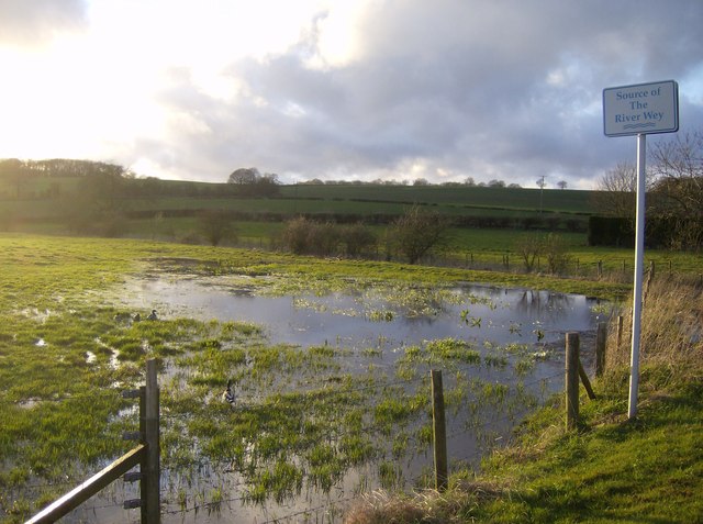
The River Wey is a main tributary of the River Thames in south east England. Its two branches, one of which rises near Alton in Hampshire and the other in West Sussex to the south of Haslemere, join at Tilford in Surrey. Once combined the flow is eastwards then northwards via Godalming and Guildford to meet the Thames at Weybridge. Downstream the river forms the backdrop to Newark Priory and Brooklands. The Wey and Godalming Navigations were built in the 17th and 18th centuries, to create a navigable route from Godalming to the Thames. The Wey drains much of south west Surrey (as well as parts of east Hampshire and the north of West Sussex) and has a total catchment area of . Although it is the longest tributary of the Thames (if the Medway is excluded), its total average discharge is lower than that of the Kennet and Cherwell. The river morphology and biodiversity of the Wey are well studied, with many places to take samples and record data. The main tributary is the Ti ... [...More Info...] [...Related Items...] OR: [Wikipedia] [Google] [Baidu] |
Guildford (borough)
The Borough of Guildford is a local government district with borough status in Surrey, England. With around half of the borough's population, Guildford is its largest settlement and only town, and is the location of the council. The district was formed on 1 April 1974, under the Local Government Act 1972 by an amalgamation of the municipal borough of Guildford and Guildford Rural District. Functions Borough councillors and officers work on devolved issues such as parks, leisure, older residents' services, youth services, streetscene, refuse collection, planning and aspects of business and tourism; Surrey County Council deal with transport, publicly owned infrastructure planning and maintenance, education, social services and overall waste management. The Borough owns significant heritage assets that include monuments such as Guildford Castle, as well museums, art collections and civic regalia. Population Guildford has the second largest population of Surrey's eleven distri ... [...More Info...] [...Related Items...] OR: [Wikipedia] [Google] [Baidu] |
M25 Motorway
The M25 or London Orbital Motorway is a major road encircling most of Greater London. The motorway is one of the most important roads in the UK and one of the busiest. Margaret Thatcher opened the final section in 1986, making the M25 the longest ring road in Europe upon opening. The Dartford Crossing completes the orbital route but is not classed as motorway; it is classed as a trunk road and designated as the A282. In some cases, including notable legal contexts such as the Communications Act 2003, the M25 is used as a ''de facto'' alternative boundary for Greater London. In the 1944 ''Greater London Plan'', Patrick Abercrombie proposed an orbital motorway around London. This evolved into the London Ringways project in the early 1960s, and by 1966, planning had started on two projects, London Ringways#Ringway 3, Ringway 3 to the north and London Ringways#Ringway 4, Ringway 4 to the south. By the time the first sections opened in 1975, it was decided the ringways would be com ... [...More Info...] [...Related Items...] OR: [Wikipedia] [Google] [Baidu] |
.jpg)


