|
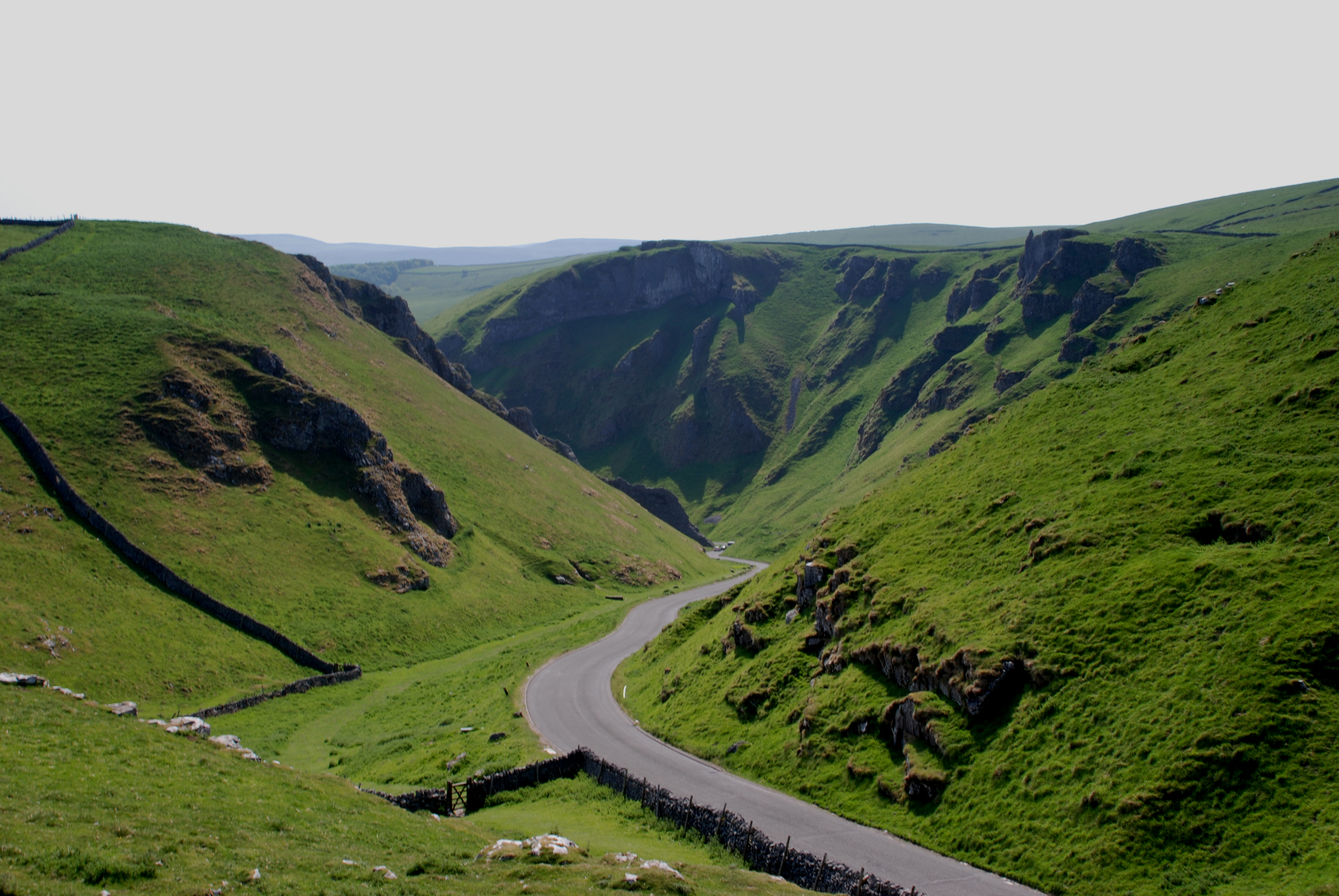
Winnats Pass
Winnats Pass (or Winnats, as shown on some Ordnance Survey maps) is a hill pass and limestone gorge in the Peak District of Derbyshire, England. The name is a corruption of 'wind gates' due to the swirling winds through the pass. It lies west of the village of Castleton, in the National Trust's High Peak Estate and the High Peak borough of Derbyshire. The road winds through a cleft, surrounded by high limestone ridges. At the foot of the pass is the entrance to Speedwell Cavern, a karst cave accessed through a flooded lead mine, and which is a popular tourist attraction. In the 1930s Winnats Pass was the location used for annual access rallies in support of greater access to the moorlands or the Peak District, around the time of the Mass Trespass of Kinder Scout. At their peak these were attended by up to 10,000 people. The permanent closure of the main A625 road at Mam Tor in 1979 due to subsidence has resulted in Winnats Pass being heavily used by road traffic. However, t ... [...More Info...] [...Related Items...] OR: [Wikipedia] [Google] [Baidu] |
Cave
A cave or cavern is a natural void in the ground, specifically a space large enough for a human to enter. Caves often form by the weathering of rock and often extend deep underground. The word ''cave'' can refer to smaller openings such as sea caves, rock shelters, and grottos, that extend a relatively short distance into the rock and they are called ''exogene'' caves. Caves which extend further underground than the opening is wide are called ''endogene'' caves. Speleology is the science of exploration and study of all aspects of caves and the cave environment. Visiting or exploring caves for recreation may be called ''caving'', ''potholing'', or ''spelunking''. Formation types The formation and development of caves is known as ''speleogenesis''; it can occur over the course of millions of years. Caves can range widely in size, and are formed by various geological processes. These may involve a combination of chemical processes, erosion by water, tectonic forces, microorga ... [...More Info...] [...Related Items...] OR: [Wikipedia] [Google] [Baidu] |
Mountain Passes Of England
A mountain is an elevated portion of the Earth's crust, generally with steep sides that show significant exposed bedrock. Although definitions vary, a mountain may differ from a plateau in having a limited summit area, and is usually higher than a hill, typically rising at least 300 metres (1,000 feet) above the surrounding land. A few mountains are isolated summits, but most occur in mountain ranges. Mountains are formed through tectonic forces, erosion, or volcanism, which act on time scales of up to tens of millions of years. Once mountain building ceases, mountains are slowly leveled through the action of weathering, through slumping and other forms of mass wasting, as well as through erosion by rivers and glaciers. High elevations on mountains produce colder climates than at sea level at similar latitude. These colder climates strongly affect the ecosystems of mountains: different elevations have different plants and animals. Because of the less hospitable terrain an ... [...More Info...] [...Related Items...] OR: [Wikipedia] [Google] [Baidu] |
Landforms Of Derbyshire
A landform is a natural or anthropogenic land feature on the solid surface of the Earth or other planetary body. Landforms together make up a given terrain, and their arrangement in the landscape is known as topography. Landforms include hills, mountains, canyons, and valleys, as well as shoreline features such as bays, peninsulas, and seas, including submerged features such as mid-ocean ridges, volcanoes, and the great ocean basins. Physical characteristics Landforms are categorized by characteristic physical attributes such as elevation, slope, orientation, stratification, rock exposure and soil type. Gross physical features or landforms include intuitive elements such as berms, mounds, hills, ridges, cliffs, valleys, rivers, peninsulas, volcanoes, and numerous other structural and size-scaled (e.g. ponds vs. lakes, hills vs. mountains) elements including various kinds of inland and oceanic waterbodies and sub-surface features. Mountains, hills, plateaux, and plains are the fou ... [...More Info...] [...Related Items...] OR: [Wikipedia] [Google] [Baidu] |
Peak Forest
Peak Forest is a small village and civil parish on the main road the ( A623) from Chapel-en-le-Frith to Chesterfield in Derbyshire. The population of the civil parish at the 2011 census was 335. The village grew from the earlier settlement of Dam (still inhabited, with a number of houses and farms) at the conjunction of Perrydale and Damdale. There is an inn, a church and a primary school. Its name probably derives from the Forest of High Peak. The village is at the heart of the old royal forest and was formerly known as Chamber of Campana. The nearby Chamber Farm or Chamber Knoll may have been the exact location of the residence and meeting place of local forest officials. Its church is dedicated to 'Charles, King & Martyr' (King Charles I of England, executed in 1649). First erected in 1657, it was replaced in 1878 as a gift from the Duke of Devonshire. Until an Act of Parliament was passed in 1754 its minister was able to perform marriages without the need for reading the b ... [...More Info...] [...Related Items...] OR: [Wikipedia] [Google] [Baidu] |
Flora Of Derbyshire
Flora is all the plant life present in a particular region or time, generally the naturally occurring ( indigenous) native plants. Sometimes bacteria and fungi are also referred to as flora, as in the terms ''gut flora'' or ''skin flora''. Etymology The word "flora" comes from the Latin name of Flora, the goddess of plants, flowers, and fertility in Roman mythology. The technical term "flora" is then derived from a metonymy of this goddess at the end of the sixteenth century. It was first used in poetry to denote the natural vegetation of an area, but soon also assumed the meaning of a work cataloguing such vegetation. Moreover, "Flora" was used to refer to the flowers of an artificial garden in the seventeenth century. The distinction between vegetation (the general appearance of a community) and flora (the taxonomic composition of a community) was first made by Jules Thurmann (1849). Prior to this, the two terms were used indiscriminately.Thurmann, J. (1849). ''Essai de Ph ... [...More Info...] [...Related Items...] OR: [Wikipedia] [Google] [Baidu] |
Hieracium
''Hieracium'' (), known by the common name hawkweed and classically as (from ancient Greek ιεράξ, 'hawk'), is a genus of flowering plant in the family Asteraceae, and closely related to dandelion (''Taraxacum''), chicory (''Cichorium''), prickly lettuce (''Lactuca'') and sow thistle (''Sonchus''), which are part of the tribe Cichorieae. Hawkweeds, with their 10,000+ recorded species and subspecies, do their part to make Asteraceae the second largest family of flowering plants. Some botanists group all these species or subspecies into approximately 800 accepted species, while others prefer to accept several thousand species. Since most hawkweeds reproduce exclusively asexually by means of seeds that are genetically identical to their mother plant (apomixis or agamospermy), clones or populations that consist of genetically identical plants are formed and some botanists (especially in UK, Scandinavia and Russia) prefer to accept these clones as good species (arguing th ... [...More Info...] [...Related Items...] OR: [Wikipedia] [Google] [Baidu] |
Hieracium Naviense
''Hieracium naviense'' is a very rare species of hawkweed which has been given the common name of Derby hawkweed. It is a native perennial plant of limestone cliffs, first discovered in Derbyshire, England, at the Winnats Pass (SK1382) by J.N. Mills in 1966, and described by him as a new species in 1968. According to the ''Flora of Derbyshire'', it has been refound there on a number of occasions since, most recently in 2013, including in 1981 by UK hawkweed expert P.D. Sell, who declared it "a good species". Like many apomictic species of ''Hieracium'', it has an extremely localised distribution and requires specialist knowledge to recognise it. Apart from the two limestone cliffs found within a single 1 km square in the Derbyshire Peak District, it has never been recorded anywhere else in Britain, or indeed the world. The only other vascular plant endemic to Derbyshire (i.e. found nowhere else) is the bramble ''Rubus durescens ''Rubus durescens'' is a rare British s ... [...More Info...] [...Related Items...] OR: [Wikipedia] [Google] [Baidu] |
Pleistocene
The Pleistocene ( , often referred to as the ''Ice age'') is the geological Epoch (geology), epoch that lasted from about 2,580,000 to 11,700 years ago, spanning the Earth's most recent period of repeated glaciations. Before a change was finally confirmed in 2009 by the International Union of Geological Sciences, the cutoff of the Pleistocene and the preceding Pliocene was regarded as being 1.806 million years Before Present (BP). Publications from earlier years may use either definition of the period. The end of the Pleistocene corresponds with the end of the last glacial period and also with the end of the Paleolithic age used in archaeology. The name is a combination of Ancient Greek grc, label=none, πλεῖστος, pleīstos, most and grc, label=none, καινός, kainós (latinized as ), 'new'. At the end of the preceding Pliocene, the previously isolated North and South American continents were joined by the Isthmus of Panama, causing Great American Interchang ... [...More Info...] [...Related Items...] OR: [Wikipedia] [Google] [Baidu] |
Periglacial
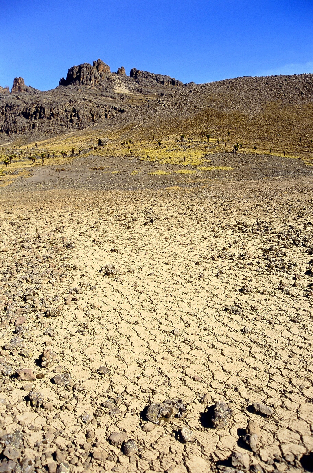
Periglaciation (adjective: "periglacial", also referring to places at the edges of glacial areas) describes geomorphic processes that result from seasonal thawing of snow in areas of permafrost, the runoff from which refreezes in ice wedges and other structures. "Periglacial" suggests an environment located on the margin of past glaciers. However, freeze and thaw cycles influence landscapes outside areas of past glaciation. Therefore, periglacial environments are anywhere that freezing and thawing modify the landscape in a significant manner. Tundra is a common ecological community in periglacial areas. History Periglaciation became a distinct subject within the study of geology after Walery Łoziński, a Polish geologist, introduced the term in 1909. Łoziński drew upon the early work of Johan Gunnar Andersson. According to Alfred Jahn, his introduction of his work at the 1910 International Geological Congress held in Stockholm caused significant discussion. In the field trip ... [...More Info...] [...Related Items...] OR: [Wikipedia] [Google] [Baidu] |
Upper Carboniferous
Upper may refer to: * Shoe upper or ''vamp'', the part of a shoe on the top of the foot * Stimulant, drugs which induce temporary improvements in either mental or physical function or both * ''Upper'', the original film title for the 2013 found footage film '' The Upper Footage'' See also {{Disambiguation ... [...More Info...] [...Related Items...] OR: [Wikipedia] [Google] [Baidu] |
Namurian
The Namurian is a stage in the regional stratigraphy of northwest Europe with an age between roughly 326 and 313 Ma (million years ago). It is a subdivision of the Carboniferous system or period and the regional Silesian series. The Namurian is named for the Belgian city and province of Namur where strata of this age occur (part of the Belgian Coal Measures). The Millstone Grit Group in the lithostratigraphy of northern England and parts of Wales is also of Namurian age. The Namurian age lasted from 326 to 313 million years ago. It is preceded by the Visean stage/age (which corresponds to the upper Carboniferous Limestone of Great Britain) and succeeded by the Westphalian stage/age (which corresponds to the lower and middle Coal Measures of Great Britain). In the official geologic timescale of the International Commission on Stratigraphy (ICS), the Namurian straddles the boundary between the Mississippian epoch (359-318 Ma) and the Pennsylvanian epoch (318-299 Ma). The ... [...More Info...] [...Related Items...] OR: [Wikipedia] [Google] [Baidu] |


.jpg)


