|
Whorwellsdown
Whorwellsdown was a hundred of the English county of Wiltshire, lying in the west of the county to the south of the towns of Bradford on Avon and Melksham and to the north and east of Westbury. An arm of the hundred reached several miles southwards into Salisbury Plain, with a detached portion, a tithing of Tilshead, lying high on the Plain about five miles east of the southern arm of the rest of the hundred. At its western end, it reached as far as the Somerset county boundary. Extent At the time of the Domesday Book (1086), the hundred contained Romsey Abbey's manors of Steeple Ashton and Edington, together with other estates at Edington, Coulston, Keevil, and Tilshead. Steeple Ashton then included West Ashton, North Bradley and Southwick.'The Hundred of Whorwellsdown', in ''A History of the County of Wiltshire: Volume 8: Warminster, Westbury and Whorwellsdown Hundreds'' (1965)pp. 193–197online at british-history.ac.uk In 1831, the hundred included Steeple Ashton (with Wes ... [...More Info...] [...Related Items...] OR: [Wikipedia] [Google] [Baidu] |
Tilshead
Tilshead () is a village and civil parish in the county of Wiltshire in Southern England, about northwest of the town of Amesbury. It is close to the geographical centre of Salisbury Plain, on the A360 road approximately midway between the villages of Shrewton and Market Lavington, and is near the source of the River Till. Its population in 2011 was 358, down from a peak of 989 inhabitants in 1951. History Salisbury Plain has much evidence of prehistoric activity. One kilometre south of Tilshead village, under the ridge of Copehill Down, is the White Barrow, a large Neolithic long barrow. To the southwest and southeast are ancient boundary ditches, partly followed by the parish boundary; the ditch in the southeast has a long barrow next to it. The name of the settlement derives from "Theodwulf's hide". In 1086, ''Tydolveshyde'' or ''Tidolthide'' was a borough and large royal estate, with a relatively large population of 164 households and nine mills. The tithing of South Tils ... [...More Info...] [...Related Items...] OR: [Wikipedia] [Google] [Baidu] |
West Ashton
West Ashton is a village and civil parish in Wiltshire, England. It is about southeast of Trowbridge, near the A350 between Melksham and Yarnbrook which bypasses Trowbridge. The parish includes the hamlets of Dunge (), East Town () and Rood Ashton (). West Ashton was anciently a tithing – alongside Great Hinton and Semington – of the large Steeple Ashton parish, within the hundred of Whorwellsdown. These tithings became separate civil parishes in the late 19th century. The village has a primary school, West Ashton Church of England Primary School, and a village hall. Parish church The Anglican Church of St John the Evangelist was built in 1846 to designs of T.H. Wyatt with funding from Walter Long. Its east window is a 1920 war memorial, which Pevsner states is the work of Henry Payne. In 1988 the church was designated as Grade II listed. It has the family crypt and monuments to the Long family of Rood Ashton House. An ecclesiastical parish was created for th ... [...More Info...] [...Related Items...] OR: [Wikipedia] [Google] [Baidu] |
Steeple Ashton
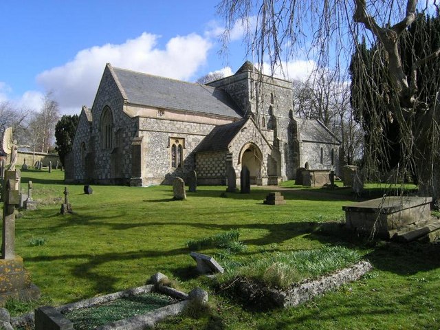
Steeple Ashton is a village and civil parish in Wiltshire, England, east of Trowbridge. In the north of the parish are the hamlets of Ashton Common and Bullenhill. Name and history Until the Dissolution of the Monasteries, Steeple Ashton was a manor of Romsey Abbey, at the centre of the abbey's large estates in the area. It was also part of the hundred of Whorwellsdown, and was the site of the hundred's courts. The first element of the village's name derives from the former steeple of the church built c. 1480–1500, which, when it was measured in 1606, was found to be 32 yards higher than the tower, making together the remarkable height of about 186ft. An inscription in the church records that the spire was struck by lightning in July 1670, and, just as repairs were being completed, struck again the following October. Two men working on it were killed, and the body of the church severely damaged, so that no attempt to rebuild the spire was made. Steeple Ashton was once ... [...More Info...] [...Related Items...] OR: [Wikipedia] [Google] [Baidu] |
Edington, Wiltshire
Edington is a village and civil parish in Wiltshire, England, about east-northeast of Westbury. The village lies under the north slope of Salisbury Plain and the parish extends south onto the Plain. Its Grade I listed parish church was built for Edington Priory in the 14th century. Tinhead is the former name of the eastern half of present-day Edington, towards Coulston along the B3098 Westbury to Market Lavington road. Tinhead is labelled on the Ordnance Survey map of 1945 but not on the 1958 map. Today the combined settlement is Edington and the name survives only in Tinhead Hill and Tinhead Lane. Geography Tinhead Hill, in the south of the parish at , rises to . The southernmost part of the parish is within the Salisbury Plain military training area. A stream which rises at Luccombe Bottom and flows north-east divides the parish from Bratton, then flows north-west across the parish. Bratton Downs, a biological and geological Site of Special Scientific Interest, inclu ... [...More Info...] [...Related Items...] OR: [Wikipedia] [Google] [Baidu] |
North Bradley
North Bradley is a village and civil parish in Wiltshire, England, between Trowbridge and Westbury. The village is about south of Trowbridge town centre. The parish includes most of the village of Yarnbrook, and the hamlets of Brokerswood, Cutteridge and Drynham. Geography North Bradley village is close to Trowbridge but retains a distinct identity, being separated from the town by small fields (one of which is the home of Trowbridge Town football club). The north–south road through the village was formerly the A363 but this was diverted to the north in the late 1990s when White Horse Business Park was developed. The parish extends some southwest of North Bradley village, beyond Brokerswood to the boundary with the county of Somerset, near Rudge. The River Biss flows through the parish. A biological Site of Special Scientific Interest is at Picket Wood and Clanger Wood near Yarnbrook at the extreme east of the parish. Nearby villages include Southwick (now its own ... [...More Info...] [...Related Items...] OR: [Wikipedia] [Google] [Baidu] |
Keevil
Keevil is a village and civil parish in Wiltshire, England, about east of the centre of Trowbridge and a similar distance south of Melksham. The village lies on a slope between Great Hinton and Bulkington. Semington Brook forms much of the northeast boundary of the parish. In the far north of the parish, on the A361, is the hamlet of The Strand. History A settlement of 42 households at Chivele was recorded in the Domesday Book of 1086, when the land was held by Ernulf de Hesdin. His son, also Ernulf, held the manor in 1130; it passed through various hands until it was sold in 1560 by Henry, Earl of Arundel to Richard Lambert, a grocer of London. His brother's grandson sold the manor to William Beach in 1681. In 1790 the estate was inherited by Henrietta Maria Beach; she married Michael Hicks of Beverstone Castle, Gloucestershire, who took the additional surname of Beach. Their grandson W.A. Hicks Beach sold the property in 1911. Two mills were recorded in the Domesday B ... [...More Info...] [...Related Items...] OR: [Wikipedia] [Google] [Baidu] |
The Crown
The Crown is the state in all its aspects within the jurisprudence of the Commonwealth realms and their subdivisions (such as the Crown Dependencies, overseas territories, provinces, or states). Legally ill-defined, the term has different meanings depending on context. It is used to designate the monarch in either a personal capacity, as Head of the Commonwealth, or as the king or queen of their realms (whereas the monarchy of the United Kingdom and the monarchy of Canada, for example, are distinct although they are in personal union). It can also refer to the rule of law; however, in common parlance 'The Crown' refers to the functions of government and the civil service. Thus, in the United Kingdom (one of the Commonwealth realms), the government of the United Kingdom can be distinguished from the Crown and the state, in precise usage, although the distinction is not always relevant in broad or casual usage. A corporation sole, the Crown is the legal embodiment of execut ... [...More Info...] [...Related Items...] OR: [Wikipedia] [Google] [Baidu] |
Stephen Of England
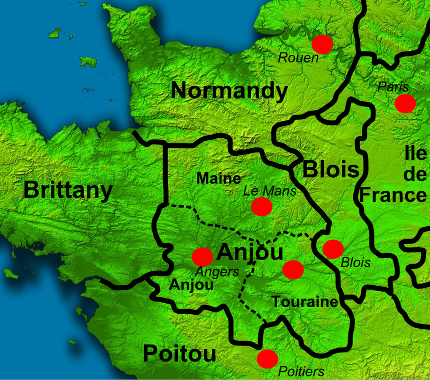
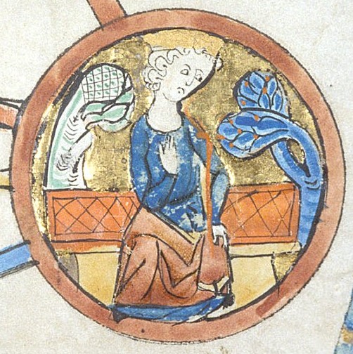
Stephen (1092 or 1096 – 25 October 1154), often referred to as Stephen of Blois, was King of England from 22 December 1135 to his death in 1154. He was Count of Boulogne '' jure uxoris'' from 1125 until 1147 and Duke of Normandy from 1135 until 1144. His reign was marked by the Anarchy, a civil war with his cousin and rival, the Empress Matilda, whose son, Henry II, succeeded Stephen as the first of the Angevin kings of England. Stephen was born in the County of Blois in central France as the fourth son of Stephen-Henry, Count of Blois, and Adela, daughter of William the Conqueror. His father died while Stephen was still young, and he was brought up by his mother. Placed into the court of his uncle Henry I of England, Stephen rose in prominence and was granted extensive lands. He married Matilda of Boulogne, inheriting additional estates in Kent and Boulogne that made the couple one of the wealthiest in England. Stephen narrowly escaped drowning with Henry I's son, William ... [...More Info...] [...Related Items...] OR: [Wikipedia] [Google] [Baidu] |
High Sheriff Of Wiltshire
This is a list of the Sheriffs and (after 1 April 1974) High Sheriffs of Wiltshire. Until the 14th century, the shrievalty was held ''ex officio'' by the castellans of Old Sarum Castle. On 1 April 1974, under the provisions of the Local Government Act 1972, the title of Sheriff of Wiltshire was retitled as High Sheriff of Wiltshire.Local Government Act 1972: Section 219 at legislation.gov.uk, accessed 28 April 2020: ”Sheriffs appointed for a county or Greater London shall be known as high sheriffs, and any reference in any enactment or instrument to a sheriff shall be construed accordingly in relation to sheriffs for a county or Greater London". Sheriff To 1400 *1066: Edric *1067–1070: Philippe de Buckland *1085: Aiulphus the Sheriff *1070–1105: < ...[...More Info...] [...Related Items...] OR: [Wikipedia] [Google] [Baidu] |
East Coulston
Coulston (until 1934 called East Coulston) is a village and civil parish in Wiltshire, England, five miles northeast of the town of Westbury, just north of the B3098 road. The village lies under the north slope of Salisbury Plain and the parish extends south onto the Plain. The parish has an elected parish council called Coulston Parish Council. Coulston has a mix of old and new houses, about sixty-five in all. The number of buildings listed as of architectural or historic importance is thirteen (all listed Grade II). There is no shop or surviving public house. History The parish was originally called East Coulston, and until 1934 the theoretical hamlet of West Coulston (immediately adjacent to East Coulston and including the village school) was a part of a tithing of Edington parish, known as Baynton and Coulston. In that year East and West Coulston were united into a parish called simply Coulston. A small school was built c. 1855 at West Coulston but was closed by 1899. Th ... [...More Info...] [...Related Items...] OR: [Wikipedia] [Google] [Baidu] |
Henry I Of England
Henry I (c. 1068 – 1 December 1135), also known as Henry Beauclerc, was King of England from 1100 to his death in 1135. He was the fourth son of William the Conqueror and was educated in Latin and the liberal arts. On William's death in 1087, Henry's elder brothers Robert Curthose and William Rufus inherited Normandy and England, respectively, but Henry was left landless. He purchased the County of Cotentin in western Normandy from Robert, but his brothers deposed him in 1091. He gradually rebuilt his power base in the Cotentin and allied himself with William Rufus against Robert. Present at the place where his brother William died in a hunting accident in 1100, Henry seized the English throne, promising at his coronation to correct many of William's less popular policies. He married Matilda of Scotland and they had two surviving children, Empress Matilda and William Adelin; he also had many illegitimate children by his many mistresses. Robert, who invaded from Normandy ... [...More Info...] [...Related Items...] OR: [Wikipedia] [Google] [Baidu] |


.jpg)
.jpg)


