|
Whitworth Institute
The Whitworth Institute is a Grade II listed building in Darley Dale, Derbyshire. It was funded by the estate of the late Sir Joseph Whitworth who lived in nearby Stancliffe Hall. The building is constructed of Staincliffe stone with green Westmorland slate. By the end of May 1890 the builders had finished work, and the joiners had moved into the interior. The building cost about £15,000 (). and although completed by September 1890, was not formally opened until May 1891. It contained a large reading room, a billiard room, a smoke room and playroom on the east side, a small reading room on the west and a swimming bath by . Upstairs there were two further reading rooms, and a large hall long and wide capable of seating 200 people. The Whitworth Institute was given to the people of Darley Dale and in 2009/10 underwent a £1.7m renovation to ensure its continued use for future generations. See also *Listed buildings in Darley Dale References {{DEFAULTSORT:Darley Dale Grade ... [...More Info...] [...Related Items...] OR: [Wikipedia] [Google] [Baidu] |
Grade II Listed
In the United Kingdom, a listed building or listed structure is one that has been placed on one of the four statutory lists maintained by Historic England in England, Historic Environment Scotland in Scotland, in Wales, and the Northern Ireland Environment Agency in Northern Ireland. The term has also been used in the Republic of Ireland, where buildings are protected under the Planning and Development Act 2000. The statutory term in Ireland is " protected structure". A listed building may not be demolished, extended, or altered without special permission from the local planning authority, which typically consults the relevant central government agency, particularly for significant alterations to the more notable listed buildings. In England and Wales, a national amenity society must be notified of any work to a listed building which involves any element of demolition. Exemption from secular listed building control is provided for some buildings in current use for worship, ... [...More Info...] [...Related Items...] OR: [Wikipedia] [Google] [Baidu] |
Darley Dale
Darley Dale, also known simply as Darley, is a town and civil parish in the Derbyshire Dales district of Derbyshire, England, with a population of 5,413. It lies north of Matlock, on the River Derwent and the A6 road. The town forms part of a built up area with both Matlock and Rowsley. Geography This article contains information on the area covered by the current civil parish of Darley Dale. The main built-up area of the parish extends for 2 miles along the A6 road north-west of Matlock, starting near the ARC Leisure Centre and ending near Stancliffe Quarry. It is bounded on the south-west by the River Derwent and extends over the hills and moors to the north-east as far as Darwin Forest Country Park. The parish includes the settlements at Darley Dale, Darley Hillside, Churchtown, Two Dales, Upper Hackney and Farley, but excludes Darley Bridge and Northwood. Darley Dale is sometimes confused with Darley Abbey (a mile north of Derby and with Dale Abbey (6 miles north-eas ... [...More Info...] [...Related Items...] OR: [Wikipedia] [Google] [Baidu] |
Derbyshire
Derbyshire ( ) is a ceremonial county in the East Midlands, England. It includes much of the Peak District National Park, the southern end of the Pennine range of hills and part of the National Forest. It borders Greater Manchester to the north-west, West Yorkshire to the north, South Yorkshire to the north-east, Nottinghamshire to the east, Leicestershire to the south-east, Staffordshire to the west and south-west and Cheshire to the west. Kinder Scout, at , is the highest point and Trent Meadows, where the River Trent leaves Derbyshire, the lowest at . The north–south River Derwent is the longest river at . In 2003, the Ordnance Survey named Church Flatts Farm at Coton in the Elms, near Swadlincote, as Britain's furthest point from the sea. Derby is a unitary authority area, but remains part of the ceremonial county. The county was a lot larger than its present coverage, it once extended to the boundaries of the City of Sheffield district in South Yorkshire where it cov ... [...More Info...] [...Related Items...] OR: [Wikipedia] [Google] [Baidu] |
Joseph Whitworth
Sir Joseph Whitworth, 1st Baronet (21 December 1803 – 22 January 1887) was an English engineer, entrepreneur, inventor and philanthropist. In 1841, he devised the British Standard Whitworth system, which created an accepted standard for screw threads. Whitworth also created the Whitworth rifle, often called the "sharpshooter" because of its accuracy, which is considered one of the earliest examples of a sniper rifle. Whitworth was created a baronet by Queen Victoria in 1869. Upon his death in 1887, Whitworth bequeathed much of his fortune for the people of Manchester, with the Whitworth Art Gallery and Christie Hospital partly funded by Whitworth's money. Whitworth Street and Whitworth Hall in Manchester are named in his honour. Whitworth's company merged with the W.G. Armstrong & Mitchell Company to become Armstrong Whitworth in 1897. Biography Early life Whitworth was born in John Street, Stockport, Cheshire, where the Stockport Courthouse is today. The site is marked b ... [...More Info...] [...Related Items...] OR: [Wikipedia] [Google] [Baidu] |
Stancliffe Hall
Stancliffe Hall is a grade II Listed building on Whitworth Road in the settlement of Darley Dale, near Matlock, Derbyshire. Early history In 1817, ''Magna Britannia'' reported that Herbert Greensmith Beard was living there in 1792 when he passed on manuscripts from the Columbell family which were made for Roger Columbell of Darley Hall who died in 1605 (which confirm the ''Magna Britannia'' version). That document records that Herbert Greensmith sold the hall in 1799 to William Heathcote for ten and a half thousand pounds. Heathcote was then in Batavia in the colony of Demarara. Heathcote's brother, John Heathcote and his family were living there in 1817.online 'Parishes: Dalbury - Derby' ''Magna Britannia'': volume 5: Derbyshire (1817), pp. 94-129. Date accessed: 2 December 2008 John died unmarried ... [...More Info...] [...Related Items...] OR: [Wikipedia] [Google] [Baidu] |
Westmorland Slate
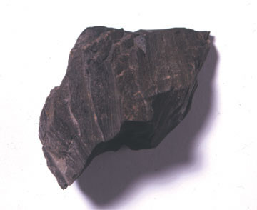
The slate industry is the industry related to the extraction and processing of slate. Slate is either quarried from a ''slate quarry'' or reached by tunneling in a ''slate mine''. Common uses for slate include as a roofing material, a flooring material, gravestones and memorial tablets, and for electrical insulation. Slate mines are found around the world. 90% of Europe's natural slate used for roofing originates from the Slate Industry in Spain.European Association of Mining Industries website retrieved on 26/01/2010 The major slate mining region in the United Kingdom is ; in |
Listed Buildings In Darley Dale
Darley Dale is a civil parish in the Derbyshire Dales district of Derbyshire, England. The parish contains 27 listed buildings that are recorded in the National Heritage List for England. Of these, three are listed at Grade II*, the middle of the three grades, and the others are at Grade II, the lowest grade. The parish contains the town of Darley Dale and the surrounding area. Most of the listed buildings are houses, cottages and associated structures, farmhouses and farm buildings. The other listed buildings include a church and its former rectory, a road bridge over the River Derwent, public houses, a mile post and a milestone, buildings associated with Darley Dale railway station Darley Dale railway station is a railway station on the heritage line Peak Rail. History Lying at the bottom of Station Road in the settlement of Darley Dale, Darley Dale in its current form is not the first station to have existed upon the sit ..., an institute, and a school. __NOTOC__ Key ... [...More Info...] [...Related Items...] OR: [Wikipedia] [Google] [Baidu] |
Grade II Listed Buildings In Derbyshire
Litfield Farm is a farm in Ridgeway, Derbyshire. The farm was once regarded as being located in a hamlet east of Ridgeway known as Litfield, but is now part of the larger settlement. The farmhouse is a 17th-century Grade II listed building. Litfield, or variations of the name, are mentioned as early as the 15th century, when the name appears on the Eckington Manorial Court Rolls. Due to various families, most notable of which was the Staniforth family, being mentioned in relation to the place, it is likely that Litfield was a loose term applied to the area surrounding the farmhouse. The farmhouse appears to have been in the possession of the Staniforth family for centuries. On 24 April 1587, Robert Sitwell transferred the land to Ralph Staniforth. During the 17th century, a William Staniforth was resident at the farmhouse. The farmhouse eventually passed down to George Staniforth of Barlborough. In 1828, the property is divided following the death of George Staniforth and was sold ... [...More Info...] [...Related Items...] OR: [Wikipedia] [Google] [Baidu] |


