|
Whitchurch, Cardiff
Whitchurch () is a suburb and Community (Wales), community in the north of Cardiff, capital of Wales. It is approximately 3 miles north of the centre of the city on the A470 road and A4054 road. It falls within the Whitchurch & Tongwynlais ward. The population of the community in 2011 was 14,267. Description With the expansion of Cardiff in the 20th century, Whitchurch is no longer a separate village, although residents refer commonly to "The Village" in preference to acknowledging its suburban status. The modern suburb contains a number of schools, a shopping centre, Whitchurch Library and the Velindre Cancer Centre, a major cancer hospital in Wales. The national office of the Presbyterian Church of Wales is located at the Tabernacle Church, Whitchurch. History Whitchurch draws its name from ''White Church''. The first mention of the area was in 1126 when the land was granted to Llandaff Cathedral and a chapel was built where Old Church Road now stands. The church, St Mary's ... [...More Info...] [...Related Items...] OR: [Wikipedia] [Google] [Baidu] |
Cardiff North (UK Parliament Constituency)
Cardiff North () is a constituency represented in the House of Commons of the UK Parliament since 2017 by Anna McMorrin of the Labour Party. The seat has been relative to others a marginal seat since 2001 as well as a swing seat as its winner's majority has not exceeded 8% of the vote since the 14.3% majority won in that year. The seat has changed political allegiance twice since that year. History This seat is the residential quarter of Wales' capital, over half of northern Cardiff consists of owner-occupied housing, with a higher number of a middle class population than other sections. Historically it has mainly elected Conservative MPs, but with new housing development Welsh Labour has overturned the nominal majority more recently, turning the seat into a national target swing-constituency. By 2004, the Conservatives held a majority of councillors within the district (13, against five Liberal Democrats, three independents and no Labour), but in the following 2005 genera ... [...More Info...] [...Related Items...] OR: [Wikipedia] [Google] [Baidu] |
Tongwynlais
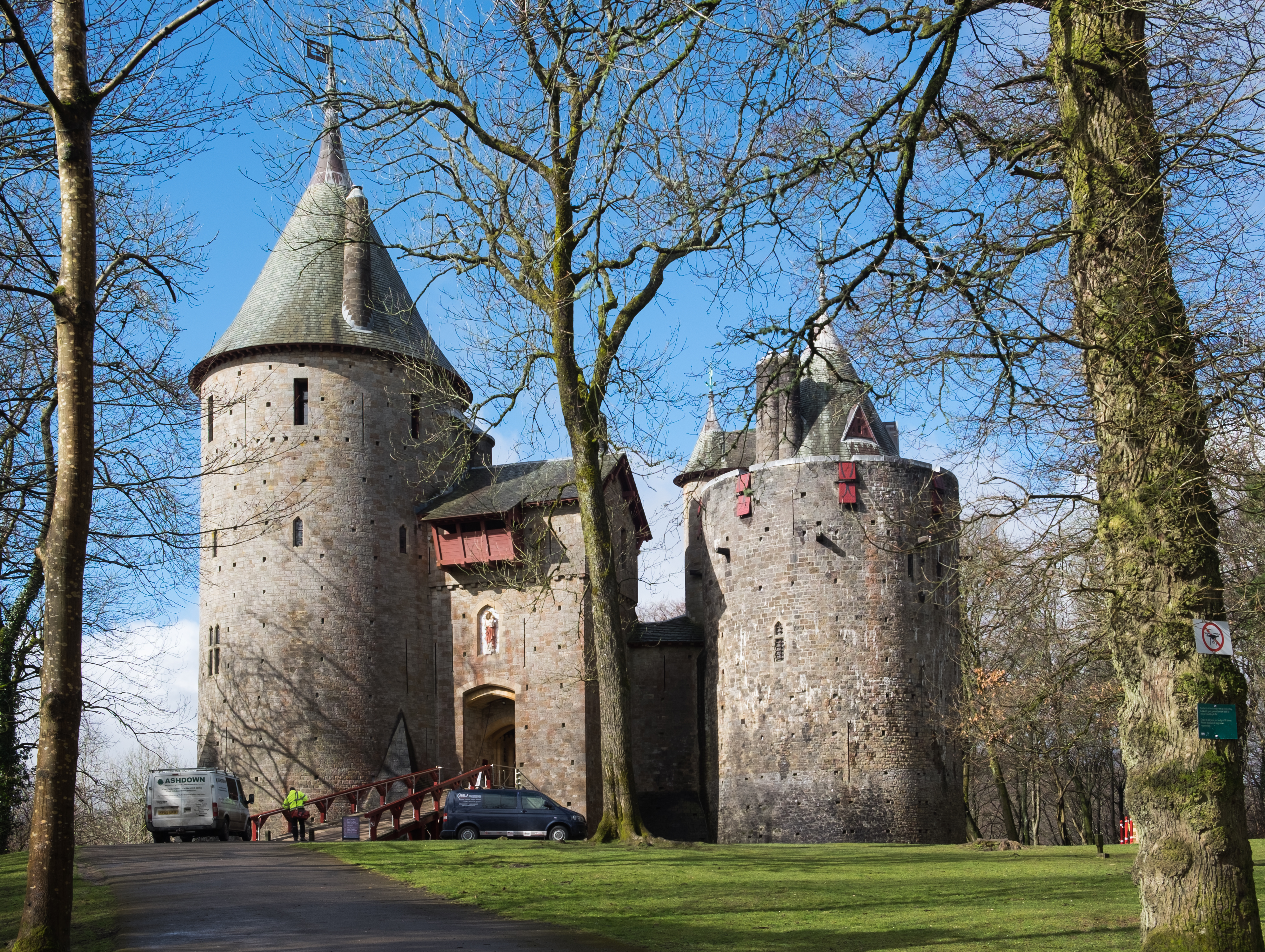
is a village and Community (Wales), community in the north of Cardiff, Wales, north of the M4 motorway in the River Taff, Taff Valley. It is notable as the location of the hillside landmark, . The population as of the 2011 census was 1871. Toponymy is believed to have obtained its name from the word meaning 'ley land', i.e. 'pasture, grassland or unploughed land'; and , the name of a local family, thus "pasture of ". (See also Tonna, Neath#Toponymy, Tonna.) Overview lies in the River Taff Valley. Its population was 1946 at the 2001 census. is located near Junction 32 of the M4 motorway, east of Bridgend and west of Newport, Wales, Newport and the A470 road, A470 trunk road. It is situated north of Cardiff city centre and south of . The surrounding towns and villages are and to the west, Taffs Well and Caerphilly to the north, and and Whitchurch, Cardiff, Whitchurch to the south. became part of Cardiff In 1974 when Cardiff expanded northwestwards. Many consider as ... [...More Info...] [...Related Items...] OR: [Wikipedia] [Google] [Baidu] |
Glamorganshire Canal Local Nature Reserve
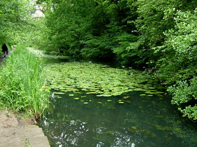
The Glamorganshire Canal local nature reserve is a nature reserve in Whitchurch, Cardiff, Wales. Formed in 1967, it comprises a disused section of the Glamorganshire Canal (constructed 1794), the Long Wood (designated as a Site of Special Scientific Interest) and an area of the flood plain of the River Taff. The reserve is also known as Forest Farm, and the old farm buildings are used to support the reserve. The water in the canal is relatively clean for an ex-industrial area, and supports several species of waterbirds, including kingfishers and herons. It is one of the few British nest sites of the Eurasian bittern. The Long Wood is chiefly oak and beech, with several trees over 200 years old. In 1992 the reserve was included in the newly declared Forest Farm Country Park which covered approximately . The reserve is supported by the Friends of Forest Farm, who organise educational events and support Cardiff Council in the protection and maintenance of the nature reserve. Se ... [...More Info...] [...Related Items...] OR: [Wikipedia] [Google] [Baidu] |
Glamorganshire Canal
The Glamorganshire Canal in South Wales, UK, was begun in 1790. It ran along the valley of the River Taff from Merthyr Tydfil to the sea at Cardiff. The final section of canal was closed in 1951. History Construction started in 1790; being watched over by the wealthy ironmasters of Merthyr Tydfil, including Richard Crawshay of the Cyfarthfa Ironworks, the canal was thought up as a solution to the issue of transporting the goods (iron ore, coal and limestone) from the valleys to Cardiff, where they would be shipped around the world. Thomas Dadford was hired to inspect and plan a route for the canal and, with support from Lord Cardiff, the canal was authorised by Parliament on 9 June 1790. Almost £90,000 was raised in preparation of constructing the canal and would be linked to any works within four miles of the canal, through branch canals and linking railways. However, during the few miles approaching Cardiff, the canal suffered from severe water shortages, resulting in goods ... [...More Info...] [...Related Items...] OR: [Wikipedia] [Google] [Baidu] |
Pentyrch
Pentyrch ( cy, Pen-tyrch) is a village and community located on the western outskirts of Cardiff, the capital city of Wales. The village gives its name to a Cardiff local authority electoral ward, Pentyrch, which covers the village and immediate surrounding area. The Pentyrch community includes the neighbouring village of Creigiau and Gwaelod y Garth. People living in Pentyrch are commonly known as "Penterchyians". On 26 February 2016, multiple witnesses reported seeing UFOs. Geography The village is situated next to the Garth Mountain, high above the River Taff. The village can be reached from junction 32 of the M4 Motorway, then A470, then via Heol Goch, a hill flanked by a quarry and nature reserve. Alternatively, Church Road provides access from Llantrisant Road near St Fagans. Other approaches are from Creigiau and Gwaelod-y-Garth. There was a separate location, Pentyrch Crossing, a flat railway crossing believed to have been removed in the 1960s, between Morganstown an ... [...More Info...] [...Related Items...] OR: [Wikipedia] [Google] [Baidu] |
Iron Ore
Iron ores are rocks and minerals from which metallic iron can be economically extracted. The ores are usually rich in iron oxides and vary in color from dark grey, bright yellow, or deep purple to rusty red. The iron is usually found in the form of magnetite (, 72.4% Fe), hematite (, 69.9% Fe), goethite (, 62.9% Fe), limonite (, 55% Fe) or siderite (, 48.2% Fe). Ores containing very high quantities of hematite or magnetite (greater than about 60% iron) are known as "natural ore" or "direct shipping ore", meaning they can be fed directly into iron-making blast furnaces. Iron ore is the raw material used to make pig iron, which is one of the main raw materials to make steel—98% of the mined iron ore is used to make steel. In 2011 the ''Financial Times'' quoted Christopher LaFemina, mining analyst at Barclays Capital, saying that iron ore is "more integral to the global economy than any other commodity, except perhaps oil". Sources Metallic iron is virtually unknown on ... [...More Info...] [...Related Items...] OR: [Wikipedia] [Google] [Baidu] |
Canal
Canals or artificial waterways are waterways or engineered channels built for drainage management (e.g. flood control and irrigation) or for conveyancing water transport vehicles (e.g. water taxi). They carry free, calm surface flow under atmospheric pressure, and can be thought of as artificial rivers. In most cases, a canal has a series of dams and locks that create reservoirs of low speed current flow. These reservoirs are referred to as ''slack water levels'', often just called ''levels''. A canal can be called a ''navigation canal'' when it parallels a natural river and shares part of the latter's discharges and drainage basin, and leverages its resources by building dams and locks to increase and lengthen its stretches of slack water levels while staying in its valley. A canal can cut across a drainage divide atop a ridge, generally requiring an external water source above the highest elevation. The best-known example of such a canal is the Panama Canal. Many ... [...More Info...] [...Related Items...] OR: [Wikipedia] [Google] [Baidu] |
Treforest
Treforest ( cy, Trefforest) is a village in the south-east of Pontypridd, in the county borough of Rhondda Cynon Taf, Wales. It is situated in the Treforest electoral ward, along with the village of Glyntaff (or Glyn-Taf). It is part of the Pontypridd Town community. Treforest runs along the west bank of the River Taff ( cy, Afon Taf), while Glyntaff runs along its east bank. Treforest extends from immediately south-east of Ynysangharad Park, where the A4058 link from the A470 joins the A473 Broadway (south of the adjoining wards of Graig and Trallwn), all the way to join the Tonteg ward in the south (part of the community of Llantwit Fardre). The village is historically connected with the Crawshay family, who established a major tinplate works in 1835. Treforest is now known for its association with the University of South Wales, originally established as the Newport Mechanics Institute in the 1840s, the campus in Treforest was established as the School of Mines in 1913. ... [...More Info...] [...Related Items...] OR: [Wikipedia] [Google] [Baidu] |
Radyr
Radyr ( cy, Radur) is an outer suburb of Cardiff, about northwest of Cardiff city centre. Radyr is part of Radyr and Morganstown Community, for which the 2011 Census recorded a population of 6,417. Morganstown is north of Radyr, on the other side of the M4 Motorway. Neighbouring communities are Whitchurch to the east on the opposite bank of the River Taff, Pentyrch to the west with St Fagans and Llandaff to the south. History Stone Age until the Norman Conquest Evidence of Stone Age occupation of the Lesser Garth Cave near Morganstown was discovered in 1912 and included worked flints. In 1916 excavation of a mound of in Radyr Woods revealed charcoal and Iron Age pottery. Radyr developed after the Norman invasion of Wales at the start of the 12th century and formed part of the Welsh Lordship or cantref of Miskin under the Lordship of Glamorgan created by the Norman King, William Rufus, in 1093. Origin of the name Hints about the derivation of the name ''Radyr'' can be ... [...More Info...] [...Related Items...] OR: [Wikipedia] [Google] [Baidu] |
River Taff
The River Taff ( cy, Afon Taf) is a river in Wales. It rises as two rivers in the Brecon Beacons; the Taf Fechan (''little Taff'') and the Taf Fawr (''great Taff'') before becoming one just north of Merthyr Tydfil. Its confluence with the River Severn estuary is in Cardiff. The river supports several species of migratory fish, including salmon, sewin (sea trout), and eel. Course From its confluence at Cefn-coed-y-cymmer, the river flows south, passing several towns. It picks up a few tributaries, such as the River Cynon, River Rhondda, Bargoed Taf and Nant Clydach. It flows through Pontypridd and through to Taff's Well, the site of Wales' only thermal spring. It flows underneath the M4 Motorway, before turning southeastward and flowing past the Cardiff suburbs of Radyr, Whitchurch, Llandaff, Pontcanna, the city centre and Grangetown, before emptying into Cardiff Bay, near to the mouth of the River Ely. Taf Fawr The Taf Fawr rises below the peak of Corn Du, south- ... [...More Info...] [...Related Items...] OR: [Wikipedia] [Google] [Baidu] |
Derby
Derby ( ) is a city and unitary authority area in Derbyshire, England. It lies on the banks of the River Derwent in the south of Derbyshire, which is in the East Midlands Region. It was traditionally the county town of Derbyshire. Derby gained city status in 1977, the population size has increased by 5.1%, from around 248,800 in 2011 to 261,400 in 2021. Derby was settled by Romans, who established the town of Derventio, later captured by the Anglo-Saxons, and later still by the Vikings, who made their town of one of the Five Boroughs of the Danelaw. Initially a market town, Derby grew rapidly in the industrial era. Home to Lombe's Mill, an early British factory, Derby has a claim to be one of the birthplaces of the Industrial Revolution. It contains the southern part of the Derwent Valley Mills World Heritage Site. With the arrival of the railways in the 19th century, Derby became a centre of the British rail industry. Derby is a centre for advanced transport manufactur ... [...More Info...] [...Related Items...] OR: [Wikipedia] [Google] [Baidu] |
Whitchurch Hospital
Whitchurch Hospital ( cy, Ysbyty'r Eglwys Newydd) was a psychiatric hospital in Whitchurch, an area in the north of Cardiff. It was managed by the Cardiff and Vale University Health Board. The hospital remains a grade II listed building. Its grounds are separately listed, also at Grade II, on the Cadw/ICOMOS Register of Parks and Gardens of Special Historic Interest in Wales. History The population of Cardiff had expanded greatly, from under 20,000 in 1851 to over 40,000 less than 20 years later. By 1890, there were 476 Cardiff residents "boarded out" in the Glamorgan Asylum, and a further 500 to 600 being held in hospitals as far away as Chester and Carmarthen. Costing £350,000 and ten years to build, the Cardiff City Asylum opened on 15 April 1908. The main hospital building covered , designed to accommodate 750 patients across ten wards, five each for men and women. Like many Victorian institutes, it was designed as a self-contained institute, with its own water tower ... [...More Info...] [...Related Items...] OR: [Wikipedia] [Google] [Baidu] |


