|
West Pennine Moors
The West Pennine Moors is an area of the Pennines covering approximately of moorland and Reservoir (water), reservoirs in Lancashire and Greater Manchester, England. It is a Site of Special Scientific Interest. The West Pennine Moors are separated from the main Pennine range by the Irwell Valley to the east. The moorland includes Withnell, Anglezarke and Rivington Moors in the extreme west, Darwen and Turton Moors, Oswaldtwistle#Oswaldtwistle Moor, Oswaldtwistle Moors and Holcombe Moors. These moors are lower in height than the main spine of the South Pennines. At , the highest point is at Winter Hill (North West England), Winter Hill. The area is of historical importance with archaeological evidence of human activity from Neolithic times. The area is close to urban areas, the dramatic backdrop to Bolton, Blackburn and Bury, Greater Manchester, Bury and neighbouring towns affording panoramic views across the Lancashire Plain and the Greater Manchester conurbation. The moorland is ... [...More Info...] [...Related Items...] OR: [Wikipedia] [Google] [Baidu] |
Wayoh Reservoir
Wayoh Reservoir is a water reservoir in the town of Edgworth, Lancashire, England. It was completed on 28 April 1876 to supply water to Bolton. Wayoh, together with the Turton and Entwistle Reservoir, make up 50% of Bolton's drinking water. In 1962 in response to an increasing demand for drinking water in Bolton, a treatment plant was built and the reservoir enlarged to its present capacity of . Today the treatment plant can supply almost of drinking water per day. The reservoir is crossed by the earlier built Armsgrove Viaduct; which was built between 1847 and 1848 by the Blackburn, Darwen and Bolton Railway to bridge Bradshaw Brook. References {{authority control Drinking water reservoirs in England Buildings and structures in Blackburn with Darwen Reservoirs in Lancashire ... [...More Info...] [...Related Items...] OR: [Wikipedia] [Google] [Baidu] |
Bury, Greater Manchester
Bury ( ) is a market town on the River Irwell in Greater Manchester, England. Metropolitan Borough of Bury is administered from the town, which had an estimated population of 78,723 in 2015. The town is within the historic county boundaries of Lancashire. It emerged in the Industrial Revolution as a mill town manufacturing textiles. The town is known for the open-air Bury Market and black pudding, the traditional local dish. Sir Robert Peel was born in the town. Peel was a Prime Minister of the United Kingdom who founded the Metropolitan Police and the Conservative Party. A memorial and monument for Peel, the former stands outside Bury parish church and the latter overlooks the borough on Holcombe Hill. The town is east of Bolton and southwest of Rochdale. It is northwest of Manchester, having a Manchester Metrolink tram terminus. History Toponymy The name ''Bury'' (also earlier known as ''Buri'' and ''Byri'') comes from an Old English word, meaning ''castle'', ''str ... [...More Info...] [...Related Items...] OR: [Wikipedia] [Google] [Baidu] |
Haslingden Grane
Haslingden Grane is the glaciated upper portion of the valley of the River Ogden, which lies west of Haslingden and is in the north east section of the West Pennine Moors. To the north is Oswaldtwistle Moor, and to the south Musbury Heights. It was once the home of Grane village, and is easily accessible via the B6232/A6077 Grane Road which links to the M65 motorway and the A56. Grane valley is dominated by its three reservoirs, Holden Wood, Calf Hey and Ogden. The village Almost nothing now remains of Grane village. Yet before the construction of the reservoirs in the 19th century, the settlement of Haslingden Grane had a population of over 1,300. It had a church, a Methodist chapel, three mills and a school. Many of the inhabitants combined mill-work with small-scale farming. Quarrying was also an important activity, with the village being situated immediately to the north of the workings on Musbury Heights. There was also a brickwork in the village. The people were considered ... [...More Info...] [...Related Items...] OR: [Wikipedia] [Google] [Baidu] |
Roddlesworth
Roddlesworth is a hamlet in the parish of Withnell in Lancashire, England. It lies on the road connecting Preston with Bolton. The name is first encountered as ''Rodtholfeswrtha'' (1160), meaning "the homestead of Hrothwulf".Ekwall, E. (1922) ''The Place-names of Lancashire''. Longmans, Green & Company, page 132. See also *River Roddlesworth, a tributary of the River Darwen *The Roddlesworth Reservoirs, a chain of reservoirs on the river: **Abbey Village Reservoir **Lower Roddlesworth Reservoir **Upper Roddlesworth Reservoir **Rake Brook Reservoir Rake Brook Reservoir is a reservoir fed by two streams, including the eponymous Rake Brook, a tributary of the River Roddlesworth in Lancashire, England. The reservoir is adjacent to the two Roddlesworth Reservoirs. It was constructed in the 18 ..., on Rake Brook, a tributary of the Roddlesworth, is often included. Notes External links Villages in Lancashire Geography of Chorley West Pennine Moors {{Lancashire ... [...More Info...] [...Related Items...] OR: [Wikipedia] [Google] [Baidu] |
Jumbles Country Park
Jumbles Country Park is a country park in Bolton, Greater Manchester. It lies on the southern edge of the West Pennine Moors. It was opened on 11 March 1971 by Queen Elizabeth II. The park is now owned and managed by United Utilities United Utilities Group plc (UU), the United Kingdom's largest listed water company, was founded in 1995 as a result of the merger of North West Water and NORWEB. The group manages the regulated water and waste water network in North West Englan .... References Country parks in Greater Manchester West Pennine Moors Tourist attractions in the Metropolitan Borough of Bolton {{coord missing, Greater Manchester ... [...More Info...] [...Related Items...] OR: [Wikipedia] [Google] [Baidu] |
United Utilities
United Utilities Group plc (UU), the United Kingdom's largest listed water company, was founded in 1995 as a result of the merger of North West Water and NORWEB. The group manages the regulated water and waste water network in North West England, which includes Cumbria, Greater Manchester, Lancashire, Merseyside, most of Cheshire and a small area of Derbyshire, which have a combined population of more than seven million. The United Utilities Group was the electricity distribution network operator for the North West until 2010, when its electricity subsidiary was sold to Electricity North West. United Utilities' headquarters are in Warrington, England, and the company has more than 5,000 direct employees. Its shares are listed on the London Stock Exchange and it is a constituent the FTSE 100 Index. North West England is the wettest region in England, and water hardness across the region is soft to very soft. History In 1989 the North West Water Authority, which was responsible ... [...More Info...] [...Related Items...] OR: [Wikipedia] [Google] [Baidu] |
Jubilee Tower
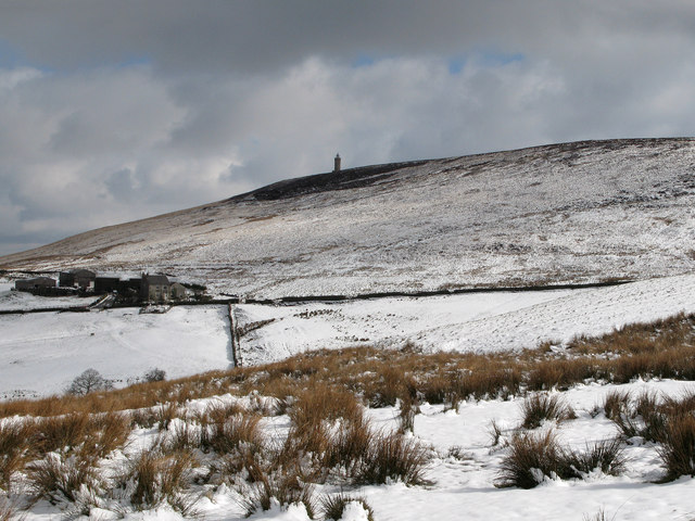
The octagonal Jubilee Tower (officially called Darwen Tower) at grid reference SD678215 on Darwen Hill overlooking the town of Darwen in Lancashire, England, was completed in 1898 to commemorate Queen Victoria's Diamond Jubilee and also to celebrate the victory of the local people for the right to access the moor. It was opened to the public on 24 September 1898. The architect was R. W. Smith-Saville and he modified the plans for the tower slightly. The tower is in height, while Darwen Hill is 1,220 feet (372 metres) above sea-level. Walkers can climb to the top of the tower via the internal staircase to see views of North Yorkshire, Morecambe Bay, Blackpool Tower, Cumbria, the Isle of Man, North Wales, Derbyshire, elsewhere in Lancashire, and surrounding moorland. Background Packmen, peddlers, farmers and labourers used tracks and moorland paths to go about their business. In the 1870s the Lord of the manor Lord of the Manor is a title that, in Anglo-Saxon England, refe ... [...More Info...] [...Related Items...] OR: [Wikipedia] [Google] [Baidu] |
Holcombe, Greater Manchester
Holcombe is a village in Ramsbottom ward, Metropolitan Borough of Bury, in Greater Manchester, England. It is situated south of Haslingden, east of Edgworth, west of Ramsbottom, and north of Tottington. The name comes from the Celtic ' meaning valley, and the Old English ', meaning deep or hollow. The village is located on the slopes of Holcombe Moor. Much of the moorland around the village is in the care of the National Trust and is popular with walkers, cyclists and bird watchers. The buildings in the area are made up predominantly of stone cottages and farms. There is a public house called the Shoulder of Mutton, a restaurant, church, and primary school. At one time the village also had a shop, post office, a lock-up, and a regular bus service linking it to Holcombe Brook, a neighbouring village in the valley bottom one mile to the south. Holcombe is the home of the Holcombe Hunt. This pack of Harrier's, which has been kennelled at Holcombe for over 200 years, is one of t ... [...More Info...] [...Related Items...] OR: [Wikipedia] [Google] [Baidu] |
Peel Monument
:''See peel tower for the generic structure'' The memorial tower to Sir Robert Peel, high above Ramsbottom was planned and erected at the same time as Bury was preparing its statue to the then recently deceased statesman who was born in Bury. The tower occupies a prominent position on Harcles Hill (known locally as "Holcombe Hill" due to its location next to Holcombe village) 1,100 feet (335 m) above sea level. The monument is believed to have been designed by members of the memorial committee who included the local textile entrepreneur and philanthropist William Grant. Grant was said to have been responsib ... [...More Info...] [...Related Items...] OR: [Wikipedia] [Google] [Baidu] |
Winter Hill Transmitting Station
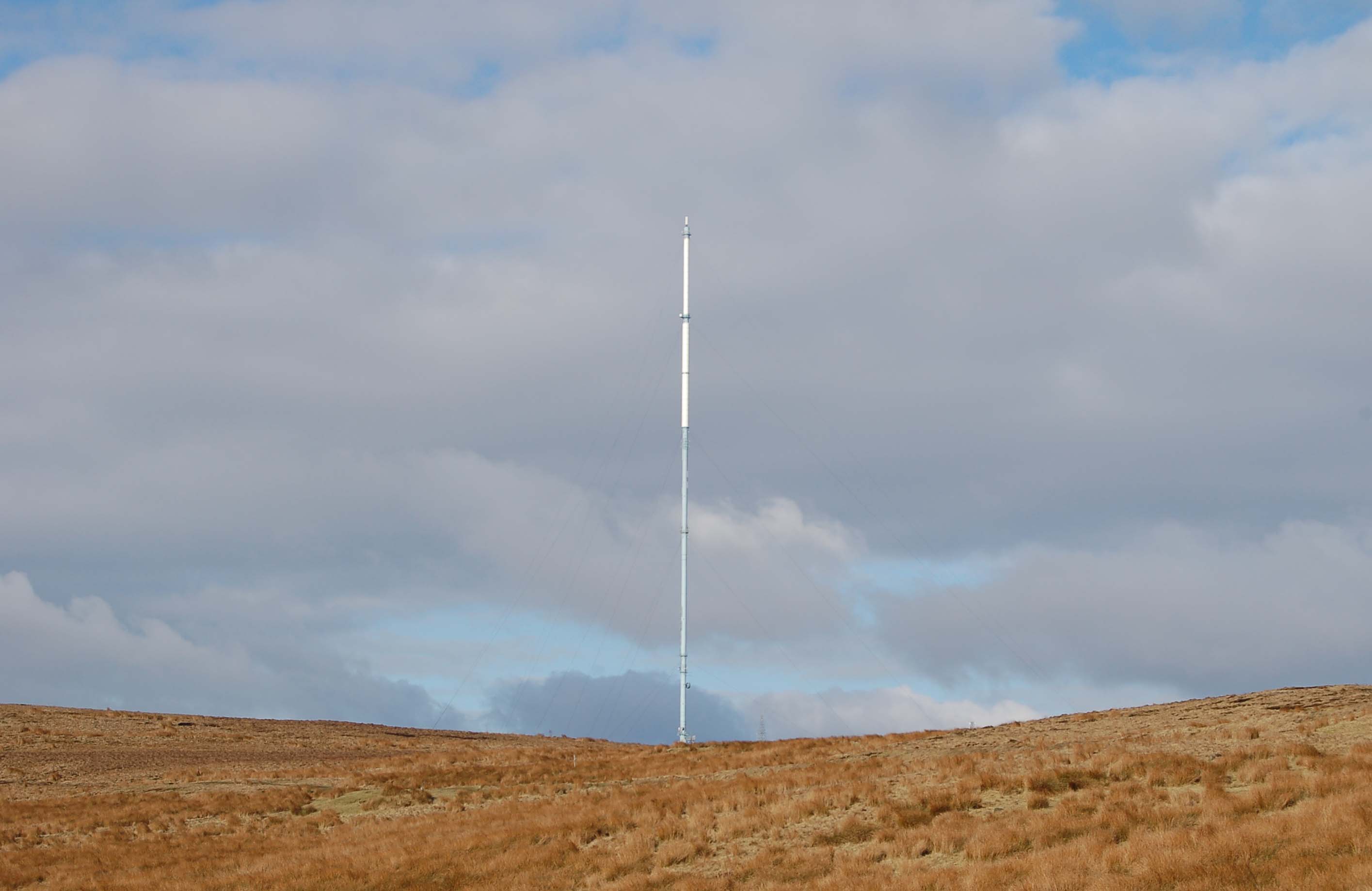
The Winter Hill transmitting station is a broadcasting and telecommunications site on Winter Hill, at the southern boundary of the Borough of Chorley, Lancashire and above Bolton. It is owned and operated by Arqiva. Height The original mast at Winter Hill was a tower that came into service on 3 May 1956, and carried the programmes of Granada Television (weekdays) and ABC Weekend Television. In 1966 services were transferred to a new higher mast erected adjacent to the original tower. The main mast structure is tall and has a diameter of . During the period of parallel digital and analogue transmissions, the DTT antenna attached to the top of the mast brought the overall height to , however as part of the Digital Switchover plans, this antenna has now been removed, reducing its overall height to . It is one of the tallest structures in the United Kingdom, the tallest being Skelton mast ; however, at above sea level, Winter Hill has the highest television transmitting antenna ... [...More Info...] [...Related Items...] OR: [Wikipedia] [Google] [Baidu] |
Haslingden
Haslingden is a town in Rossendale, Lancashire, England. It is north of Manchester. The name means 'valley of the hazels' or 'valley growing with hazels'. At the time of the 2011 census the town (including Helmshore) had a population of 15,969. The town is surrounded by high moorland; 370 m (1215 ft) to the north; 396 m (1300 ft) Cribden to the east; 418 m (1372 ft) Bull Hill to the south.Murray's Lancashire Architectural Guide/Peter Fleetwood-Hesketh 1955 Haslingden is the birthplace of the industrialist John Cockerill (1790–1840) and the composer Alan Rawsthorne (1905–1971), and was the home for many years of the Irish Republican leader, Michael Davitt (1846–1906). Haslingden Cricket Club is a member of the Lancashire League. History There is some evidence of Bronze Age human presence in the area of Haslingden. Thirteen Stones Hill is west of the town and probably dates from about 3000BC. There is now just one stone visible. Part of ... [...More Info...] [...Related Items...] OR: [Wikipedia] [Google] [Baidu] |
Ramsbottom
Ramsbottom is a market town in the Metropolitan Borough of Bury, Greater Manchester, England. The population at the 2011 census was 17,872. Historically in Lancashire, it is on the River Irwell in the West Pennine Moors, northwest of Bury, and of Manchester. Its name is believed to derive from Old English and , meaning 'valley of the ram'. Its Victorian architecture, Pennine landscape and industrial heritage, including the East Lancashire Railway, contribute to heritage tourism in the town. History Toponymy The name either means 'ram's valley' from the Old English , 'a ram' and , 'a valley' but could mean a 'wild garlic valley', with the first element representing the Old English meaning 'wild garlic'. A record from 1324 recording the name as is inconclusive. The town was alternatively recorded as ''Ramysbothom'' in 1540. Early history Evidence of prehistoric human activity has been discovered in the hills surrounding the town. Early records show that in Norman times R ... [...More Info...] [...Related Items...] OR: [Wikipedia] [Google] [Baidu] |


.jpg)


