|
West Melton, New Zealand
West Melton is a town in the Selwyn District, in the Canterbury region of New Zealand's South Island. It is located west of Christchurch and is part of the Christchurch metropolitan area. The town has a population of 2,640 (June 2022), making it the 124th-largest urban area in New Zealand, the 16th-largest in Canterbury and fifth-largest in the Selwyn District (behind Darfield and before Leeston). History West Melton was first settled in the 1870s, where it has long been associated with horse racing (trotting), cropping, and sheep farming. Recently, it has become associated with wine growing and deer farming. In 1881, Alfred Saunders arrived in West Melton, where he bought a farm that he referred to as a “bleak and wild looking property”. On 26 October 2014, West Melton residents celebrated the town's 150th anniversary. Urban expansion In 2007, West Melton saw the start of its urban expansion. Gainsborough and Halkett Grove subdivisions were the first developmen ... [...More Info...] [...Related Items...] OR: [Wikipedia] [Google] [Baidu] |
Urban Areas Of New Zealand
Statistics New Zealand defines urban areas of New Zealand for statistical purposes (they have no administrative or legal basis). The urban areas comprise List of cities in New Zealand, cities, List of towns in New Zealand, towns and other conurbations (an aggregation of urban settlements) of a thousand people or more. In combination, the urban areas of the country constitute New Zealand's urban population. As of , the urban population made up % of New Zealand's total population. The current standard for urban areas is the Statistical Standard for Geographic Areas 2018 (SSGA18), which replaced the New Zealand Standard Areas Classification 1992 (NZSAC92) in 2018. There are four classes of urban area under SSGA18: *Major urban areas, with a population of 100,000 or more. There are seven major urban areas which combined have a population of (% of the total population). *Large urban areas, with a population of 30,000 to 99,999. There are 13 large urban areas which combined have a pop ... [...More Info...] [...Related Items...] OR: [Wikipedia] [Google] [Baidu] |
Leeston
Leeston (Māori language, Māori: ''Karumata'') is a town on the Canterbury Plains in the South Island of New Zealand. It is located 30 kilometres southwest of Christchurch, between the shore of Lake Ellesmere / Te Waihora and the mouth of the Rakaia River. The town is home to a growing number of services which have increased and diversified along with the population. Leeston has a supermarket, schools (pre-school, primary school and high school), churches, hospital (for the elderly only), gym, cafes, restaurants, medical centre, pharmacy and post office. The Selwyn District Council currently has a service office in Leeston, after the headquarters was shifted to Rolleston, New Zealand, Rolleston. Demographics Leeston is described by Statistics New Zealand as a small urban area, and covers . It had an estimated population of as of with a population density of people per km2. Leeston had a population of 2,208 at the 2018 New Zealand census, an increase of 669 people (43.5%) ... [...More Info...] [...Related Items...] OR: [Wikipedia] [Google] [Baidu] |
Rolleston, New Zealand
Rolleston ( mi, Roretana, Tauwharekākaho) is the seat and largest town in the Selwyn District, in the Canterbury region of New Zealand's South Island. It is located on the Canterbury Plains south-west of Christchurch, and is part of the wider Christchurch metropolitan area. The town has a population of making it New Zealand's 24th-largest urban area and the third-largest in Canterbury (behind Christchurch and Timaru). It was nicknamed the "Town of the Future" in the 1970s by Prime Minister Norman Kirk. The "Town of the Future" signage has since been removed from the entrances to Rolleston. History Rolleston originated as a railway terminus in 1866, and is named after the Canterbury statesman William Rolleston. Rolleston, who was born in Yorkshire in 1831 and died in 1903, served as Superintendent of the Province of Canterbury from 1868 until 1876 (when central government abolished the New Zealand provinces). He also served as a Member of Parliament, holding various Cabinet ... [...More Info...] [...Related Items...] OR: [Wikipedia] [Google] [Baidu] |
Burnham Military Camp
Burnham, also known as Burnham Camp, is the largest army base in New Zealand's South Island. It is located 28 kilometres south of Christchurch on the Canterbury Plains in the Selwyn District, close to the town of Dunsandel. Burnham was named after Burnham Beeches, Buckinghamshire. The senior headquarters at the camp has seen many changes. Previously Headquarters 3 Task Force, 3 Task Force Region, HQ Ready Reaction Force, and 3 Land Force Group have been based here. Most recently 3 Land Force Group was disbanded in 2011, and Headquarters Deployable Joint Task Force Headquarters - Land (DJTFHQ-L) was formed. Demographics Burnham Camp is described by Statistics New Zealand as a rural settlement, and covers . It had an estimated population of as of with a population density of people per km2. Burnham Camp had a population of 1,146 at the 2018 New Zealand census, an increase of 57 people (5.2%) since the 2013 census, and a decrease of 60 people (-5.0%) since the 2006 cen ... [...More Info...] [...Related Items...] OR: [Wikipedia] [Google] [Baidu] |
Waimakariri River
The Waimakariri River is one of the largest rivers in Canterbury, on the eastern coast of New Zealand's South Island. It flows for in a generally southeastward direction from the Southern Alps across the Canterbury Plains to the Pacific Ocean. The river rises on the eastern flanks of the Southern Alps, eight kilometres southwest of Arthur's Pass. For much of its upper reaches, the river is braided, with wide shingle beds. As the river approaches the Canterbury Plains, it passes through a belt of mountains, and is forced into a narrow canyon (the Waimakariri Gorge), before reverting to its braided form for its passage across the plains. It enters the Pacific north of Christchurch, near the town of Kaiapoi. Instead of being unoccupied Crown land as are most New Zealand river beds, the bed of the Waimakariri River is vested in the Canterbury Regional Council (Environment Canterbury). Name The name ''Waimakariri'' comes from the Māori words ''wai'', meaning ''water'', and ''makari ... [...More Info...] [...Related Items...] OR: [Wikipedia] [Google] [Baidu] |
2006 New Zealand Census
The New Zealand Census of Population and Dwellings ( mi, Te Tatauranga o ngā Tāngata Huri Noa i Aotearoa me ō rātou Whare Noho) is a national population and housing census conducted by government department Statistics New Zealand every five years. There have been 34 censuses since 1851. In addition to providing detailed information about national demographics, the results of the census play an important part in the calculation of resource allocation to local service providers. The 2018 census took place on Tuesday 6 March 2018. The next census is expected in March 2023. Census date Since 1926, the census has always been held on a Tuesday and since 1966, the census always occurs in March. These are statistically the month and weekday on which New Zealanders are least likely to be travelling. The census forms have to be returned by midnight on census day for them to be valid. Conducting the census Until 2018, census forms were hand-delivered by census workers during the lead ... [...More Info...] [...Related Items...] OR: [Wikipedia] [Google] [Baidu] |
2013 New Zealand Census
The 2013 New Zealand census was the thirty-third national census. "The National Census Day" used for the census was on Tuesday, 5 March 2013. The population of New Zealand was counted as 4,242,048, – an increase of 214,101 or 5.3% over the 2006 census. The 2013 census forms were the same as the forms developed for the 2011 census which was cancelled due to the February 2011 major earthquake in Christchurch. There were no new topics or questions. New Zealand's next census was conducted in March 2018. Collection methods The results from the post-enumeration survey showed that the 2013 census recorded 97.6 percent of the residents in New Zealand on census night. However, the overall response rate was 92.9 percent, with a non-response rate of 7.1 percent made up of the net undercount and people who were counted in the census but had not received a form. Results Population and dwellings Population counts for New Zealand regions. Note: All figures are for the census usually r ... [...More Info...] [...Related Items...] OR: [Wikipedia] [Google] [Baidu] |
2018 New Zealand Census
Eighteen or 18 may refer to: * 18 (number), the natural number following 17 and preceding 19 * one of the years 18 BC, AD 18, 1918, 2018 Film, television and entertainment * ''18'' (film), a 1993 Taiwanese experimental film based on the short story ''God's Dice'' * ''Eighteen'' (film), a 2005 Canadian dramatic feature film * 18 (British Board of Film Classification), a film rating in the United Kingdom, also used in Ireland by the Irish Film Classification Office * 18 (''Dragon Ball''), a character in the ''Dragon Ball'' franchise * "Eighteen", a 2006 episode of the animated television series ''12 oz. Mouse'' Music Albums * ''18'' (Moby album), 2002 * ''18'' (Nana Kitade album), 2005 * '' 18...'', 2009 debut album by G.E.M. Songs * "18" (5 Seconds of Summer song), from their 2014 eponymous debut album * "18" (One Direction song), from their 2014 studio album ''Four'' * "18", by Anarbor from their 2013 studio album '' Burnout'' * "I'm Eighteen", by Alice Cooper commo ... [...More Info...] [...Related Items...] OR: [Wikipedia] [Google] [Baidu] |
Statistics New Zealand
Statistics New Zealand ( mi, Tatauranga Aotearoa), branded as Stats NZ, is the public service department of New Zealand charged with the collection of statistics related to the economy, population and society of New Zealand. To this end, Stats NZ produces censuses and surveys. Organisation Statistics New Zealand employs people with a variety of skills, including statisticians, mathematicians, computer science specialists, accountants, economists, demographers, sociologists, geographers, social psychologists, and marketers. There are seven organisational subgroups each managed by a Deputy Government Statistician: * Macro-economic and Environment Statistics studies prices, national accounts, develops macro-economic statistics, does government and international accounts, and ANZSIC 06 implementation (facilitating changeover to new classification code developed jointly with Australian statistics officials.) * Social and Population Statistics studies population, social conditions, ... [...More Info...] [...Related Items...] OR: [Wikipedia] [Google] [Baidu] |
Alfred Saunders
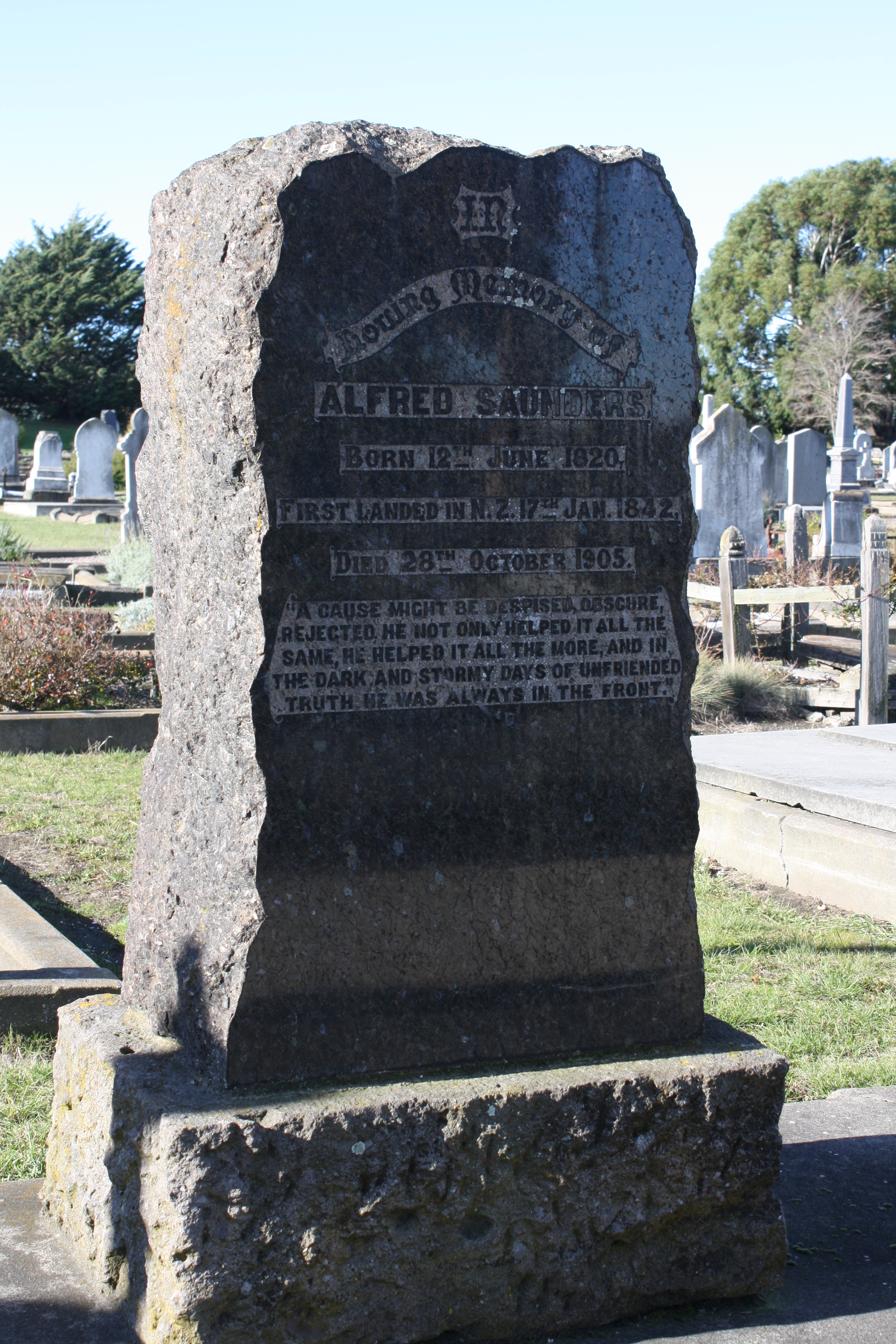
Alfred Saunders (12 June 1820 – 28 October 1905) was a 19th-century New Zealand politician. Early life Saunders was born in 1820 in Market Lavington, the youngest son of Mary and Amram Saunders. He was educated in Market Lavington and at a Bristol academy. William Saunders (1823–1895) was a younger brother. Political career He was elected onto the Nelson Provincial Council representing Waimea South in 1855 and remained a councillor until his election of Superintendent for the Nelson Province from 1865 to 1867. He was elected as Member of Parliament for Waimea in 1861, and he resigned from this seat in 1864. He then represented Cheviot from 1878 to 1881 when he was defeated. He unsuccessfully contested the in the electorate. He contested the in the electorate and was defeated by John Verrall by just two votes. From 1889 to 1890 he represented the Lincoln electorate and from 1890 to 1896 he represented Selwyn, being defeated at the general election of 189 ... [...More Info...] [...Related Items...] OR: [Wikipedia] [Google] [Baidu] |
Viticulture
Viticulture (from the Latin word for ''vine'') or winegrowing (wine growing) is the cultivation and harvesting of grapes. It is a branch of the science of horticulture. While the native territory of ''Vitis vinifera'', the common grape vine, ranges from Western Europe to the Iran, Persian shores of the Caspian Sea, the vine has demonstrated high levels of adaptability to new environments, hence viticulture can be found on every continent except Antarctica. Duties of the viticulturist include monitoring and controlling Pest (organism), pests and Plant pathology, diseases, fertilizer, fertilizing, irrigation (wine), irrigation, canopy (grape), canopy Glossary of viticultural terms#Canopy management, management, monitoring fruit development and Typicity, characteristics, deciding when to harvest (wine), harvest, and vine pruning during the winter months. Viticulturists are often intimately involved with winemakers, because vineyard management and the resulting grape characteristics ... [...More Info...] [...Related Items...] OR: [Wikipedia] [Google] [Baidu] |
Sheep Farming In New Zealand
Sheep farming is a significant industry in New Zealand. According to 2007 figures reported by the Food and Agriculture Organization (FAO) of the United Nations, there are 39 million sheep in the country (a count of about 10 per human). The country has the highest density of sheep per unit area in the world. For 130 years, sheep farming was the country's most important agricultural industry, but it was overtaken by dairy farming in 1987. Sheep numbers peaked in New Zealand in 1982 to 70 million and then dropped to about 27.6 million. There are 16,000 sheep and beef farms in the country which has made the country the world's largest exporter of lambs, with 24 million finished lambs recorded every year. History Sheep were introduced into New Zealand between 1773 and 1777 with credit to James Cook, the British explorer. Samuel Marsden, a missionary, introduced some flocks of sheep to the Bay of Islands, and then also farmed in Mana Island close to Wellington for the purpose of feedi ... [...More Info...] [...Related Items...] OR: [Wikipedia] [Google] [Baidu] |


