|
West Malpais Wilderness
West Malpais Wilderness is a designated Wilderness Area managed by the U. S. Bureau of Land Management LMlocated south of Grants, NM in Cibola County, New Mexico. Established in 1987, the 35,940-acre West Malpais Wilderness is located within the larger El Malpais National Conservation Area, a 231,230-acre BLM-managed area created in 1987 to protect the Grants Lava Flow, the Las Ventanas Chacoan Archeological Site, and other significant natural and cultural resources in Western New Mexico. One of two Wilderness Areas in the Conservation Area, the 35,940 acre West Malpais area is open to hiking, backpacking, horseback riding, and "Leave No Trace" primitive camping, and contains a short section of the Continental Divide National Scenic Trail. History and Administration The West Malpais Wilderness was created on December 31, 1987, with the passage of Public Law 100-225 by the 100th Congress. An important piece of public lands legislation, the law created not only the West Malpais ... [...More Info...] [...Related Items...] OR: [Wikipedia] [Google] [Baidu] |
Cibola County
Cibola County is a county in the U.S. state of New Mexico. As of the 2010 census, the population was 27,213. Its county seat is Grants. It is New Mexico's youngest county, and the third youngest county in the United States, created on June 19, 1981, from the westernmost four-fifths of the formerly much larger Valencia County. Cibola County comprises the Grants, New Mexico Micropolitan Statistical Area. The county is a rich mining area with numerous Uranium mines. Geography According to the U.S. Census Bureau, the county has an area of , of which is land and (0.05%) is water. Adjacent counties * McKinley County - north * Sandoval County - northeast * Bernalillo County - east * Valencia County - east * Socorro County - southeast * Catron County - south * Apache County, Arizona - west National protected areas * Cibola National Forest (part) * El Malpais National Conservation Area * El Malpais National Monument * El Morro National Monument Demographics 2000 census As of ... [...More Info...] [...Related Items...] OR: [Wikipedia] [Google] [Baidu] |
Cebolla Wilderness
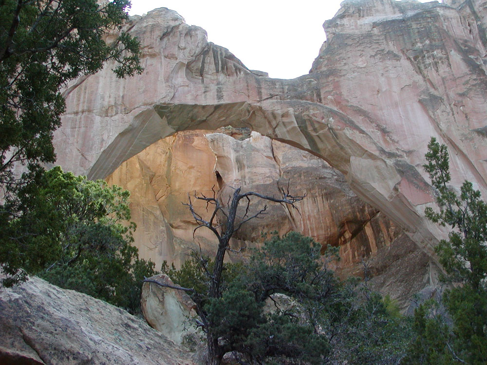
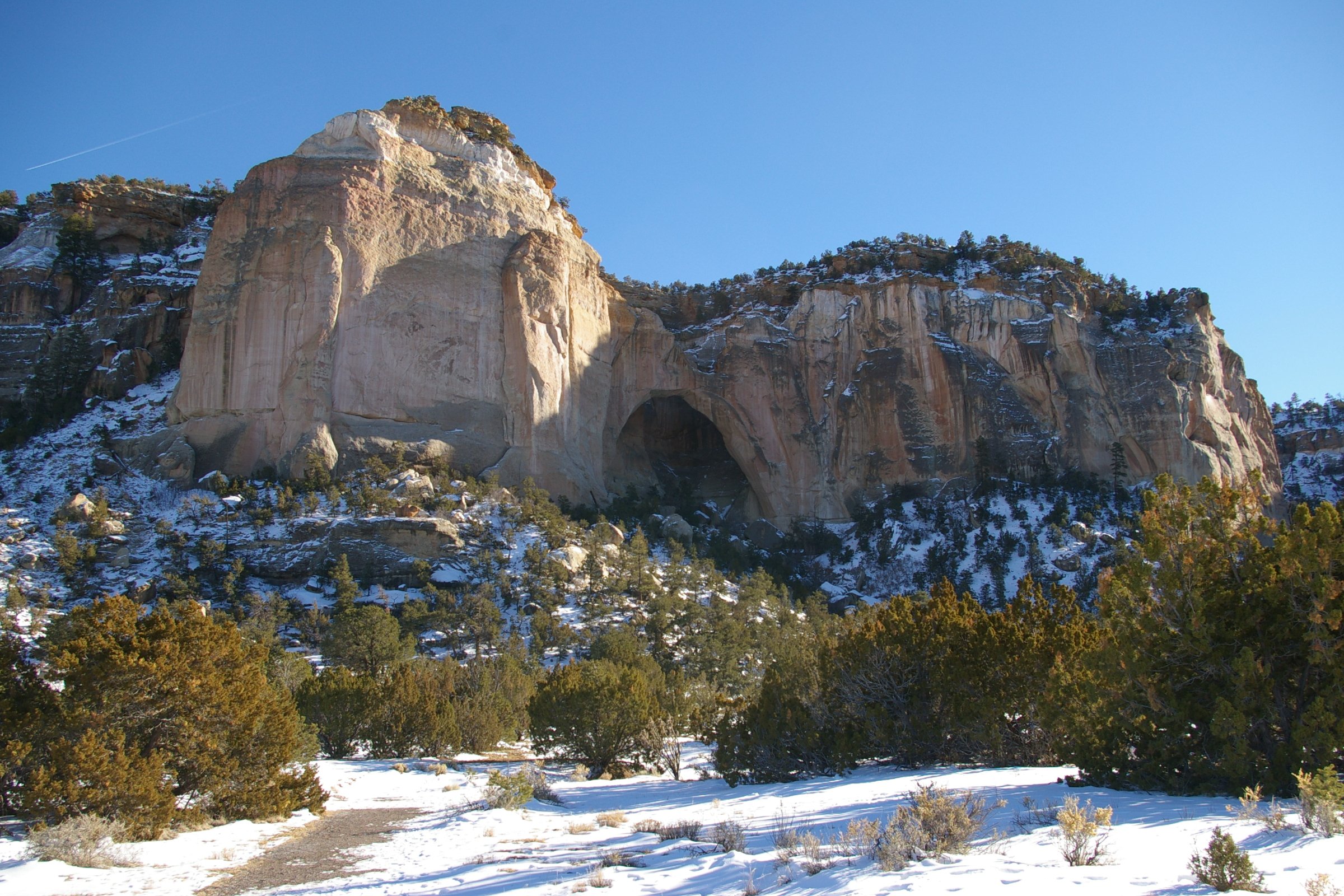
Cebolla Wilderness is a Wilderness area located within the El Malpais National Conservation Area in New Mexico. The area was added to the National Wilderness Preservation System on December 31, 1987 by Public Law 100-225. The area is a bordered by the Acoma Pueblo to the east and the El Malpais National Monument and New Mexico Highway 117 to the west. Elevations range from to . The sandstone canyons and mesas of this rimrock Rimrock is the sheer rock wall at the upper edge of a plateau, canyon, or geological uplift. It may refer to either the rock formation or to the rock itself. Rimrock may be composed of almost any stone—basalt, gneiss, granite, sandstone, et ... area include features such as La Ventana natural arch. References {{coord, 34.75, -107.92, type:landmark_region:US-NM_dim:50000, display=title Wilderness areas of New Mexico Protected areas of Cibola County, New Mexico ... [...More Info...] [...Related Items...] OR: [Wikipedia] [Google] [Baidu] |
El Morro National Monument
El Morro National Monument is a U.S. national monument in Cibola County, New Mexico, United States. Located on an ancient east–west trail in the western part of the state, the monument preserves the remains of a large prehistoric pueblo atop a great sandstone promontory with a pool of water at its base, which subsequently became a landmark where over the centuries explorers and travelers have left personal inscriptions that survive today. Between about 1275 to 1350 AD, up to 600 people of the Ancestral Puebloan culture lived in the 355+-room mesa-top pueblo. The village was situated on the old Zuni-Acoma Trail, an important ancient trade route. Spanish explorers visiting the area in the 16th century referred to the notable promontory as ''El Morro'' ("The Headland"); the local Zuni Indians call it ''A'ts'ina'' ("Place of writings on the rock"), and early Anglo-Americans referred to it as Inscription Rock. With its oasis-like source of water, El Morro served as a natural resting ... [...More Info...] [...Related Items...] OR: [Wikipedia] [Google] [Baidu] |
National Park Service
The National Park Service (NPS) is an agency of the United States federal government within the U.S. Department of the Interior that manages all national parks, most national monuments, and other natural, historical, and recreational properties with various title designations. The U.S. Congress created the agency on August 25, 1916, through the National Park Service Organic Act. It is headquartered in Washington, D.C., within the main headquarters of the Department of the Interior. The NPS employs approximately 20,000 people in 423 individual units covering over 85 million acres in all 50 states, the District of Columbia, and US territories. As of 2019, they had more than 279,000 volunteers. The agency is charged with a dual role of preserving the ecological and historical integrity of the places entrusted to its management while also making them available and accessible for public use and enjoyment. History Yellowstone National Park was created as the first national par ... [...More Info...] [...Related Items...] OR: [Wikipedia] [Google] [Baidu] |
El Malpais NM Ventana Arch
EL, El or el may refer to: Religion * El (deity), a Semitic word for "God" People * EL (rapper) (born 1983), stage name of Elorm Adablah, a Ghanaian rapper and sound engineer * El DeBarge, music artist * El Franco Lee (1949–2016), American politician * Ephrat Livni (born 1972), American street artist Arts, entertainment, and media Fictional entities * El, a character from the manga series ''Shugo Chara!'' by Peach-Pit * El, short for Eleven, a fictional character in the TV series ''Stranger Things'' * El, family name of Kal-El (Superman) and his father Jor-El in ''Superman'' *E.L. Faldt, character in the road comedy film ''Road Trip'' Literature * ''Él'', 1926 autobiographical novel by Mercedes Pinto * ''Él'' (visual novel), a 2000 Japanese adult visual novel Music * Él Records, an independent record label from the UK founded by Mike Alway * ''Él'' (Lucero album), a 1982 album by Lucero * "Él", Spanish song by Rubén Blades from ''Caminando'' (album) * "Él" (Luc ... [...More Info...] [...Related Items...] OR: [Wikipedia] [Google] [Baidu] |
Ponderosa Pine
''Pinus ponderosa'', commonly known as the ponderosa pine, bull pine, blackjack pine, western yellow-pine, or filipinus pine is a very large pine tree species of variable habitat native to mountainous regions of western North America. It is the most widely distributed pine species in North America.Safford, H.D. 2013. Natural Range of Variation (NRV) for yellow pine and mixed conifer forests in the bioregional assessment area, including the Sierra Nevada, southern Cascades, and Modoc and Inyo National Forests. Unpublished report. USDA Forest Service, Pacific Southwest Region, Vallejo, CA/ref> ''Pinus ponderosa'' grows in various erect forms from British Columbia southward and eastward through 16 western U.S. states and has been successfully introduced in temperate regions of Europe, and in New Zealand. It was first documented in modern science in 1826 in eastern Washington near present-day Spokane (of which it is the official city tree). On that occasion, David Douglas misidenti ... [...More Info...] [...Related Items...] OR: [Wikipedia] [Google] [Baidu] |
Albuquerque, NM
Albuquerque ( ; ), ; kee, Arawageeki; tow, Vakêêke; zun, Alo:ke:k'ya; apj, Gołgéeki'yé. abbreviated ABQ, is the most populous city in the U.S. state of New Mexico. Its nicknames, The Duke City and Burque, both reference its founding in 1706 as ''La Villa de Alburquerque'' by Nuevo México governor Francisco Cuervo y Valdés''.'' Named in honor of the Viceroy of New Spain, the 10th Duke of Alburquerque, the city was an outpost on El Camino Real linking Mexico City to the northernmost territories of New Spain. Located in the Albuquerque Basin, the city is flanked by the Sandia Mountains to the east and the West Mesa to the west, with the Rio Grande and bosque flowing from north-to-south. According to the 2020 census, Albuquerque had 564,559 residents, making it the 32nd-most populous city in the United States and the fourth largest in the Southwest. It is the principal city of the Albuquerque metropolitan area, which had 916,528 residents as of July 2020, and forms ... [...More Info...] [...Related Items...] OR: [Wikipedia] [Google] [Baidu] |
El Malpais National Monument
El Malpais National Monument is a National Monument located in western New Mexico, in the Southwestern United States. The name El Malpais is from the Spanish term '' Malpaís'', meaning ''badlands'', due to the extremely barren and dramatic volcanic field that covers much of the park's area. It is on the Trails of the Ancients Byway, one of the designated New Mexico Scenic Byways.Trail of the Ancients. New Mexico Tourism Department. Retrieved August 14, 2014. Geography and geology |
New Mexico
) , population_demonym = New Mexican ( es, Neomexicano, Neomejicano, Nuevo Mexicano) , seat = Santa Fe , LargestCity = Albuquerque , LargestMetro = Tiguex , OfficialLang = None , Languages = English, Spanish ( New Mexican), Navajo, Keres, Zuni , Governor = , Lieutenant Governor = , Legislature = New Mexico Legislature , Upperhouse = Senate , Lowerhouse = House of Representatives , Judiciary = New Mexico Supreme Court , Senators = * * , Representative = * * * , postal_code = NM , TradAbbreviation = N.M., N.Mex. , area_rank = 5th , area_total_sq_mi = 121,591 , area_total_km2 = 314,915 , area_land_sq_mi = 121,298 , area_land_km2 = 314,161 , area_water_sq_mi = 292 , area_water_km2 = 757 , area_water_percent = 0.24 , population_as_of = 2020 , population_rank = 36th , 2010Pop = 2,117,522 , population_density_rank = 45th , 2000DensityUS = 17.2 , 2000Density = 6.62 , MedianHouseholdIncome = $51,945 , IncomeRank = 45th , AdmittanceOrder = ... [...More Info...] [...Related Items...] OR: [Wikipedia] [Google] [Baidu] |
Continental Divide National Scenic Trail
The Continental Divide National Scenic Trail (in short Continental Divide Trail (CDT)) is a United States National Scenic Trail with a length measured by the Continental Divide Trail Coalition of between the U.S. border with Chihuahua, Mexico and the border with Alberta, Canada. Frequent route changes and a large number of alternate routes result in an actual hiking distance of to . The CDT follows the Continental Divide of the Americas along the Rocky Mountains and traverses five U.S. states — Montana, Idaho, Wyoming, Colorado, and New Mexico. In Montana near the Canadian border the trail crosses Triple Divide Pass (near Triple Divide Peak, from which waters may flow to either the Arctic Ocean (via Hudson Bay), Atlantic Ocean or Pacific Ocean). In 2021, the CDT was about 70 percent complete, with a combination of dedicated trails and dirt and paved roads. Hikers can continue north into Alberta and British Columbia via the Great Divide Trail to Kakwa Lake in Kakwa Provi ... [...More Info...] [...Related Items...] OR: [Wikipedia] [Google] [Baidu] |
El Malpais National Conservation Area
The El Malpais National Conservation Area is a federally protected conservation area in the U.S. state of New Mexico. The El Malpais National Conservation area was established in 1987 and is managed by the Bureau of Land Management as part of the National Landscape Conservation System. The adjoining El Malpais National Monument was established at the same time and is managed by the National Park Service. The El Malpais NCA includes two wilderness areas — the West Malpais Wilderness and Cebolla Wilderness Area — covering almost . Cultural landscape For more than 10,000 years people have interacted with the El Malpais landscape. Historic and prehistoric Cultural landscape sites provide connections to past times. More than mere artifacts, these cultural resources are kept alive by the spiritual and physical presence of contemporary Indian groups, including the Puebloan peoples of Acoma, Laguna and Zuni, and the Ramah Navajo. Features El Malpais ('the badlands') is S ... [...More Info...] [...Related Items...] OR: [Wikipedia] [Google] [Baidu] |


.png)
.jpg)