|
West Linga
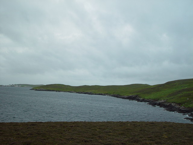
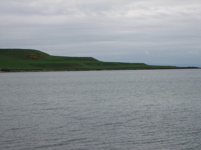
West Linga is an uninhabited island located between Mainland and Whalsay in Shetland, Scotland. Geography and geology West Linga is a long narrow island covered in rough heath. It is separated from Whalsay by Linga Sound, and Lunning on Mainland, Shetland to the west. Little Linga, Swarta Skerry, Lona Skerry and Ketill Holm lie to the west. The Calf of Linga to the south is a drying islet. Wether Holm is separated by a deep channel at the north end. There are two lochs, and a natural arch in the north west. The two main hills are at either end - North and South Ward. There is a cairn in the south. The rock is coarse micaceous, and hornblendic gneiss with granite veins. There is a raised beach above Croo Wick at the southern extremity. History West Linga appears to have been inhabited intermittently until the late 18th century. The lack of an anchorage and somewhat brackish water have hindered settlement. Some acreage on "Liungøuo í Hwalsøyo" is recorded in 14 ... [...More Info...] [...Related Items...] OR: [Wikipedia] [Google] [Baidu] |
Shetland Mainland
The Mainland is the main island of Shetland, Scotland. The island contains Shetland's only burgh, Lerwick, and is the centre of Shetland's ferry and air connections. Geography It has an area of , making it the third-largest Scottish island and the fifth largest of the British Isles after Great Britain, Ireland, Lewis and Harris and Skye. Mainland is the second most populous of the Scottish islands (only surpassed by Lewis and Harris), and had 18,765 residents in 2011 compared to 17,550 in 2001. The mainland can be broadly divided into four sections: *The long southern peninsula, south of Lerwick, has a mixture of moorland and farmland and contains many important archaeological sites. **Bigton, Cunningsburgh, Sandwick, Scalloway, and Sumburgh *The Central Mainland has more farmland and some woodland plantations. *The West Mainland **Aith, Walls, and Sandness *The North Mainland – in particular the large Northmavine peninsula, connected to Mainland by a narrow isthmus at Mav ... [...More Info...] [...Related Items...] OR: [Wikipedia] [Google] [Baidu] |
Mica
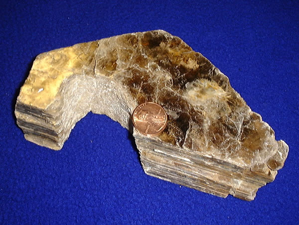
Micas ( ) are a group of silicate minerals whose outstanding physical characteristic is that individual mica crystals can easily be split into extremely thin elastic plates. This characteristic is described as perfect basal cleavage. Mica is common in igneous and metamorphic rock and is occasionally found as small flakes in sedimentary rock. It is particularly prominent in many granites, pegmatites, and schists, and "books" (large individual crystals) of mica several feet across have been found in some pegmatites. Micas are used in products such as drywalls, paints, fillers, especially in parts for automobiles, roofing and shingles, as well as in electronics. The mineral is used in cosmetics and food to add "shimmer" or "frost." Properties and structure The mica group is composed of 37 phyllosilicate minerals. All crystallize in the monoclinic system, with a tendency towards pseudohexagonal crystals, and are similar in structure but vary in chemical composition. Micas are ... [...More Info...] [...Related Items...] OR: [Wikipedia] [Google] [Baidu] |
Uninhabited Islands Of Shetland
The list of uninhabited regions includes a number of places around the globe. The list changes year over year as human beings migrate into formerly uninhabited regions, or migrate out of formerly inhabited regions. List As a group, the list of uninhabited places are called the "nonecumene". This is a special geography term which means the uninhabited area of the world. * Virtually all of the Ocean *Virtually all of Antarctica *Most of The Arctic *Most of Greenland *Most of The Sahara * Antipodes Islands * Ashmore and Cartier Islands * Bajo Nuevo Bank * Baker Island * Ball's Pyramid * Balleny Islands * Big Major Cay * Bouvet Island * Much of the interior of Brazil * Caroline Island * Clipperton Island * The semi-arid regions and deserts of Australia * Devon Island * Much of Eastern Oregon * Elephant Island * Elobey Chico * Ernst Thälmann Island * Much of Fiordland, New Zealand * Goa Island * Gough Island * Hans Island * Harmil * Hashima Island * Hatutu * Heard Island and ... [...More Info...] [...Related Items...] OR: [Wikipedia] [Google] [Baidu] |
Hugh MacDiarmid
Christopher Murray Grieve (11 August 1892 – 9 September 1978), best known by his pen name Hugh MacDiarmid (), was a Scottish poet, journalist, essayist and political figure. He is considered one of the principal forces behind the Scottish Renaissance and has had a lasting impact on Scottish culture and politics. He was a founding member of the National Party of Scotland in 1928 but left in 1933 due to his Marxist–Leninist views. He joined the Communist Party the following year only to be expelled in 1938 for his nationalist sympathies. He would subsequently stand as a parliamentary candidate for both the Scottish National Party (1945) and British Communist Party (1964). Grieve's earliest work, including ''Annals of the Five Senses'', was written in English, but he is best known for his use of "synthetic Scots", a literary version of the Scots language that he himself developed. From the early 1930s onwards MacDiarmid made greater use of English, sometimes a "synthetic English ... [...More Info...] [...Related Items...] OR: [Wikipedia] [Google] [Baidu] |
Norway
Norway, officially the Kingdom of Norway, is a Nordic country in Northern Europe, the mainland territory of which comprises the western and northernmost portion of the Scandinavian Peninsula. The remote Arctic island of Jan Mayen and the archipelago of Svalbard also form part of Norway. Bouvet Island, located in the Subantarctic, is a dependency of Norway; it also lays claims to the Antarctic territories of Peter I Island and Queen Maud Land. The capital and largest city in Norway is Oslo. Norway has a total area of and had a population of 5,425,270 in January 2022. The country shares a long eastern border with Sweden at a length of . It is bordered by Finland and Russia to the northeast and the Skagerrak strait to the south, on the other side of which are Denmark and the United Kingdom. Norway has an extensive coastline, facing the North Atlantic Ocean and the Barents Sea. The maritime influence dominates Norway's climate, with mild lowland temperatures on the se ... [...More Info...] [...Related Items...] OR: [Wikipedia] [Google] [Baidu] |
Bergen
Bergen (), historically Bjørgvin, is a city and municipality in Vestland county on the west coast of Norway. , its population is roughly 285,900. Bergen is the second-largest city in Norway. The municipality covers and is on the peninsula of Bergenshalvøyen. The city centre and northern neighbourhoods are on Byfjorden, 'the city fjord', and the city is surrounded by mountains; Bergen is known as the "city of seven mountains". Many of the extra-municipal suburbs are on islands. Bergen is the administrative centre of Vestland county. The city consists of eight boroughs: Arna, Bergenhus, Fana, Fyllingsdalen, Laksevåg, Ytrebygda, Årstad, and Åsane. Trading in Bergen may have started as early as the 1020s. According to tradition, the city was founded in 1070 by King Olav Kyrre and was named Bjørgvin, 'the green meadow among the mountains'. It served as Norway's capital in the 13th century, and from the end of the 13th century became a bureau city of the Hanseatic Leag ... [...More Info...] [...Related Items...] OR: [Wikipedia] [Google] [Baidu] |
Holy Cross Church, Bergen
Holy Cross Church ( no, Korskirken) is a special parish church in Bergen municipality in Vestland county, Norway. It is situated in the centre of the city of Bergen, just east of the head of the Vågen bay. The church is located at the intersection of the streets Kong Oscars gate and Nedre Korskirkeallmenning. It is one of the churches for the Bergen domprosti parish which is part of the Bergen domprosti (arch-deanery) in the Diocese of Bjørgvin. The large stone church was built in a cruciform design around the year 1150 using plans drawn up by an unknown architect. The church seats about 600 people. History The oldest part of the church dates back to the second half of the 12th century. The first church on the site was built around the year 1150. Holy Cross Church was first mentioned in Sverris saga from 1185. At the time of construction, the church was situated on the shore of Vågen, probably marking the southern border of settlement in Bergen. The name refers to the True ... [...More Info...] [...Related Items...] OR: [Wikipedia] [Google] [Baidu] |
Brackish Water
Brackish water, sometimes termed brack water, is water occurring in a natural environment that has more salinity than freshwater, but not as much as seawater. It may result from mixing seawater (salt water) and fresh water together, as in estuaries, or it may occur in brackish fossil aquifers. The word comes from the Middle Dutch root '' brak''. Certain human activities can produce brackish water, in particular civil engineering projects such as dikes and the flooding of coastal marshland to produce brackish water pools for freshwater prawn farming. Brackish water is also the primary waste product of the salinity gradient power process. Because brackish water is hostile to the growth of most terrestrial plant species, without appropriate management it is damaging to the environment (see article on shrimp farms). Technically, brackish water contains between 0.5 and 30 grams of salt per litre—more often expressed as 0.5 to 30 parts per thousand (‰), which is a specific gr ... [...More Info...] [...Related Items...] OR: [Wikipedia] [Google] [Baidu] |
Raised Beach
A raised beach, coastal terrace,Pinter, N (2010): 'Coastal Terraces, Sealevel, and Active Tectonics' (educational exercise), from 2/04/2011/ref> or perched coastline is a relatively flat, horizontal or gently inclined surface of marine origin,Pirazzoli, PA (2005a): 'Marine Terraces', in Schwartz, ML (ed) ''Encyclopedia of Coastal Science.'' Springer, Dordrecht, pp. 632–633 mostly an old abrasion platform which has been lifted out of the sphere of wave activity (sometimes called "tread"). Thus, it lies above or under the current sea level, depending on the time of its formation.Strahler AH; Strahler AN (2005): ''Physische Geographie.'' Ulmer, Stuttgart, 686 p.Leser, H (ed)(2005): ‚''Wörterbuch Allgemeine Geographie.'' Westermann&Deutscher Taschenbuch Verlag, Braunschweig, 1119 p. It is bounded by a steeper ascending slope on the landward side and a steeper descending slope on the seaward side (sometimes called "riser"). Due to its generally flat shape, it is often used for a ... [...More Info...] [...Related Items...] OR: [Wikipedia] [Google] [Baidu] |
Granite
Granite () is a coarse-grained (phaneritic) intrusive igneous rock composed mostly of quartz, alkali feldspar, and plagioclase. It forms from magma with a high content of silica and alkali metal oxides that slowly cools and solidifies underground. It is common in the continental crust of Earth, where it is found in igneous intrusions. These range in size from dikes only a few centimeters across to batholiths exposed over hundreds of square kilometers. Granite is typical of a larger family of ''granitic rocks'', or ''granitoids'', that are composed mostly of coarse-grained quartz and feldspars in varying proportions. These rocks are classified by the relative percentages of quartz, alkali feldspar, and plagioclase (the QAPF classification), with true granite representing granitic rocks rich in quartz and alkali feldspar. Most granitic rocks also contain mica or amphibole minerals, though a few (known as leucogranites) contain almost no dark minerals. Granite is nearly alway ... [...More Info...] [...Related Items...] OR: [Wikipedia] [Google] [Baidu] |
Gneiss
Gneiss ( ) is a common and widely distributed type of metamorphic rock. It is formed by high-temperature and high-pressure metamorphic processes acting on formations composed of igneous or sedimentary rocks. Gneiss forms at higher temperatures and pressures than schist. Gneiss nearly always shows a banded texture characterized by alternating darker and lighter colored bands and without a distinct cleavage. Gneisses are common in the ancient crust of continental shields. Some of the oldest rocks on Earth are gneisses, such as the Acasta Gneiss. Description Orthogneiss from the Czech Republic In traditional English and North American usage, a gneiss is a coarse-grained metamorphic rock showing compositional banding (gneissic banding) but poorly developed schistosity and indistinct cleavage. In other words, it is a metamorphic rock composed of mineral grains easily seen with the unaided eye, which form obvious compositional layers, but which has only a weak tendency to fracture ... [...More Info...] [...Related Items...] OR: [Wikipedia] [Google] [Baidu] |


