|
Wendron
Wendron ( kw, Egloswendron (village), Pluw Wendron (parish); historically St. Wendron) is a village and civil parish in Cornwall, England, United Kingdom, to the north of Helston. The parish population at the 2011 census was 2,743. The electoral ward of Wendron had a 2011 population of 4,936. History The parish of Wendron was part of the Hundred of Kerrier and was originally bounded by the parishes of Illogan, Gwennap, Stithians, Constantine, Mawgan-in-Meneage, Gunwalloe, Sithney and Crowan. Until the mid 19th-century the parish of Wendron included the town of Helston and what are now the parishes of Carnmenellis and Pencoys. The parish of Carnmenellis was created in 1846; Helston in 1848; and Pencoys in 1881. Before 1284 Edmund, Earl of Cornwall, gave the church of Wendron, with its chapels, to Rewley Abbey near Oxford. Before this it had belonged to the Earl's, Manor of Helston, which included the whole parish. The church is cruciform but was enlarged in the 15th-century ... [...More Info...] [...Related Items...] OR: [Wikipedia] [Google] [Baidu] |
Bodilly
Bodilly is a Hamlet (place), hamlet in south Cornwall, England, United Kingdom, that lends its name to neighbouring farms and settlements. It is situated in the civil parish of Wendron approximately northwest of Wendron. The hamlet itself is at , but the name Bodilly generally covers the area northwest of Wendron. History The hamlet dates at least to the 14th century. It first appears in print around 1302, as "Bodelymur juxta Relegh", meaning "Bodelymur adjoining Releath". In terms of toponymy, the name quickly shortened to Bodely and variations (Bodili, Bodilli, Bodilly, Bodyly) in the mid- to late 14th century. The hamlet appears as Bodillye in 1678, but Bodilly has been used since 1844. In Medieval times, there was a chapel of St Henry the Hermit (died 1120, feast day on 16 January) in Bodilly. The site was located to the west of the hamlet, down a footpath that now crosses the valley to the west. Not much remains of the original chapel. It would have originally been a wood ... [...More Info...] [...Related Items...] OR: [Wikipedia] [Google] [Baidu] |
Helston
Helston ( kw, Hellys) is a town and civil parish in Cornwall, England, United Kingdom. It is situated at the northern end of the Lizard Peninsula approximately east of Penzance and south-west of Falmouth.Ordnance Survey: Landranger map sheet 203 ''Land's End'' Helston is the most southerly town on the island of Great Britain and is around farther south than Penzance. The population in 2011 was 11,700. The former stannary and cattle market town is best known for the annual Furry Dance (known locally as the Flora Dance), said to originate from the medieval period. However, the Hal-an-Tow is reputed to be of Celtic origin. The associated song and music, The Floral Dance, is known to have been written in 1911. In 2001, the town celebrated the 800th anniversary of the granting of its Charter. History The name comes from the Cornish 'hen lis' or 'old court' and 'ton' added later to denote a Saxon manor; the Domesday Book refers to Henliston (which survives as the name of ... [...More Info...] [...Related Items...] OR: [Wikipedia] [Google] [Baidu] |
Cornwall
Cornwall (; kw, Kernow ) is a historic county and ceremonial county in South West England. It is recognised as one of the Celtic nations, and is the homeland of the Cornish people. Cornwall is bordered to the north and west by the Atlantic Ocean, to the south by the English Channel, and to the east by the county of Devon, with the River Tamar forming the border between them. Cornwall forms the westernmost part of the South West Peninsula of the island of Great Britain. The southwesternmost point is Land's End and the southernmost Lizard Point. Cornwall has a population of and an area of . The county has been administered since 2009 by the unitary authority, Cornwall Council. The ceremonial county of Cornwall also includes the Isles of Scilly, which are administered separately. The administrative centre of Cornwall is Truro, its only city. Cornwall was formerly a Brythonic kingdom and subsequently a royal duchy. It is the cultural and ethnic origin of the Cornish dias ... [...More Info...] [...Related Items...] OR: [Wikipedia] [Google] [Baidu] |
Rewley Abbey
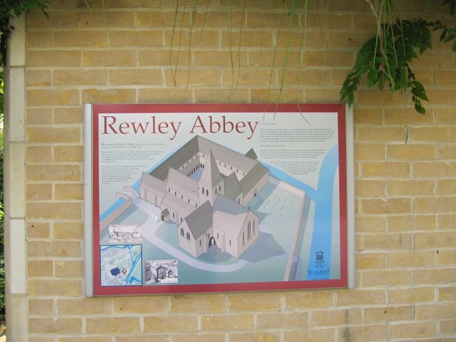
The Cistercian Abbey of Rewley was an abbey in Oxford, England. It was founded in the 13th century by Edmund, 2nd Earl of Cornwall. Edmund's father, Richard, 1st Earl of Cornwall, founder of Hailes Abbey, had intended to establish a college or chantry of three secular priests to pray for his soul, but his son Edmund substituted 'six Cistercian monks, having more confidence in them'. If this was the original plan, it was soon enlarged. In 1280 he offered the general chapter of the Cistercian order to found a college (studium) for Cistercians at Oxford, and the chapter accepted the offer, and decreed that the college should have the same privileges as the college of St. Bernard at Paris, and that it should be under the Abbot of Thame, as the other was under the Abbot of Clairvaux. The following year the chapter decreed 'out of due respect to the Earl of Cornwall' that the Abbot of Thame should be empowered to appoint an Abbot of his own choice for the house of study at Oxford, a ... [...More Info...] [...Related Items...] OR: [Wikipedia] [Google] [Baidu] |
St Uny
Saint Euny or Uny (6th century) is the patron saint of the churches of Lelant and Redruth in west Cornwall, England, UK. Life William Worcester in his account of travels in Cornwall in 1478 records that St Uny, the brother of St Herygh, was buried at the parish church of St Uny near the town of Lelant, and that his feast day was 1 February. According to him Uny and Herygh (patron of St Erth) were the brothers of St Ia, patron of St Ives (St Ia was an Irish princess who evangelised part of Cornwall). This account is the first record of the spelling "Uny", no doubt because it was recorded as spoken rather than written. The correct spelling is "Euny" though the spelling "Uny" is used after the mid 16th century. As well as being the patron of Lelant and Redruth Euny is the joint patron of Crowan. In all three churches the feast day is the Sunday nearest to 1 February, the day mentioned by William Worcester. In some 18th-century documents there is evidence that the parish of Crowan w ... [...More Info...] [...Related Items...] OR: [Wikipedia] [Google] [Baidu] |
Stithians
Stithians ( kw, Stedhyans), also known as St Stythians, is a village and civil parishes in England, civil parish in Cornwall, England, United Kingdom. It lies in the middle of the triangle bounded by Redruth, Helston and Falmouth, Cornwall, Falmouth. Its population (2001) is 2,004, increasing to 2,101 at the 2011 census An electoral ward in the same name also exists but stretches north to St Day. The population here also at the 2011 census was 5,023. The parish is mainly agricultural, lying south of the Gwennap mining area and north of the quarrying areas of Rame, Wendron, Rame and Longdowns. The River Kennall runs through the parish: in the 19th century, this river workea flour mill and a number of gunpowder mills, machinery at a foundry, and a paper mill Churches Parish church The parish church is dedicated to St Stythian, but it is hard to identify this saint. References to the parish in 13th and 14th century records show various spellings: Stethyana, Stediana, Stedyan, ... [...More Info...] [...Related Items...] OR: [Wikipedia] [Google] [Baidu] |
Degibna
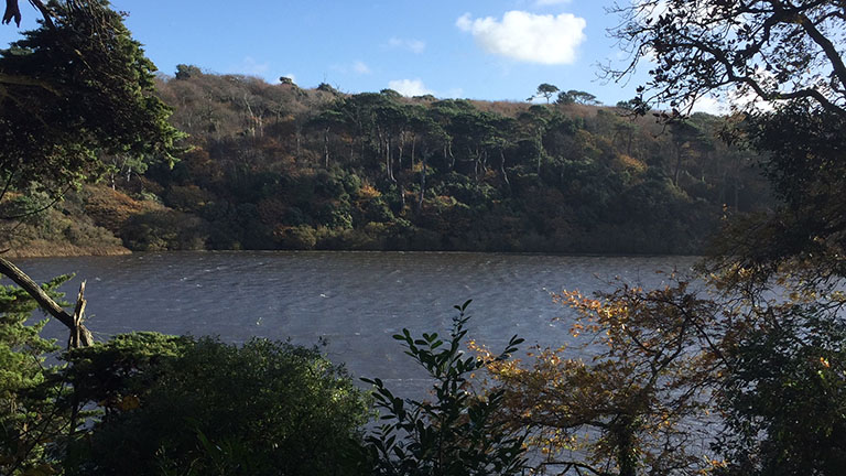
Degibna is a hamlet and farm in the parish of Helston, Cornwall, England, UK. It lies on the eastern bank of the largest natural freshwater lake in Cornwall, The Loe, and forms part of the Penrose Estate. Geography Degibna lies in the Cornwall Area of Outstanding Natural Beauty. Almost a third of Cornwall has AONB designation, with the same status and protection as a National Park. It is agricultural in nature, with most of the hamlet being devised of farmland. There is a large plantation, Degibna Woods, on the edge of the Loe which used to act as a carriage ride and shoot location for visitors to Penrose Estate, but is now utilised by walkers. Degibna is bordered to the north by the parish of Helston, to the east by the parish of St Mawgan-in-Meneage, to the south by the parish of Gunwalloe and Mount's Bay, and to the west by the Parish of Porthleven. History The earliest mention of Degibna is in 1272 when King Edward I granted land of a Cornish acre at Decuman to William de ... [...More Info...] [...Related Items...] OR: [Wikipedia] [Google] [Baidu] |
Crowan
Crowan ( kw, Egloskrewen (village), Pluw Grewen (parish)) is a village and civil parish in Cornwall, United Kingdom. It is about three-and-a-half miles (6 km) south of Camborne.Ordnance Survey: Landranger map sheet 203 ''Land's End'' A former mining parish, all of the mines had shut by 1880. Geography Crowan had a population of 2,375 (2001) which had increased to 2,454 in the 2011 census. Crowan Churchtown is not the largest settlement: there are villages at Praze-an-Beeble, Nancegollan, Bolitho and Leedstown and a hamlet at Black Rock (on the B3280 road four miles (6.5 km) south of Camborne and five miles (8 km) north of Helston). The hamlets of Carzise, Clowance Wood, Drym, Fraddam, Gwinear Downs, Horsedowns, Nine Maidens Downs, Noonvares, Paul's Green, Releath, Townshend and Tremayne are also in the parish. The River Hayle rises near Crowan and flows through the village and the railway branch to Helston passed nearby. Notable buildings and antiquities ... [...More Info...] [...Related Items...] OR: [Wikipedia] [Google] [Baidu] |
Carnmenellis
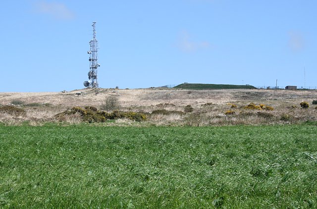
Carnmenellis Hill (or just Carnmenellis) gives its name to the area of west Cornwall in England, between Redruth, Helston and Penryn. The hill itself is situated approximately three miles (5 km) south of Redruth.Ordnance Survey: Landranger map sheet 203 ''Land's End'' It is one of five Marilyns in Cornwall; the others being Brown Willy (420 m), Kit Hill (334 m), Hensbarrow Beacon (312 m) and Watch Croft (252 m). The natural region of Carnmenellis has been designated as national character area 155 by Natural England. Penmarth, a nearby village, is sometimes referred to locally as Carnmenellis. The term 'Carnmenellis Granite' refers to the plateau In geology and physical geography, a plateau (; ; ), also called a high plain or a tableland, is an area of a highland consisting of flat terrain that is raised sharply above the surrounding area on at least one side. Often one or more sides ha ... of high ground in this area, one of five granite plutons in Cornwall that ... [...More Info...] [...Related Items...] OR: [Wikipedia] [Google] [Baidu] |
Pencoys
Four Lanes ( kw, Peder Bownder) is a village in west Cornwall, England, United Kingdom approximately south of Redruth at in the civil parish of Carn Brea. Pencoys is a smaller settlement which adjoins Four Lanes immediately to the south. St Andrew's Church was consecrated by Bishop Benson in 1881. Geography Four Lanes and Pencoys are on the upland plateau of the Carnmenellis granite batholith. Four Lanes village centre is 220 metres (720 feet) above sea level. The village is centred on The Square which is at a crossroads where the north-to-south B3297 Redruth-Helston road is intersected by unclassified lanes to Stithians (south-east) and Carnkie (north-west). Post-1960s housing estates are to the south of the crossroads. History Four Lanes is the main settlement in the ecclesiastical parish of Pencoys which was established in 1881. In earlier times the area was part of the parish of Wendron and the name Pencoys means the end of the wood. Maria Charlotte Broadley, the wife ... [...More Info...] [...Related Items...] OR: [Wikipedia] [Google] [Baidu] |
Camborne And Redruth (UK Parliament Constituency)
Camborne and Redruth is a parliamentary constituency in the United Kingdom. The seat is in Cornwall on the South West Peninsula of England, and is currently represented by George Eustice, a Conservative who served as Environment Secretary between 2020 and 2022. History The constituency was created for the 2010 general election, primarily as the successor to Falmouth and Camborne, following a review of parliamentary representation in Cornwall by the Boundary Commission which increased the number of seats in the county from five to six. Constituency profile This is a large rural seat spanning both coasts of Cornwall where the Conservatives are strongest, but also the former mining towns of Hayle, Camborne and Redruth which are more Labour-leaning. Residents are less wealthy than the UK average.Electoral Calculus https://www.electoralcalculus.co.uk/fcgi-bin/seatdetails.py?seat=Camborne+and+Redruth Boundaries The District of Kerrier wards of Camborne North, Camborne South, C ... [...More Info...] [...Related Items...] OR: [Wikipedia] [Google] [Baidu] |
Constantine, Cornwall
Constantine () ( kw, Lann Gostentin, meaning ''church enclosure of St Constantine'') is a village and civil parish in Cornwall, England, United Kingdom. It is situated approximately five miles (8 km) west-southwest of Falmouth. The electoral ward also bears the same name but includes Budock Water and the surrounding area. At the 2011 census, the population of the ward was 4,709 and the population of the civil parish was 1,789. The parish of Constantine is bounded by the parishes of Mabe, Mawnan, Gweek, Wendron and the north bank of the Helford River. Constantine is named after Saint Constantine, a 6th-century Cornish saint possibly identified with a minor British king Constantine. History In pre-historic times, a fogou was constructed near Trewardreva: its purpose is unknown. The ancient name of Constantine, "Langostentyn", implies that the settlement was monastic, with the "Lan" prefix. Dr Lynette Olson (1989) has examined literary and archaeological evidence for ... [...More Info...] [...Related Items...] OR: [Wikipedia] [Google] [Baidu] |


