|
Wegener Canyon
Wegener Canyon () is a submarine canyon named for Alfred Wegener. It is located between Kap Norvegia and the Explora Escarpment as a feature for sediment transport at the Antarctic continental margin. The Canyon was mapped during various expeditions of the German research vessel RV Polarstern with a swath sonar system. The name was proposed by Hans Werner Schenke, Alfred Wegener Institute for Polar and Marine Research Oceanography (), also known as oceanology and ocean science, is the scientific study of the oceans. It is an Earth science, which covers a wide range of topics, including ecosystem dynamics; ocean currents, waves, and geophysical fluid dynamic ..., Bremerhaven, Germany. Name approved 7/89 (ACUF 233). Canyons and gorges of Antarctica {{marine-geo-stub ... [...More Info...] [...Related Items...] OR: [Wikipedia] [Google] [Baidu] |
Alfred Wegener
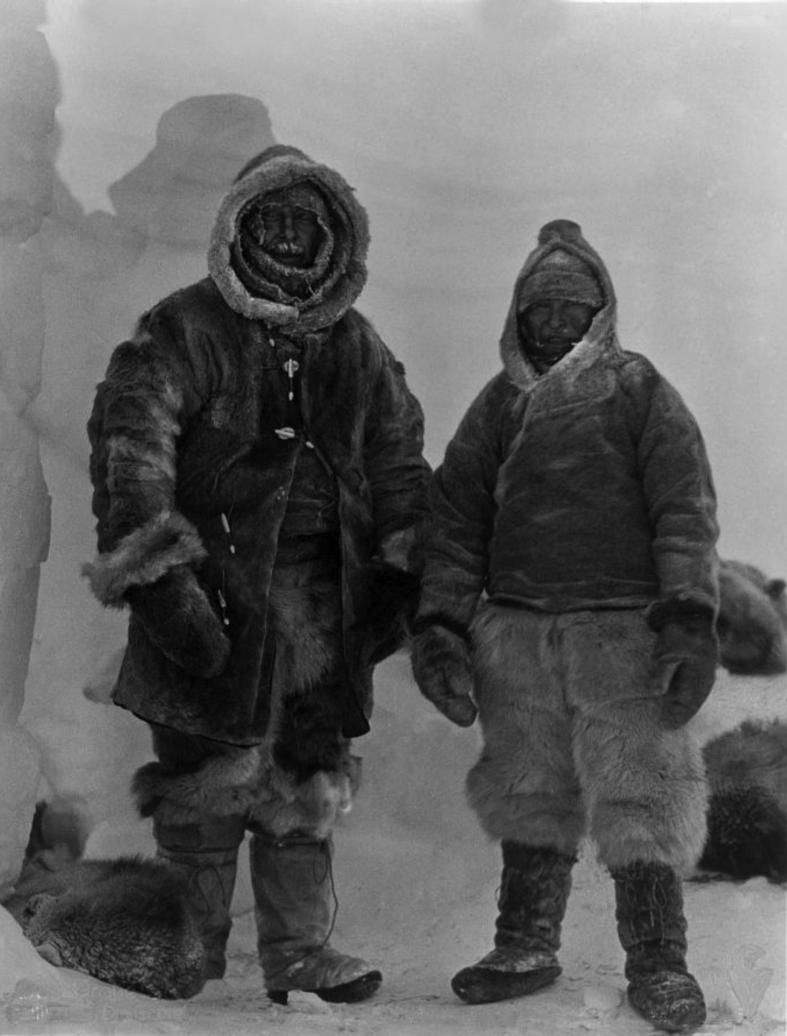
Alfred Lothar Wegener (; ; 1 November 1880 – November 1930) was a German climatologist, geologist, geophysicist, meteorologist, and polar researcher. During his lifetime he was primarily known for his achievements in meteorology and as a pioneer of polar research, but today he is most remembered as the originator of continental drift hypothesis by suggesting in 1912 that the continents are slowly drifting around the Earth (German: '). His hypothesis was controversial and widely rejected by mainstream geology until the 1950s, when numerous discoveries such as palaeomagnetism provided strong support for continental drift, and thereby a substantial basis for today's model of plate tectonics. Wegener was involved in several expeditions to Greenland to study polar air circulation before the existence of the jet stream was accepted. Expedition participants made many meteorological observations and were the first to overwinter on the inland Greenland ice sheet and the first to ... [...More Info...] [...Related Items...] OR: [Wikipedia] [Google] [Baidu] |
Explora Escarpment
Explora Escarpment () is an undersea escarpment named for the Antarctic science ship '' F.S. Explora''. The name, proposed by Dr. Heinrich Hinze of the Alfred Wegener Institute for Polar and Marine Research, Bremerhaven, Germany, was approved by the Advisory Committee for Undersea Features in June 1997. The Explora Escarpment was aligned with the Lebombo monocline in southern Africa before the break-up of Gondwana Gondwana () was a large landmass, often referred to as a supercontinent, that formed during the late Neoproterozoic (about 550 million years ago) and began to break up during the Jurassic period (about 180 million years ago). The final stages .... References * Escarpments of Antarctica Landforms of Queen Maud Land Princess Martha Coast {{PrincessMarthaCoast-geo-stub ... [...More Info...] [...Related Items...] OR: [Wikipedia] [Google] [Baidu] |
RV Polarstern
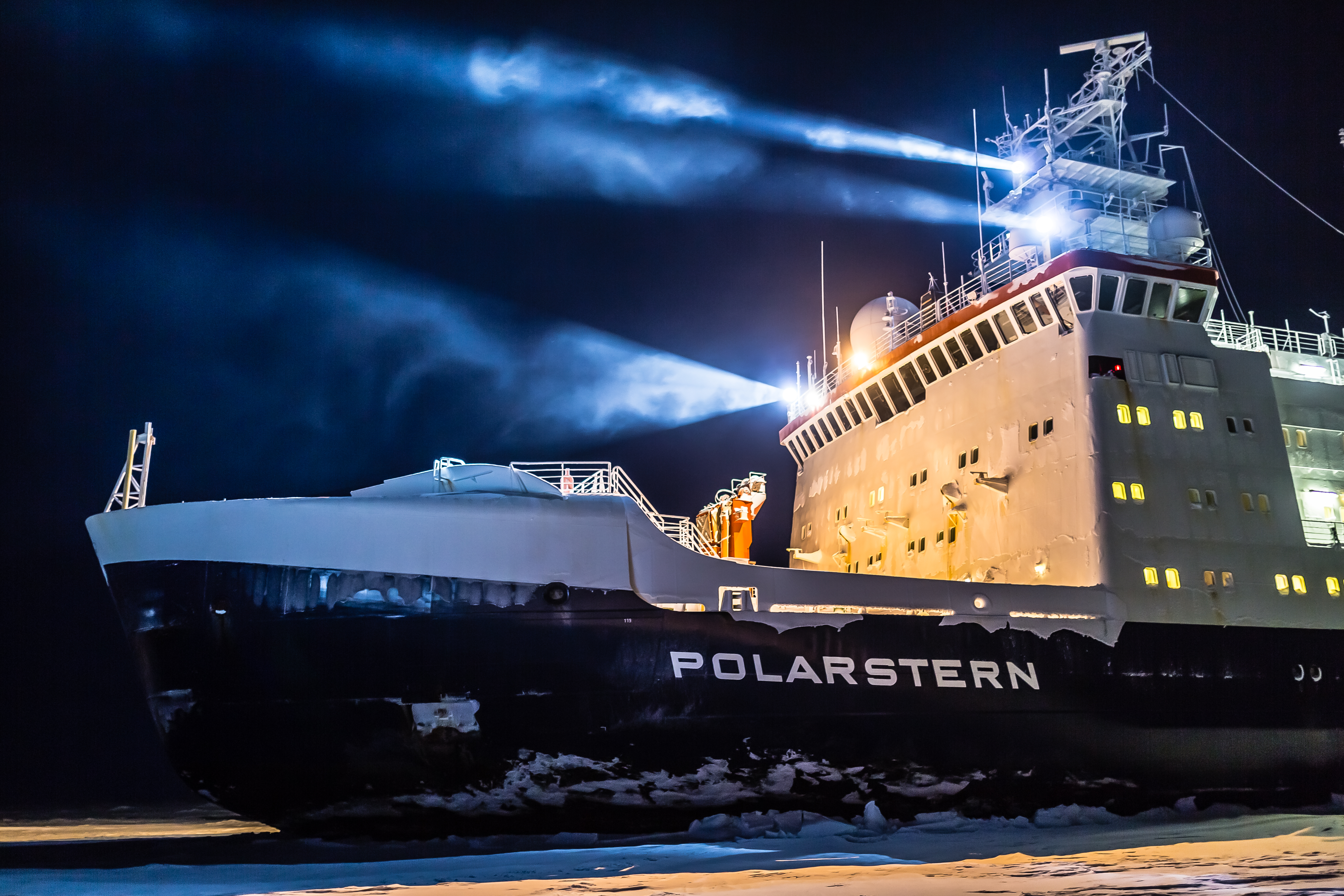
RV ''Polarstern'' (meaning pole star) is a German research icebreaker of the Alfred Wegener Institute for Polar and Marine Research (AWI) in Bremerhaven, Germany. ''Polarstern'' was built by Howaldtswerke-Deutsche Werft in Kiel and Nobiskrug in Rendsburg, was commissioned in 1982, and is mainly used for research in the Arctic and Antarctica. The ship has a length of 118 metres (387 feet) and is a double-hulled icebreaker. She is operational at temperatures as low as . ''Polarstern'' can break through ice thick at a speed of . Thicker ice of up to can be broken by ramming. History On 7 September 1991, ''Polarstern'', assisted by the Swedish arctic icebreaker , reached the North Pole as the first conventional powered vessels. Both scientific parties and crew took oceanographic and geological samples and had a common tug of war and a football game on an ice floe. In 2001, ''Polarstern'' together with reached the pole again. She returned for a third time on 22 August 2011. This ti ... [...More Info...] [...Related Items...] OR: [Wikipedia] [Google] [Baidu] |
Echo Sounding
Echo sounding or depth sounding is the use of sonar for ranging, normally to determine the depth of water (bathymetry). It involves transmitting acoustic waves into water and recording the time interval between emission and return of a pulse; the resulting time of flight, along with knowledge of the speed of sound in water, allows determining the distance between sonar and target. This information is then typically used for navigation purposes or in order to obtain depths for charting purposes. Echo sounding can also be used for ranging to other targets, such as fish schools. Hydroacoustic assessments have traditionally employed mobile surveys from boats to evaluate fish biomass and spatial distributions. Conversely, fixed-location techniques use stationary transducers to monitor passing fish. The word '' sounding'' is used for all types of depth measurements, including those that don't use sound, and is unrelated in origin to the word ''sound'' in the sense of noise or ton ... [...More Info...] [...Related Items...] OR: [Wikipedia] [Google] [Baidu] |
Alfred Wegener Institute
The Alfred Wegener Institute, Helmholtz Centre for Polar and Marine Research (German: ''Alfred-Wegener-Institut, Helmholtz-Zentrum für Polar- und Meeresforschung'') is located in Bremerhaven, Germany, and a member of the Helmholtz Association of German Research Centres. It conducts research in the Arctic, the Antarctic, and the high and mid latitude oceans. Additional research topics are: North Sea research, marine biological monitoring, and technical marine developments. The institute was founded in 1980 and is named after meteorologist, climatologist, and geologist Alfred Wegener. History The foundation of the AWI happened in a political environment that was characterized by system competition between East and West. The GDR had been conducting its own Antarctic research for decades. In the 1970s it became clear that there would be one scarcity of biological- and mineral resources. Also due to the experience of the oil crisis of 1973, the Federal Republic of Germany decide ... [...More Info...] [...Related Items...] OR: [Wikipedia] [Google] [Baidu] |
Marine Research
Oceanography (), also known as oceanology and ocean science, is the scientific study of the oceans. It is an Earth science, which covers a wide range of topics, including ecosystem dynamics; ocean currents, waves, and geophysical fluid dynamics; plate tectonics and the geology of the sea floor; and fluxes of various chemical substances and physical properties within the ocean and across its boundaries. These diverse topics reflect multiple disciplines that oceanographers utilize to glean further knowledge of the world ocean, including astronomy, biology, chemistry, climatology, geography, geology, hydrology, meteorology and physics. Paleoceanography studies the history of the oceans in the geologic past. An oceanographer is a person who studies many matters concerned with oceans, including marine geology, physics, chemistry and biology. History Early history Humans first acquired knowledge of the waves and currents of the seas and oceans in pre-historic times. Observations ... [...More Info...] [...Related Items...] OR: [Wikipedia] [Google] [Baidu] |


