|
Washburn Island, Massachusetts
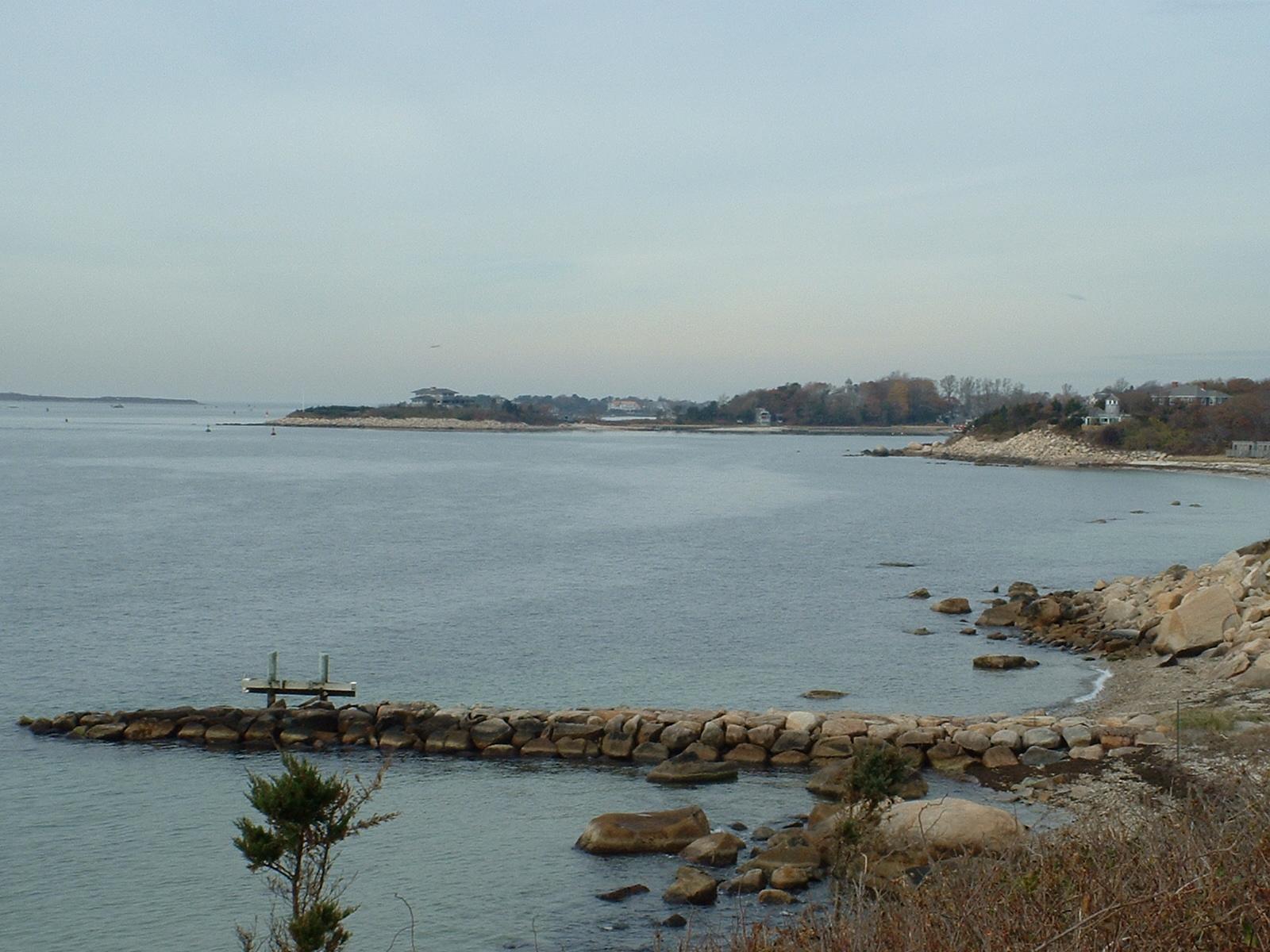
Washburn Island is a island off the coast of East Falmouth, Massachusetts within Waquoit Bay. It is home to some primitive campsites and is part of the Waquoit Bay National Estuarine Research Reserve. It is part of the Town of Falmouth, in Barnstable County in the village of Waquoit. During World War II, the island was home to Camp Washburn Camp Edwards is a United States military training installation which is located in western Cape Cod in Barnstable County, Massachusetts. Originally the Massachusetts Military Reservation (which was another name for it until 2013) acquired in Se .... Ecosystem Washburn Island contains marshes, sand dunes, and small ponds, and pine and oak trees make up the woods of the island. History Washburn Island was originally named Menauhant by the native people. At some points in time the island was owned as land by people. The island at one point had three farms on the island in the mid-nineteenth century, and parts of the island were cleared ... [...More Info...] [...Related Items...] OR: [Wikipedia] [Google] [Baidu] |
East Falmouth, Massachusetts
East Falmouth is a census-designated place (CDP) in the town of Falmouth in Barnstable County, Massachusetts, United States. It is located at the base of Massachusetts' "fishhook" peninsula (''see map at right''). The population was 6,038 at the 2010 census, making East Falmouth the most populous of the six CDPs in Falmouth. Geography East Falmouth is located in the southeastern part of Falmouth at (41.565096, -70.549984). It is bordered to the west by the village of Teaticket and to the east by the Childs River. Its southern border is the shore of Vineyard Sound. According to the United States Census Bureau, the CDP has a total area of . of it is land and of it (13.54%) is water. East Falmouth neighborhoods South of Massachusetts Route 28, the CDP is split into four necks, separated by tidal creeks (or "ponds"), each neck forming a natural neighborhood within the CDP. From east to west, the neighborhoods are: Seacoast Shores Seacoast Shores, formerly known as Jenkin's Nec ... [...More Info...] [...Related Items...] OR: [Wikipedia] [Google] [Baidu] |
Waquoit Bay
Waquoit Bay is a public national estuary, which is typically used as a research reserve. It is a part of Nantucket Sound and is located on the southern shore of Cape Cod in Massachusetts, USA. This bay forms the border of the towns of Falmouth and Mashpee, Massachusetts. The name Waquoit comes from the Wompanoag word "Weeqayut" (Waquoit) meaning "Place of Light". National Marine Research Reserve Due to the pressures on the coastal resources of the United States, Congress enacted the Coastal Zone Management Act which gave federal aid to operate estuarine areas as natural field laboratories. Waquoit Bay is one of these natural field laboratory zones. The areas that the Coastal Management Act Encompass the Visitor Center/Headquarters Property. Facilities The Visitor's Center is a 28-acre (11 ha) piece of land. It is open year-round, Monday through Friday, 10 a.m. – 5 p.m. The center has a path to the beach below it and hosts many activities to educate visitors about the ma ... [...More Info...] [...Related Items...] OR: [Wikipedia] [Google] [Baidu] |
Waquoit Bay National Estuarine Research Reserve
Waquoit Bay National Estuarine Research Reserve (WBNERR) encompasses open waters, barrier beaches, marshlands and uplands on the south shore of Cape Cod in the towns of Falmouth and Mashpee. The park is managed by the Department of Conservation and Recreation (DCR) and the National Oceanic and Atmospheric Administration. The WBNERR is representative of the northern section (Cape Cod to Sandy Hook) of the Virginian biogeographic region. WBNERR is located within the transitional border between the Virginian and Acadian biogeographic regions. Reserve areas The reserve comprises several individual sites: *Visitor Center/Headquarters Property The Visitor's Center is open year round, Monday through Friday, 10 am – 4 pm. Has a short nature trail and runs numerous seasonal education programs. * South Cape Beach State Park, Sage Lot Pond and Flat Pond This eastern section of the reserve serves has a swimming beach which is a noted surf casting site during the annual bluefish and strip ... [...More Info...] [...Related Items...] OR: [Wikipedia] [Google] [Baidu] |
Falmouth, Massachusetts
Falmouth ( ) is a town in Barnstable County, Massachusetts, United States. The population was 32,517 at the 2020 census, making Falmouth the second-largest municipality on Cape Cod after Barnstable. The terminal for the Steamship Authority ferries to Martha's Vineyard is located in the village of Woods Hole in Falmouth. Woods Hole also contains several scientific organizations such as the Woods Hole Oceanographic Institution (WHOI), the Marine Biological Laboratory (MBL), the Woodwell Climate Research Center, NOAA's Woods Hole Science Aquarium, and the scientific institutions' various museums. For geographic and demographic information on specific parts of the town of Falmouth, please see the articles on East Falmouth, Falmouth Village, North Falmouth, Teaticket, West Falmouth, and Woods Hole. Falmouth also encompasses the villages of Hatchville and Waquoit, which are not census-designated places and fall within the village of East Falmouth based on postal service. History ... [...More Info...] [...Related Items...] OR: [Wikipedia] [Google] [Baidu] |
Barnstable County, Massachusetts
Barnstable County is a county located in the U.S. state of Massachusetts. At the 2020 census, the population was 228,996. Its shire town is Barnstable. The county consists of Cape Cod and associated islands (some adjacent islands are in Dukes County and Nantucket County). Barnstable County was formed as part of the Plymouth Colony on 2 June 1685, including the towns of Falmouth, Sandwich, and others lying to the east and north on Cape Cod. Plymouth Colony was merged into the Province of Massachusetts Bay in 1691. History Giovanni da Verrazzano Cape Cod is described in a letter from the Italian explorer Giovanni da Verrazzano to Francis I of France, relating the details of a voyage to the New World made on behalf of the French crown in the ship Dauphine, the only surviving of a fleet of four. Sailing from Madeira in 1524, the Dauphine made land in North Carolina in March. It sailed north to Newfoundland, mapping the coast and interviewing the natives, whom he found frie ... [...More Info...] [...Related Items...] OR: [Wikipedia] [Google] [Baidu] |
World War II
World War II or the Second World War, often abbreviated as WWII or WW2, was a world war that lasted from 1939 to 1945. It involved the vast majority of the world's countries—including all of the great powers—forming two opposing military alliances: the Allies and the Axis powers. World War II was a total war that directly involved more than 100 million personnel from more than 30 countries. The major participants in the war threw their entire economic, industrial, and scientific capabilities behind the war effort, blurring the distinction between civilian and military resources. Aircraft played a major role in the conflict, enabling the strategic bombing of population centres and deploying the only two nuclear weapons ever used in war. World War II was by far the deadliest conflict in human history; it resulted in 70 to 85 million fatalities, mostly among civilians. Tens of millions died due to genocides (including the Holocaust), starvation, ma ... [...More Info...] [...Related Items...] OR: [Wikipedia] [Google] [Baidu] |
Camp Washburn
Camp Edwards is a United States military training installation which is located in western Cape Cod in Barnstable County, Massachusetts. Originally the Massachusetts Military Reservation (which was another name for it until 2013) acquired in September 1935, in 1938 it was named after Major General Clarence Edwards, commander of the 26th Division in World War I. It is home to the 3rd Battalion, 126th Aviation Regiment. In 1931, the National Guard deemed Camp Devens to be too small to meet their needs and began to look for a new training area, and two years later Cape Cod was identified as having a suitable environment to build a new camp. Camp Edwards was officially dedicated in 1938. In 1940, the U.S. Army leased Camp Edwards as a training facility as part of its mobilization strategy for World War II. The Army undertook significant construction which helped to expand Camp Edwards from a rustic military post to a small city, overflowing with new GIs. The new plan called fo ... [...More Info...] [...Related Items...] OR: [Wikipedia] [Google] [Baidu] |
Coastal Islands Of Massachusetts
The coast, also known as the coastline or seashore, is defined as the area where land meets the ocean, or as a line that forms the boundary between the land and the coastline. The Earth has around of coastline. Coasts are important zones in natural ecosystems, often home to a wide range of biodiversity. On land, they harbor important ecosystems such as freshwater or estuarine wetlands, which are important for bird populations and other terrestrial animals. In wave-protected areas they harbor saltmarshes, mangroves or seagrasses, all of which can provide nursery habitat for finfish, shellfish, and other aquatic species. Rocky shores are usually found along exposed coasts and provide habitat for a wide range of sessile animals (e.g. mussels, starfish, barnacles) and various kinds of seaweeds. Along tropical coasts with clear, nutrient-poor water, coral reefs can often be found between depths of . According to a United Nations atlas, 44% of all people live within 5 km (3.3mi) of ... [...More Info...] [...Related Items...] OR: [Wikipedia] [Google] [Baidu] |


