|
Wasgau
The Wasgau (german: Wasgau, french: Vasgovie) is a Franco-German hill range in the German state of Rhineland-Palatinate and the French departments of Bas-Rhin and Moselle. It is formed from the southern part of the Palatine Forest and the northern part of the Vosges mountains, and extends from the River Queich in the north over the French border to the Col de Saverne in the south. The highest hill in the entire Wasgau is the Grand Wintersberg (581 m above NHN) near Niederbronn-les-Bains in northern Alsace. Next, at 577 m is the only slightly lower Rehberg near Annweiler in the South Palatinate, which is the highest summit on German soil in the Wasgau. The Wasgau forms the southern part of the Palatine Forest-North Vosges Biosphere Reserve. Geography Location The Wasgau runs from a line between Pirmasens and Landau in the north that, from Wilgartswiesen coincides with the course of the River Queich, to the Col de Saverne and a line between Phalsbourg to Sa ... [...More Info...] [...Related Items...] OR: [Wikipedia] [Google] [Baidu] |
Rehberg (Wasgau)
The Rehberg is a prominent hill, ,Schriftliche Mitteilung des Landesamtes für Vermessung und Geobasisinformation Rheinland-Pfalz, Koblenz, vom 23. August 2011: „…The exact height f the Rehbergwas measured in 2002 by laser scanning from an aeroplane. From the points measured we derived the highest point on the terrain to be m.“ in the German state of Rhineland-Palatinate. After the Grand Wintersberg (ca. 581 m) in French North Alsace, the Rehberg is the second highest hill in the Wasgau (french: Vasgovie), the Franco-German region that forms the southern part of the Palatine Forest and runs from the valley of the River Queich to the Col de Saverne . The Rehberg is also the highest hill on German soil in the Wasgau. As part of the Palatine Forest-North Vosges Biosphere Reserve it has been placed under special protection measures. It lies two kilometres south of the town of Annweiler and has an observation tower at the summit named the ''Rehberg tower'' ... [...More Info...] [...Related Items...] OR: [Wikipedia] [Google] [Baidu] |
Vosges (mountains)
The Vosges ( , ; german: Vogesen ; Franconian and gsw, Vogese) are a range of low mountains in Eastern France, near its border with Germany. Together with the Palatine Forest to the north on the German side of the border, they form a single geomorphological unit and low mountain range of around in area. It runs in a north-northeast direction from the Burgundian Gate (the Belfort–Ronchamp– Lure line) to the Börrstadt Basin (the Winnweiler–Börrstadt–Göllheim line), and forms the western boundary of the Upper Rhine Plain. The Grand Ballon is the highest peak at , followed by the Storkenkopf (), and the Hohneck ().IGN maps available oGéoportail/ref> Geography Geographically, the Vosges Mountains are wholly in France, far above the Col de Saverne separating them from the Palatinate Forest in Germany. The latter area logically continues the same Vosges geologic structure but traditionally receives this different name for historical and political reasons. From 187 ... [...More Info...] [...Related Items...] OR: [Wikipedia] [Google] [Baidu] |
Vosges
The Vosges ( , ; german: Vogesen ; Franconian and gsw, Vogese) are a range of low mountains in Eastern France, near its border with Germany. Together with the Palatine Forest to the north on the German side of the border, they form a single geomorphological unit and low mountain range of around in area. It runs in a north-northeast direction from the Burgundian Gate (the Belfort–Ronchamp– Lure line) to the Börrstadt Basin (the Winnweiler– Börrstadt–Göllheim line), and forms the western boundary of the Upper Rhine Plain. The Grand Ballon is the highest peak at , followed by the Storkenkopf (), and the Hohneck ().IGN maps available oGéoportail/ref> Geography Geographically, the Vosges Mountains are wholly in France, far above the Col de Saverne separating them from the Palatinate Forest in Germany. The latter area logically continues the same Vosges geologic structure but traditionally receives this different name for historical and political reasons. From ... [...More Info...] [...Related Items...] OR: [Wikipedia] [Google] [Baidu] |
Annweiler Am Trifels
Annweiler am Trifels (), or Annweiler is a town in the Südliche Weinstraße district, in Rhineland-Palatinate, Germany. It is situated on the river Queich, 12 km west of Landau. Annweiler am Trifels station is on the Landau– Saarbrücken railway. Annweiler is situated in the Southern part of the Palatinate forest called the Wasgau, and is surrounded by high hills which yield a famous red sandstone. The town's main industry is tourism. On the ''Sonnenberg'' (493 m) lie the ruins of the castle of Trifels, in which Richard Coeur de Lion was imprisoned from 31 March to 19 April 1193. Annweiler is the seat of the ''Verbandsgemeinde'' ("collective municipality") of Annweiler am Trifels. In a 1911 edition of the Brockhaus Enzyklopädie, the area around Annweiler was referred to as "Pfälzer Schweiz". Annweiler has a primary school and a secondary school ('' Staatliche Realschule Annweiler '') which was a partner school with the William Lovell Secondary School in ... [...More Info...] [...Related Items...] OR: [Wikipedia] [Google] [Baidu] |
Wilgartswiesen
Wilgartswiesen is a municipality in Südwestpfalz district, in Rhineland-Palatinate, western Germany. Geography The municipality lies in the southern part of the Palatine Forest, the German part of the Wasgau, in the middle of the Palatine Forest-North Vosges Biosphere Reserve. On the territory of Wilgartswieser the Wellbach stream empties into the Queich, which itself is one of the main drainage systems of the Palatinate region. North of the village run several bunter sandstone The Buntsandstein (German for ''coloured'' or ''colourful sandstone'') or Bunter sandstone is a lithostratigraphic and allostratigraphic unit (a sequence of rock strata) in the subsurface of large parts of west and central Europe. The Buntsands ... rock groups, out of which the castles of Wilgartaburg and Falkenburg have been hewn. The municipal terrain, most of which is part of the Frankenweide, is almost entirely wooded. References Municipalities in Rhineland-Palatinate Palatinate Fo ... [...More Info...] [...Related Items...] OR: [Wikipedia] [Google] [Baidu] |
Alsace
Alsace (, ; ; Low Alemannic German/ gsw-FR, Elsàss ; german: Elsass ; la, Alsatia) is a cultural region and a territorial collectivity in eastern France, on the west bank of the upper Rhine next to Germany and Switzerland. In 2020, it had a population of 1,898,533. Alsatian culture is characterized by a blend of Germanic and French influences. Until 1871, Alsace included the area now known as the Territoire de Belfort, which formed its southernmost part. From 1982 to 2016, Alsace was the smallest administrative ''région'' in metropolitan France, consisting of the Bas-Rhin and Haut-Rhin departments. Territorial reform passed by the French Parliament in 2014 resulted in the merger of the Alsace administrative region with Champagne-Ardenne and Lorraine to form Grand Est. On 1 January 2021, the departments of Bas-Rhin and Haut-Rhin merged into the new European Collectivity of Alsace but remained part of the region Grand Est. Alsatian is an Alemannic dialect closely related ... [...More Info...] [...Related Items...] OR: [Wikipedia] [Google] [Baidu] |
South Palatinate
The Palatinate (german: Pfalz; Palatine German: ''Palz'') is a region of Germany. In the Middle Ages it was known as the Rhenish Palatinate (''Rheinpfalz'') and Lower Palatinate (''Unterpfalz''), which strictly speaking designated only the western part of the Electorate of the Palatinate (''Kurfürstentum Pfalz''), as opposed to the Upper Palatinate (''Oberpfalz''). It occupies roughly the southernmost quarter of the German federal state of Rhineland-Palatinate (''Rheinland-Pfalz''), covering an area of with about 1.4 million inhabitants. Its residents are known as Palatines (''Pfälzer''). Geography The Palatinate borders Saarland in the west, historically also comprising the state's Saarpfalz District. In the northwest, the Hunsrück mountain range forms the border with the Rhineland region. The eastern border with Hesse and the Baden region runs along the Upper Rhine river, while the left bank, with Mainz and Worms as well as the Selz basin around Alzey, belong to the ... [...More Info...] [...Related Items...] OR: [Wikipedia] [Google] [Baidu] |
Palatine Forest-North Vosges Biosphere Reserve
The Franco-German Palatinate Forest-North Vosges Biosphere Reserve (german: Biosphärenreservat Pfälzerwald-Nordvogesen, french: Réserve de biosphère transfrontalière des Vosges du Nord-Forêt palatine) was created in 1998 as the first UNESCO trans-boundary biosphere reserve in Europe. The German part became the 12th of 16 biosphere reserves in Germany and the French one the 6th of 14 in France. The biosphere reserve is a fusion of the older Palatinate Forest Nature Park in Germany and Northern Vosges Regional Nature Park in France, covering a total area of 3,018 km², with 1,809.7 km² in Germany and 1208.3 km² in France respectively. Geography Location The biosphere reserve lies in the Palatinate Forest and in the North Vosges on the boundary between the southwest German state of Rhineland-Palatinate and the northeast French region of Grand Est. Gallery File:Biosphärenhaus.jpg, Biosphere house in Fischbach near Dahn File:WipfelpfadTurm.jpg, Platforms on the Bau ... [...More Info...] [...Related Items...] OR: [Wikipedia] [Google] [Baidu] |
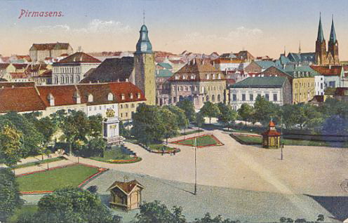
Pirmasens
Pirmasens (; pfl, Bärmesens (also ''Bermesens'' or ''Bärmasens'')) is an independent town in Rhineland-Palatinate, Germany, near the border with France. It was famous for the manufacture of shoes. The surrounding rural district was called ''Landkreis Pirmasens'' from 1818 until 1997, when it was renamed to ''Südwestpfalz''. Pirmasens can be easily mistaken with ''Primasens'', of which means a first sense in Latin-derived languages (the first sense in Latin would be "primus sensus"). History Early years The first mention of "Pirminiseusna", a colony of Hornbach Abbey, dates from 860. The name derives from St. Pirminius, the founder of the monastery. During the period it was under rule of the Bishopric of Metz. It was passed to Diocese of Speyer in last the quarter of the 11th century, then was captured by County of Saarbrücken in 1100. In 1182, the County of Saarbrücken was divided by Simon II and Henry I, who were sons of Simon I. Pirmasens was given to the latter and He ... [...More Info...] [...Related Items...] OR: [Wikipedia] [Google] [Baidu] |
Niederbronn-les-Bains
Niederbronn-les-Bains () is a commune in the Bas-Rhin department in Grand Est in north-eastern France. It is positioned between Bitche and Wissembourg, close to the current frontier with Germany. Niederbronn-les-Bains is part of the Northern Vosges Regional Natural Park. It has a tradition as a spa town, and continues to attract tourists and other visitors needing to recuperate. History Niederbronn-les-Bains was founded in 48 BC when the Romans discovered the healing properties of the local water. The earliest bathing place was in or near the location now occupied by the town's casino. During the fifth century the little town fell victim to the violence that accompanied the period of intense migrations that followed the disappearance from the western empire of Roman governance. Economy and tourism The commune incorporates two mineral water springs, one of them, first exploited more than two thousand years ago, known as the ''Roman Spring'' and the other known as the ''Ce ... [...More Info...] [...Related Items...] OR: [Wikipedia] [Google] [Baidu] |
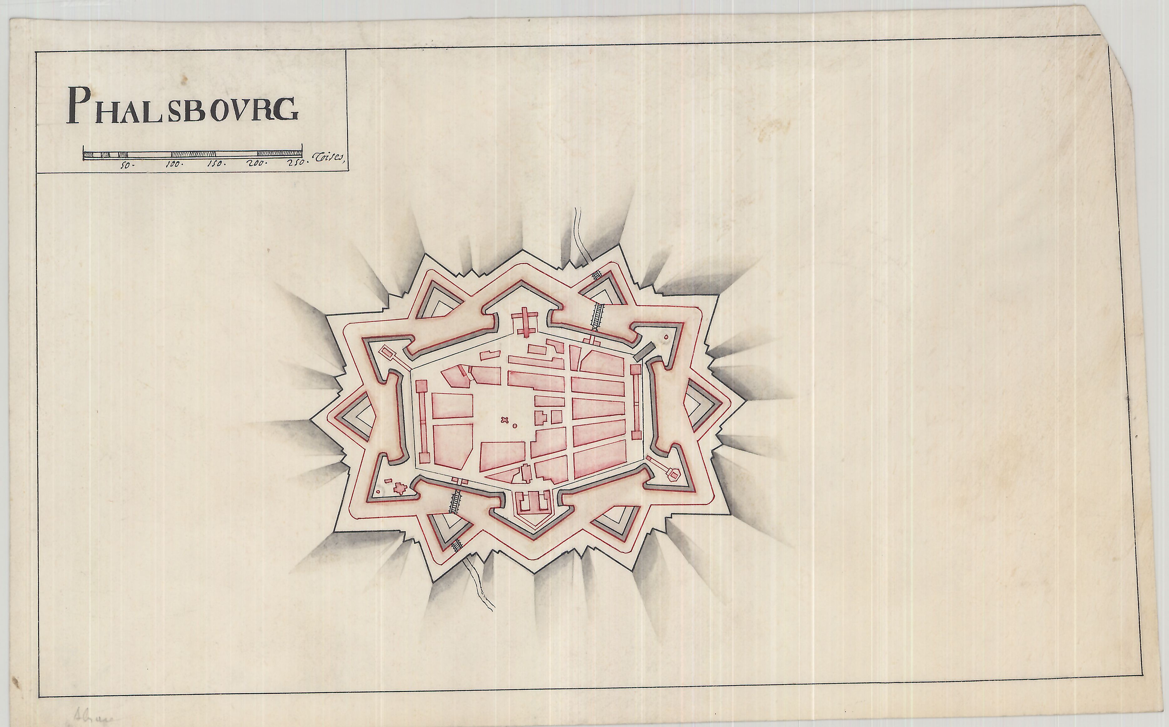
Phalsbourg
Phalsbourg (; ; Lorraine Franconian: ''Phalsburch'') is a commune in the Moselle department in Grand Est in north-eastern France, with a population of about 5,000. It lies high on the west slopes of the Vosges, northwest of Strasbourg by rail. In 1911, it contained an Evangelical and a Roman Catholic church, a synagogue and a teachers' seminary. Its industries then included the manufacture of gloves, straw hats and liqueurs, and quarrying. History The area of the city of Phalsbourg, originally Pfalzburg, was originally part of the principality of Lützelstein, under the overlordship of Luxembourg, then the bishops of Metz and of Strasbourg, before becoming possessed by the Dukes of Palantine Veldenz, all within the Holy Roman Empire of the German Nation. In 1570, Duke Georg Johann I of Palantine Veldenz founded the town of Pfalzburg as a refuge for Reformed Protestants expelled from of the Duchy of Lorraine, and as an administrative center of his holdings. But the cost forced ... [...More Info...] [...Related Items...] OR: [Wikipedia] [Google] [Baidu] |


