|
Wardleworth
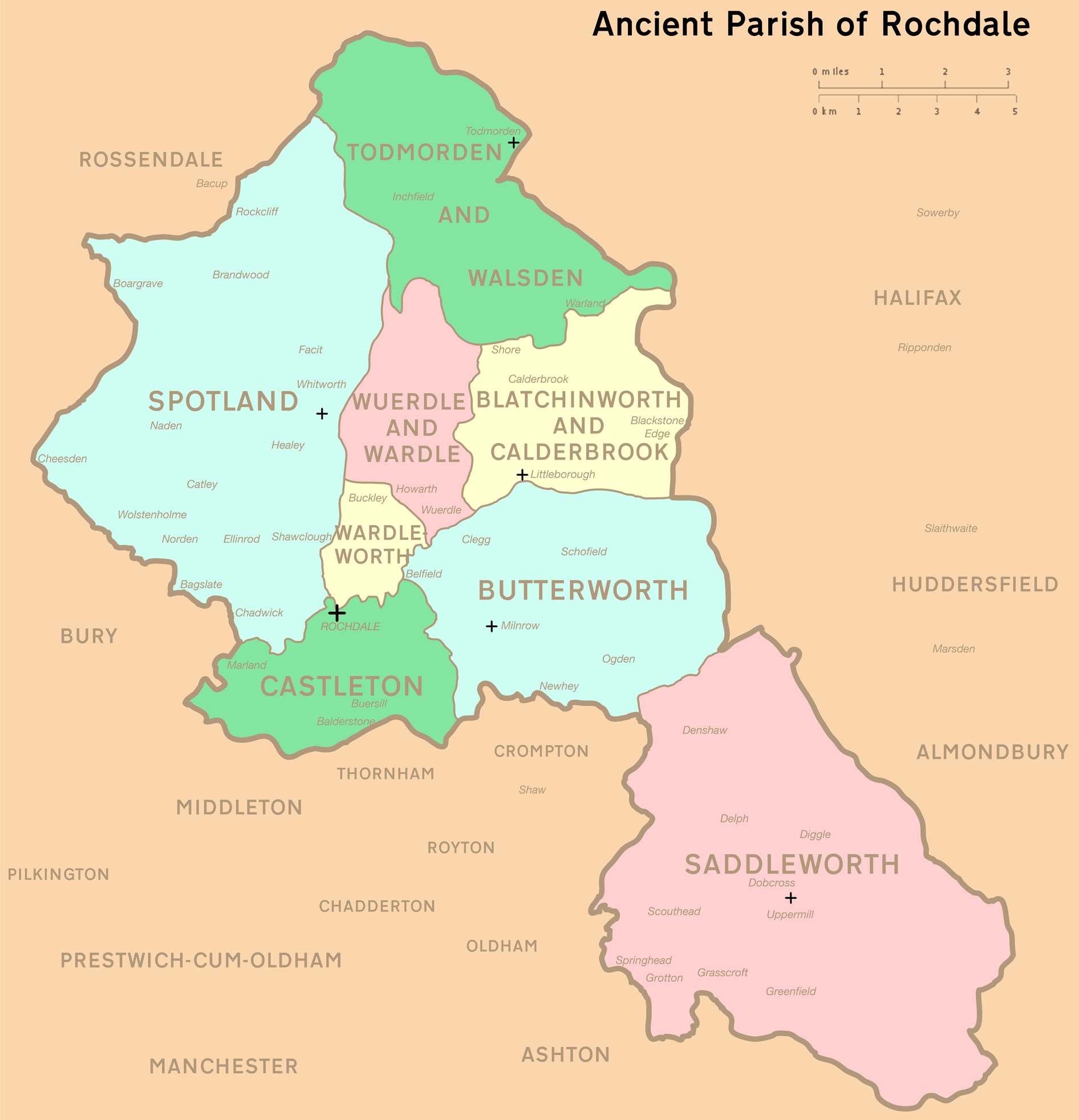
Wardleworth was a township at the geographic centre of the Parish of Rochdale, in Salford Hundred, Lancashire, England. The principal estate of the township was Buckley. Though the administrative territory has long been abolished, the name continues as a geographic reference frame for that part of Rochdale. Wardleworth was a township that included territory to the northeast of the town of Rochdale, including the hamlets of Buckley, Crankey Shaw and Hamer Fold, and, although close to the village of Wardle, Wardleworth did not contain the settlement, which was instead within the neighbouring township of Wuerdle and Wardle. In 1830, Wardleworth was recorded to have 6,451 inhabitants. The Buckley and Entwistle families are recorded to have been the principal landowners of this township, with Buckley Hall being the seat of the estateholders for many years. See also *Butterworth (ancient township) Butterworth was a Township (England), township occupying the southeastern par ... [...More Info...] [...Related Items...] OR: [Wikipedia] [Google] [Baidu] |
Buckley, Greater Manchester
Buckley is a suburban area within the Metropolitan Borough of Rochdale, in Greater Manchester, England. It lies at the northern fringe of Rochdale, along the course of Buckley Brook, "upon an eminence of ground" by the South Pennines. It is south-southwest of the village of Wardle and north-northeast of Rochdale's town centre. Buckley spans a watercourse, a prison, farmland and residential properties. Buckley emerged as a constituent community of the manor of Hundersfield following the Anglo-Saxon settlement of Britain. Although the name Buckley is of Old English derivation, the settlement's medieval history is tied closely to a Norman family who were granted the estate as a gift for their services given in the Norman conquest of England; they subsequently adopted the surname ' de Buckley'. Members of the Buckleys of Buckley family appear throughout the High Middle Ages in legal charters related to Buckley, the surrounding area, and its manor house Buckley Hall. Throughout ... [...More Info...] [...Related Items...] OR: [Wikipedia] [Google] [Baidu] |
Wardleworth Railway Station
Wardleworth railway station served the township of Wardleworth in Rochdale, in the Metropolitan Borough of Rochdale in Greater Manchester, England England is a country that is part of the United Kingdom. It shares land borders with Wales to its west and Scotland to its north. The Irish Sea lies northwest and the Celtic Sea to the southwest. It is separated from continental Europe b ..., from 1870 until closure in 1947. It was on the Facit Branch between Rochdale and Facit, which was extended to Bacup in 1881. The station was quite well placed for Rochdale town centre and so, in addition to the branch trains, a few other services from Manchester terminated here. Between here and Rochdale station was the Roch Valley Viaduct, now demolished. References *Lost Railways of Lancashire by Gordon Suggitt () Disused railway stations in the Metropolitan Borough of Rochdale Former Lancashire and Yorkshire Railway stations Railway stations in Great Britain opened i ... [...More Info...] [...Related Items...] OR: [Wikipedia] [Google] [Baidu] |
Rochdale (ancient Parish)
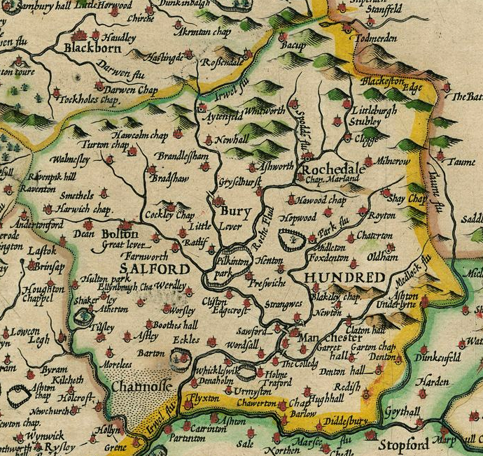
Rochdale was an ecclesiastical parish of early-medieval origin in northern England, administered from the Church of St Chad, Rochdale. At its zenith, it occupied of land amongst the South Pennines, and straddled the historic county boundary between Lancashire and the West Riding of Yorkshire. To the north and north-west was the parish of Whalley; to the southwest was the parish of Bury; to the south was Middleton and Prestwich-cum-Oldham. Anciently a dependency of Whalley Abbey, the parish of Rochdale is believed to be of Anglo-Saxon origin, as evidenced by historical documentation, toponymy and its dedication to Chad of Mercia. Urbanisation, population shifts, and local government reforms all contributed towards the gradual alteration and ultimate dissolution of the historic parish boundaries; the social welfare functions of the parish were broadly superseded by the English Poor Laws and new units of local governance, such as the County Borough of Rochdale and the Milnrow Ur ... [...More Info...] [...Related Items...] OR: [Wikipedia] [Google] [Baidu] |
Rochdale
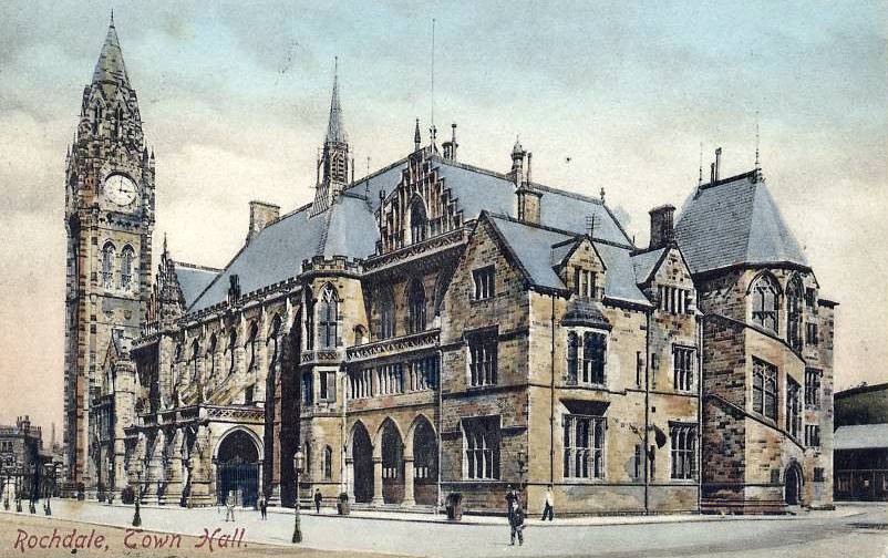
Rochdale ( ) is a large town in Greater Manchester, England, at the foothills of the South Pennines in the dale on the River Roch, northwest of Oldham and northeast of Manchester. It is the administrative centre of the Metropolitan Borough of Rochdale, which had a population of 211,699 in the 2011 census. Located within the historic boundaries of the county of Lancashire. Rochdale's recorded history begins with an entry in the Domesday Book of 1086 under "Recedham Manor". The ancient parish of Rochdale was a division of the hundred of Salford and one of the largest ecclesiastical parishes in England, comprising several townships. By 1251, Rochdale had become important enough to have been granted a Royal charter. Rochdale flourished into a centre of northern England's woollen trade, and by the early 18th century was described as being "remarkable for many wealthy merchants". Rochdale rose to prominence in the 19th century as a mill town and centre for textile manufacture ... [...More Info...] [...Related Items...] OR: [Wikipedia] [Google] [Baidu] |
County Borough Of Rochdale
Rochdale was, from 1856 to 1974, a local government district coterminate with the town of Rochdale in the northwest of England. Municipal borough In January 1856 the inhabitant householders of the Parliamentary Borough of Rochdale, Lancashire, petitioned the Privy Council for the grant of a charter of incorporation under the Municipal Corporations Act constituting the town as a municipal borough. The petition was successful and the charter was granted in September 1856. In 1858 the borough corporation took over the powers of the Rochdale Improvement Commissioners, which had been established by private act of parliament in 1825 to watch, light and cleanse the town. The borough was extended in 1872. County borough The Local Government Act 1888 constituted all municipal boroughs with a population of more than 50,000 as "county borough"s. Accordingly, the County Borough of Rochdale came into existence in 1889, with the powers of both a borough and a county council. Rochdale remai ... [...More Info...] [...Related Items...] OR: [Wikipedia] [Google] [Baidu] |
Salford (hundred)
The Salford Hundred (also known as Salfordshire) was one of the subdivisions of the historic county of Lancashire, in Northern England (see:Hundred (county division). Its name alludes to its judicial centre being the township of Salford (the suffix ''-shire'' meaning the territory was appropriated to the prefixed settlement). It was also known as the Royal Manor of Salford and the Salford wapentake.. Origins The Manor or Hundred of Salford had Anglo-Saxon origins. The ''Domesday Book'' recorded that the area was held in 1066 by Edward the Confessor. Salford was recorded as part of the territory of ''Inter Ripam et Mersam'' or "Between Ribble and Mersey", and it was included with the information about Cheshire, though it cannot be said clearly to have been part of Cheshire. The area became a subdivision of the County Palatine of Lancaster (or Lancashire) on its creation in 1182. Salford Hundred Court In spite of its incorporation into Lancashire, Salford Hundred retained a se ... [...More Info...] [...Related Items...] OR: [Wikipedia] [Google] [Baidu] |
Buckley Hall
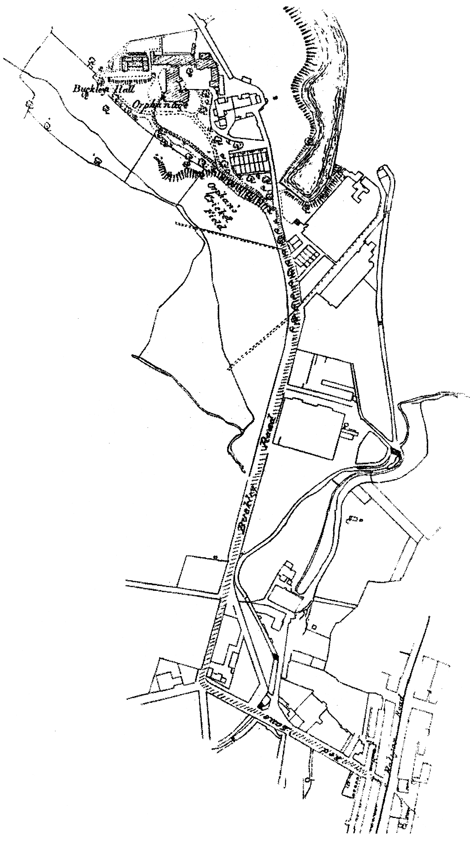
Buckley Hall was a historic house in Buckley near Rochdale, Lancashire, England which was the home of the Buckley and later Entwistle family. The building was a Catholic boys' orphanage from 1888 to 1947, when it was demolished; Buckley Hall Prison now occupies the site. History The surname Buckley in its various spellings was first recorded in the 12th century and was supposed to have descended from a supporter of William the Conqueror. The original Hall was in existence before 1626 and was demolished in 1860, and rebuilt to "the highest standards of opulence and comfort" by William Whitworth Schofield, a local mill owner. Orphanage After the death of the owner, William Schofield, in 1882, the Hall remained unoccupied for five years. Herbert Vaughan, the Bishop of Salford, enlisted the help of the Congregation of the Brothers of Charity, an organisation already active in the welfare and education of children in Belgium and France, to initiate a similar service in the Roman Cath ... [...More Info...] [...Related Items...] OR: [Wikipedia] [Google] [Baidu] |
Areas Of Rochdale
Area is the quantity that expresses the extent of a region on the plane or on a curved surface. The area of a plane region or ''plane area'' refers to the area of a shape or planar lamina, while ''surface area'' refers to the area of an open surface or the boundary of a three-dimensional object. Area can be understood as the amount of material with a given thickness that would be necessary to fashion a model of the shape, or the amount of paint necessary to cover the surface with a single coat. It is the two-dimensional analogue of the length of a curve (a one-dimensional concept) or the volume of a solid (a three-dimensional concept). The area of a shape can be measured by comparing the shape to squares of a fixed size. In the International System of Units (SI), the standard unit of area is the square metre (written as m2), which is the area of a square whose sides are one metre long. A shape with an area of three square metres would have the same area as three such squares. ... [...More Info...] [...Related Items...] OR: [Wikipedia] [Google] [Baidu] |
History Of Lancashire
Lancashire is a county of England, in the northwest of the country. The county did not exist in 1086, for the Domesday Book, and was apparently first created in 1182, making it one of the youngest of the traditional counties. The historic county consisted of two separate parts. The main part runs along the northwestern coast of England. When it included Manchester and Liverpool it had a greatest length of 76 miles, and breadth of 45 miles, and an area of 1,208,154 acres. The northern detached part of the old county palatine, consisting of Furness and Cartmell was 25 miles in length, 23 miles in breadth and was separated from the main portion of Lancashire by Morecambe Bay and the Kendal district of Westmorland. The highest point in the historic county is at the Old Man of Coniston. As a county palatine, the Duke of Lancaster had sovereignty rights in the areas of justice and administration within the county. However the third man to hold the title, Henry Bolingbroke seized ... [...More Info...] [...Related Items...] OR: [Wikipedia] [Google] [Baidu] |
History Of Rochdale
History (derived ) is the systematic study and the documentation of the human activity. The time period of event before the invention of writing systems is considered prehistory. "History" is an umbrella term comprising past events as well as the memory, discovery, collection, organization, presentation, and interpretation of these events. Historians seek knowledge of the past using historical sources such as written documents, oral accounts, art and material artifacts, and ecological markers. History is not complete and still has debatable mysteries. History is also an academic discipline which uses narrative to describe, examine, question, and analyze past events, and investigate their patterns of cause and effect. Historians often debate which narrative best explains an event, as well as the significance of different causes and effects. Historians also debate the nature of history as an end in itself, as well as its usefulness to give perspective on the problems of the p ... [...More Info...] [...Related Items...] OR: [Wikipedia] [Google] [Baidu] |
Butterworth (ancient Township)
Butterworth was a township occupying the southeastern part of the parish of Rochdale, in the hundred of Salford, Lancashire, England. It encompassed of land in the South Pennines which spanned the settlements of Belfield, Bleaked-gate-cum-Roughbank, Butterworth Hall, Clegg, Haughs, Hollingworth, Kitcliffe, Lowhouse, Milnrow, Newhey, Ogden, Rakewood, Smithy Bridge, Tunshill and Wildhouse. It extended to the borders of Crompton to the south, and to the highest points of Bleakedgate Moor and Clegg Moor, up to the ridge of Blackstone Edge, to the east, where its boundary was the old county boundary between Lancashire and Yorkshire. Butterworth was probably settled in Saxon times in the Early Middle Ages. Its land was divided into two divisions, the Lordship side with rents or services payable to the lord of the manor and the Freehold side that retained its importance until 1879 as a Registration district for births, deaths and marriages. In 1830, Butterworth was recorded to have ... [...More Info...] [...Related Items...] OR: [Wikipedia] [Google] [Baidu] |

.jpg)
