|
Wakefield, Washington, D.C.
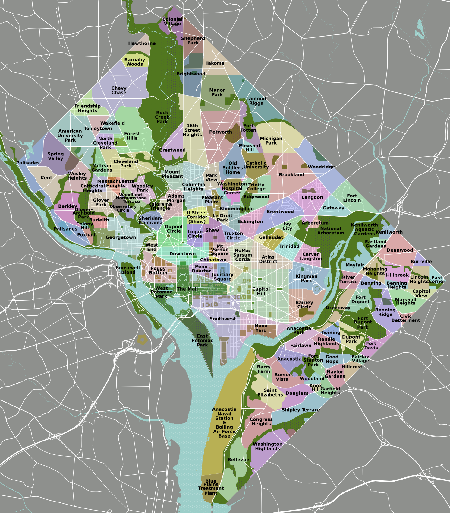
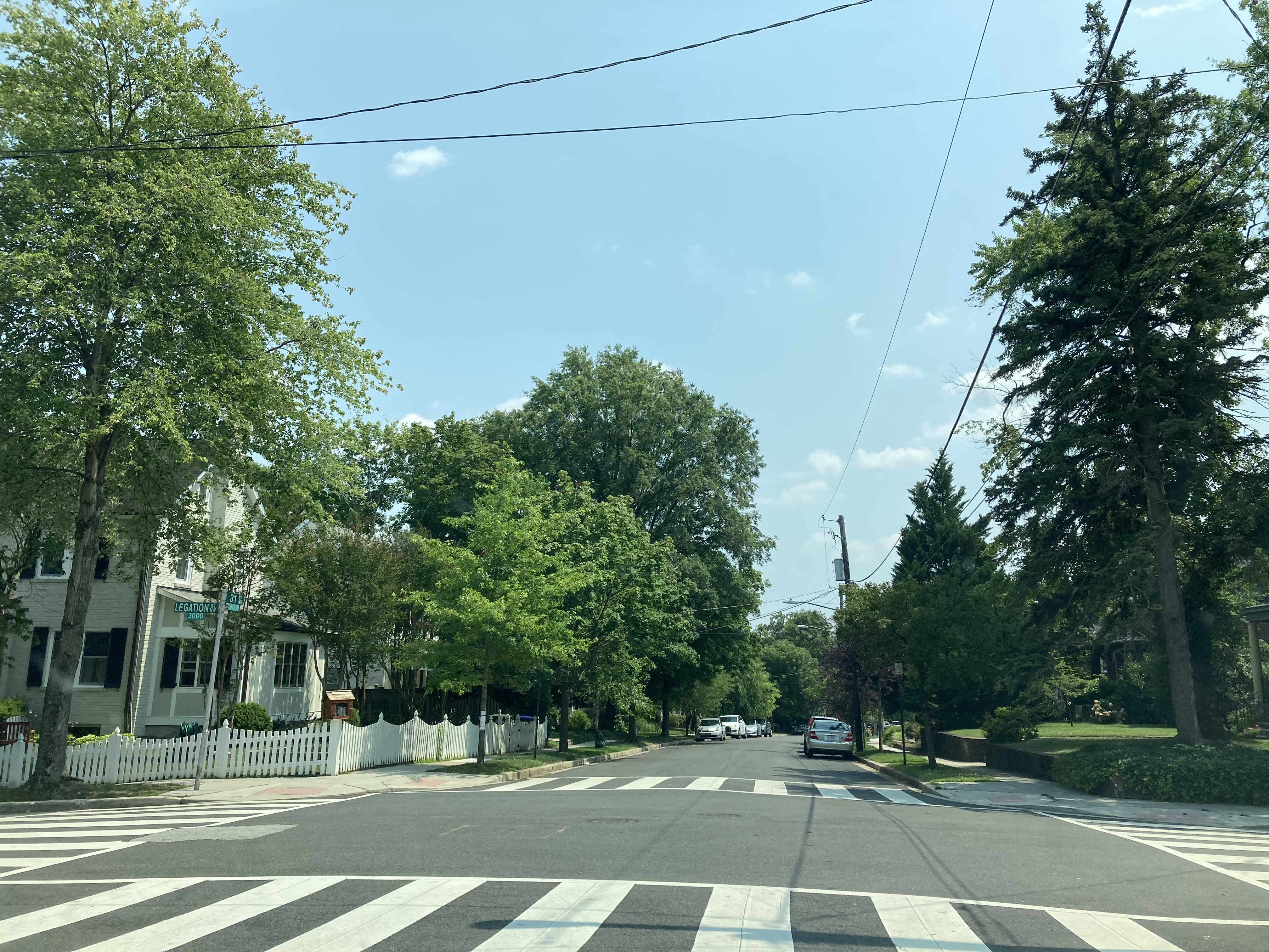
Wakefield is a neighborhood in the Northwest quadrant of Washington, D.C. ) , image_skyline = , image_caption = Clockwise from top left: the Washington Monument and Lincoln Memorial on the National Mall, United States Capitol, Logan Circle, Jefferson Memorial, White House, Adams Morgan, ..., bounded by Albemarle Street NW to the south, Nebraska Avenue NW to the west, and Connecticut Avenue to the east. It is served by the Van Ness-UDC and Tenleytown-AU station on the Washington Metro's Red Line. The area was first developed in the 1930s by R.B. Warren, who built 100 brick homes between Nebraska and Connecticut north of Albemarle and named the new neighborhood "Wakefield", after the plantation where George Washington was born. This new residential development was part of, and contributed to, the burgeoning growth along Connecticut Avenue. To support the growing population in Wakefield and surrounding neighborhoods, a Piggly Wiggly grocery sto ... [...More Info...] [...Related Items...] OR: [Wikipedia] [Google] [Baidu] |
List Of Neighborhoods Of The District Of Columbia By Ward
Neighbourhood, Neighborhoods in Washington, D.C., are distinguished by their history, culture, architecture, demographics, and geography. The names of 131 neighborhoods are unofficially defined by the D.C. Office of Planning. Neighborhoods can be defined by the boundaries of wards, historic districts, Advisory Neighborhood Commissions, civic associations, and business improvement districts (BIDs); these boundaries will overlap. The eight wards each elect a member to the Council of the District of Columbia and are redistricted every ten years. As the capital of the United States, Washington's local neighborhood history and culture is often presented as being distinct from that of the national government. List of neighborhoods by ward Ward 1 :Council of the District of Columbia, Ward 1 Councilmember: Brianne Nadeau :Population (2021): 91,673 *Adams Morgan *Columbia Heights (Washington, D.C.), Columbia Heights *Howard University *Kalorama, Washington, D.C., Kalorama *LeDroit P ... [...More Info...] [...Related Items...] OR: [Wikipedia] [Google] [Baidu] |
United States
The United States of America (U.S.A. or USA), commonly known as the United States (U.S. or US) or America, is a country primarily located in North America. It consists of 50 states, a federal district, five major unincorporated territories, nine Minor Outlying Islands, and 326 Indian reservations. The United States is also in free association with three Pacific Island sovereign states: the Federated States of Micronesia, the Marshall Islands, and the Republic of Palau. It is the world's third-largest country by both land and total area. It shares land borders with Canada to its north and with Mexico to its south and has maritime borders with the Bahamas, Cuba, Russia, and other nations. With a population of over 333 million, it is the most populous country in the Americas and the third most populous in the world. The national capital of the United States is Washington, D.C. and its most populous city and principal financial center is New York City. Paleo-Americ ... [...More Info...] [...Related Items...] OR: [Wikipedia] [Google] [Baidu] |
Mary Cheh
Mary M. Cheh (born 1950) is an American Democratic politician from Washington, D.C. In November 2006, she won a seat on the Council of the District of Columbia representing Ward 3. Background and family Mary Cheh was born in Elizabeth, New Jersey. The first in her family to graduate from high school, Cheh is a Phi Beta Kappa graduate of Douglass College (the women's college of Rutgers University–New Brunswick) and has law degrees from Rutgers School of Law-Newark and Harvard Law School. Cheh has been a resident of Ward 3 since 1980. She has two daughters, Jane and Nora, who were born and raised in the District, attended Murch Elementary School and Georgetown Day School, and now work as lawyers. Professional experience Upon graduation from law school, Cheh served as a law clerk to the Hon. Richard J. Hughes, chief justice of the New Jersey Supreme Court. Cheh then joined the Washington office of Fried, Frank, Shriver, Harris & Kempleman as an associate. In 1979, Cheh joined ... [...More Info...] [...Related Items...] OR: [Wikipedia] [Google] [Baidu] |
Wakefield Washington DC 2021
Wakefield is a cathedral city in West Yorkshire, England located on the River Calder. The city had a population of 99,251 in the 2011 census.https://www.nomisweb.co.uk/census/2011/ks101ew Census 2011 table KS101EW Usual resident population, West Yorkshire – Wakefield BUASD, code E35000474 The city is the administrative centre of the wider City of Wakefield metropolitan district, which had a population of , the most populous district in England. It is part of the West Yorkshire Built-up Area and the Yorkshire and The Humber region. In 1888, it was one of the last group of towns to gain city status due to having a cathedral. The city has a town hall and county hall, as the former administrative centre of the city's county borough and metropolitan borough as well as county town to both the West Riding of Yorkshire and West Yorkshire, respectively. The Battle of Wakefield took place in the Wars of the Roses, and the city was a Royalist stronghold in the Civil War. Wakefiel ... [...More Info...] [...Related Items...] OR: [Wikipedia] [Google] [Baidu] |
Van Ness-UDC (Washington Metro)
A van is a type of road vehicle used for transporting goods or people. Depending on the type of van, it can be bigger or smaller than a pickup truck and SUV, and bigger than a common car. There is some varying in the scope of the word across the different English-speaking countries. The smallest vans, microvans, are used for transporting either goods or people in tiny quantities. Mini MPVs, compact MPVs, and MPVs are all small vans usually used for transporting people in small quantities. Larger vans with passenger seats are used for institutional purposes, such as transporting students. Larger vans with only front seats are often used for business purposes, to carry goods and equipment. Specially-equipped vans are used by television stations as mobile studios. Postal services and courier companies use large step vans to deliver packages. Word origin and usage Van meaning a type of vehicle arose as a contraction of the word caravan. The earliest records of a van as a vehicle i ... [...More Info...] [...Related Items...] OR: [Wikipedia] [Google] [Baidu] |
Washington Metro
The Washington Metro (or simply Metro), formally the Metrorail,Google Books search/preview is a rapid transit system serving the Washington metropolitan area of the United States. It is administered by the Washington Metropolitan Area Transit Authority (WMATA), which also operates the Metrobus (Washington, D.C.), Metrobus and Metrorail services under the Metro name. Opened in 1976, the network now includes six lines, 97 stations, and of Network length (transport)#Route length, route. Metro serves Washington, D.C., as well as several jurisdictions in the states of Maryland and Virginia. In Maryland, Metro provides service to Montgomery County, Maryland, Montgomery and Prince George's County, Maryland, Prince George's counties; in Virginia, to Arlington County, Virginia, Arlington, Fairfax C ... [...More Info...] [...Related Items...] OR: [Wikipedia] [Google] [Baidu] |
Red Line (Washington Metro)
The Red Line is a rapid transit line of the Washington Metro system, consisting of 27 stations in Montgomery County, Maryland, and Washington, D.C., in the United States. It is a primary line through downtown Washington and the oldest and busiest line in the system. It forms a long, narrow "U", capped by its terminal stations at Shady Grove and Glenmont. Trains run most frequently during morning and evening rush hours (nominally four to eight minutes apart) and least frequently after 9:30 p.m. (nominally 15 to 18 minutes apart). The Red Line is the only line in the system that does not share its tracks with another Metrorail line, though it does operate along gauntlet track shared with CSX Transportation freight trains along the railroad's Metropolitan Subdivision from the D.C. neighborhood of Brentwood north past Silver Spring, Maryland. History Planning for Metro began with the Mass Transportation Survey in 1955, which attempted to forecast freeway and mass tra ... [...More Info...] [...Related Items...] OR: [Wikipedia] [Google] [Baidu] |
Tenleytown
Tenleytown is a historic neighborhood in Northwest, Washington, D.C. History In 1790, locals began calling the neighborhood "Tennally's Town" after area tavern owner John Tennally. Over time, the spelling has evolved and by the 19th century the area was commonly known by its current name, although the spelling Tennallytown continued to be used for some time in certain capacities, including streetcars through the 1920s. The area is the site of Fort Reno, one of the forts that formed a ring around Washington, D.C. during the American Civil War to protect the capital against invasions. It proved to be the crucial lookout point for preventing a siege of Washington, because it is the highest natural elevation point in the District of Columbia. Fort Reno was decommissioned with the surrender of the Confederate army. The last remains of Fort Reno were removed about 1900, when the land owned by the Dyer family was being prepared for a reservoir. Due to its elevation it is also the ... [...More Info...] [...Related Items...] OR: [Wikipedia] [Google] [Baidu] |
Chevy Chase DC
Chevy Chase () is a neighborhood in northwest Washington, D.C. It borders Chevy Chase, Maryland, a collection of similarly affluent neighborhoods. Geography The neighborhood is generally agreed to be bounded by Rock Creek Park on the east, Western Avenue (which divides D.C. and Maryland) and Tennyson Street on the north, and, to the west, Reno Road and the Friendship Heights neighborhood. Opinions differ on the southern boundary, where Chevy Chase meets Forest Hills, but many residents consider it to be Broad Branch Road between 32nd and 27th streets. The main roads leading in and out of Chevy Chase, D.C. are Connecticut Avenue, Nebraska Avenue, Reno Road, Military Road and Western Avenue. The area is served by the M4, L1, L2, L8, E2, E4 and E6 Metrobus lines. Chevy Chase is within walking distance of three Red Line stations: Van Ness-UDC, Tenleytown-AU, and Friendship Heights. The public schools that serve Chevy Chase are Lafayette Elementary, Ben W. Murch Elementary, Alice ... [...More Info...] [...Related Items...] OR: [Wikipedia] [Google] [Baidu] |


