|
Waits River Formation
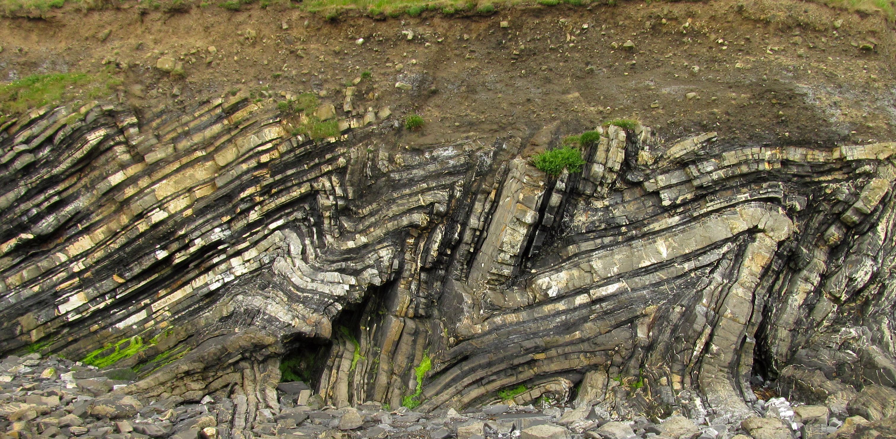
The Waits River Formation (WRF) is a late Silurian to early Devonian limestone containing lesser amounts of phyllite and schist. It is located in the northern Appalachian Mountains of North America. It ranges from Long Island Sound in Connecticut to the Gulf of Saint Lawrence, Gulf of St. Lawrence in Quebec (about 1,000 km), and its width ranges from 10–50 km. It is part of the Connecticut Valley–Gaspé Trough, which is present in eastern and northeastern Vermont. Geologic setting The Waits River formation was deposited through normal faulting and back-arc extension in the late Silurian period. During the Acadian orogeny, the land mass Ganderia, Gander collided with Laurentia. The facies of the unit indicates that its protolith was a Carbonate mineral, carbonate rock, formed from a carbonate bank, reef or atolls around volcanic islands. Stratigraphy The Waits River Formation is stratigraphically below the Gile Mountain Formation and above the Northfield Slate. ... [...More Info...] [...Related Items...] OR: [Wikipedia] [Google] [Baidu] |
Garnet
Garnets () are a group of silicate minerals that have been used since the Bronze Age as gemstones and abrasives. All species of garnets possess similar physical properties and crystal forms, but differ in chemical composition. The different species are pyrope, almandine, spessartine, grossular (varieties of which are hessonite or cinnamon-stone and tsavorite), uvarovite and andradite. The garnets make up two solid solution series: pyrope-almandine-spessartine (pyralspite), with the composition range ; and uvarovite-grossular-andradite (ugrandite), with the composition range . Etymology The word ''garnet'' comes from the 14th-century Middle English word ''gernet'', meaning 'dark red'. It is borrowed from Old French ''grenate'' from Latin ''granatus,'' from ''granum'' ('grain, seed'). This is possibly a reference to ''mela granatum'' or even ''pomum granatum'' ('pomegranate', ''Punica granatum''), a plant whose fruits contain abundant and vivid red seed covers ( arils), whic ... [...More Info...] [...Related Items...] OR: [Wikipedia] [Google] [Baidu] |
Phyllite
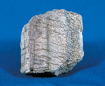
Phyllite ( ) is a type of foliated metamorphic rock created from slate that is further metamorphosed so that very fine grained white mica achieves a preferred orientation.Stephen Marshak ''Essentials of Geology'', 3rd ed. It is primarily composed of quartz, sericite mica, and chlorite. Phyllite has fine-grained mica flakes, whereas slate has extremely fine mica flakes, and schist has large mica flakes, all mica flakes of which have achieved a preferred orientation. Among foliated metamorphic rocks, it represents a gradation in the degree of metamorphism between slate and schist. The minute crystals of graphite, sericite, or chlorite, or the translucent fine-grained white mica, impart a silky, sometimes golden sheen to the surfaces of cleavage, called "phyllitic luster". The word comes from the Greek ''phyllon'', meaning "leaf". The protolith (or parent rock) for phyllite is shale or pelite, or slate, which in turn came from a shale protolith. Its constituent platy minerals ... [...More Info...] [...Related Items...] OR: [Wikipedia] [Google] [Baidu] |
Interbedding
In geology, interbedding occurs when beds (layers of rock) of a particular lithology lie between or alternate with beds of a different lithology. For example, sedimentary rocks may be interbedded if there were sea level variations in their sedimentary depositional environment. Intercalation is a special case of interbedding where a layer is variably inserted into an already existing sequence; or where two separate depositional environments in close spatial proximity migrate alternately across the contact. While interbedding has layers that are horizontally flat (or aligned with the angle of the entire stratum), intercalated rock on the other hand has slanted layers that streak through each other (even when it aligns with the stratum). For example intercalated conglomerate and sandstone looks like ripples of different material networked through each other somewhat off the horizontal, as the beds are deposited in a gradient. This is likely due to differing fluvial conditions and ... [...More Info...] [...Related Items...] OR: [Wikipedia] [Google] [Baidu] |
Atoll
An atoll () is a ring-shaped island, including a coral rim that encircles a lagoon partially or completely. There may be coral islands or cays on the rim. Atolls are located in warm tropical or subtropical oceans and seas where corals can grow. Most of the approximately 440 atolls in the world are in the Pacific Ocean. Two different, well-cited models, the subsidence and antecedent karst models, have been used to explain the development of atolls.Droxler, A.W. and Jorry, S.J., 2021. ''The Origin of Modern Atolls: Challenging Darwin's Deeply Ingrained Theory.'' ''Annual Review of Marine Science'', 13, pp.537-573. According to Charles Darwin's ''subsidence model'', the formation of an atoll is explained by the subsidence of a volcanic island around which a coral fringing reef has formed. Over geologic time, the volcanic island becomes extinct and eroded as it subsides completely beneath the surface of the ocean. As the volcanic island subsides, the coral fringing reef becomes a ... [...More Info...] [...Related Items...] OR: [Wikipedia] [Google] [Baidu] |
Carbonate Mineral
Carbonate minerals are those minerals containing the carbonate ion, . Carbonate divisions Anhydrous carbonates *Calcite group: trigonal **Calcite CaCO3 **Gaspéite (Ni,Mg,Fe2+)CO3 **Magnesite MgCO3 **Otavite CdCO3 **Rhodochrosite MnCO3 **Siderite FeCO3 **Smithsonite ZnCO3 **Spherocobaltite CoCO3 *Aragonite group: orthorhombic **Aragonite CaCO3 **Cerussite PbCO3 **Strontianite SrCO3 **Witherite BaCO3 **Rutherfordine UO2CO3 **Natrite Na2CO3 Anhydrous carbonates with compound formulas *Dolomite group: trigonal **Ankerite CaFe(CO3)2 **Dolomite (mineral), Dolomite CaMg(CO3)2 **Huntite Mg3Ca(CO3)4 **Minrecordite CaZn(CO3)2 **Barytocalcite BaCa(CO3)2 Carbonates with hydroxyl or halogen *Carbonate with hydroxide: monoclinic **Azurite Cu3(CO3)2(OH)2 **Hydrocerussite Pb3(CO3)2(OH)2 **Malachite Cu2CO3(OH)2 **Rosasite (Cu,Zn)2CO3(OH)2 **Phosgenite Pb2(CO3)Cl2 **Hydrozincite Zn5(CO3)2(OH)6 **Aurichalcite (Zn,Cu)5(CO3)2(OH)6 Hydrated carbonates *Hydromagnesite Mg5(CO3)4(OH)2.4H2O *Ikaite ... [...More Info...] [...Related Items...] OR: [Wikipedia] [Google] [Baidu] |
Laurentia
Laurentia or the North American Craton is a large continental craton that forms the ancient geological core of North America. Many times in its past, Laurentia has been a separate continent, as it is now in the form of North America, although originally it also included the cratonic areas of Greenland and also the northwestern part of Scotland, known as the Hebridean Terrane. During other times in its past, Laurentia has been part of larger continents and supercontinents and itself consists of many smaller terranes assembled on a network of Early Proterozoic orogenic belts. Small microcontinents and oceanic islands collided with and sutured onto the ever-growing Laurentia, and together formed the stable Precambrian craton seen today. The craton is named after the Laurentian Shield, through the Laurentian Mountains, which received their name from the Saint Lawrence River, named after Lawrence of Rome. Interior platform In eastern and central Canada, much of the stable craton is ... [...More Info...] [...Related Items...] OR: [Wikipedia] [Google] [Baidu] |
Ganderia
Ganderia or Gander Terrane (located near the town Gander, Newfoundland) is a terrane in the northern Appalachians which broke off the supercontinent Gondwana (Ma) together with Avalonia, Megumia, and Carolinia. Extent The microcontinent Avalonia broke off Gondwana in the Late Neoproterozoic together with a series of terranes that either formed its eastern coast or a separate block called Ganderia in front of it, if so separated from the Avalon Zone by the several hundred metres-wide Dover Fault. These terranes include the Early Palaeozoic siliciclastic rocks of the Gander Zone, the eastern passive margin of the Iapetus Ocean, now found in Newfoundland, New Brunswick, and New England, but they also include the contemporaneous or slightly older rocks of the Bras d'Or terrane in Cape Breton Island, the 550 Ma Upsalquitch gabbro, the Brookville and New River terranes in New Brunswick, and the Seven Hundred Acre Island in Maine. The Gander Zone also extends to the British Isl ... [...More Info...] [...Related Items...] OR: [Wikipedia] [Google] [Baidu] |
Normal Fault
In geology, a fault is a planar fracture or discontinuity in a volume of rock across which there has been significant displacement as a result of rock-mass movements. Large faults within Earth's crust result from the action of plate tectonic forces, with the largest forming the boundaries between the plates, such as the megathrust faults of subduction zones or transform faults. Energy release associated with rapid movement on active faults is the cause of most earthquakes. Faults may also displace slowly, by aseismic creep. A ''fault plane'' is the plane that represents the fracture surface of a fault. A ''fault trace'' or ''fault line'' is a place where the fault can be seen or mapped on the surface. A fault trace is also the line commonly plotted on geologic maps to represent a fault. A ''fault zone'' is a cluster of parallel faults. However, the term is also used for the zone of crushed rock along a single fault. Prolonged motion along closely spaced faults can blur the ... [...More Info...] [...Related Items...] OR: [Wikipedia] [Google] [Baidu] |
Quebec
Quebec ( ; )According to the Canadian government, ''Québec'' (with the acute accent) is the official name in Canadian French and ''Quebec'' (without the accent) is the province's official name in Canadian English is one of the thirteen provinces and territories of Canada. It is the largest province by area and the second-largest by population. Much of the population lives in urban areas along the St. Lawrence River, between the most populous city, Montreal, and the provincial capital, Quebec City. Quebec is the home of the Québécois nation. Located in Central Canada, the province shares land borders with Ontario to the west, Newfoundland and Labrador to the northeast, New Brunswick to the southeast, and a coastal border with Nunavut; in the south it borders Maine, New Hampshire, Vermont, and New York in the United States. Between 1534 and 1763, Quebec was called ''Canada'' and was the most developed colony in New France. Following the Seven Years' War, Quebec b ... [...More Info...] [...Related Items...] OR: [Wikipedia] [Google] [Baidu] |
Gulf Of Saint Lawrence
, image = Baie de la Tour.jpg , alt = , caption = Gulf of St. Lawrence from Anticosti National Park, Quebec , image_bathymetry = Golfe Saint-Laurent Depths fr.svg , alt_bathymetry = Bathymetry of the Gulf of St. Lawrence , caption_bathymetry = Bathymetry of the Gulf of St. Lawrence , location = , group = , coordinates = , type = Gulf , etymology = , part_of = , inflow = , rivers = , outflow = , oceans = , catchment = , basin_countries = CanadaSaint Pierre and Miquelon (France) , agency = , designation = , date-built = , engineer = , date-flooded = , length = , width = , area = , depth = , max-depth = , volume = , residence_time = , salinity ... [...More Info...] [...Related Items...] OR: [Wikipedia] [Google] [Baidu] |


.jpg)